
© Glacier 3000 AG - Arnaud Magnin

© Glacier 3000 AG - Arnaud Magnin

© Glacier 3000 AG - Arnaud Magnin

© Glacier 3000 AG - Arnaud Magnin


- Brief description
-
easy to walk alpine trail
- Difficulty
-
medium
- Rating
-
- Starting point
-
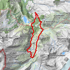
Scex Rouge (2'940 m)
- Route
-
Col de Prapio (2,831 m)0.6 km
- Best season
-
JanFebMarAprMayJunJulAugSepOctNovDec
- Description
-
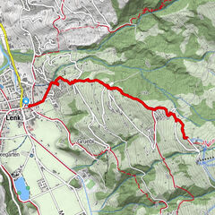
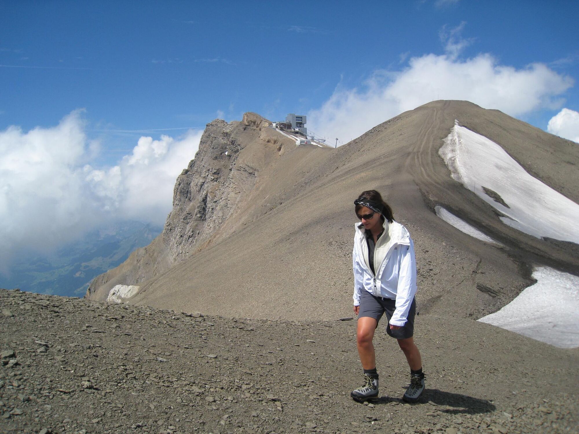
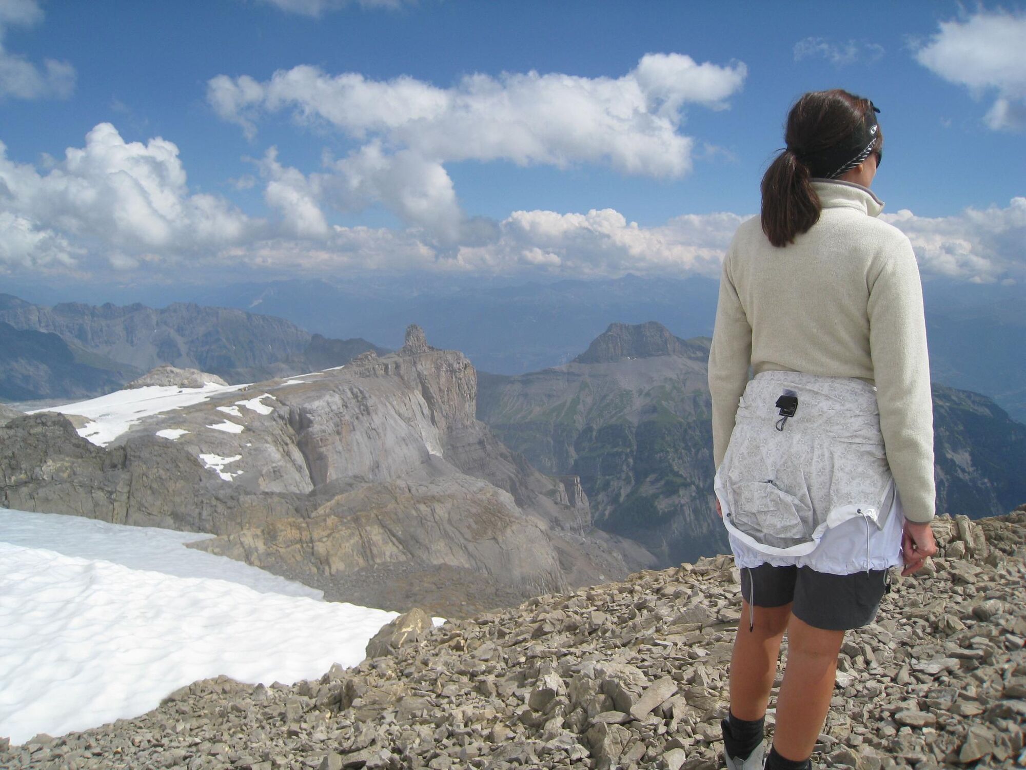
The ingredients for this unique peak experience are quite simple: a nice wide path, surrounded by stones and large boulders, lots of fresh air – and a stunning view. The Dôme hike is a beautiful hike from the Scex Rouge mountain station that leads up to the 3’016m Dôme. It is quite possible that you will hold your breath for a moment, when you get to the top: Because when you get to the so-called man of stone, the view onto the glacier, the valleys far below and the Diablerets peak is simply breath-taking. This view is worth every effort! That is why hikers returning from the Dôme are so relaxed – because once on top, they completely forget their worries.
- Highest point
- 2,986 m
- Endpoint
-
Dôme (3’016 m)
- Height profile
-
 © outdooractive.com
 - Directions
-
Glacier 3000 is easily reached by car from the Lake Thun (Spiez), Lake Geneva (Aigle) and Gruyère (Bulle) areas.
- Public transportation
-
The are two main routes to get to Les Diablerets or Gstaad, from which the Postauto departs to Col du Pillon on a regular basis. The route from Geneva via Lausanne, Montreux and Aigle takes you to Les Diablerets. The route from Zurich via Bern, Spiez, Zweisimmen takes you to Gstaad.
- Parking
-
You will find a large lot with free parking next to the Col du Pillon cable car station, located directly on the mountain pass road between Gstaad and Les Diablerets.


- Author
-
The tour Walk your Worries off is used by outdooractive.com provided.
GPS Downloads


General info
Refreshment stop
A lot of view
Other tours in the regions
-
Thyon les Collons
1440
-
Coteaux du Soleil
614
-
Les Diablerets
149