© Jura Rando


- Difficulty
-
medium
- Rating
-
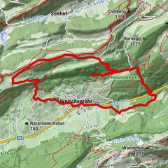
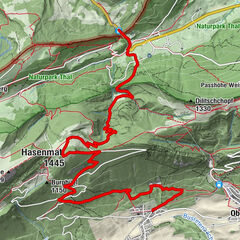
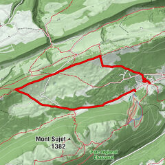
- Route
-
Il Pulcinella0.1 kmCourtételle (441 m)0.1 kmAuberge des Fouchies11.4 kmIl Pulcinella16.5 kmCourtételle (441 m)16.5 km
- Best season
-
JanFebMarAprMayJunJulAugSepOctNovDec
- Highest point
- 1,055 m
- Endpoint
-
Courtételle
- Height profile
-
 © outdooractive.com
- Author
-
The tour Haut du Droit is used by outdooractive.com provided.
GPS Downloads


General info
Refreshment stop
A lot of view
Other tours in the regions
-
Kanton Jura
1148
-
Bucheggberg
525
-
Courtételle
80