© Intersoc VZW - Bruno Oosters

- Brief description
-
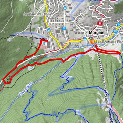
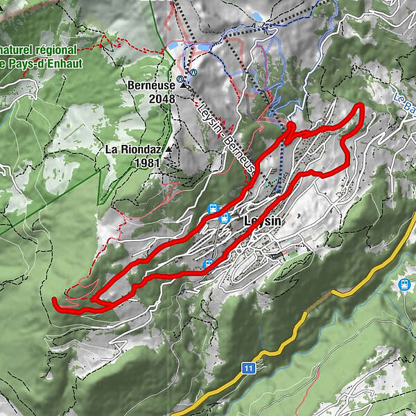
Nid d'Aigle
- Route
-
Leysin1.8 kmNid d'Aigle5.3 kmLeysin-Village (1,269 m)7.7 kmChapelle du village8.6 kmLeysin8.6 km
- Highest point
- 1,455 m
- Height profile
-
 © outdooractive.com

-

-
AuthorThe tour LEY-JOG - Nid d'Aigle is used by outdooractive.com provided.
GPS Downloads


Other tours in the regions