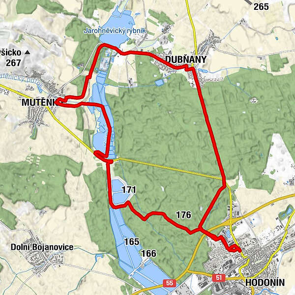
Hodonín - Mutenice

Logo Hodonín - Mutenice
Tour data
26.35km
165 - 203m
Distance
99hm
100hm
Ascent
01:31h
 
Duration
Brief description

Odpolední projížďka kolem rybníků

Difficulty
easy
Rating
Technique
Fitness
Landscape
Experience
Route
Göding
Mutenitz
11.4 km
Mutenitz
11.9 km
U CHytilů
17.0 km
Dolní Konec
17.1 km
Sídliště
17.9 km
Dubnian
18.0 km
Göding
26.3 km

Highest point
203 m

Overall rating

5

0

%

4

0

%

3

0

%

2

0

%

1

0

%

Error
An error has occurred. Please try again.
Thank you for your review

Rating has been deleted

GPS Downloads
  • GPX GPS Exchange Format (XML)
  • KML Google Earth, Google Maps
QR Download Codes for Mobile Phones
Other tours in the regions