
- Brief description
-
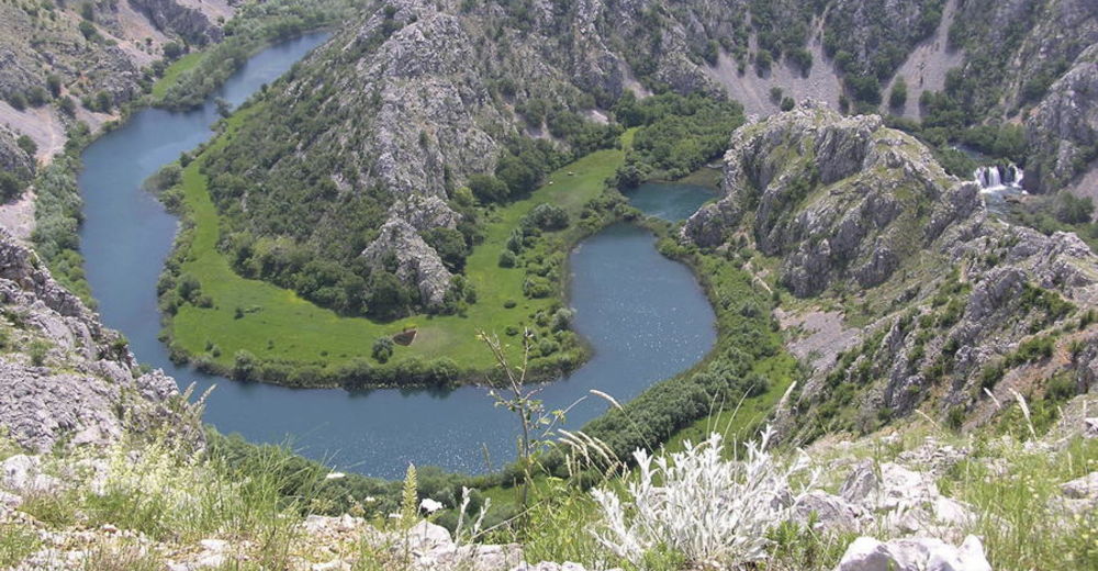
The Blue Line of Via Dinarica offers a chance to explore the Croatian Adriatic coast. Part of the trail that passes through Croatia links four picturesque Croatian islands (Krk, Rab, Pag, Mljet) and two biggest Croatian peninsulas (Istria and Pelješac), taking hikers through three national parks (Paklenica, Krka, Mljet) and four nature parks (Učka, Velebit, Vransko jezero, Biokovo). It also descends into the canyons of the most beautiful littoral rivers (Zrmanja, Cetina), passing across the longest Croatian bridges (Krčki most, Paški most, Šibenski most), visiting fertile karst fields and many important localities of Croatian history. The Croatian part of the Adriatic coast is renowned precisely for its unique blend of the mountains and the sea, making it possible to ideally combine the experience provided by the sea and the coastal region with experience of spending time in the mountains and exploring them. With the exception of the trail section in the Biokovo Nature Park, the Blue Line of Via Dinarica does not entail demanding or very difficult sections, and it is ideal for bicycle tours.
- Difficulty
-
difficult
- Rating
-
- Starting point
-
Istra
- Route
-
Špičasti vrh (957 m)0.4 kmMuzari (985 m)0.5 kmSbeunizza (1,014 m)1.5 kmPlaninarski dom Žbevnica2.5 kmBrest2.7 kmTrstenik4.7 kmLobardina (888 m)8.1 kmGomila (1,027 m)9.1 kmBrajkov vrh (1,091 m)19.5 kmPlaninarska kuća Korita19.8 kmŽupanj vrh (1,130 m)21.5 kmSK HAD 584 (1,120 m)24.3 kmVeliki Planik (1,272 m)25.1 kmMali Planik (1,259 m)25.5 kmGradec (1,092 m)28.0 kmZamej29.7 kmRadiša30.4 kmPlaninarski dom Poklon31.5 kmPoklon31.6 kmMonte Maggiore (1,401 m)33.0 kmJazvina (1,110 m)35.7 kmVeli dol37.7 kmBudišinac (948 m)45.9 kmVedež47.9 kmMattuglie48.2 kmAndretići48.7 kmŠklavići49.1 kmŠkalnica49.2 kmRuccavazzo49.6 kmSušnji50.0 kmRošići50.3 kmFerlania52.9 kmCrkva svetog Sebastijana i svetog Fabijana54.2 kmCastua54.3 kmGornji lazi54.6 kmZvirić57.2 kmBresa61.7 kmScalnizza63.1 kmClana68.5 kmSv. Mihovil69.4 km051 32672.1 kmVojak (916 m)75.8 kmPlaninarski dom Hahlić (1,097 m)78.4 kmFratar (1,353 m)80.4 kmMali Pribeniš89.2 kmPlaninarski dom "Sušak"89.5 kmVeliki Kamenjak (837 m)93.3 kmKrasica106.0 kmBuccari107.7 kmBuccarizza112.7 kmKonoba Portić112.7 kmRestaurant Frankopan113.1 kmPorto Re114.6 kmKonoba "LUKA"115.9 kmCastelmuschio120.3 kmDol120.6 kmNjivice121.1 kmKijac121.7 kmRadići132.9 kmMalinsca133.1 kmBogovići133.8 kmMilcetici133.9 kmKapela Sv. Antona135.3 kmSant'Antonio di Veglia135.3 kmSabljići135.9 kmStrilčići136.5 kmBaicici138.3 kmNenadići138.6 kmŽgaljići141.3 kmScherbe142.0 kmTonivale142.2 kmPizza Valbenz145.5 kmValbisca145.6 kmSveti Mikula (85 m)146.2 kmLoparo147.0 kmLopar173.4 kmMarkunići175.1 kmBegovi175.9 kmDudići177.3 kmVaroš178.2 kmArbe178.3 kmKaldanac178.4 kmMondanìa180.0 kmBarčići180.0 kmKamenjak (408 m)185.3 kmRibarići186.0 kmSušići188.7 kmBagnoli189.6 kmArbe189.7 kmTavernelle197.1 kmPunta Loni198.9 kmŠankovi Stani201.5 kmKućičino (140 m)202.1 kmGradac (138 m)202.8 kmVeli kanat (96 m)204.1 kmNovaglia204.4 kmBistro Novalja206.2 kmGaja219.5 kmRestaurant Figurica220.5 kmKolan226.1 kmSveti Vid (349 m)230.2 kmSveta Marija231.4 kmPago231.8 kmDubrava232.7 kmNemčić232.8 kmBosciana233.2 kmStari grad233.3 kmVodice235.9 kmVercici237.3 kmVilla Vecchia238.8 kmGorizia239.1 kmKukovići239.4 kmMagassi241.5 kmDignisca241.8 kmMoravčići242.3 kmMiscovizzi246.0 kmMiletići249.2 kmRtina250.7 kmTabari251.6 kmMiočići252.3 kmRažanac260.5 kmCrkva Gospe od Ružarija264.6 kmCrljena greda270.2 kmPlaninarski dom Paklenica279.4 kmZapadak279.7 kmKatići281.7 kmSeline289.4 kmBurilovac Gornji290.7 kmRovanjska294.8 kmRončevići294.9 kmGlavica Bužonjića297.5 kmGiasenizze298.7 kmZaton Obrovački299.2 kmBravarica299.4 kmParavinje303.2 kmJokići322.0 kmObrovazzo322.5 kmDonje Polje324.6 kmMarići326.7 kmŠušnjar I329.5 kmVrkića Stan329.8 kmPizzeria Pizzicato330.0 kmCicingaj330.0 kmcrkva Uznesenja Blažene Djevice Marije331.3 kmGornji Karin331.3 kmDonji Karin331.5 kmBenkovačko Selo345.3 kmBencovazzo346.7 kmŠopot348.3 kmMiranje Donje352.1 kmMiranje352.5 kmPećina354.6 kmAurana355.6 kmMarina355.7 kmŽenska špilja360.0 kmŠpilja pod Bakom360.6 kmOton363.7 kmKrklješove kuće363.8 kmZverinac (197 m)366.4 kmKamenjak (286 m)369.2 kmMernjača369.8 kmOsridak (181 m)370.3 kmTranquilo371.1 kmSlosella380.2 kmMartin384.4 kmSovlje390.8 kmTrebocconi393.2 kmVruje393.7 kmBristak394.0 kmKapelica Sv Ante394.0 kmPudarica394.3 kmDolac394.6 kmLovetovo394.7 kmPlimica394.8 kmBrunac394.8 kmDulcin395.2 kmVodizze395.3 kmSrima395.6 kmgrill Popaj396.0 kmGuberina400.7 kmNjivice406.1 kmSebenico407.1 kmGatara408.6 kmNovo Naselje411.2 kmTromilja415.3 kmSlapovi Krke415.3 kmBife Ivan415.3 kmGolub416.3 kmpizzeria Uzdravlje418.2 kmKalikuša419.8 kmGrancigula419.8 kmSkradinski Buk420.1 kmTromilja423.4 kmČogelji424.2 kmKlarendići427.5 kmVišnjići427.6 kmLipci427.6 kmSveti Jure427.9 kmBlačići428.2 kmPlenčići433.9 kmVrcići435.0 kmPodine435.1 kmČuklini437.0 kmGostionica Boraja439.0 kmTomislav439.2 kmBurazeri439.4 kmBoraja439.4 kmKneževići439.8 kmLjubitovica444.8 kmPrapatnica445.7 kmKovačevići454.5 kmDonji Strižići455.1 kmTomasi455.5 kmGornji Botići459.5 kmLabin460.1 kmIvkovići461.0 kmCrni krug (647 m)461.1 kmGoli brig (542 m)461.8 kmUljani umac (522 m)463.2 kmGolo brdo463.9 kmChapel of the Blessed Aloysius Cardinal Stepinac464.0 kmMalačka (477 m)464.1 kmSveti Juraj (676 m)464.2 kmPlaninarska kuća "Česmina"464.3 kmBirnjac (562 m)465.1 kmKatići465.9 kmSpajići466.1 kmPopići466.3 kmOdžići466.9 kmCastelli467.7 kmPerlica468.8 kmHajduk468.8 kmŽižina Tureta (582 m)474.1 kmCrljena greda474.3 kmSalona476.6 kmMihovilovići481.4 kmMedveđak (861 m)483.9 kmAlmissa490.8 kmBotajna (1,196 m)493.6 kmSedlo (1,176 m)494.5 kmSveti Jure (1,319 m)497.0 kmChurch of the Holy Spirit502.4 kmSt. Roch's Church502.4 kmChurch of St. Michael502.5 kmBaučići503.1 kmBorak503.7 kmRaljevići507.3 kmPodašpilje507.8 kmBalići508.1 kmGornja Brela508.5 kmČaglji509.5 kmŠarići509.7 kmMušići510.0 kmSvinišće510.1 kmTafre510.4 kmOrline510.8 kmKozji rat (788 m)514.1 kmLokvica (671 m)515.1 kmBiline stine (597 m)515.9 kmDubci519.4 kmUrsići525.6 kmTomaši526.2 kmBartulovići528.3 kmSpilja Pozjata531.3 kmPozjata531.3 kmJagodnik (1,534 m)531.7 kmŠćirovac (1,619 m)533.7 kmKorenik (1,556 m)537.0 kmĆavlenovača541.5 kmVošac (1,421 m)543.1 kmPlaninarski dom 'Toni Roso' Vošac543.1 kmPerčin (1,373 m)545.7 kmVilenjača (1,240 m)549.3 kmKimet (1,536 m)551.9 kmVitrenik (1,457 m)553.8 kmVelika Mačka (1,440 m)554.2 kmMala Mačka (1,356 m)554.8 kmKozica559.1 kmŠošići560.3 kmGornje Igrane561.1 kmČikići561.7 kmBrist564.0 kmRasovac (799 m)568.2 kmSv. Paškal568.4 kmVilovita glavica570.9 kmSokolić (788 m)572.3 kmSelo573.6 kmJagmići574.2 kmKosirišće574.8 kmZaostrog576.9 kmStara Podaca579.5 kmGradac582.6 kmGrain cargo terminal589.2 kmVišnjica (243 m)590.6 kmPorto Tolero595.8 kmPloče595.8 kmTrpanj603.7 kmTrpanj604.2 kmcrkva svetog Petra i Pavla613.5 kmcrkva Gospe od Karmela613.7 kmsv. Rok613.9 kmOsobjava625.3 kmDol626.9 kmŽarma627.3 kmDomanuta631.0 kmJanjina631.0 kmDubrava639.0 kmPrčevići646.2 kmRadetići646.5 kmŠatare646.5 kmDančanje646.5 kmDebeli Brijeg (441 m)648.0 kmČesvinica654.6 kmStagno657.4 kmSv. Kata660.2 kmMili661.0 kmPrapratno661.5 kmPrapratno662.2 kmSobra671.8 kmSobra673.9 kmPločin dolac674.6 kmDračevac674.8 kmKočevci675.2 kmVeliki Grad (514 m)676.5 kmPian di Bàbino676.8 kmMali dolac676.9 kmVelika Sutilija (388 m)681.3 kmMala Sutilija (352 m)681.9 kmBlato684.4 kmV. Planjak (392 m)692.1 kmPristanište697.9 kmSanta Maria di Méleda697.9 kmPorto Fontana698.4 kmGnìvizze698.4 kmMali Raj698.5 kmGovegiari698.5 kmGoćuh (52 m)699.5 kmPetraia699.9 kmGovegiari702.2 kmBrakova glavica (151 m)702.9 kmPorto Palazzo703.3 kmVilin Gradac (305 m)707.6 kmTravište (178 m)709.0 kmBlato712.3 kmVelja gora (264 m)714.7 kmDuboki do715.7 kmDračevac (74 m)717.1 kmStudenac (267 m)719.6 kmSkuljenac720.9 kmDočine (71 m)721.2 kmSobra723.9 kmVeja (153 m)724.7 kmDebela (108 m)725.6 kmStražište (168 m)727.8 kmKriž (125 m)755.3 kmCalamotta756.5 kmBrač (87 m)756.6 kmGornje Čelo757.1 kmDubrovnik763.0 kmGravosa763.3 kmDubrovnik764.5 kmSv. Jakov Pipunar764.8 kmNuncijata764.9 kmBorgo Plonche765.2 kmBorgo Pile765.4 kmSanta Croce765.7 kmCittà Vecchia765.8 kmViktorija765.8 kmForte Imperiale765.9 kmZlatni potok766.2 kmSveti Jakov766.7 kmOrsula768.2 kmDubac770.0 kmČibača771.6 kmKupari772.9 kmBrašina773.3 kmSrebreno773.5 kmSoline774.1 kmChurch of Saint Hillarus774.3 kmMlini774.3 kmSaint Rocco774.3 kmZavrelje774.6 kmZupcica775.3 kmPlat776.1 kmGornji Obod780.8 kmZvekovica781.8 kmRajčevići783.1 kmVlahutini783.2 kmGabrili784.4 kmBijelići784.5 kmUskoplje785.0 kmKlečaci785.7 kmPrihodnje787.9 kmDrvenik788.4 kmMihanići790.2 kmRudež791.4 kmNartiće792.3 kmPridvorje792.4 kmLovorno793.5 kmArbansi793.7 kmVrelo795.5 kmGornja Ljuta795.9 kmButkovine797.6 kmDubravka799.5 km
- Best season
-
JanFebMarAprMayJunJulAugSepOctNovDec
- Description
-
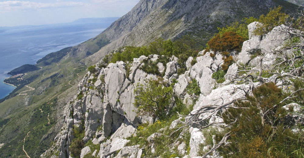
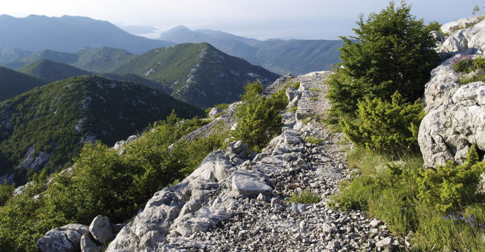
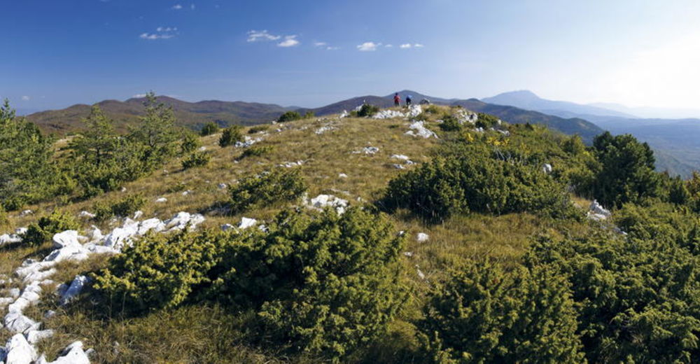
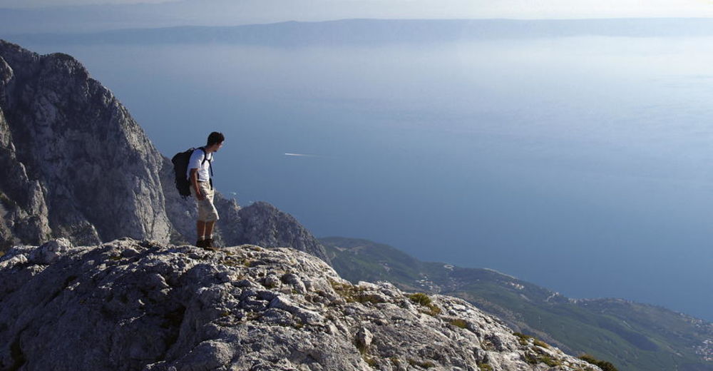
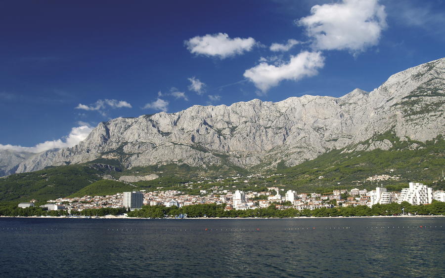
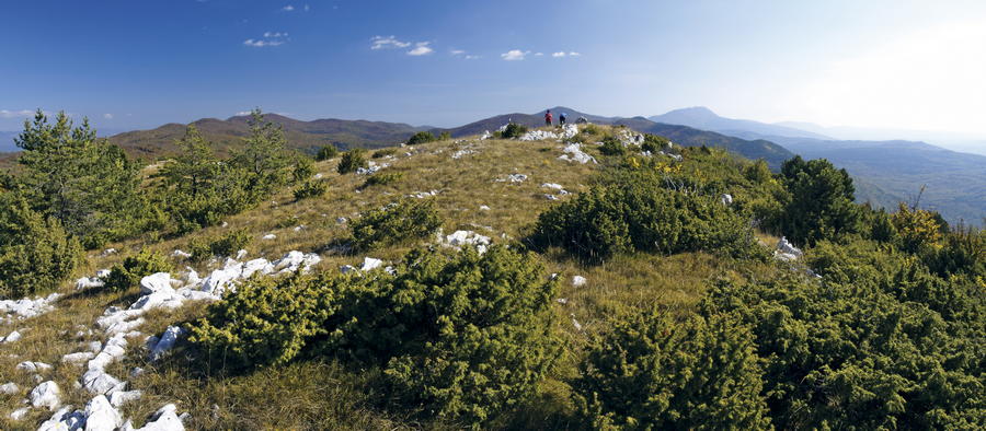
The key characteristics of littoral mountains are directly connected with their belonging to the Dinaric mountain system. One of the key characteristics is their limestone structure. In addition, it is worth noting that the Dinarides extend in parallel with the Adriatic coast, from northwest to southeast, in several parallel series. Since these series begin with island mountains, one can actually perceive the Adriatic islands as remains of the submerged part of the Dinarides. It is interesting to note that coastal mountains in the Croatian south are mostly scarce in vegetation, while northern Adriatic mountains regularly have abundant forest cover. However, when it comes to the islands, the situation is reverse: the northern islands are predominantly bare (Krk, Rab, Pag), and the more we go southwards, the greener and more abundant in vegetation the islands get (e.g. Mljet).
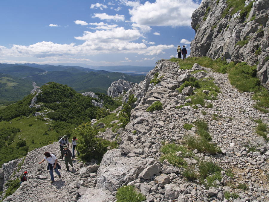
With their height and length, the Dinarides represent a sharp wall preventing the penetration of the Mediterranean influences into the hinterland. Despite abundant precipitation at the boundary of the two climatic regions, there are very few surface watercourses, and water quickly disappears in karrens, abysses and underground cavities. Visitors of coastal mountains must bear in mind that hilly areas along the sea are not as fresh as high mountain areas, so it is better to avoid difficult climbs during the summer period. In addition, bora wind can be quite unpleasant, and even dangerous in strong gusts. The ideal seasons for exploring the Blue Line of Via Dinarica in Croatia are late spring and autumn.
With the exception of the Biokovo Nature Park, the Blue Line of Via Dinarica has no demanding or extremely hard routes. This longitudinal tour enables hikers to explore amazingly diverse coastal areas and their interesting karst characteristics.
- Directions
-
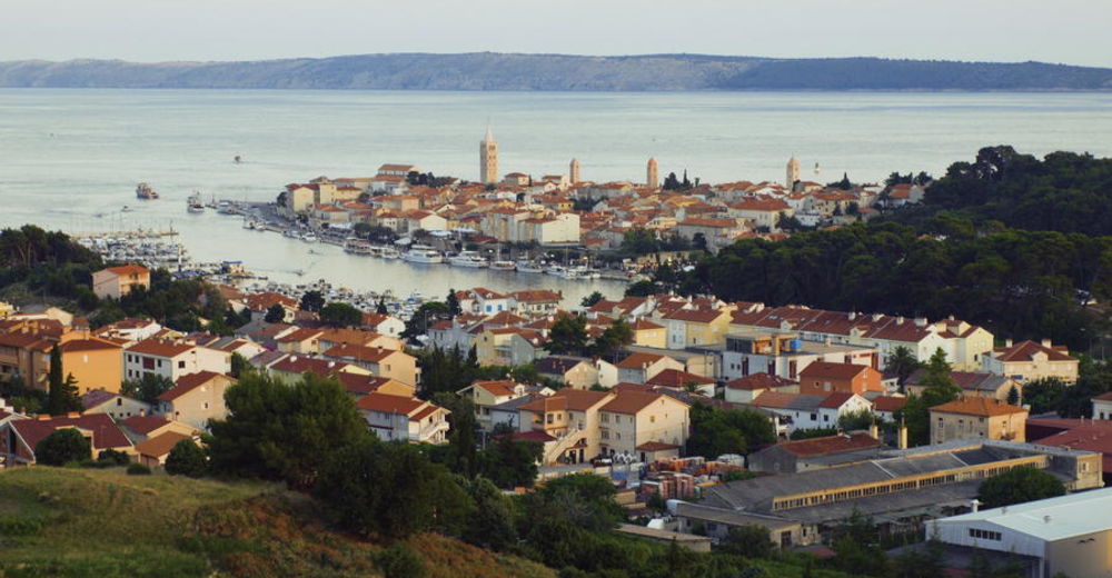
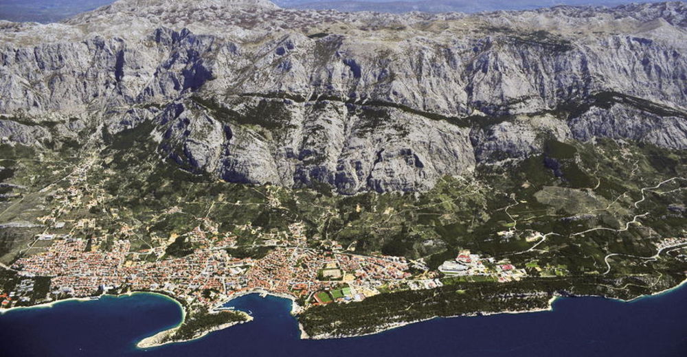
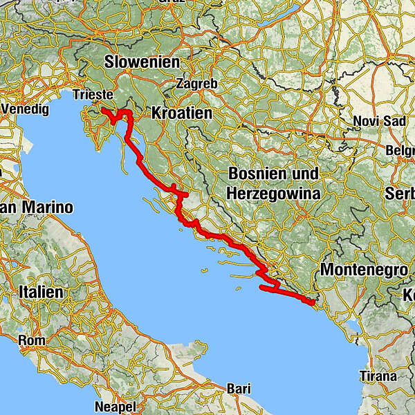
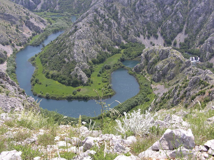
The Blue Line enters Croatia at the peak of Žbevnica on Ćićarija, from the direction of Slavnik in Slovenia. One available access option is to use the trail that begins at the cape of Savudrija and continues towards Žbevnica along the routes of the Istrian Hiking Trail (Istarski planinarski put), Parenzana and the E-12 European Long-Distance Path. Proceeding along Ćićarija and Učka, Via Dinarica follows the route of the Istrian Hiking Trail to Poklon and to the peak of Vojak, continuing across Ćićarija towards Matulji. What follows is a climb from Klana into the area of Obruč and Hahlić, and the route then continues through mountainous terrain towards Platak, following the route of the Rijeka Hiking Tour (Riječka planinarska obilaznica, RPO). From Platak, the route descends to Kamenjak, using a series of so-called senior trails towards the bay of Bakarski zaljev and towards the bridge Krčki most, taking hikers to the island of Krk. From Valbiska on the island of Krk, the trail continues towards Lopar on the island of Rab, continuing further along a well-maintained network of attractive trails (Premužić Trail on the island of Rab, the Kamenjak area) towards the city of Rab. From the city of Rab, the Blue Line then takes us to Lun on the island of Pag, continuing lengthwise across the island. The trail then touches the Paklenica National Park and the border area of the Velebit Nature Park, descending to the canyon of the Zrmanja River.
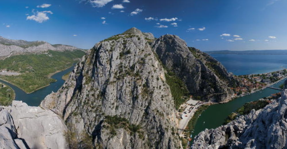
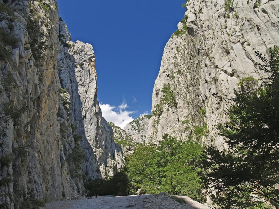
The section from the Zrmanja River to the city of Trogir is not mountainous in character, and it is ideal for a bicycle tour. In areas near the city of Šibenik (Vransko Jezero Nature Park, Krka National Park, the hill of Trtar), there are intriguing hiking sections. In the area above the bay of Kaštelanski zaljev, the trail follows the markings along Kozjak, partly using the route of hiking trails Cradle of Croatian Statehood and Solin Hiking Trail. Continuing across Klis, the trail proceeds towards the mountain of Mosor, passing it lengthwise to the area of Gata and Omiš in the canyon of the Cetina River. Given the fact that there is no longitudinal trail (along Omiška Dinara) in the section from Omiš to Gornja Brela, Via Dinarica is following the course of the Cetina River upstream towards Blato na Cetini, reaching Gornja Brela by road. The area of Omiš and the Cetina River offers ideal possibilities for various outdoor activities (rock climbing, rafting).
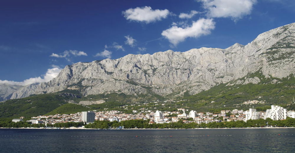
The section of the trail in the Biokovo Nature Park is over 100 kilometers long, and very demanding for hikers. This particular section is simply impassable without strong logistics and excellent fitness level. The core of this section is the Biokovo Hiking Trail, and a tour of this trail "in one go" is also colloquially known as the "Biokovo Wolf". Despite lower elevation, the southern part of Biokovo is also very difficult to pass through. From the lakes of Baćinska jezera, the Blue Line then descends to the city of Ploče.
The final part of the route continues along the Pelješac peninsula, starting from the town of Trpanj that can be reached by a ferry from the city of Ploče. Once on Pelješac, the Blue Line continues to the city of Orebić and to the peak of Sv. Ilija, following the cycling trail Maslina from Orebić to Ston. From there, a ferry takes visitors to the island of Mljet with excellent hiking infrastructure. This is where the corridor briefly takes the "opposite" direction, from southeast to northwest, by taking the route of the Mljet Hiking Trail from Sobra to Pomena, since that is the logical route direction on the island of Mljet. Pomena is also linked with the city of Dubrovnik by boat. Visitors interested in exploring the section from Dubrovnik to Konavle are recommended to tour that section by bicycle, since there is no suitable hiking infrastructure available in the area at this time. The mountain of Sniježnica offers remarkable views of the area of Konavle, which is where the Blue Line reaches the border of Croatia, Bosnia and Herzegovina and Montenegro, connecting with the Montenegro Hiking Tour on the mountain of Orjen.
- Highest point
- 1,533 m
- Endpoint
-
Dubrovnik
- Height profile
-
 © outdooractive.com


-

-
AuthorThe tour Via Dinarica Trail u Hrvatskoj - Plava linija - HR-B is used by outdooractive.com provided.