
- Brief description
-
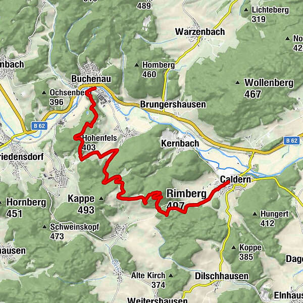
Let’s hope that you will be lucky with the weather for today’s tour in order to be able to enjoy the views. One of its highlights is the Rimberg. Afterwards you will walk past the ruins of Hohenfels castle to get to Buchenau.
- Difficulty
-
medium
- Rating
-
- Starting point
-
Caldern
- Route
-
CaldernRimberg (497 m)3.9 kmKarlshof6.8 kmHohenfels (403 m)10.9 kmBuchenau13.4 km
- Best season
-
JanFebMarAprMayJunJulAugSepOctNovDec
- Description
-
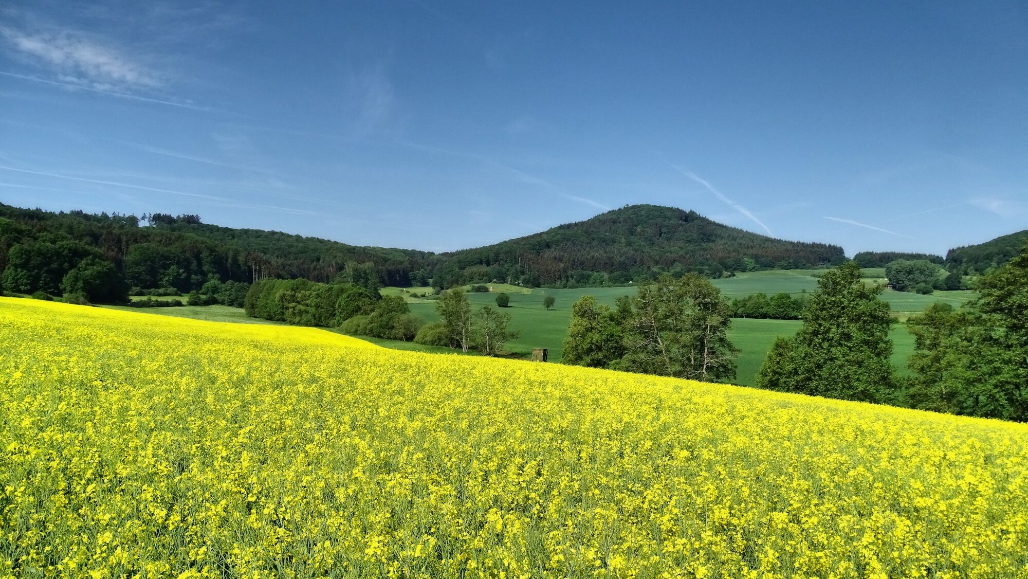
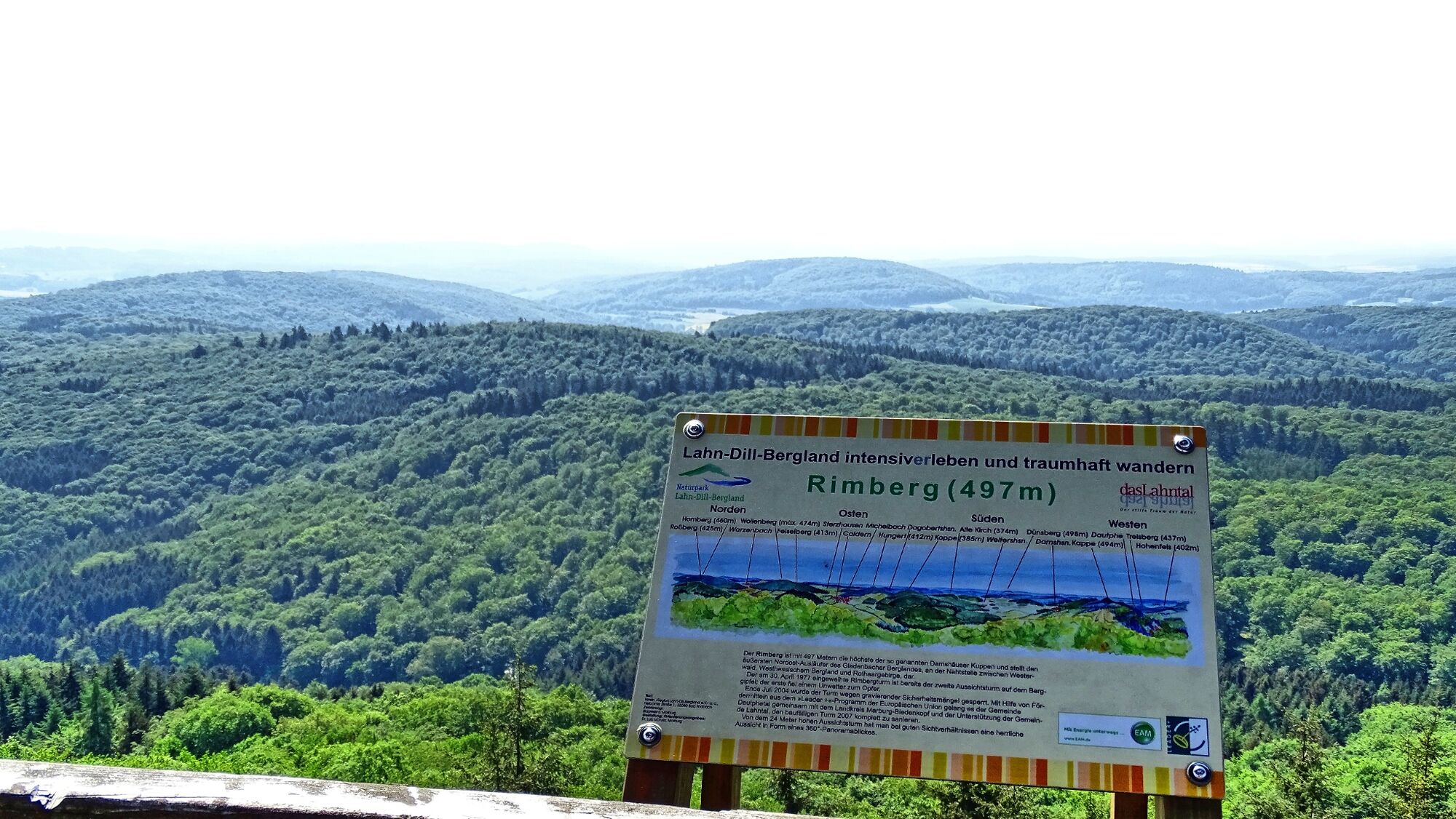
From the Rimberg tower you will have a view as far as the Vogelsberg, the Taunus and the Rothaargebirge. The hill has always provoked arguments among the population because its peak is just within the area of Dautphetal village while its eastern part belongs to Lahntal-Caldern village. Nowadays they see eye to eye about the Rimberg: on May 1st and October 3rd, citizens of both communities flock to the Rimberg and celebrate together. Finally, the tour continues through woods and meadows past the ruins of the Hohenfels double castle down to Buchenau.
- Directions
-
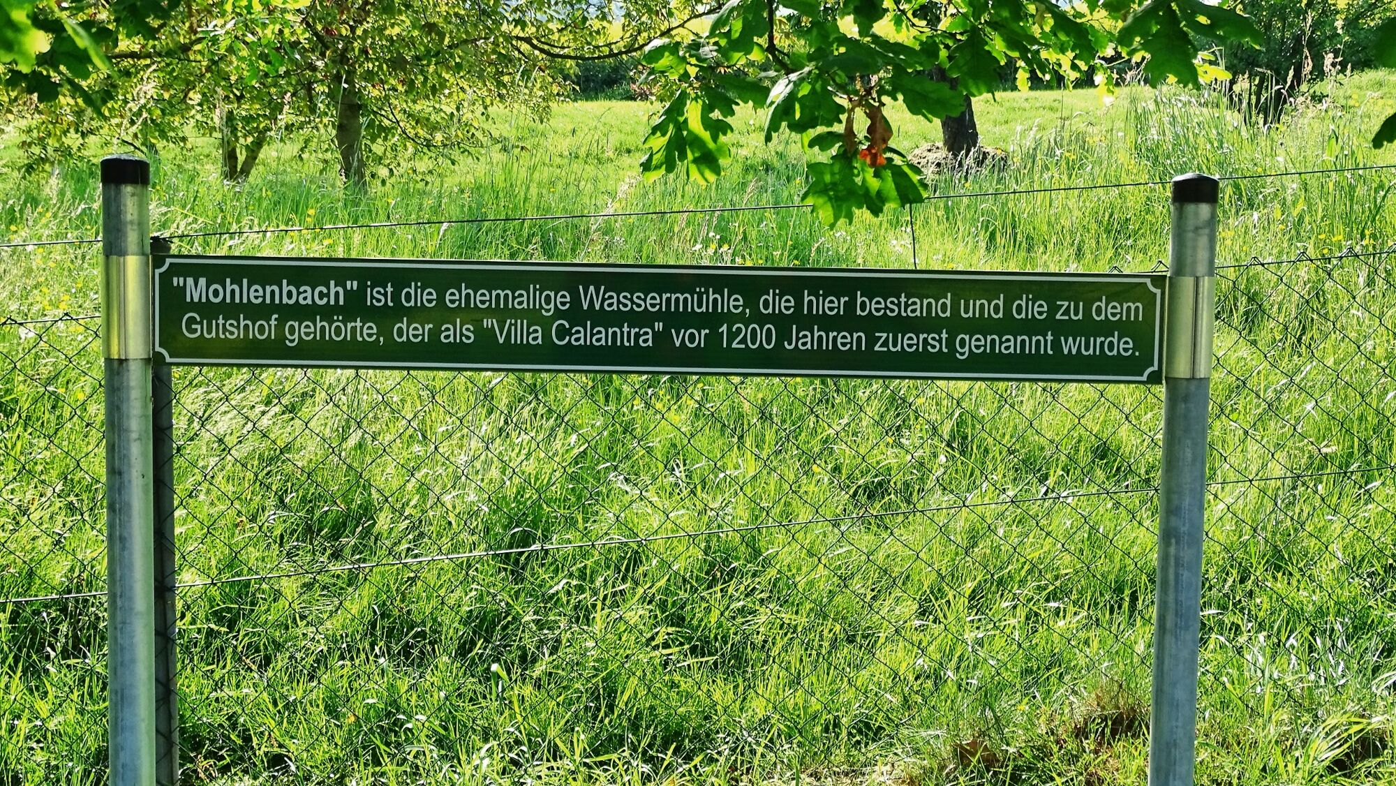
We will start in Calantra which was how Caldern used to be called about 1200 years ago. After an (optional) detour to the beautiful Nikolaikirche, the Lahnwanderweg trail leaves the tiny village and goes into a westerly direction. Soon you will be able to spot the Rimberg that is overlooking everything. Make sure to turn around at the edge of the forest and let your gaze wander over Caldern. Afterwards, the hike goes steeply uphill through the forest towards the Rimberg.
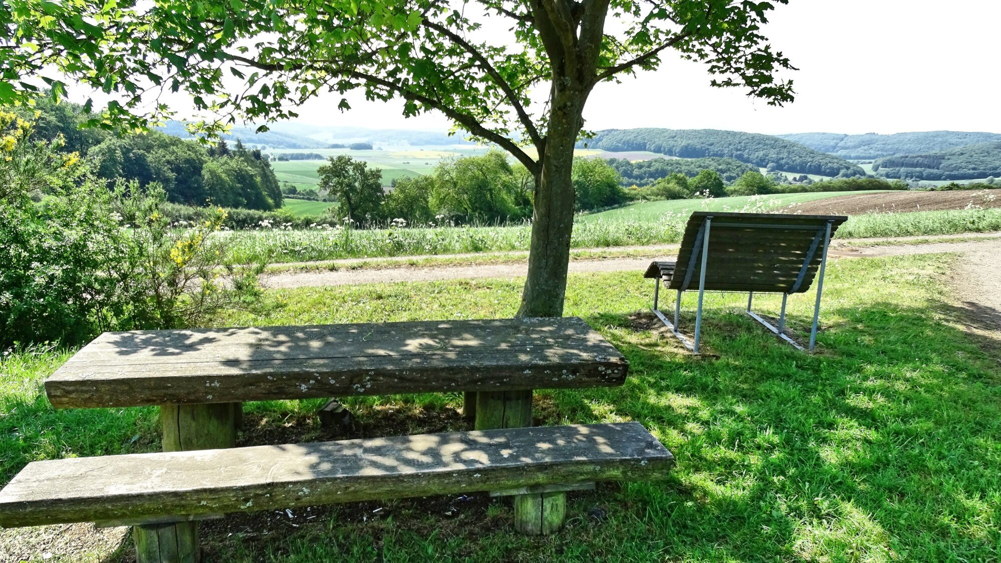
The Rimbergturm was destroyed by a storm in 1971 and rebuilt in 1997 by the district of Marburg-Biedenkopf which was supported by neighboring communities as well as private donations. From the top you have a wonderful view as far as the Vogelsberg, the Taunus and the Rothaargebirge You will also find a refuge. Walking on narrow paths and wide trails you will be taken downhill to a rest area with a great panoramic view. Afterwards the trail will lead across the field with some more beautiful views and guide you along the edge of the forest. Damshausen lies in the upcoming valley.
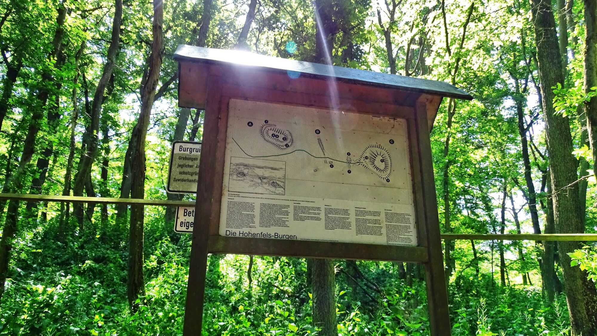
You will cross the woods and get out of it again next to two small ponds. Across meadows and fields, the path leads into the next wooded area where you will walk past the ruins of the double Hohenfels castle. Since 1997 the Hohenfels Castle Association has been researching and preserving the castle ruins with the help of the University of Marburg. Keep right behind the castle and take a relaxed stroll down through the forest. You will soon reach Buchenau with the Lahn bridge and the town center.
- Highest point
- 474 m
- Endpoint
-
Buchenau, bridge over river Lahn
- Height profile
-
 © outdooractive.com
 - Equipment
-
Ordinary hiking equipment, possibly hiking sticks for descent from Rimberg.
- Safety instructions
- Tips
-
Take a break at the Rimberg where you should make sure to climb the tower. There won’t be any refreshment stops on this stage so you should take provisions with you. If you want to stay overnight, we recommend booking in advance.
- Additional information
-
Lahnwanderweg
Collecting memories with the hiking pass
The free pocket guide "Lahnwanderweg" and further information are available at www.daslahntal.de and from
Lahntal Tourismus Verband e. V.
Brückenstraße 2, 35576 Wetzlar
Tel. 06441-30998-0
Naturpark Lahn-Dill-Bergland
Herborner Straße 1, 35080 Bad Endbach
Tel. 02776/801-15
- Directions
-
B62 from Marburg to Caldern and Buchenau
- Public transportation
- Parking
-
In Caldern or at railway station Buchenau


-

-
AuthorThe tour Lahnwanderweg stage 05 upstream Caldern - Buchenau is used by outdooractive.com provided.


General info
-
Lahntal / Hessen
457
-
Marburg Stadt & Land
196
-
Biedenkopf
74