- Brief description
-
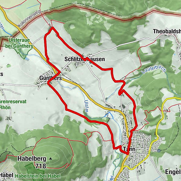
Three-village tour
Circular route from Tann with a wonderful view of the Hessisches Kegelspiel or the Kuppenrhön
- Starting point
-
Tann (Rhön), market square
- Route
-
Zum ZobelZur KroneTann0.0 kmSt.-Nikolaus Kirche0.4 kmDas Lämmchen3.7 kmSchlitzenhausen3.7 kmSinswinden5.1 kmObere Mühle6.5 kmUntere Mühle6.6 kmLandgasthof zur Ulsterbrücke6.6 kmGünthers6.8 kmZum Zobel10.1 kmTann10.2 kmZur Krone10.2 km
- Best season
-
JanFebMarAprMayJunJulAugSepOctNovDec
- Description
-
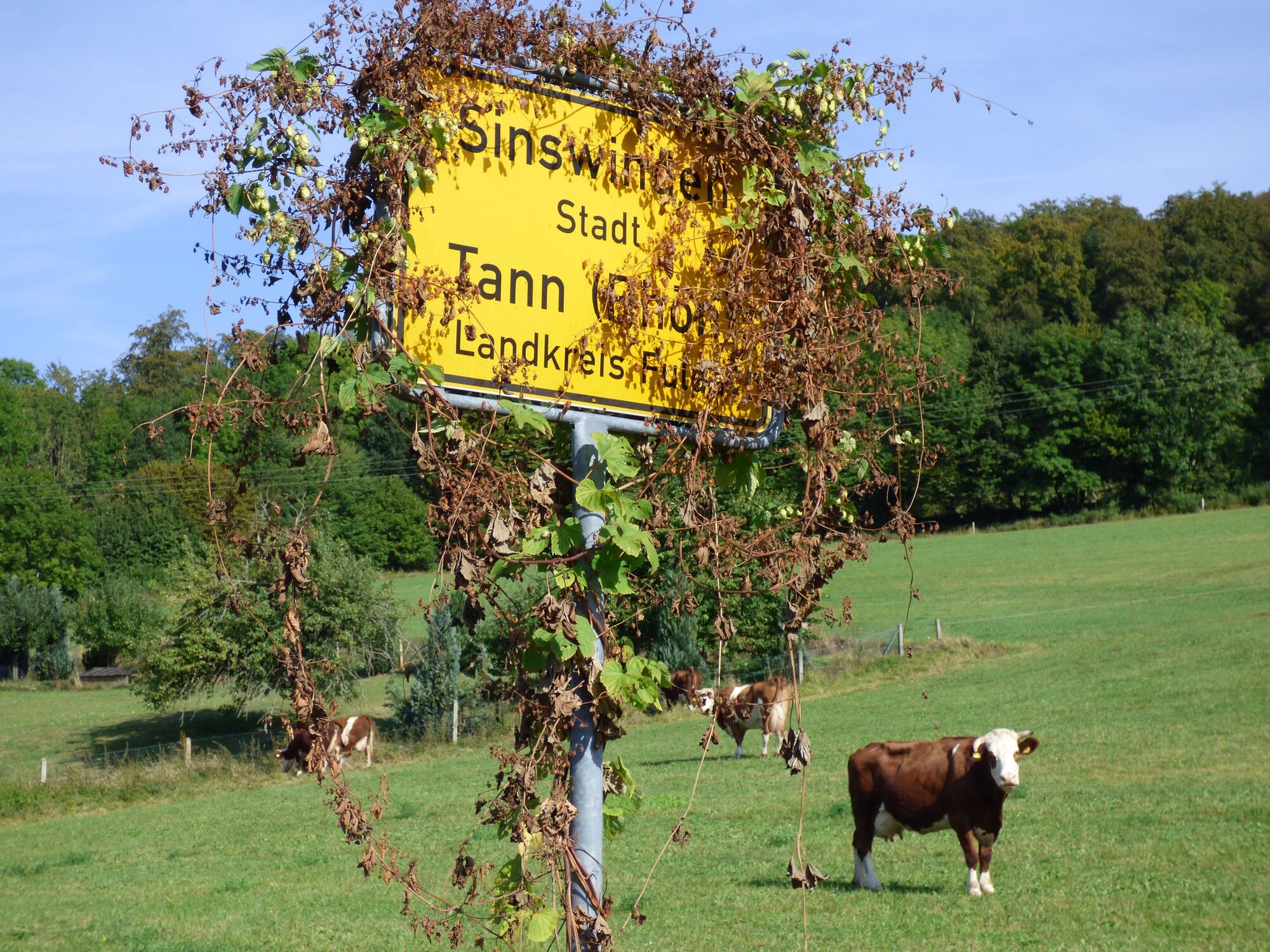
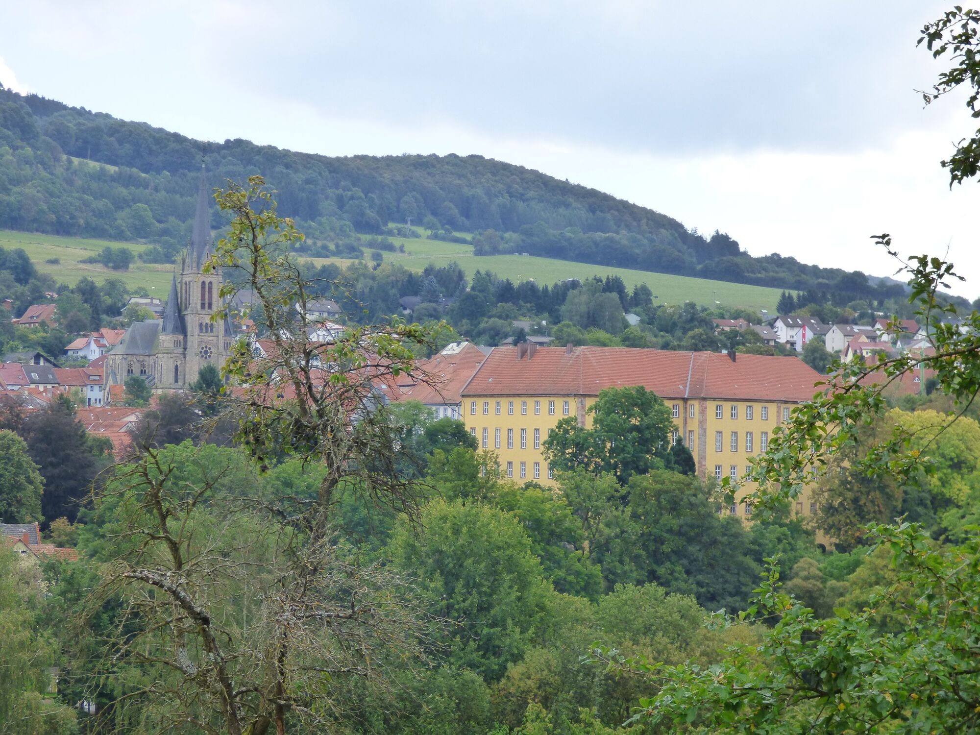
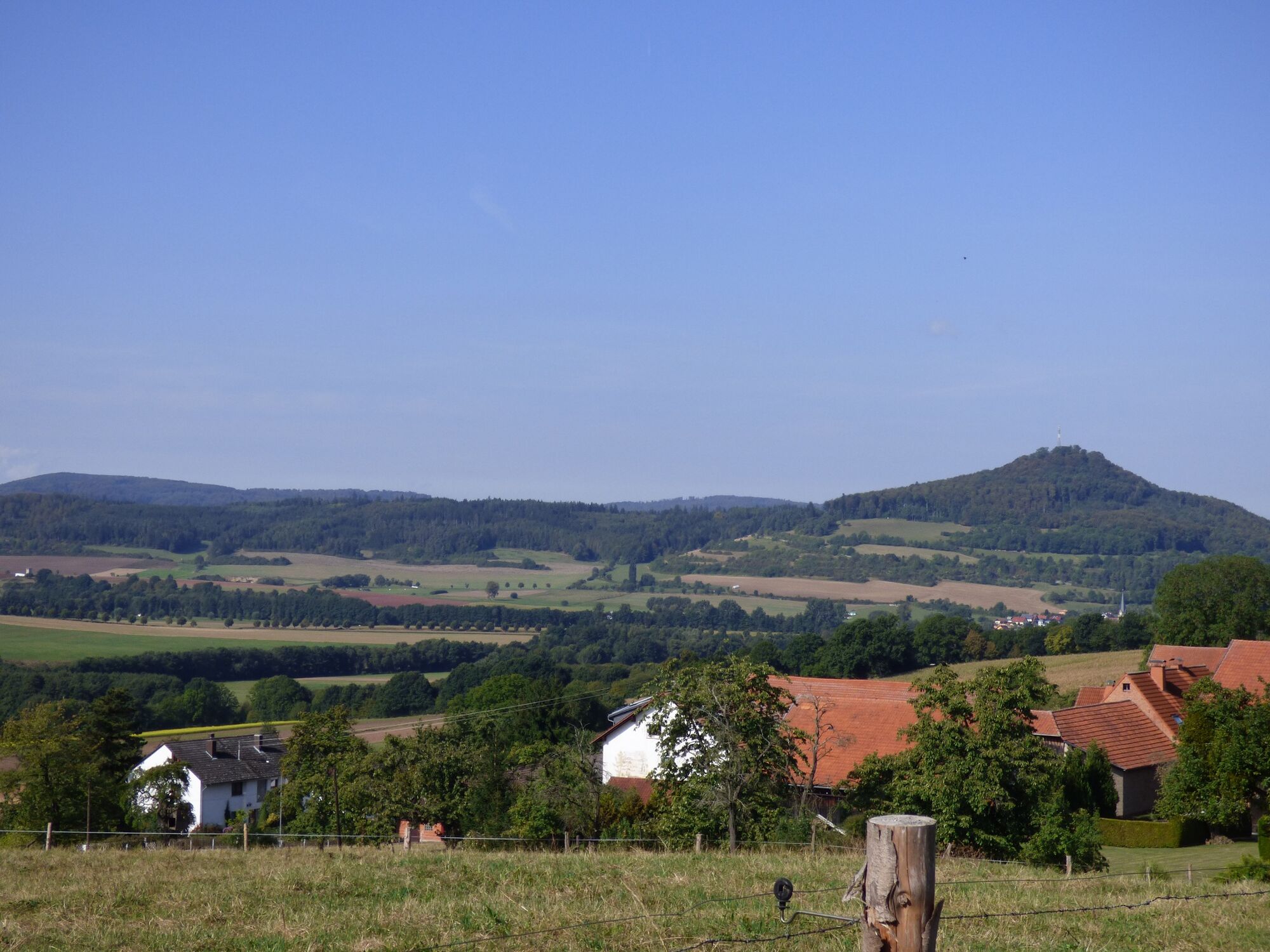
On the hill to the right of the Ulster Valley, this 8.5 km long hiking trail, starting from the Tanner market square, leads to the district of Schlitzenhausen with wonderful views. Here you have the option of a leisurely stop or, indeed, of shopping (weekdays). On the direct route to Günthers, using the public footpath, the route can be shortened by around 2 km. On the regular route, the hiker then reaches the small hamlet of Sinswinden with a view of the Thuringian Rhön - half of the route is now done. We recommend interested visitors to take a short detour to the north, away from the hiking trail, via the former border fortifications to the area of the razed "Langwinden" farm (length of the detour: approx. 3 km). The way back leads through the Ulsteraue to Günthers and from there through the "Hasenwald" back to Tann. On the way, the hiker gets interesting impressions of the harmonious interaction between agriculture, forestry and nature, the typical landscape of the Rhön biosphere reserve.
- Directions
-
From the Tanner Marktpklatz, head north through the center of Tanner. At the cemetery, go a few meters to the right and then continue north along the road above the cemetery. Following the course of the road, you walk past the sawmill via the Mühlberg and the Galgenberg. At the fork in the road, turn left for about 50 meters and then turn sharp right onto a service road that leads in the direction of Schlitzenhausen. In the village, follow the through road in the direction of Günthers and then follow the signs to the right to the hamlet of Sinswinden. From here it now goes in a westerly direction down to the Ulsteraue, in Günthers you cross the Ulster and walk a little uptown in a westerly direction. Turn left at the DGH and follow the path through the Hasenwald along the flank of the Habelberg back to Tann.
- Highest point
- 414 m
- Endpoint
-
Tann (Rhön), market square
- Height profile
-
 © outdooractive.com
 - Safety instructions
-
The tourist paths of the Rhön are mostly used by other active people (hikers, mountain bikers, cyclists, walkers, horse riders, cross-country skiers, etc.).
We ask all active nature sports enthusiasts to show consideration for one another. Of course, the same applies to nature - it is worth protecting. In the Rhön, nature sports should therefore only be practiced in daylight on designated paths and areas.
- Tips
-
For those interested in history, it is worth making a detour to the former border to the shattered hamlet of Langenwinden, or interrupting the hike for a short shopping trip in the district of Schlitzenhausen
- Additional information
- Directions
-
On the A7 exit Fulda Mitte, continue left towards Fulda, then follow the signs to the right towards Hofbieber - Tann.
- Parking
- Author
-
The tour Rhön Rundweg 5 Tann - Rhön is used by outdooractive.com provided.


General info
-
Die Rhön / Thüringen
825
-
Hessisches Kegelspiel
278
-
Tann / Rhön
104