- Brief description
-
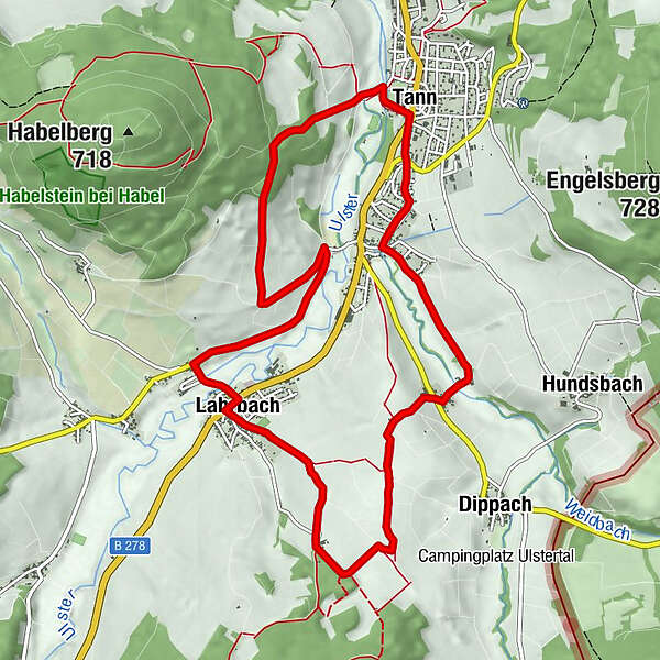
Circular route from Tann along the Habelberg to Lahrbach and over the Kugelbaum back to Tann.
- Difficulty
-
medium
- Rating
-
- Starting point
-
Tann (Rhön), Marktplatz
- Route
-
Lahrbach1.2 kmLandhaus Kehl1.3 kmMollartshof1.9 kmTann6.4 kmZur Krone6.5 kmWendershausen7.4 kmHerdathurm9.0 km
- Best season
-
JanFebMarAprMayJunJulAugSepOctNovDec
- Description
-
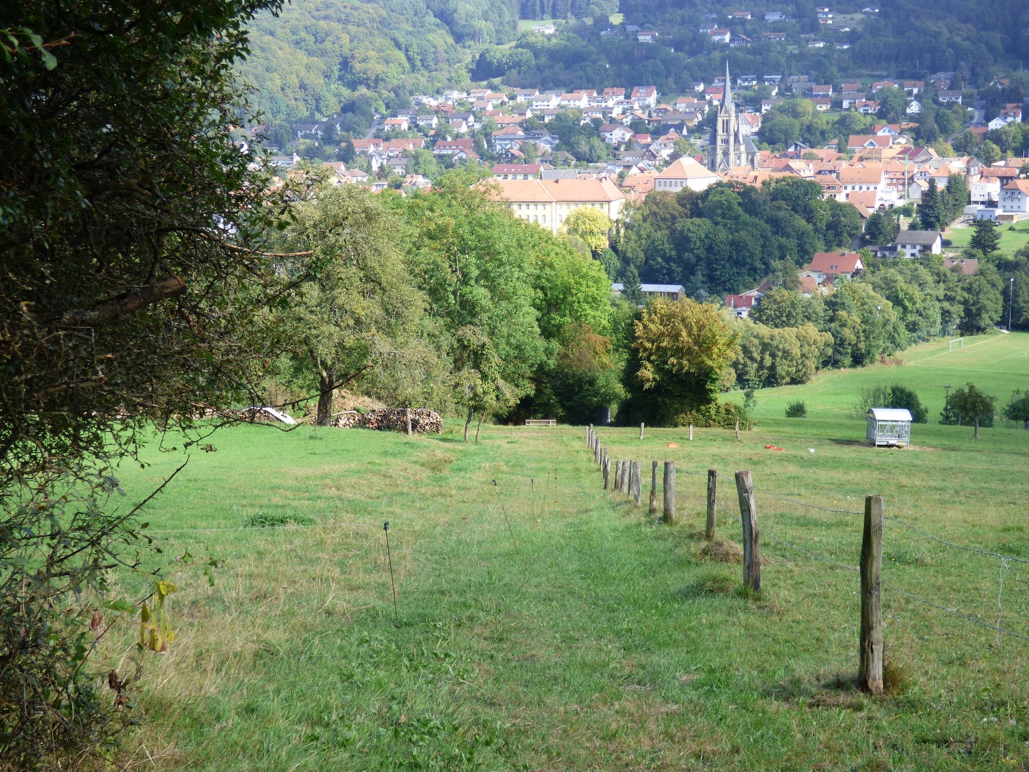
The starting point for the Rhön Rundweg 6 is the Tanner Marktplatz. The tour leads along the castle wall, crosses the Ulster and climbs at the foot of the Habelberg in the direction of "Ludwigseiche".
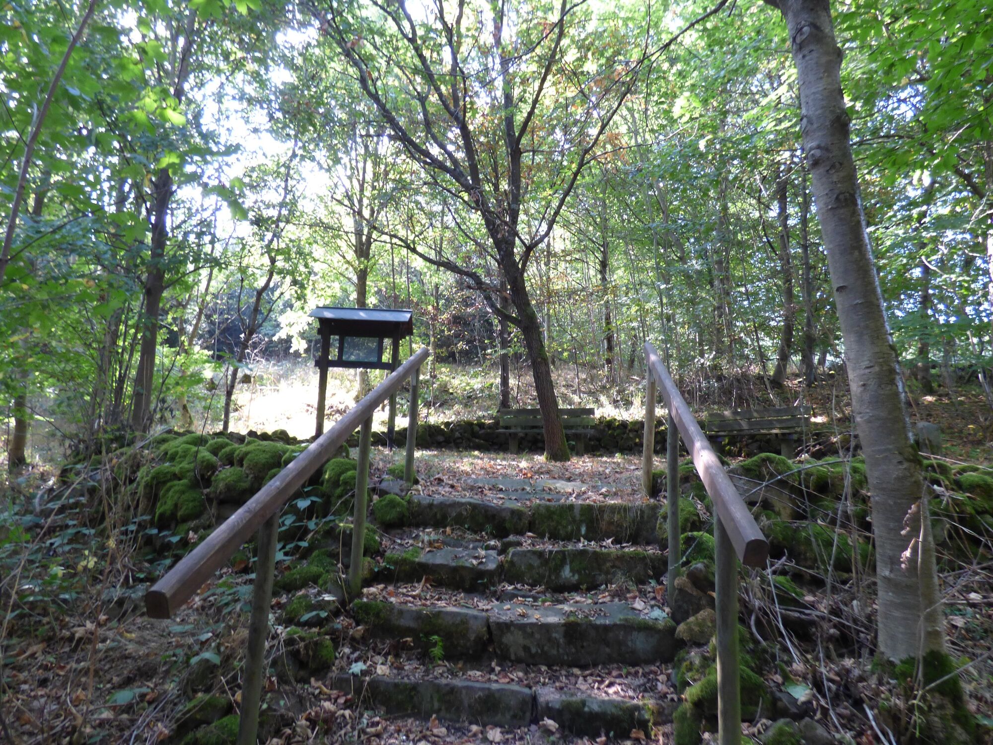
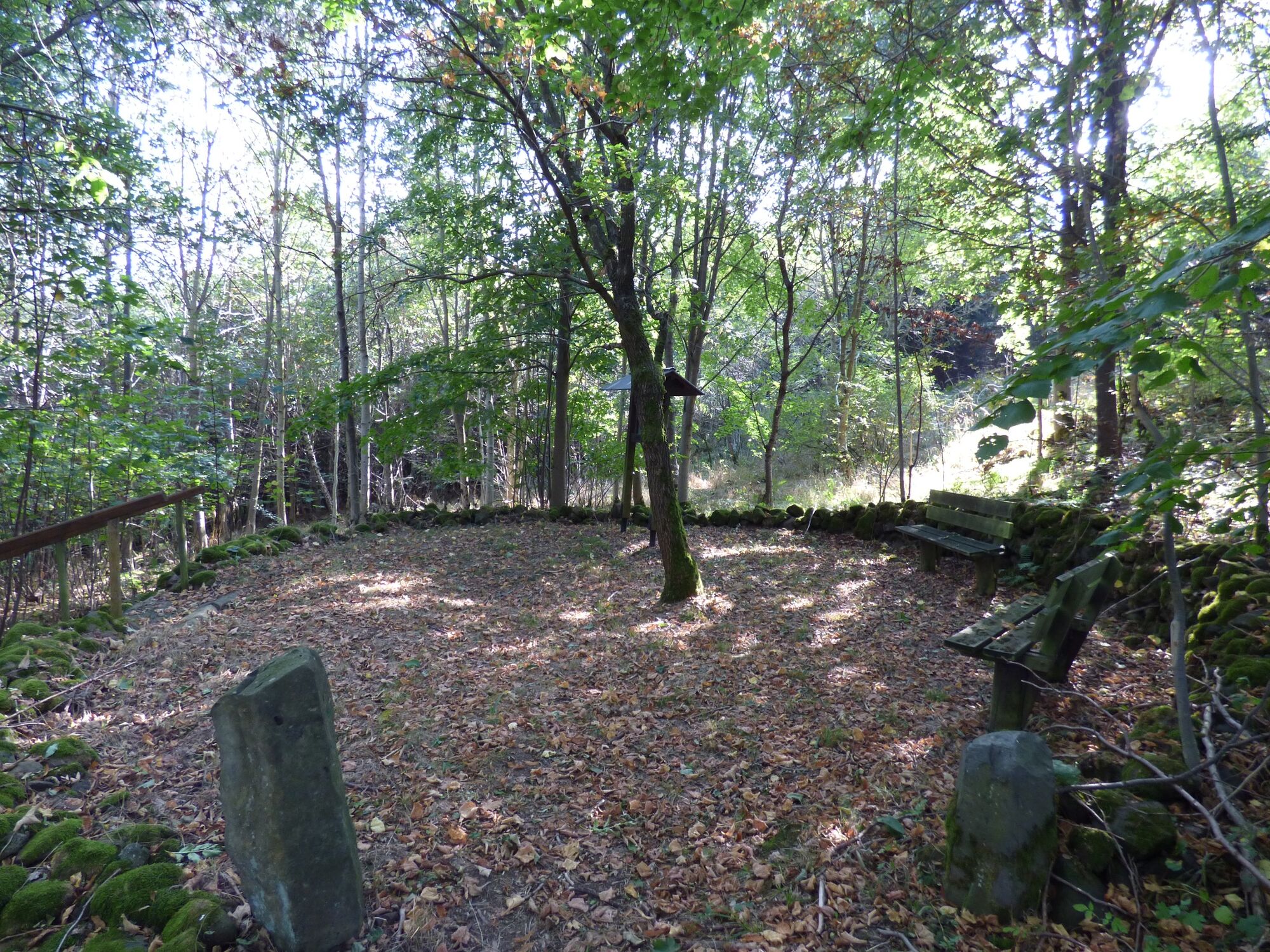
Now it goes along the mountain flank above Wendershausen before using part of the Ulstertalradweg to Mollartshof. Via Lahrbach (with a stop for refreshments) you hike to the local recreation area "Gänskutte" with Rhönklubhütte and barbecue area, which is hidden in a mixed forest conservation area. Here you can relax at a small pond and prepare for the second part of the hike.
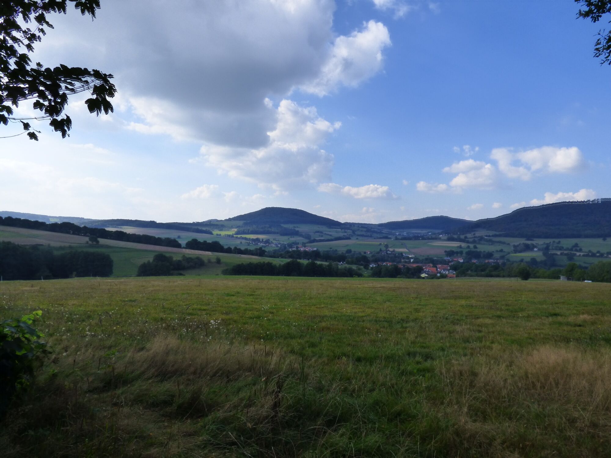
A little later on the hiking trail, hikers reach the viewpoint and the natural monument "Kugelbaum", an ancient, isolated sycamore tree. Wonderful views of the Ulster Valley and the Kuppenrhön open up from this location.
The route then goes via the small hamlet of Herdathurm to Wendershausen and back to Tann.
- Directions
-
You start at Tanner Marktplatz in a southerly direction, pass through the town gate and turn right immediately after, follow the old town walls and cross the Ulster. At the foot of the Habelberg, follow the signs slightly left uphill on a service road. After you have crossed the field path, follow a narrow footpath up to the "Ludwigseiche", General Ludwig's favorite place from and to Tann-Rathsamhausen. Continue uphill following the forest path in a westerly direction until you reach the next Witschaftsweg. Here you turn left and follow the signposted path. Arriving back in the valley, turn right and walk a bit on the Ulstertalradweg to Mollartshof. From here it goes along the L3174 to Lahrbach. In the village you can stop off at Gastaus Kehl and take a well-deserved break. We continue in an easterly direction, crossing the B 278, to Lindenplatz via Marienstraße in the direction of Gänskulle to the "Paradieshof" farmer's shop. A short detour to the right to the local recreation area "Gänskull" and the bee educational trail is worthwhile. From the Paradieshof, following the signs in the direction of the Kugelbaum, you will reach the Kugelbaum natural monument, a solitary sycamore maple that can be seen from afar. On easily accessible farm roads, it then goes via Herdathurm, Wendershausen back to Tann.
- Highest point
- 491 m
- Endpoint
-
Tann (Rhön), Marktplatz
- Height profile
-
 © outdooractive.com
 - Equipment
-
Sturdy shoes
Rain gear
Sun protection in high temperatures
First aid kit
GPS navigator or map
Sufficient drink reserves and provisions
Camera to capture the beautiful views - Safety instructions
-
The tourist paths of the Rhön are mostly used by other active people (hikers, mountain bikers, cyclists, walkers, horse riders, cross-country skiers, etc.).
We ask all active nature sports enthusiasts to show consideration for one another. Of course, the same applies to nature - it is worth protecting. In the Rhön, nature sports should therefore only be practiced in daylight on designated paths and areas.
- Tips
-
Just let your soul dangle in the local recreation area "Gänskulle" or enjoy the wonderful view into the land of open distances at the natural monument "Kugelbaum".
- Additional information
- Directions
-
On the A7 exit Fulda Mitte, continue left in the direction of Fulda, then follow the signs to the right in the direction of Hofbieber - Tann.
- Public transportation
-
In Tann (Rhön), there are four bus stops. The Rhönhalle bus stop is the most suitable. The LNG Fulda lines depart from here:
- Line 20: Tann - Hofbieber - Petersberg - Fulda
- Line 24: Tann - Wendershausen - Lahrbach - Hilders
- Line 90 - RhönRadBus: Gersfeld - Wasserkuppe - Hilders - Milseburgradweg - Fulda
In addition, the following line of the Verkehrsgemeinschaft Wartburgregion also runs to this bus stop:
- Line 110 - Rhönkurier: Eisenach - Vacha - Geisa - Tann
- Parking
- Author
-
The tour Rhön Rundweg 6 Tann - Rhön is used by outdooractive.com provided.


General info
-
Die Rhön / Thüringen
826
-
Hessisches Kegelspiel
278
-
Tann / Rhön
104