- Brief description
-
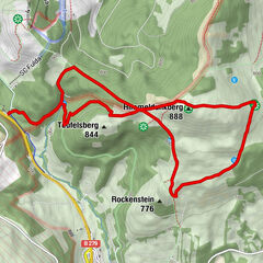
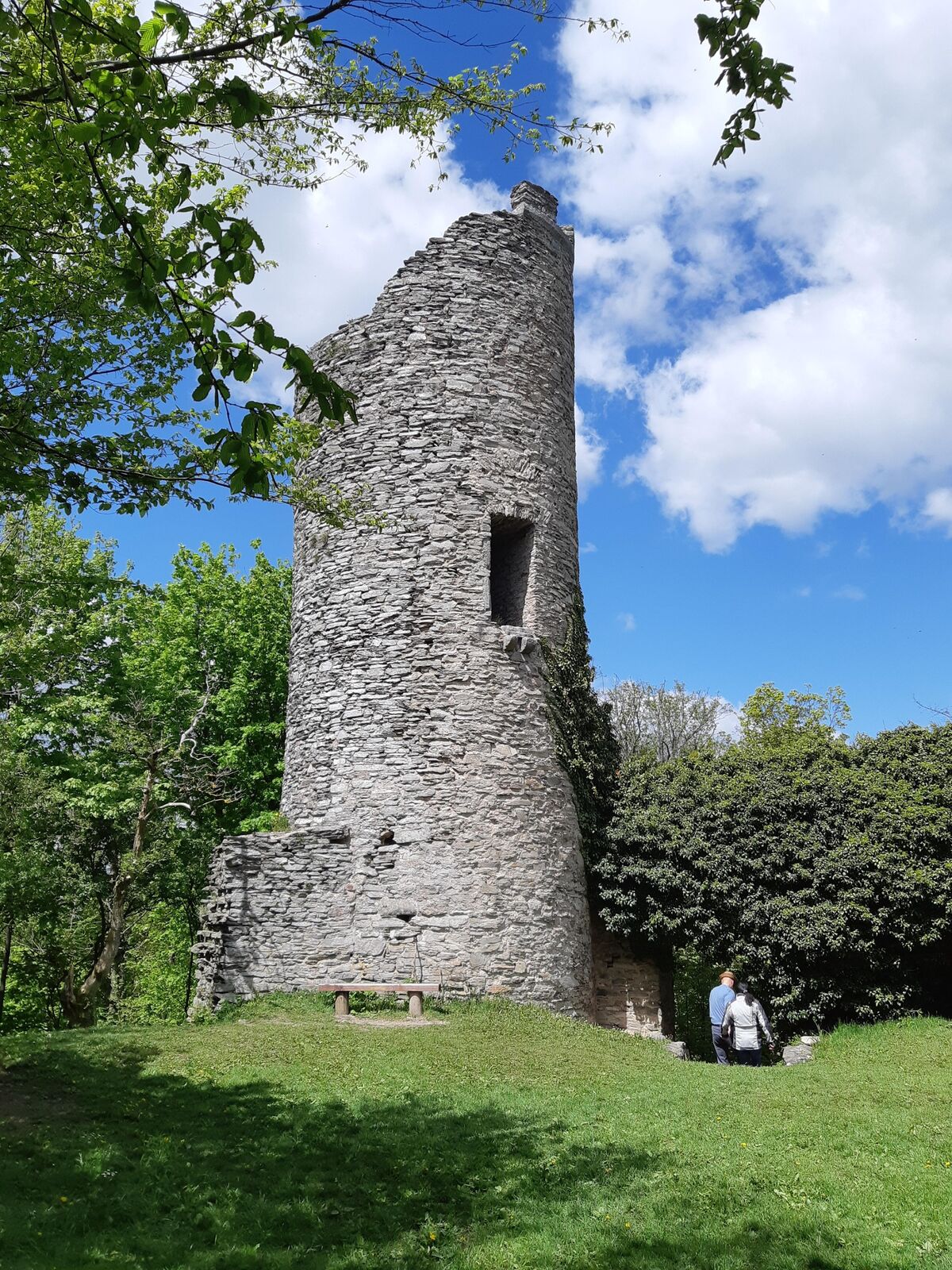
This circular hiking trail leads to the Ebersburg castle ruins.
- Difficulty
-
difficult
- Rating
-
- Starting point
-
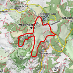
Village center of Poppenhausen (Wasserkuppe)
- Route
-
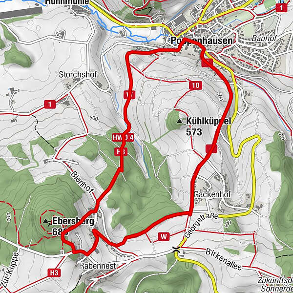
PoppenhausenSt. Georg0.0 kmNeuwart2.0 kmRabennest2.7 kmGackenhof4.0 kmPoppenhausen5.4 kmSt. Georg5.6 km
- Best season
-
JanFebMarAprMayJunJulAugSepOctNovDec
- Description
-
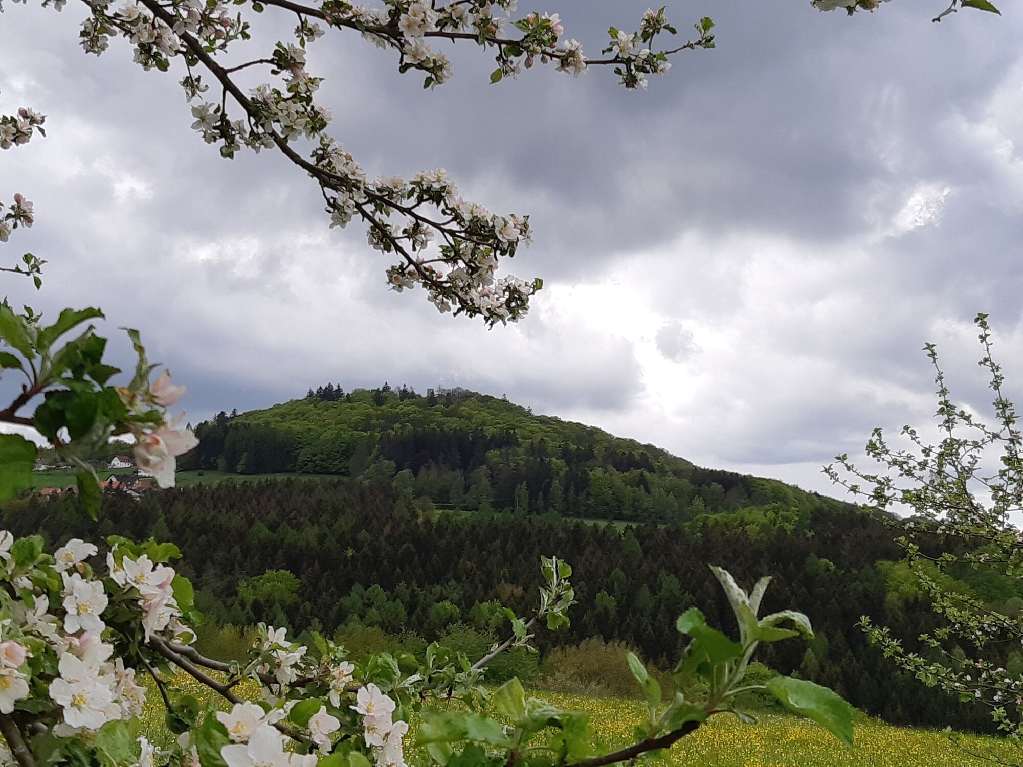
The Ebersburg castle ruins are enthroned on the Ebersberg at a height of 689 meters. It is believed that the Ebersburg was built around the year 1200 by the noble Ebersberg family.
Only a ruin of the Ebersburg remains today. There are two towers that are connected by a castle wall. There is seating in the courtyard to relax. If you want to climb the castle tower to enjoy the great view, you have to get the key in advance. More information on this under the links.
- Directions
-
We leave the village in a south-westerly direction. With the cooling bucket on the left and the Storchshof on the right, it goes steadily uphill through the forest to the district of Neuwart. It continues uphill to the castle ruins. The way back goes through the hamlet of Gackenhof back into the valley basin to Poppenhausen (Wasserkuppe).
- Highest point
- 646 m
- Endpoint
-
Village center of Poppenhausen (Wasserkuppe)
- Height profile
-
 © outdooractive.com
 - Equipment
-
Sturdy shoes
Rain clothes
Sun protection at high temperatures
First aid kit
GPS navigation device or map
Sufficient drinks and provisions - Safety instructions
-
The tourist routes of the Rhön are mostly used by other active people (hikers, mountain bikers, cyclists, walkers, riders, cross-country skiers, etc.).
We ask all active nature sports enthusiasts to show consideration for one another. The same applies, of course, to nature - it is worth protecting. In the Rhön, therefore, nature sports should only be practiced in daylight on designated paths and areas.
- Additional information
- Directions
-
Arrival by car is possible via the A7 and A66.
Leave the A7 at exit 92 Fulda-Mitte and take the B458 in the direction of Hilders. When you reach the small village of Steinwand, turn right towards Poppenhausen.
Leave the A66 at exit 54 Eichenzell and then join the L3307 in the direction of Rönshausen / Poppenhausen. In Weyhers, turn right onto Fuldaer Straße and at the exit of the town turn left again onto Lüttertal street (L3307). On this one reaches Poppenhausen.
- Public transportation
-
The following lines of the LNG Fulda run at the bus stop "Poppenhausen, Kirche":
- Line 35: Wasserkuppe - Poppenhausen - Weyhers - Künzell - Fulda
- Line 37: Poppenhausen - Gersfeld - Wasserkuppe - Wüstensachsen
- Line 44: Dalherda - Schmalnau - Weyhers - Oberrod - Poppenhausen
It is approx. 500 meters from the church to the start of the hiking trail.
- Parking

-
-
AuthorThe tour Rhön - Rundweg 8 Poppenhausen (Wasserkuppe) is used by outdooractive.com provided.


General info
-
Rhön / Hessen
534
-
Hessisches Kegelspiel
278
-
Poppenhausen
209