© SommeTourisme-DR

© ADRT80-DM

© Somme Tourisme - DR

© NBryant

© ADRT80-DM

© ADRT80-DM

© ADRT80-DM

© Nicolas Bryant

- Difficulty
-
easy
- Rating
-
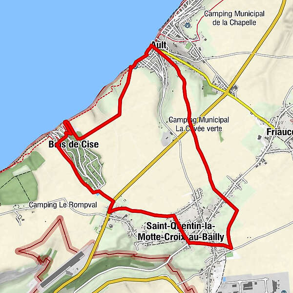
- Route
-
Église Saint-PierreAult0.1 kmCalvaire0.5 kmBois de Cise2.2 kmSaint-Quentin-la-Motte-Croix-au-Bailly6.2 kmÉglise Saint-Pierre10.9 kmAult11.0 km
- Best season
-
JanFebMarAprMayJunJulAugSepOctNovDec
- Highest point
- 110 m
- Endpoint
-
AULT
- Height profile
-
 © outdooractive.com


- Author
-
The tour Circuit de Lamotte is used by outdooractive.com provided.