
- Brief description
-
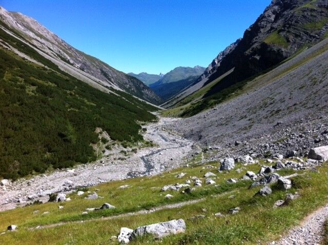
A challenging hike through the wild Welschtobel, all the way up to the Erzhorn saddle and via the romantic Älplisee lake back to Arosa.
- Difficulty
-
difficult
- Rating
-
- Starting point
-
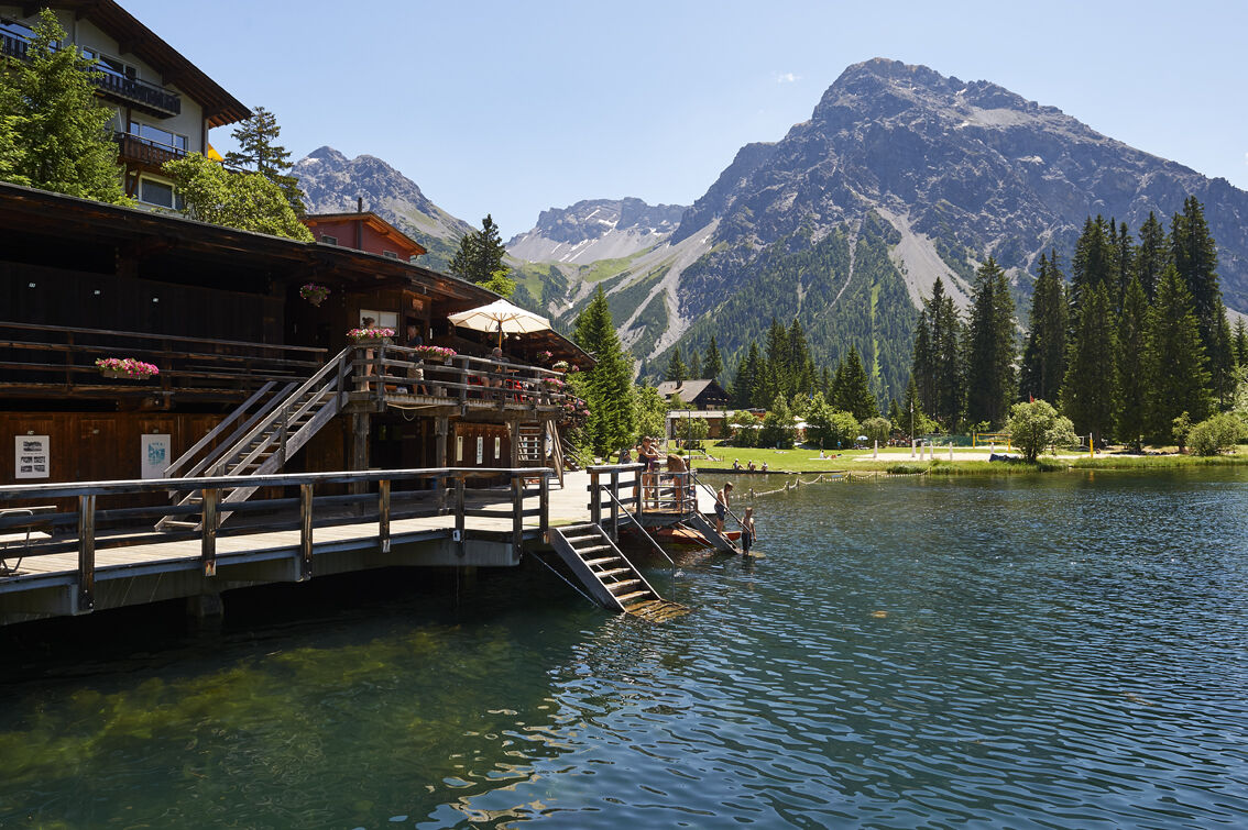
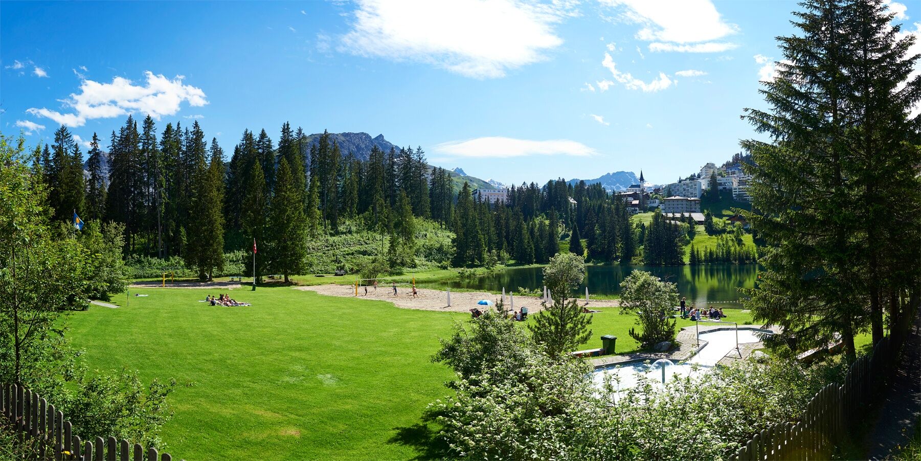
Strandbad (Lido) Untersee Arosa
- Route
-
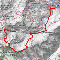
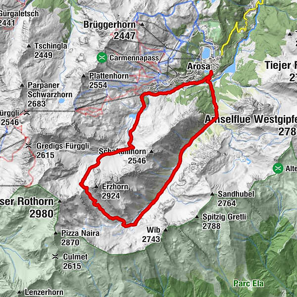
Arosa (1,739 m)0.3 kmRamozhütte7.7 kmErzhornsattel9.9 kmInnerarosa (1,820 m)15.9 kmArosa (1,739 m)17.8 km
- Best season
-
JanFebMarAprMayJunJulAugSepOctNovDec
- Description
-
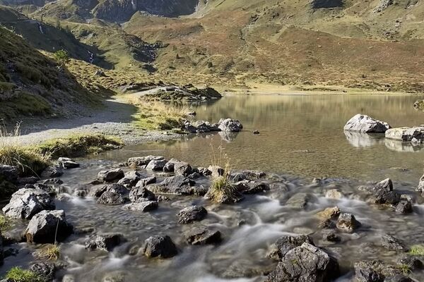
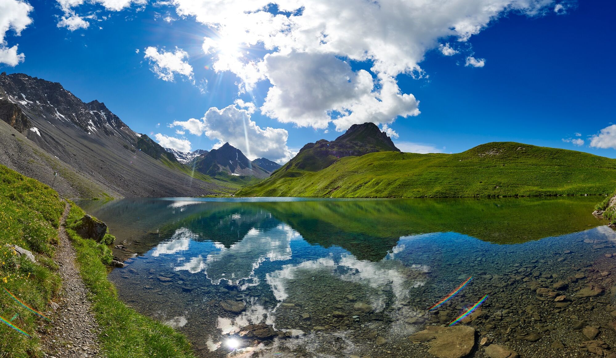
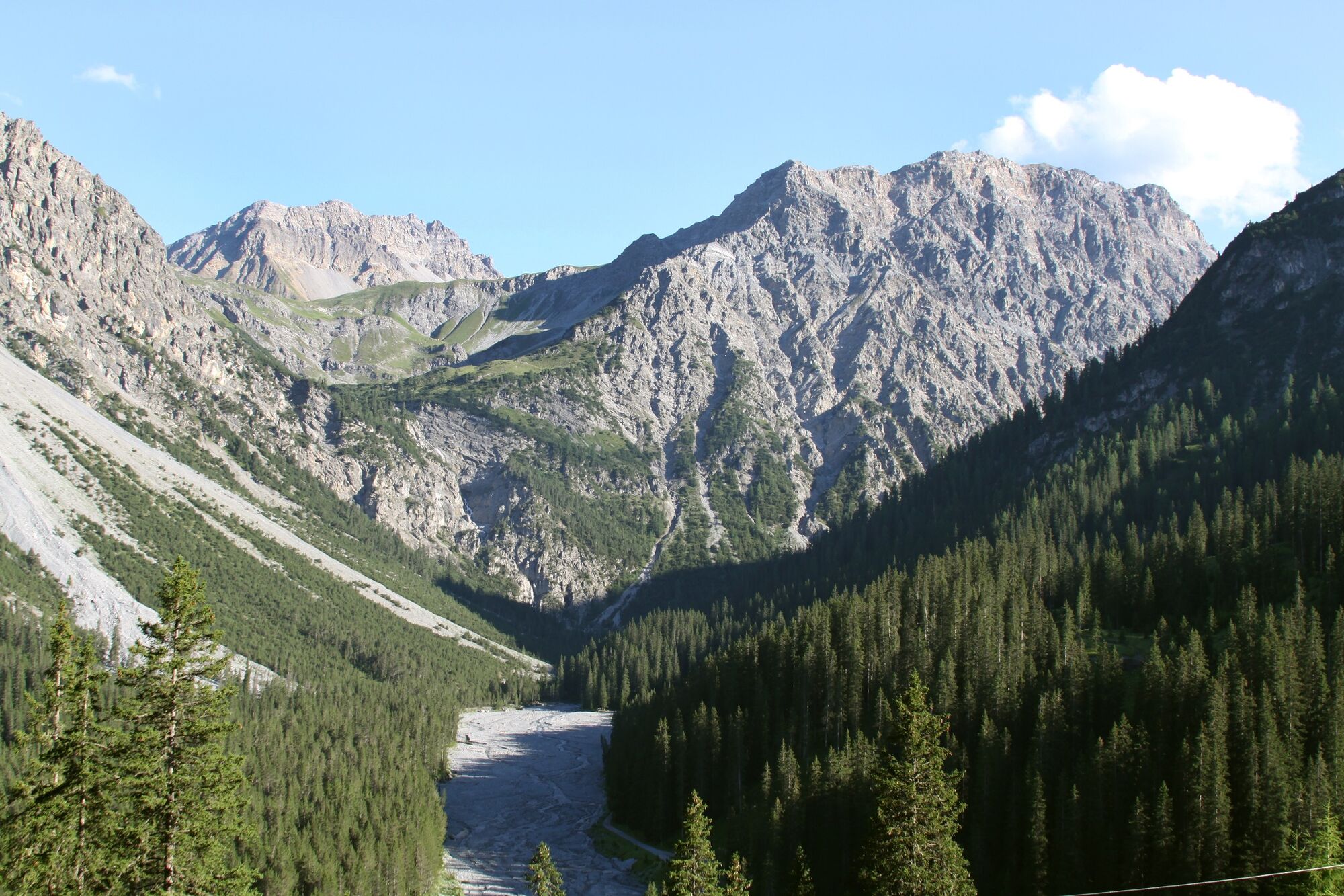
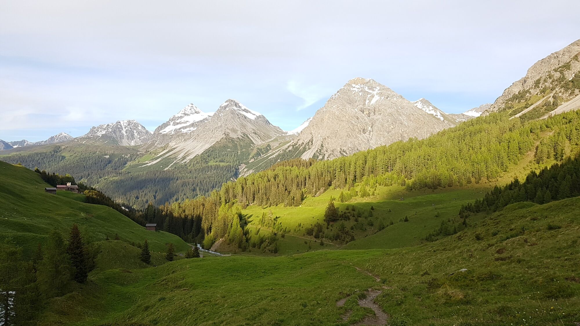
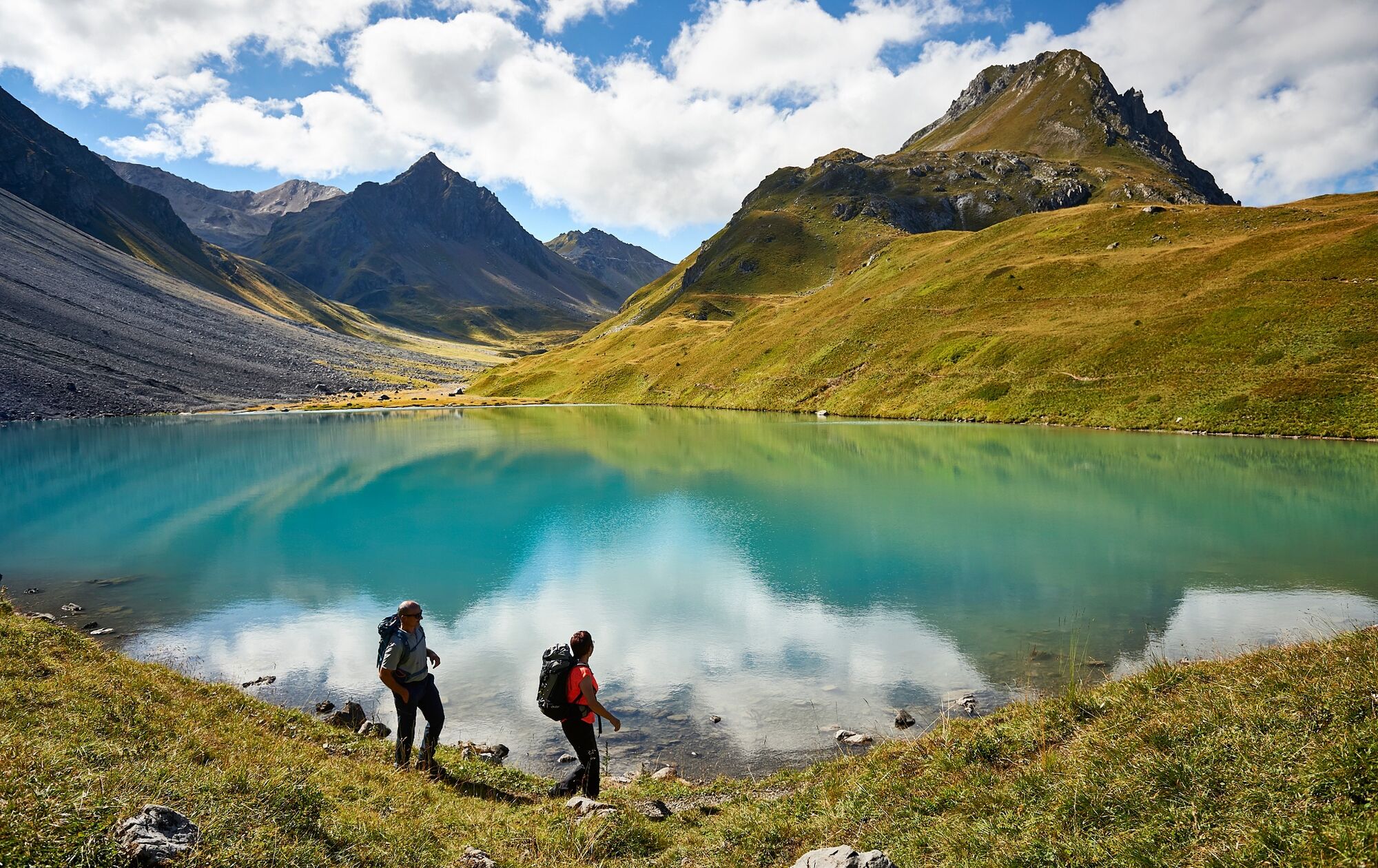
The hike starts at the Untersee lake Arosa and leads to the Isel, across the river and deeper into the wild valley (Welschtobel). The hills on both sides are steep and one might also observe chamois, deer and ibexes. Once at the Ramoz hut (a non-attended SAC hut) it might be wise to enjoy a break before the path ascents to the Erzhorn saddle. As of here surefootedness and head for heights is required. Also the ascent demands high concentration. As soon as the tricky passage is over the path continues downhill to the Älplisee lake. Your feet will love the cool down in the icy water. During the summer you might even enjoy a swim. After the Älplisee lake the trail leads to the Schwellisee lake and finally arrives back to Arosa.
- Directions
-
Strandbad Untersee Arosa - Isel - following the river - Ramoz Hut - Erzohrnsattel - Älplisee lake - Schwellisee lake - Strandbad Untersee Arosa
- Highest point
- 2,727 m
- Endpoint
-
Strandbad (Lido) Untersee Arosa
- Height profile
-
 © outdooractive.com
 - Equipment
-
Weatherproof clothing, sturdy shoes, walking sticks and sufficient water are recommended. It is also recommended to take food in your backpack, as there are no restaurants along the way.
- Safety instructions
- Tips
-
An overnight stay in the Ramozhütte is an unforgettable experience. (Self-catering hut, reservation required)
- Additional information
-
Arosa strives to provide hikers with a well-developed and marked network of hiking trails. Please heed the rules and signposting. You will find further helpful tips under the hiking information.
This hike is only possible during the summer season.
Please find more information about the Ramoz Hut and the reservation here.
- Directions
-
Once you arrive in Chur, follow the sign posts and the winding road to Arosa. At the village entrance, after the petrol station, turn left and follow the street downhill.
- Public transportation
-
The Rhaetian Railway leaves Chur to Arosa and back at hourly intervals. From the train station Arosa, the Untersee lake (starting point of the hike) is accessible by foot or by the free local bus.
- Parking
- Author
-
The tour Arosa - Ramoz hut - Lake Älplisee - Arosa is used by outdooractive.com provided.