- Brief description
-
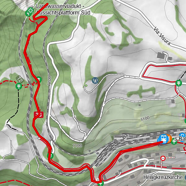
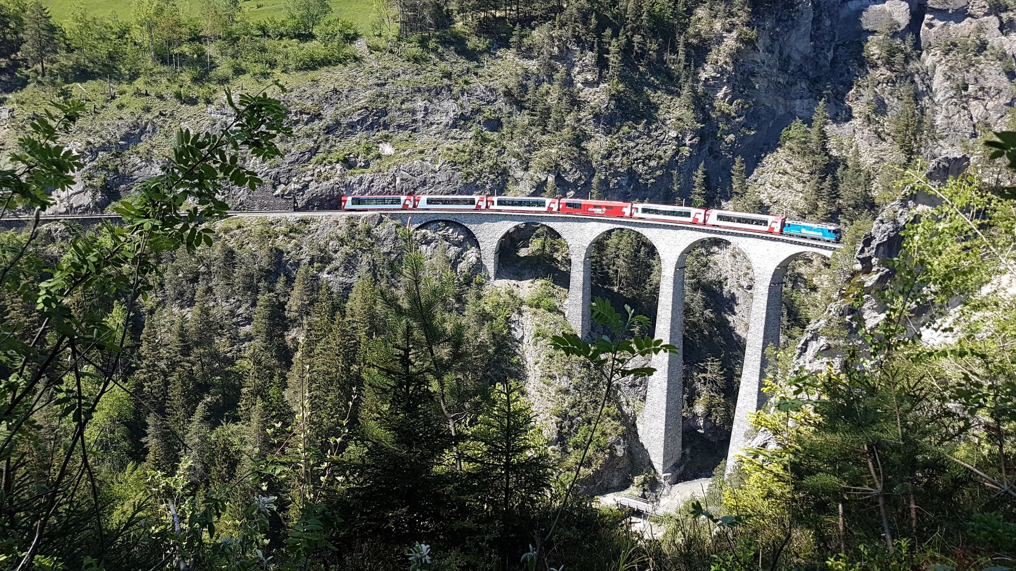
Gemütliche Wanderung bis zum Aussichtspunkt mit schwindelerregendem Blick auf das berühmte Landwasserviadukt und in die Tiefen des Landwassers. Auf gleichem Weg zurück mit sicherem Boden unter den Füssen.
- Difficulty
-
easy
- Rating
-
- Route
-
Filisur (1,080 m)s'Bahnhöfli
- Highest point
- 1,092 m
- Endpoint
-
Filisur, Bahnhof
- Height profile
-
 © outdooractive.com

- Author
-
The tour Landwasserviadukt-Aussichtsplattform Süd is used by outdooractive.com provided.
GPS Downloads


General info
Refreshment stop
Cultural/Historical
A lot of view
Other tours in the regions
-
Bergün Filisur
801
-
Filisur
215