
- Brief description
-
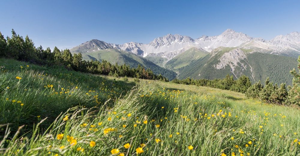
Short but partly steep hike up to Mot Madlain, where a wonderful panoramic view of the surrounding valleys awaits.
- Difficulty
-
medium
- Rating
-
- Starting point
-
PostBus Stop S-charl
- Route
-
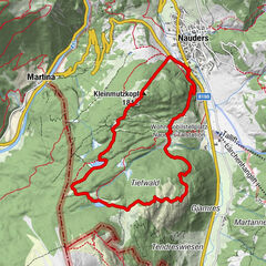
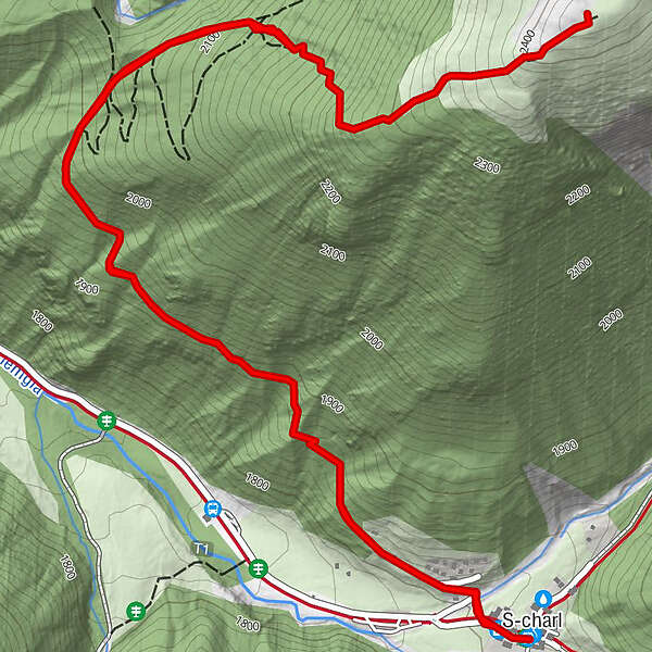
S-charl (1,810 m)Reformierte Kirche0.0 kmReformierte Kirche6.1 kmS-charl (1,810 m)6.1 km
- Best season
-
JanFebMarAprMayJunJulAugSepOctNovDec
- Description
-
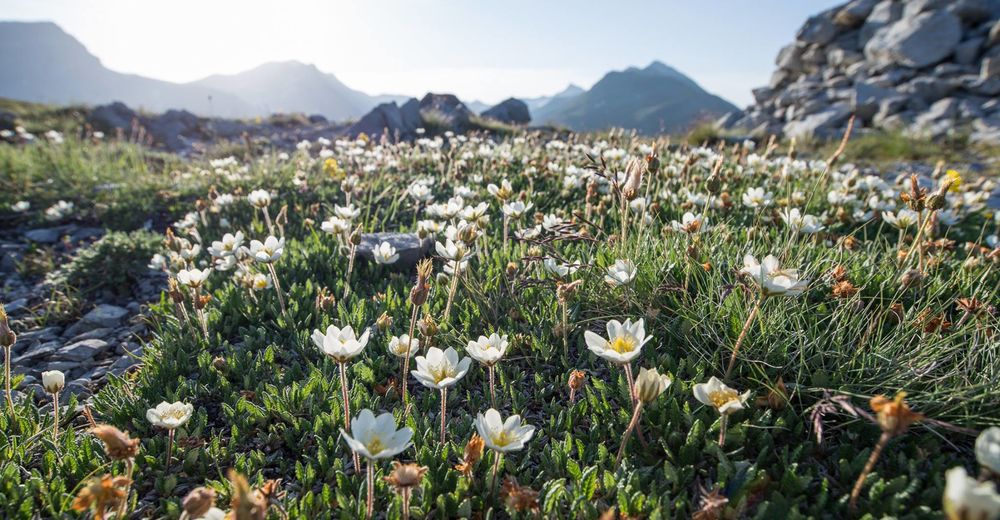
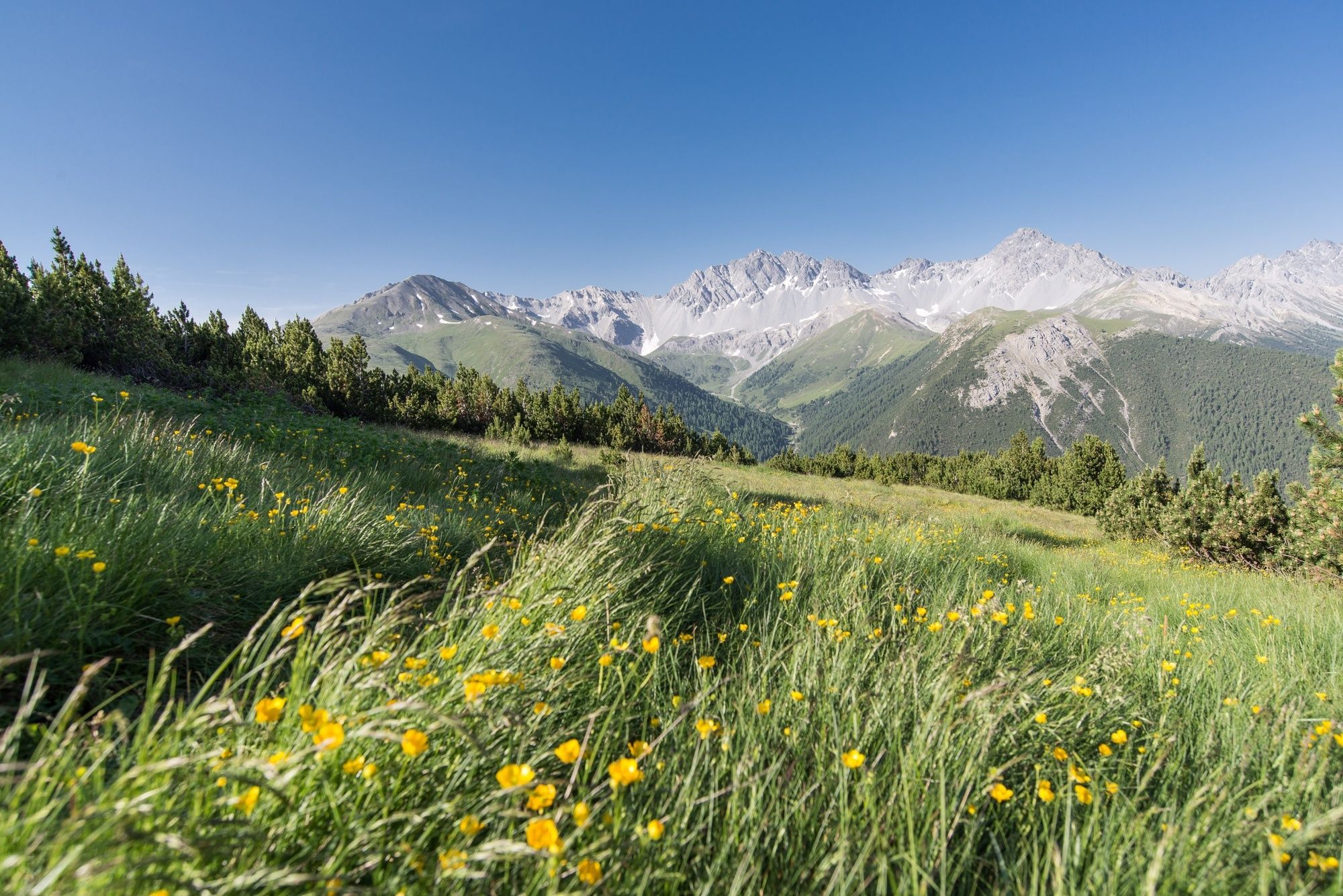
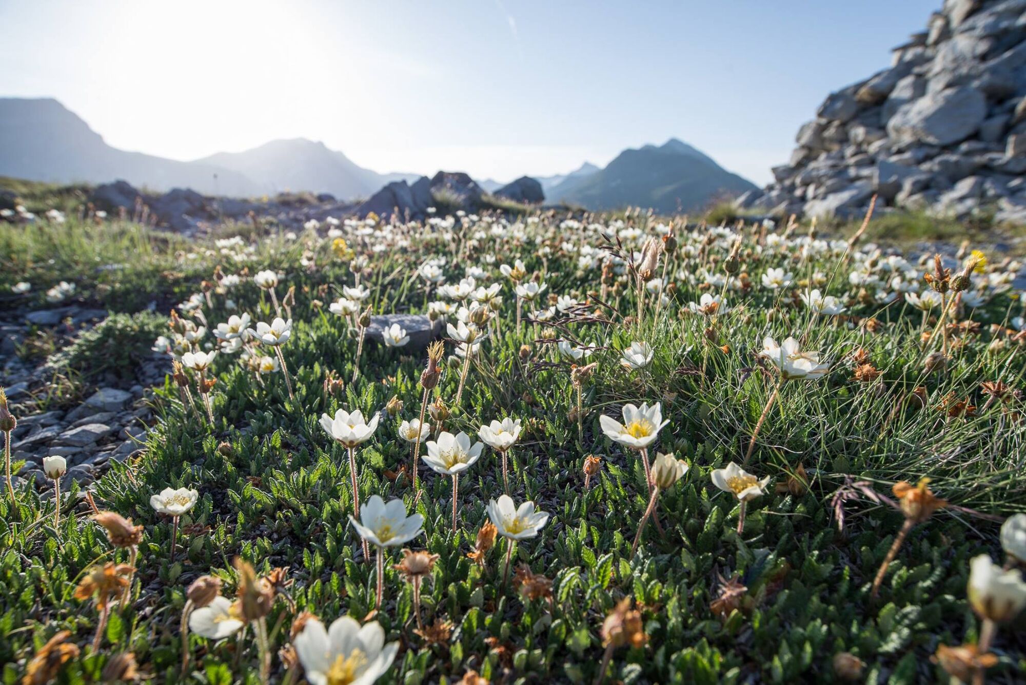
From the former mining settlement of S-charl, where silver and lead were once mined, the rather short and sometimes steep hike leads up to Mot Madlain. Here you can enjoy a magnificent view of the surrounding valleys such as Val Tavrü and Val S-charl. In summer, you can admire the varied flora with groups of edelweiss.
- Directions
-
From the summer village of S-charl, at the bridge at the entrance to the village, the path leads in the direction of Ils Chomps, gently ascending through the forest. On the way we pass the remains of a mine. Towards the tree line, the hike eventually climbs quite steeply, before it becomes flatter again on the last stretch to Mot Madlain. We descend along the same path to S-charl.
- Highest point
- 2,415 m
- Endpoint
-
PostBus Stop S-charl
- Height profile
-
 © outdooractive.com
 - Equipment
-
Mountain boots, possibly poles, sun protection, enough to drink.
- Safety instructions
-
The tour has been assessed in favourable weather conditions, it is imperative that current weather conditions and weather forecasts are taken into account before starting the tour. This hike requires surefootedness, hiking boots and hiking equipment.
Emergency call:
144 Emergency call, first aid
1414 Mountain rescue REGA
112 International emergency call
- Tips
-
The "Crusch Alba" and "Mayor", each with a sun terrace, invite you to stop off in idyllically situated S-charl.
The mining history of S-charl can be experienced up close during guided excursions in the tunnels. Visitor Information Centre Scuol, Tel. +41 81 861 88 00
In the Schmelzra S-charl museum with a bear exhibition we learn more about the miners and bears in Switzerland, www.schmelzra.ch - Directions
-
- From the north: via Landquart - Klosters by car transport through the Vereina Tunnel (Selfranga - Sagliains) or via the Flüela Pass to Scuol. The summer village of S-charl can be reached from Scuol in around 25 minutes.
- From the east: via Landeck / Austria in the direction of Scuol and then also turn into the side valley Val S-charl.
- Due to the sometimes narrow road conditions, we recommend travelling from Scuol to S-charl by PostBus.
- Public transportation
-
- By Rhaetian Railway (from Chur, Landquart/Prättigau or from the Upper Engadine) hourly to Scuol-Tarasp station.
- By PostBus (from Martina, Sent, Ftan or Tarasp) hourly service to Scuol-Tarasp station.
- Continue by PostBus with hourly connection to the PostBus stop S-charl
- Parking
-
- Free parking at the entrance to the village of S-charl
- Author
-
The tour S-charl – Mot Madlain (Circular Route) is used by outdooractive.com provided.


General info
-
Vinschgau
1278
-
Engadin Scuol Zernez
730
-
Scuol
134