


- Brief description
-
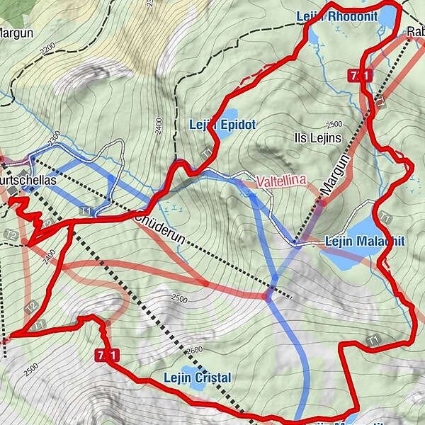
Discover the unique high-alpine flora and lake landscape of the Upper Engadine on this hiking circuit to the six 6 Lejins (Romansh: small lakes). The lakes are named after the minerals and rock types they contain.
- Difficulty
-
medium
- Rating
-
- Starting point
-
Sils.i.E. (Furtschellas)
- Route
-
La Chüdra0.0 kmFurtschellas0.1 kmFurtschellas5.9 kmLa Chüdra6.0 km
- Best season
-
JanFebMarAprMayJunJulAugSepOctNovDec
- Description
-
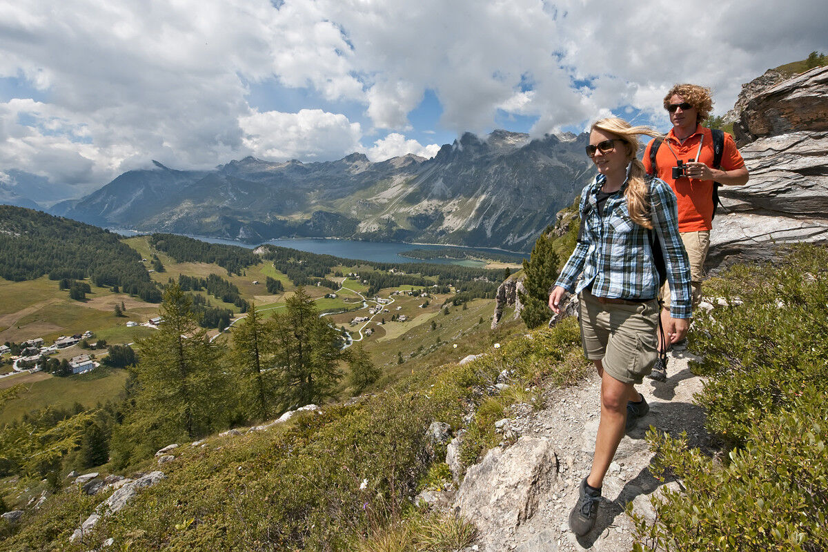
Experience the magic of the crystal-clear mountain lakes. The reflection of the Engadine sky in the lakes is just fantastic!
You’ll start at the top station of Furtschellas at 2312 m. From there the 2 ½ hours round-path first leads towards Alp Munt and then around the six small mountain lakes: Lejin Cristal, Lejin Magnetit, Lejin Malachit, Lejin Rhodonit, Lejin S-chaglia and Lejin Epidot. Wherever you look you’ll enjoy the view up to the icy pinnacles and rocky flanks of the Corvatsch range. There are many resting places which invite you to stay. At the Rabgiusa hut or at the restaurant La Chüdera with its great panoramic terrace you can eat and drink something.
- Highest point
- 2,653 m
- Endpoint
-
Sils.i.E. (Furtschellas)
- Height profile
-
 © outdooractive.com
 - Safety instructions
-
Please note: Snow fields are possible on the upper sections right through to the summer months.
- Tips
-
Water path Autio Tour with thrilling stories about the 6 Lejins could be download directly from our homepage.
- Additional information
-
Corvatsch AG
7513 Silvaplana


- Author
-
The tour 721 Senda Ils Lejins Sils/Furtschellas is used by outdooractive.com provided.


General info
-
Veltlin / Valtellina
852
-
Engadin St. Moritz
782
-
Sils
311


