
- Brief description
-
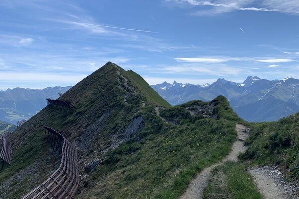
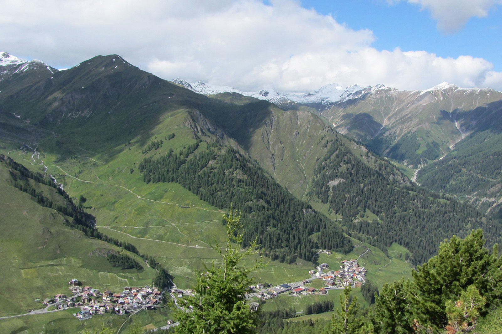
Panoramic hike high above the Samnaun valley.
- Difficulty
-
medium
- Rating
-
- Starting point
-
PostBus stop Samnaun Dorf, Riva
- Route
-
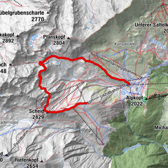
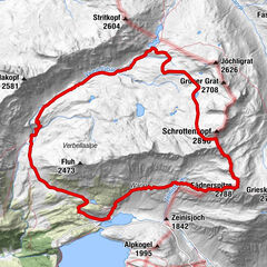
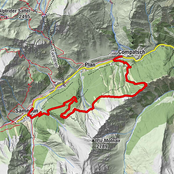
El Rico0.1 kmSamnaun (1,846 m)0.2 kmLaret (1,731 m)8.8 kmCompatsch (1,715 m)8.8 km
- Best season
-
JanFebMarAprMayJunJulAugSepOctNovDec
- Description
-
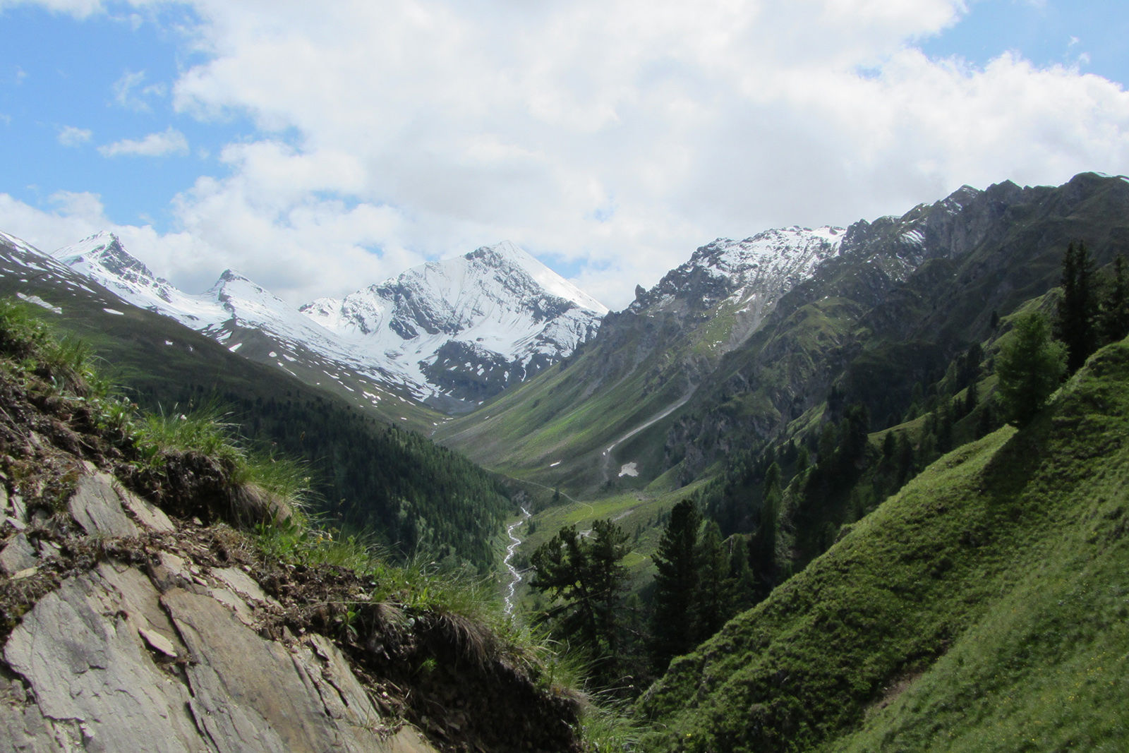
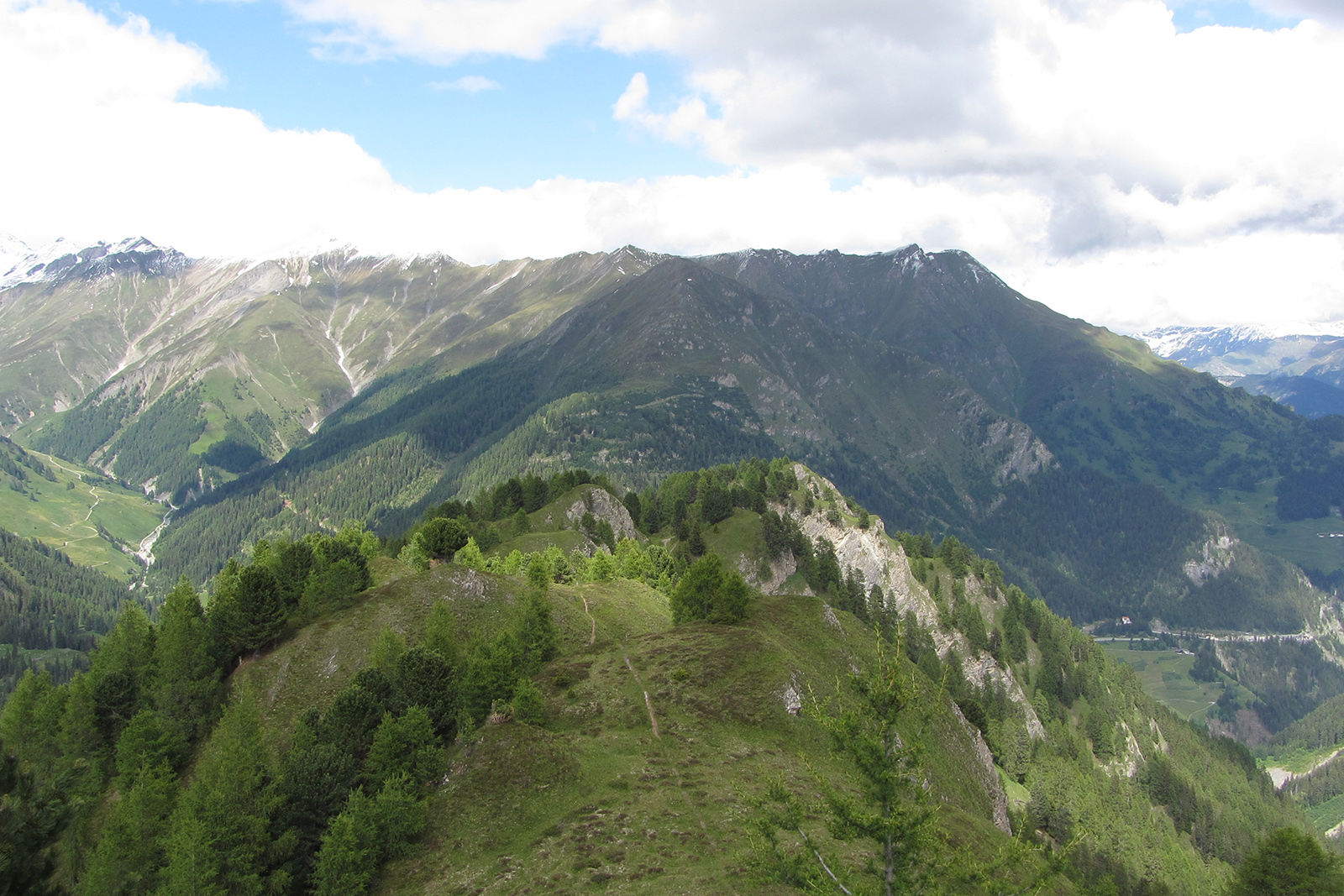
From the guest information desk the hike starts along the village road. After the Hotel Post turn left, at Hotel Bündnerhof turn left again over the bridge over the Maisasbach. Immediately afterwards the leisurely ascent through the forest begins to the Motta Saltuorn hut and on to the vantage point above the Val Motnaida, where the view opens up over Samnaun village and the Piz Ot. Past the avalanche barriers, the view opens up over the whole Samnaun valley. On the other side of the valley you can see the Silvretta Arena with the imposing peaks of Flimspitz and Bürkelkopf for once from a distance. After the somewhat exposed passage through the Val da Chierns - this path is also called the "Schäfersteig" (shepherd's path) by the locals - we walk comfortably via Motta Foppazins to the Piz Mezdi, where the view of the Val Sampuoir opens up. Over the border ridge of the two communities of Samnaun and Valsot, the path descends to Fuorcla Curschiglias. From here there is the possibility to descend towards Samnaun-Compatsch either along the forest road or in direct descent via Magnüda.
- Directions
-
Cross the street before the guest information desk
Turn left after the Hotel Post
Turn left at Hotel Bündnerhof
Over the bridge
Follow the hiking trail via Motta Saltuorn to the viewpoint
Past the avalanche barriers
Exposed passage through the Val da Chierns
Via Motta Foppazins to Piz Mezdi
Over the border ridge down to Fuorcla Curschiglias
Descent to Samnaun-Compatsch - Highest point
- 2,249 m
- Endpoint
-
PostBus stop Samnaun-Compatsch, village
- Height profile
-
 © outdooractive.com
 - Equipment
-
Good shoes, rain and sun protection, water bottle, bandages.
- Safety instructions
-
The tour has been evaluated under favorable weather conditions. Current weather conditions and weather forecasts must be taken into account before the tour starts. This hike requires elementary alpine experience, orientation skills. Trekking shoes are recommended.
emergency call:
144 Emergency call, first aid
1414 Mountain rescue REGA
112 International emergency call
- Additional information
- Directions
-
- On the north: via Landquart - Klosters by car transport through the Vereina tunnel (Selfranga - Sagliains). Then take the H27 in the direction via Scuol and Martina to Vinadi. At the junction Vinadi to Samnaun (about 1 hour from Vereina Südportal)
- From the east: via the Inn valley road B180 via Landeck to Pfunds, junction Kajetansbrücke and via Spiss to Samnaun.
- From the south: via Reschenpass (Nauders) on B180 to Pfunds, junction Kajetansbrücke and via Spiss to Samnaun.
- Public transportation
-
With the Rhaetian Railway (from Chur, Landquart/Prättigau or from the Upper Engadine) every hour to Scuol-Tarasp station
Continue with the PostBus (from Scuol-Tarasp, or Martina, cunfin) every hour to the PostBus stop Samnaun-Dorf, Riva
In Samnaun during the day hourly access with the Samnaunbus
- Parking
-
Free parking in Samnaun village (Chasa Riva, Musella or Votlas)
- Author
-
The tour Fuorcla Curschiglias over the Schäfersteig is used by outdooractive.com provided.