© Graubünden Ferien - Marco Hartmann


© Graubünden Ferien - Marco Hartmann
- Brief description
-
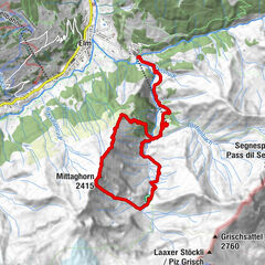
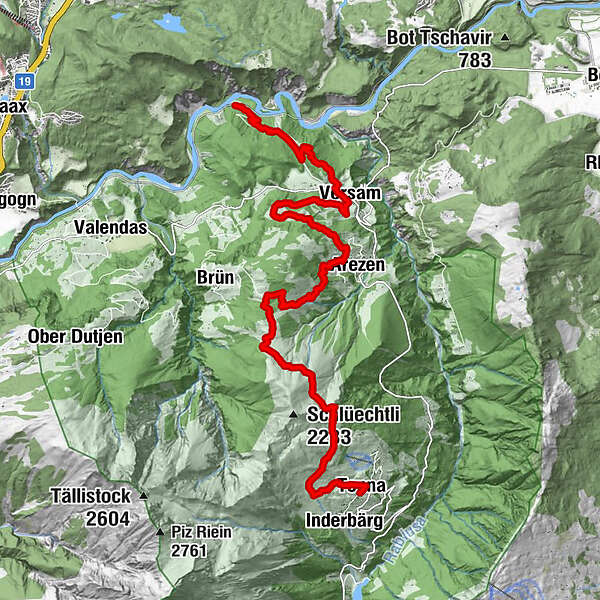
Versam - Brüner Alp - Tenner Chrüz - Tenna
- Difficulty
-
medium
- Rating
-
- Starting point
-
Versam
- Route
-
Versam-Safien (635 m)0.0 kmVersam3.8 kmArezen7.5 kmMaiensäßbeizli Ilmschlacht10.3 kmTenner Kreuz (2,020 m)13.4 kmBleichtaboda14.3 kmTenna (1,643 m)16.4 kmBerghotel Alpenblick16.4 kmMitti16.5 km
- Best season
-
JanFebMarAprMayJunJulAugSepOctNovDec
- Description
-
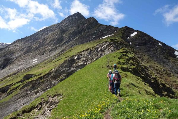
From Versam you will climb steadily upwards past the Brüner Alp and up to the Tenner Chrüz. The view towards Ringelspitz and Tschingelhörner becomes more and more impressive. From the Tenner Chrüz you look into Safiental. Now it’s downhill to Tenna.
- Directions
-
Versam-Safien railway station - Versam - Imschlacht - Brüner Alp - Tenner Chrüz - Tenner Alp - Tenna
- Highest point
- 2,009 m
- Endpoint
-
Tenna
- Height profile
-
 © outdooractive.com
 - Tips
-
The Maiensäss Beizli Imschlacht is an ideal place for a lunch break. The tour can be shortened by taking the Rheinschlucht/Ruinaulta bus.
- Additional information
- Public transportation
-
By train from Chur to Versam-Safien station


- Author
-
The tour Walser trail Safiental Stage 1 is used by outdooractive.com provided.
GPS Downloads


General info
Refreshment stop
A lot of view
Other tours in the regions
-
Heidiland
2201
-
Flims Laax Falera
774
-
Trin
277