
- Brief description
-
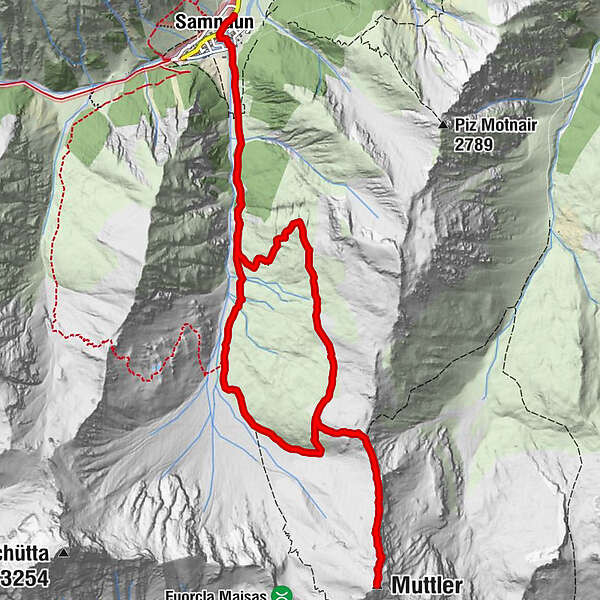
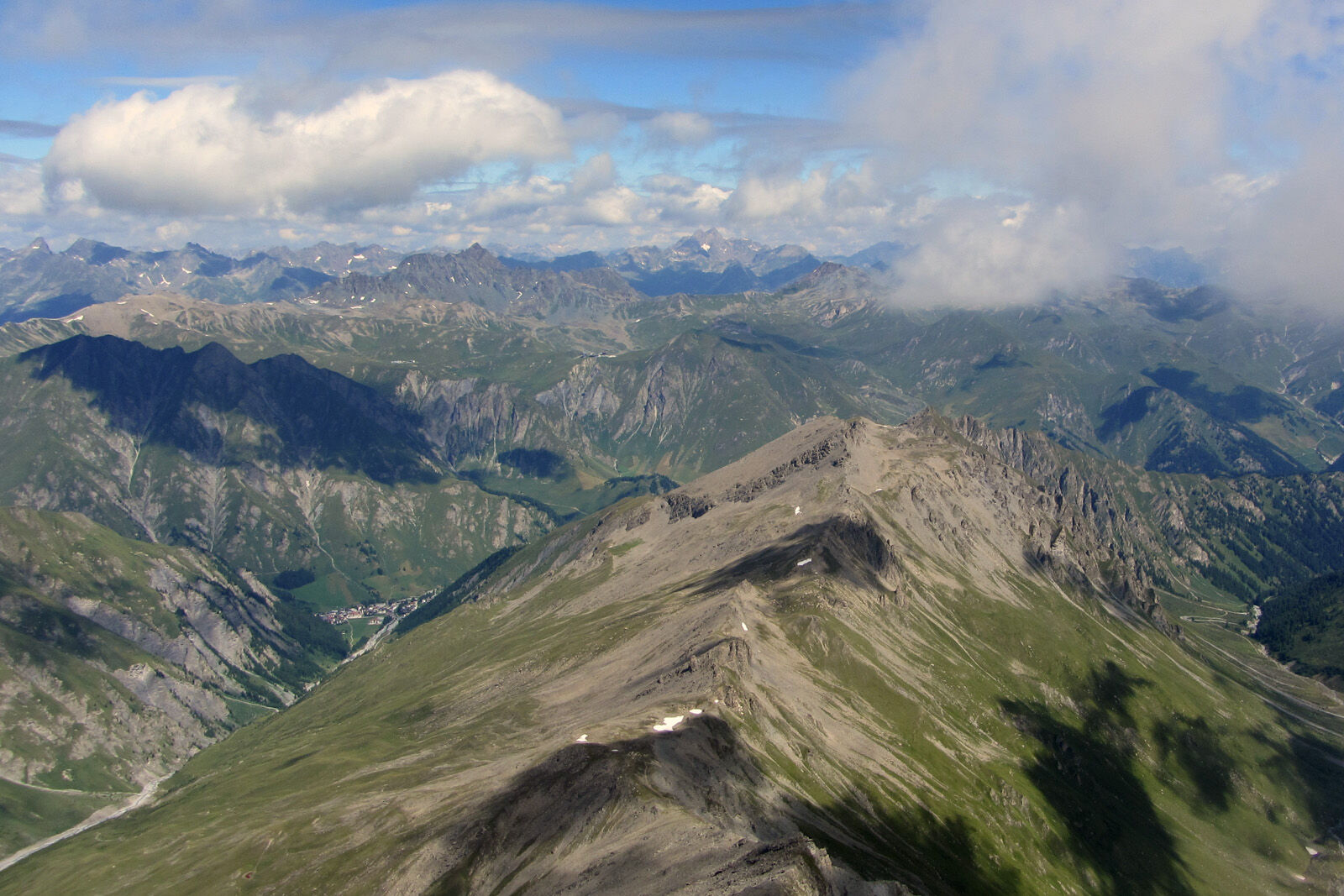
Demanding mountain hike to the highest Samnaun peak, the Muttler (3,294 m above sea level).
- Difficulty
-
difficult
- Rating
-
- Starting point
-
PostBus stop Samnaun village, Riva
- Route
-
El Rico0.1 kmSamnaun (1,846 m)0.2 kmMuttler (3,294 m)7.3 kmSamnaun (1,846 m)14.4 kmEl Rico14.7 km
- Best season
-
JanFebMarAprMayJunJulAugSepOctNovDec
- Description
-
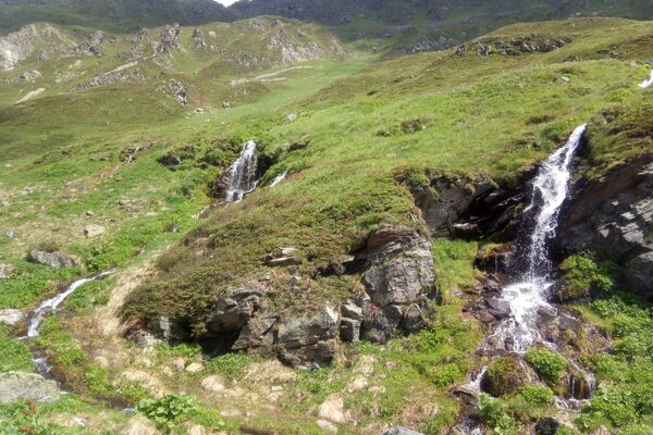
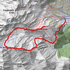
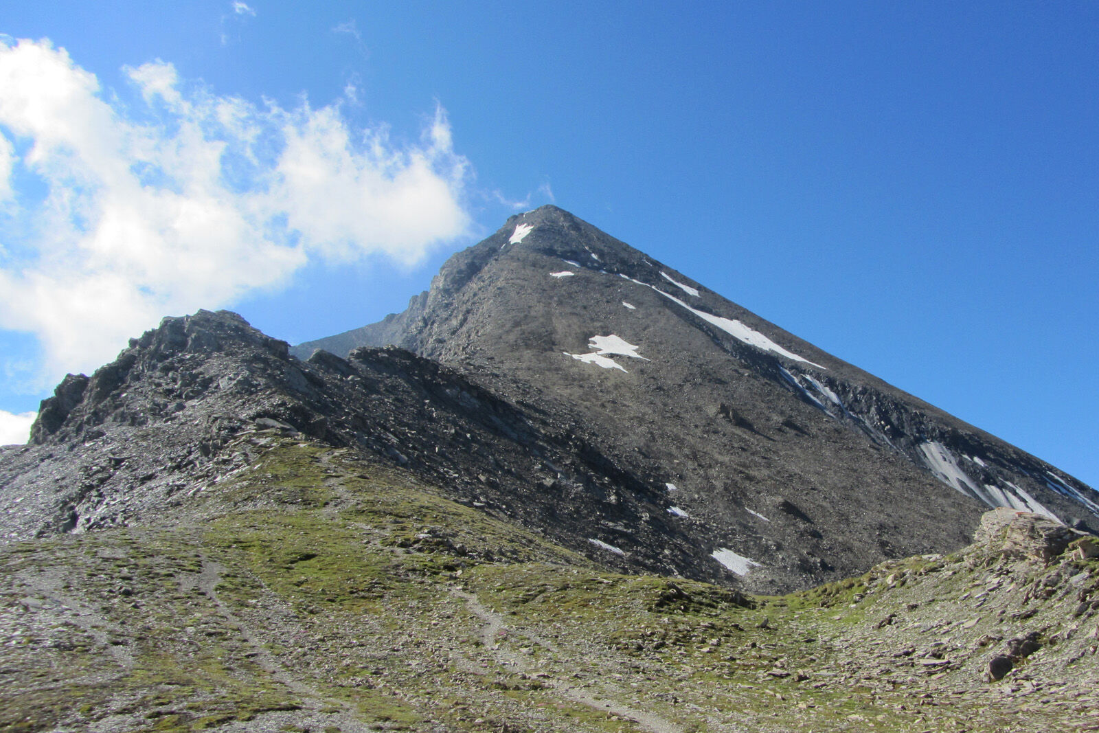
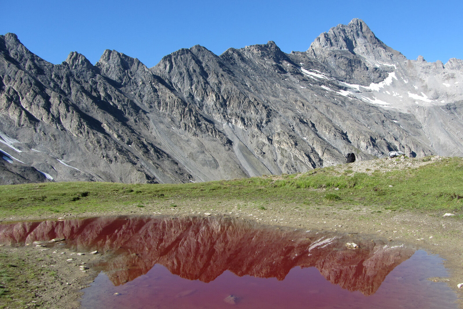
From Samnaun Dorf the hiking path leads into Val Maisas, past the shepherd's hut and over alpine meadows to Rossboden. The day's destination, Muttler, always remains in view. We continue via Lange Seite to reach Rote Seeli, which turns red in summer. In recent years the lake has often almost dried up, so that the natural phenomenon is unfortunately no longer visible. Algae are responsible for the colouring. On Rossbodenjoch the view opens up over Val Sampuoir and the Mundin group. From here you continue via Nordgrad to Samnaun’s highest peak, Muttler. The last steep section over brittle slate is often damp or even icy and thus slippery. The summit panorama compensates the effort and includes the Silvretta, Bernina and Verwall groups in the west and north, the Ötztal Alps and Ortler in the east and south. On a clear day you can even see the Lake of Constance. The same path takes us back again to Samnaun Dorf.
- Directions
-
From Samnaun village turn into Val Maisas
Follow the valley
Keep left when branching in the basin
To the Rote Seeli on the Rossbodenjoch
Last rise on the Muttler
Same way back to Samnaun village - Highest point
- 3,252 m
- Endpoint
-
PostBus stop Samnaun village, Riva
- Height profile
-
 © outdooractive.com
 - Equipment
-
Good shoes, rain and sun protection, water bottle, bandages.
- Safety instructions
-
The tour has been evaluated under favorable weather conditions. Current weather conditions and weather forecasts must be taken into account before the tour starts.
emergency call:
144 Emergency call, first aid
1414 Mountain rescue REGA
112 International emergency call
- Additional information
- Directions
-
- From the north: via Landquart - Klosters by car transport through the Vereina tunnel (Selfranga - Sagliains) Then take the H27 in the direction via Scuol and Martina to Vinadi. At the junction Vinadi to Samnaun (about 1 hour from Vereina Südportal)
- From the east: via the Inn valley road B180 via Landeck to Pfunds, junction Kajetansbrücke and via Spiss to Samnaun.
- From the south: via Reschenpass (Nauders) on B180 to Pfunds, junction Kajetansbrücke and via Spiss to Samnaun.
- Public transportation
-
- With the Rhaetian Railway (from Chur, Landquart/Prättigau or from the Upper Engadine) every hour to Scuol-Tarasp station
- Continue by PostBus (from Scuol-Tarasp or Martina, Cunfin) every hour to the PostBus stop Samnaun village, Riva
- In Samnaun during the day hourly connection with the Samnaunbus to the PostBus stop Samnaun Dorf, Riva
- Parking
-
Parking Chasa Riva at the entrance of Samnaun villageAdditional parking spaces at Musella or Votlas

- Author
-
The tour Muttler is used by outdooractive.com provided.