- Brief description
-
Around the border mountain Flimspitz, over an impressive rockfall and past the idyllic little lakes "Bei den Seen".
- Difficulty
-
medium
- Rating
-
- Starting point
-
Mountain station double-decker lift, Alp Trida Sattel
- Route
-
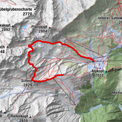
Alptrider Sattel (2,495 m)0.3 kmViderjochbahn 1 (2,613 m)1.3 kmFlimsattelbahn (2,735 m)2.9 kmSattel8.5 km
- Best season
-
JanFebMarAprMayJunJulAugSepOctNovDec
- Description
-
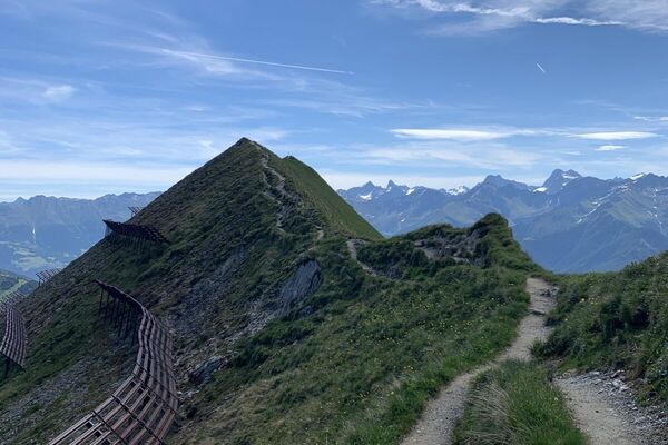
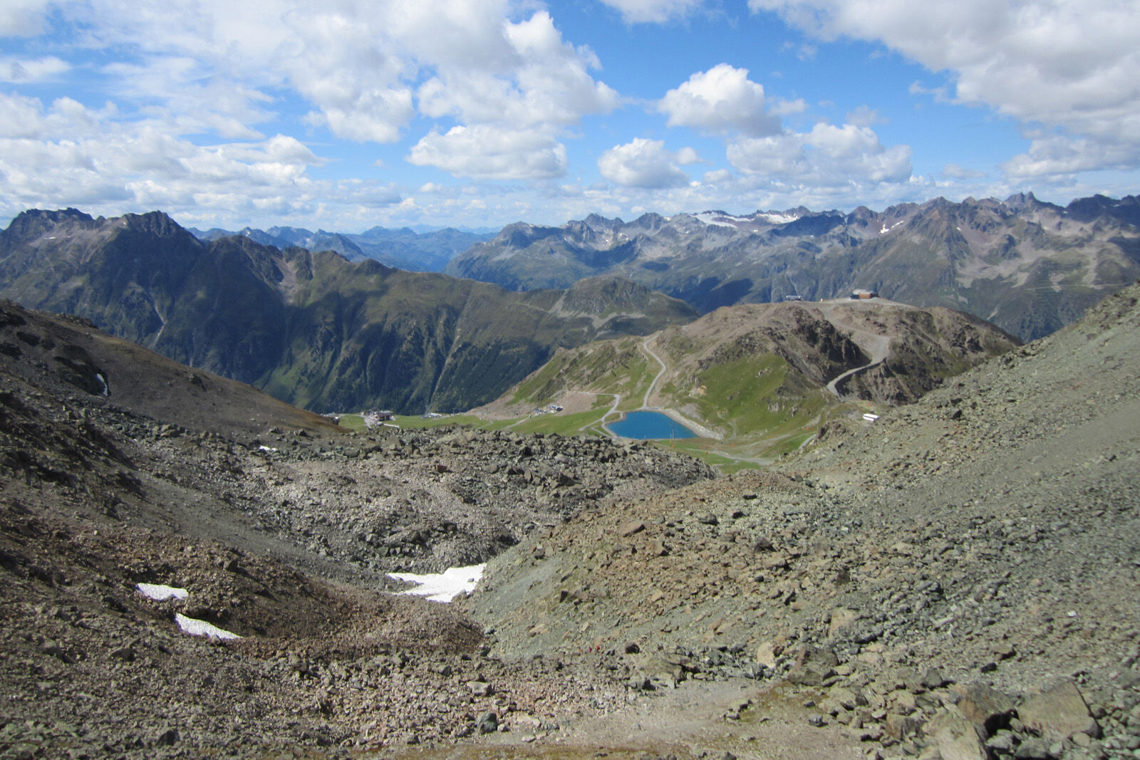
From the Alp Trida saddle the hike begins along the ridge of Alp Trider Eck towards Viderjoch. Shortly below Viderjoch, the trail passes the deep blue snow-making lake. Viderjoch is on the border between Austria and Switzerland. This point can also be reached by chairlift via Alp Trida. Now the path continues to the left of Flimspitz on Austrian soil. A short descent follows before the well-signposted path leads over the imposing rockfall below Flimspitz. The path leads in a short ascent to Flimjoch, where again the national border is crossed. Here you have the possibility to make a detour to the Flimspitz. To the left, Bürkelkopf and Bürkelspitze arise. At the bottom of the plain there are five small lakes. The numerous large boulders around the lakes are perfect for a rest. You can return to the Alp Trida saddle in just under an hour.
- Directions
-
From Alp Trida Sattel along the ridge towards Viderjoch
Under the Viderjoch past the mountain lake and towards Flimspitz
Follow the path to Flimjoch
Optional detour to the Flimspitz
Descent to the lakes
Return to the Alp Trida saddle - Highest point
- 2,747 m
- Endpoint
-
Mountain station double-decker lift, Alp Trida Sattel
- Height profile
-
 © outdooractive.com
 - Equipment
-
Good shoes, rain and sun protection, water bottle, bandages.
- Safety instructions
-
The tour has been evaluated under favorable weather conditions. Current weather conditions and weather forecasts must be taken into account before the tour starts.
emergency call:
144 Emergency call, first aid
1414 Mountain rescue REGA
112 International emergency call
- Additional information
- Directions
-
- From the north: via Landquart - Klosters by car transport through the Vereina tunnel (Selfranga - Sagliains) Then take the H27 in the direction via Scuol and Martina to Vinadi. At the junction Vinadi to Samnaun (about 1 hour from Vereina Südportal)
- From the east: via the Inn valley road B180 via Landeck to Pfunds, junction Kajetansbrücke and via Spiss to Samnaun.
- From the south: via Reschenpass (Nauders) on B180 to Pfunds, junction Kajetansbrücke and via Spiss to Samnaun.
- Public transportation
-
- With the Rhaetian Railway (from Chur, Landquart/Prättigau or from the Upper Engadine) every hour to Scuol-Tarasp station
- Hourly connections with the PostBus, line 921 to Samnaun-Ravaisch, mountain railroads
- Parking
-
Parking spaces at the valley station of the double-decker cable car, Samnaun-Ravaisch


- Author
-
The tour 2-Country Hike is used by outdooractive.com provided.