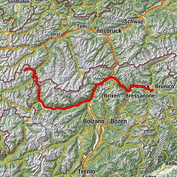

- Starting point
-
Chalet Silvretta, Samnaun
- Route
-
Samnaun (1,846 m)0.1 kmEl Rico0.2 kmRavaisch (1,799 m)1.3 kmPlan (1,725 m)2.4 kmLaret (1,731 m)3.4 kmCompatsch (1,715 m)3.8 kmSpiss (1,628 m)7.1 kmPfandshof (1,507 m)7.2 kmVinadi14.1 kmOvella16.6 kmMartina (1,035 m)19.6 kmMutzkopflift26.9 kmPizzeria Hans32.0 kmPizzeria Irene32.2 kmReschnerhof33.6 kmHotel Schwarzer Adler33.8 kmPfarrkirche zum heiligen Sebastian34.1 kmReschen (1,500 m)34.2 kmSt. Anna36.1 kmRestaurant Traube-Post37.4 kmGraun im Vinschgau (1,520 m)37.5 kmSt. Valentin auf der Haide42.3 kmPfarrkirche St. Valentin44.4 kmRaststation Haidepark48.9 kmSt. Nikolaus Kirche50.0 kmBurgeis50.4 kmSt. Michaelskirche50.7 kmMals (1,052 m)54.1 kmRestaurant Pizzeria Remo55.1 kmRestaurant Michlwirt55.3 kmPfarrkirche Hl. Andreas55.4 kmTartsch (1,029 m)55.6 kmPizzeria Bar Ortler58.1 kmSchluderns (919 m)58.2 kmSpondinig62.5 kmEyrs (876 m)65.2 kmLaas (869 m)69.7 kmLourdeskirche70.9 kmKortsch74.0 kmSchlanders (721 m)76.1 kmGoldrainer Hof80.8 kmGoldrain (662 m)81.1 kmLatsch (642 m)83.7 kmPfarrkirche83.8 kmSpitalkirche zum Hl. Geist83.9 kmKastelbell (587 m)87.3 kmGalsaun88.4 kmKesslwirt90.4 kmTschars90.5 kmStaben92.9 kmTschirland94.7 kmNaturns96.1 kmPlaus99.1 kmGasthof Mondschein99.7 kmChiesa di San Giacobbe101.5 kmRabland101.7 kmTöll104.0 kmTrauttmansdorffer Thronsessel105.4 kmMitterplars106.4 kmAlgund107.5 kmGratsch109.0 kmMeran110.7 kmSt. Ruprechtkapelle111.2 kmFinele112.6 kmKuens (592 m)112.6 kmRiffian (504 m)114.2 kmSaltauser Hof117.9 kmPizzeria117.9 kmKirche zum Heiligen Michael118.0 kmSaltaus118.0 kmPasserheim119.1 kmQuellenhof119.8 kmRestaurant Quellenhof120.1 kmNeuhaus (569 m)122.8 kmSt. Martin in Passeier (595 m)124.9 kmSandwirt127.2 kmAndreas Hofer Kapelle127.3 kmHeilige Grab am Sand127.3 kmSt. Leonhard in Passeier128.7 kmGasthof Schlossberg (1,001 m)133.0 kmWalten (1,269 m)137.7 kmGasthof Alpenrose137.7 kmJägerhof138.6 kmBach (1,436 m)139.2 kmInnerwalten139.2 kmEnzianhütte (1,970 m)146.8 kmBar Edelweiss148.3 kmPanorama-Hütte148.4 kmKapelle Maria Heimsuchung149.6 kmAlpenblick156.9 kmJägerheim157.0 kmSt. Anton157.1 kmKalch (1,443 m)157.2 kmRatschings161.1 kmBockenhof (955 m)162.2 kmGasteig (970 m)163.4 kmThuins (1,070 m)164.5 kmFischadler164.8 kmSterzing (948 m)166.0 kmGasthof Burgfrieden168.6 kmTrens (987 m)170.5 kmFreienfeld170.9 kmLener170.9 kmBache171.3 kmMaulsner Höhe172.6 kmJägerheim174.6 kmGourmetstube Einhorn174.8 kmMaulser Kirchlein174.9 kmMauls (940 m)174.9 kmGasthofstube Stafler174.9 kmGriesser175.6 kmGrasstein (866 m)178.7 kmAH-Bräu179.4 kmSt. Anna179.4 kmSachsenklemme179.4 kmMittewald (803 m)181.9 kmGasthof Thaler (800 m)181.9 kmOberau (757 m)184.5 kmFranzensfeste (747 m)186.0 kmHl. Herzen Jesu186.1 kmAicha (719 m)189.0 kmSchabs (760 m)191.1 kmHotel Putzerhof (762 m)192.7 kmMühlbach (775 m)194.1 kmMühlbach194.4 kmHaslach (787 m)198.0 kmNiedervintl199.4 kmLodenwirt200.5 kmHubertus201.3 kmObervintl (749 m)202.3 kmSt. Nikolaus202.3 kmDörfl (763 m)202.9 kmSt. Sigmund (782 m)205.9 kmPizzeria Petra206.5 kmKelder (775 m)206.6 kmGestl (778 m)208.1 kmGatterer208.5 kmKiens208.6 kmHotel Zur Post208.7 kmSonnenburg (827 m)213.8 kmPflaurenz214.2 kmGasthof Sonne214.7 kmAlte Post214.8 kmTraube214.8 kmHl. Laurentius214.8 kmSt. Lorenzen (810 m)214.9 kmHurtmüller (895 m)216.6 kmMessnerhof217.2 kmStefansdorf (964 m)217.5 kmReischach (956 m)219.2 km
- Description
-
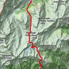
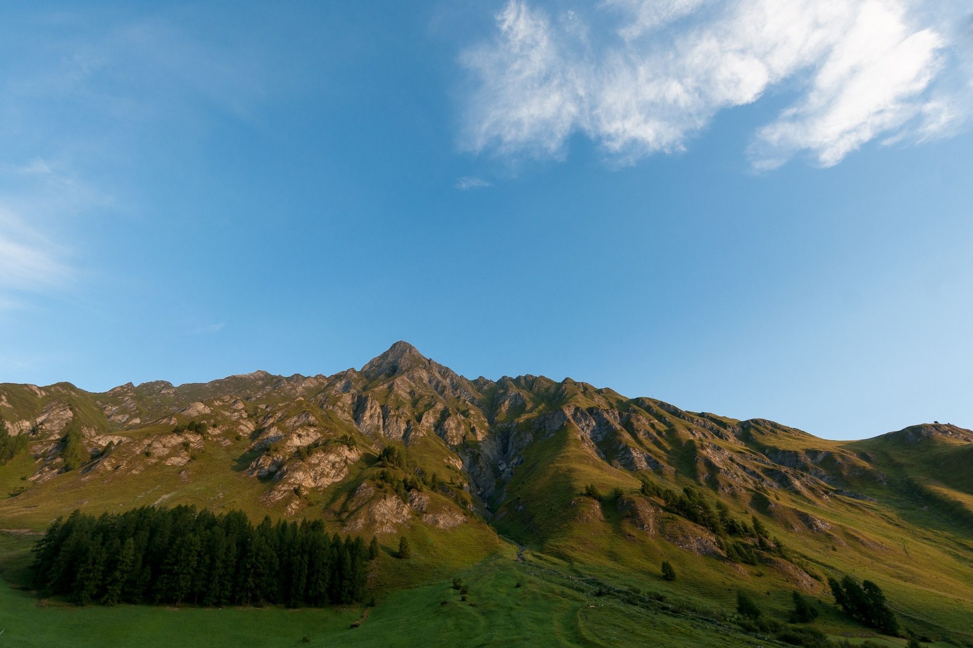
From Samnaun the road leads you to the Reschecnpass and to the Lake Reschen. Just like a mirage, in the middle of Lake Reschen, the tower rises above the surface – the landmark of the Vinschgau valley – both strange and yet fairytale- like at the same time. In reality, sombre and tragic, the picture postcard appearance belies a darker, silent witness to the Second World War. In 1939 the industrial engineering and chemical company Montecantini submitted a project to create an artificial reservoir for it only to be finished in 1950; the dams were closed and the land was flooded. Nearly 150 families were forced to re-locate or even emigrate for the creation of the reservoir and little compensation was made for their sacrifice. Today the the church tower in Lake Reschen is protected as a historic monument.
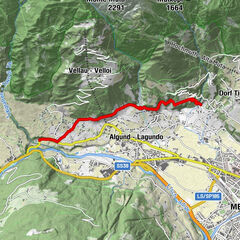
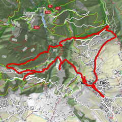
The tour then continues through South Tyrol to the Dolomite region. Your day's destination is the Rubner's Hotel Rudolf in Reischach near Brunico - directly on the Kronplatz and in the immediate vicinity of the Three Peaks. The hike to the Three Peaks is a must see for hiking and mountain lovers.
- Highest point
- 2,095 m
- Endpoint
-
Rubner's Hotel Rudolf, Reischach/Bruneck
- Height profile
-
 © outdooractive.com
-

-
AuthorThe tour Samnaun - Bruneck/Reischach is used by outdooractive.com provided.


-
Meraner Land
1736
-
Meran und Umgebung
757
-
Pfelders
252