© Engadin Tourismus AG - Michael Pfäffli

© Engadin Tourismus AG - Michael Pfäffli

© Engadin Tourismus AG - Michael Pfäffli
© Engadin Tourismus AG - Michael Pfäffli


- Brief description
-
Discover the wild and hidden Val Chamuera.
- Difficulty
-
medium
- Rating
-
- Starting point
-
Muottas Muragl
- Route
-
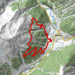
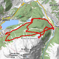
Muottas Muragl (2,456 m)Fuorcla Muragl (2,891 m)4.4 kmSerlas (2,023 m)10.9 kmAcla Veglia (2,000 m)11.4 kmChamues-ch17.5 km
- Best season
-
JanFebMarAprMayJunJulAugSepOctNovDec
- Description
-
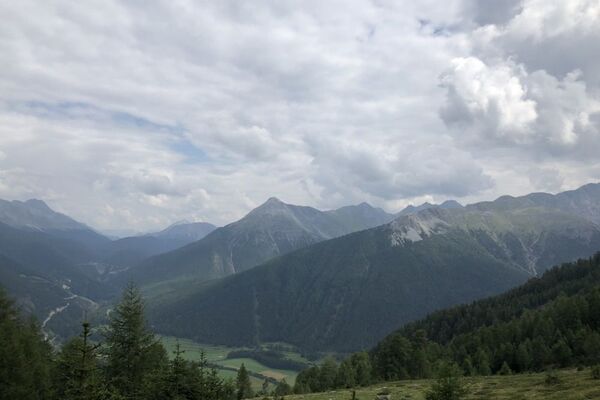
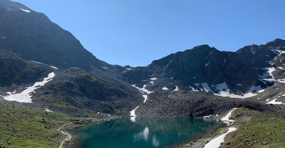
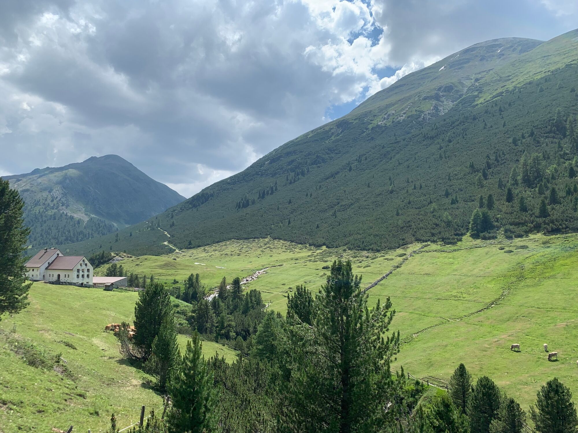
From Punt Muragl, the funicular railway takes you up to 2454 m above sea level. Here you can enjoy the breathtaking panorama of the Upper Engadin lake district. The signposted hike begins on the left above the panorama path with a slight ascent. Along the path, past flora and fauna and the charms of the high alpine landscape, there is an excellent view of the block glacier, which slowly descends towards the valley like a lava flow. After a good hour you reach the Lej Muragl (2'715m), which presents itself in beautiful colours. From Lej Muragl you climb the Fuorcla Muragl, at 2892m the highest point of the hike. From here the descent into Val Prüna begins. The hiking trail leads along the Ova Prüna into one of the most remote side valleys of the Engadin. Here you can enjoy not only the high alpine flora and fauna but also the silence of the mountain world. The trail finally leads to Alp Serlas, an imposing building at 2000 m a.s.l., which was originally built for year-round operation. Nowadays, however, Alp Serlas is only run as a summer farm. From here the last stage of the hike through the Val Chamuera, the valley of the chamois, along the river of the same name begins. On this section, some barbecue sites invite you to take a well-deserved break. Freshly fortified, the final part follows with the narrowest parts of the Val Chamuera, until you finally reach La Punt Chamues-ch and thus the end of the hike.
More information
Engadin Tourismus AG
Via Maistra 1
CH-7500 St. Moritz
Phone: +41 81 830 00 01
E-mail: allegra@engadin.ch
Internet: www.engadin.ch - Directions
-
Muottas Muragl – Lej Muragl – Fuorcla Muragl – Val Prüna – Alp Serlas – Val Chamuera – La Punt Chamues-ch
- Highest point
- 2,878 m
- Endpoint
-
Chamues-ch
- Height profile
-
 © outdooractive.com
 - Tips
-
Depending on snow conditions, snowfields can still be expected along the trail in early summer.


- Author
-
The tour Muottas Muragl - Fuorcla Muragl - Val Chamuera is used by outdooractive.com provided.
GPS Downloads


General info
Cultural/Historical
Flora
A lot of view
Other tours in the regions
-
Engadin St. Moritz
782
-
La Punt
226