Through the romantic gorge of the brook 'Schraubach' from Schiers to Schuders


- Brief description
-
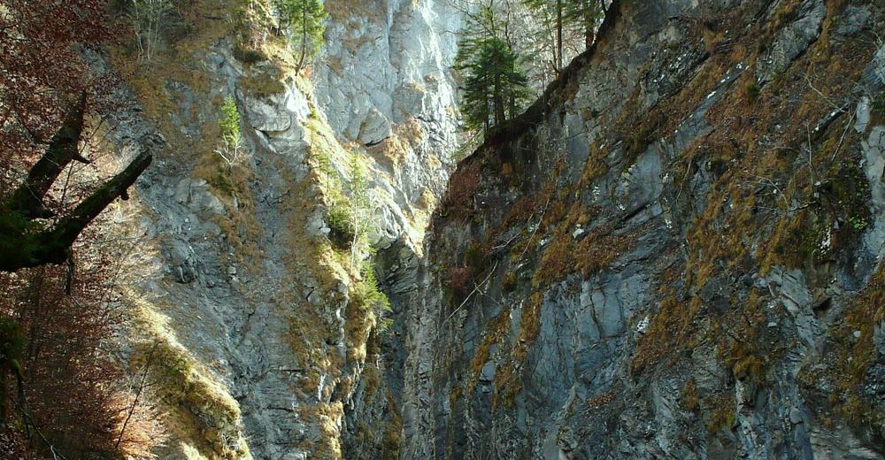
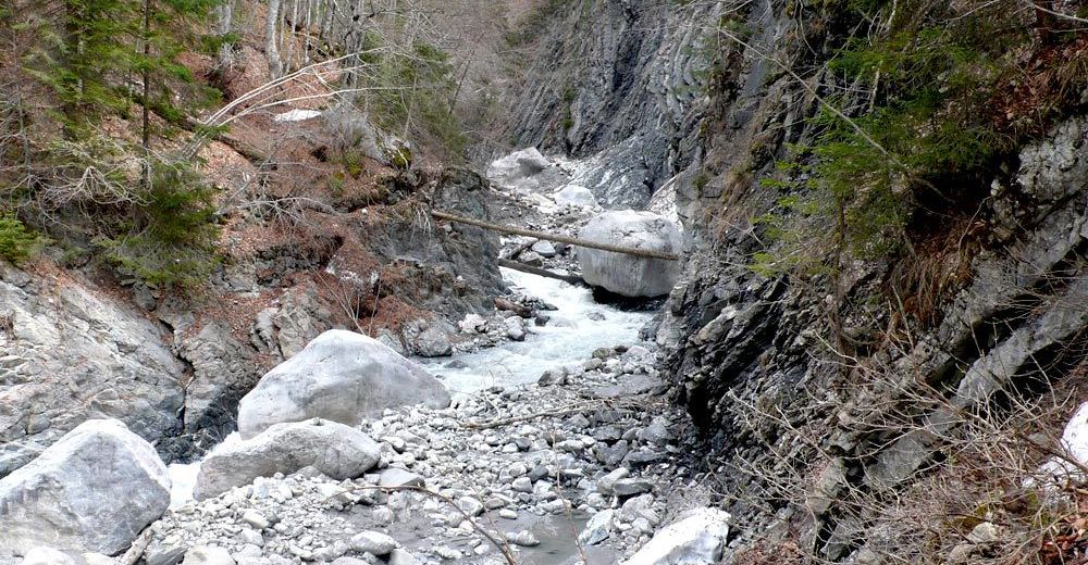
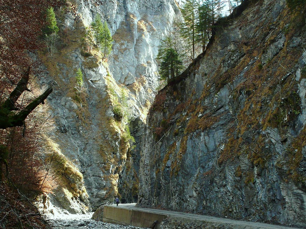
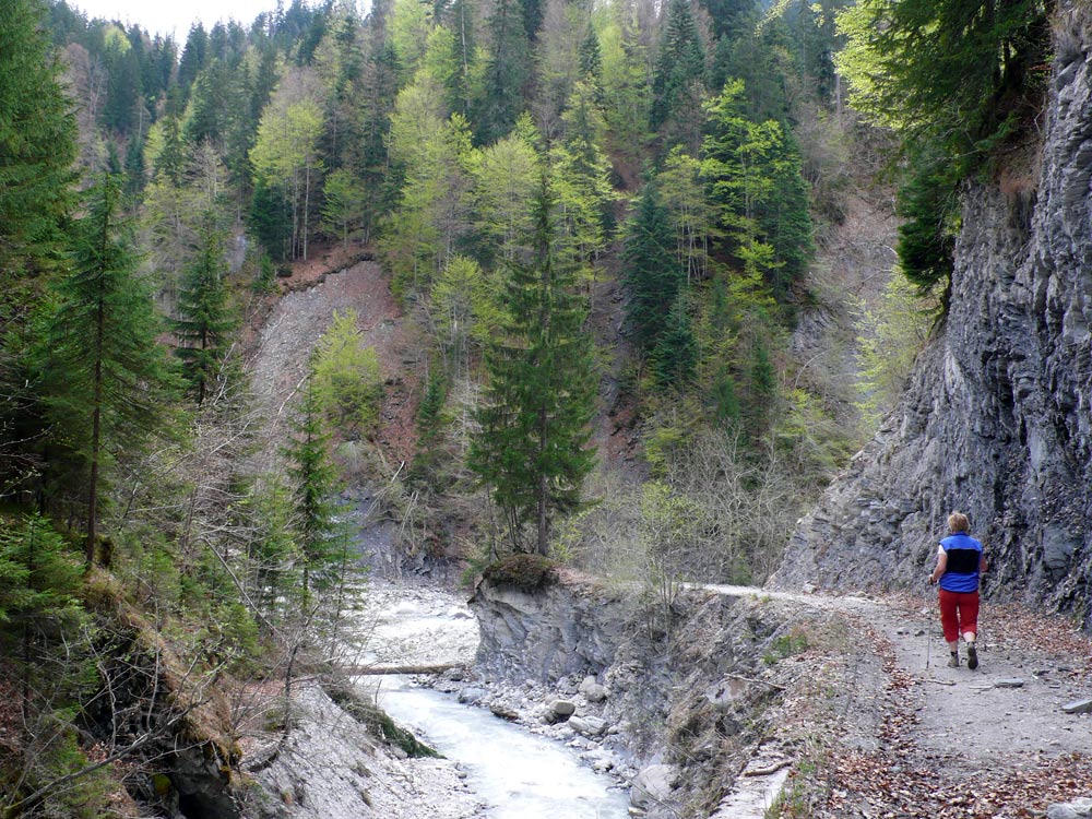
The untouched gorge of the brook between Schiers and Schuders is almost like a piece of Canada here in Prättigau and is fascinating both young and old. Where tree trunks were rafted in the early times, you can now walk along the brook on a gravelled path. As the riverbed becomes wider the path and the brook unify into a wild-romantic oasis which is inviting to take a bath, collect stones or have a picnic.
- Difficulty
-
easy
- Rating
-
- Starting point
-
Starting point is Schiers station
- Route
-
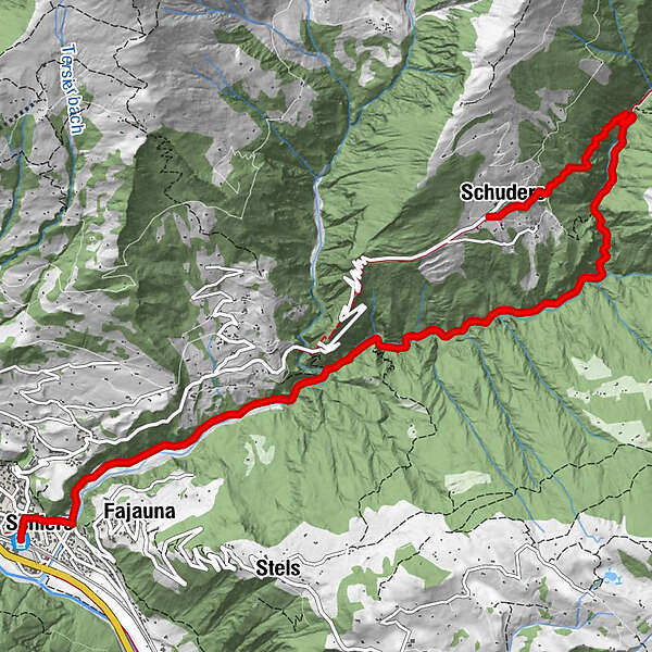
Schiers (654 m)Restaurant Sternen0.2 kmSchiers (665 m)0.3 kmSpielplatz Schiers0.4 kmMontagna0.9 kmFajauna (862 m)1.2 kmSchuders9.0 kmReformierte Kirche Schuders9.0 kmBerggasthof Alte Post9.1 km
- Best season
-
JanFebMarAprMayJunJulAugSepOctNovDec
- Description
-
You follow the signs to the Salgina-World-Monument Bridge and fork left as soon as you reach the brook. You pass a big carpentry as well as the working-premises of the community Schiers, then you cross the gravel works and walk past a trout farming. Now you have left civilization behind you! The private gravelled path is quite wide because it is mainly used to transport wood. At the lime kiln hut the roundpath turns off left to Salgina-World-Monument Bridge. You continue walking northwards until you reach the broadest part of the brook. Here you can find a number of different pretty stones in the water and it is difficult to resist the temptation of collecting them all ! It is an ideal place to have a little rest to take a foot bath or make a fire and grill a sausage.
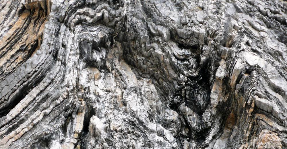
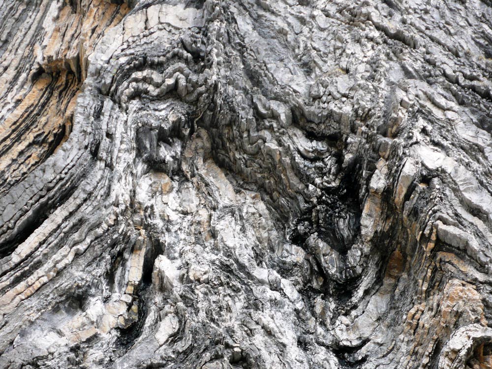
As you walk on, the scenery is getting more romantic with rock faces and little gravel crevasses. In the past this was where the raftsmen guided the tree trunks to Schiers, often in mortal danger. The natives of the hamlet Salfsch, however, were sawing the wood there and then. The building of the old sawmill can still be recognized on the right above the second bridge. From this bridge the path to Schuders branches off left and is immediately ascending steeply. At the end it is about 200 metres uphill to the mountain village Schuders - admittedly quite strenuous but always in the shade of a pleasant forest path. The reward is awaiting you in the mountain village Schuders from where you have a fantastic panoramic view over to the 'Rätschen' massif. There is the possibility to wait for the post-office van in the restaurant 'Post' or else to walk back to Schiers across the Salgina World-Monument Bridge.
- Highest point
- 1,262 m
- Endpoint
-
Destination Schuders
- Height profile
-
 © outdooractive.com
 - Tips
-
You can go on this easy hike also in rainy weather. Not recommended in thunderstorm though.
- Directions
-
Access roads are A13 to Landquart and B28 to Schiers.
- Public transportation
-
Public transport by railway RhB to Schiers (timetable-entry 910)
- Parking
-
Free parking at the first exit road in Schiers (coming from Landquart, turn left). At the station you will find car parks liable to pay cost.


- Author
-
The tour Through the romantic gorge of the brook 'Schraubach' from Schiers to Schuders is used by outdooractive.com provided.