- Brief description
-
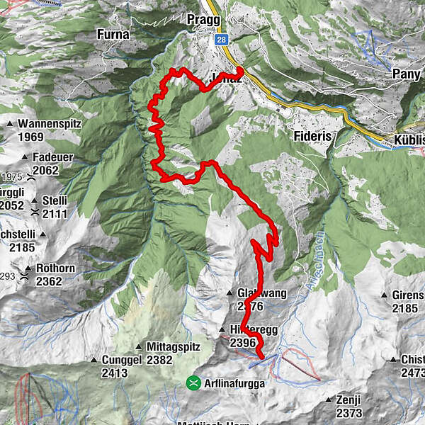
From the mountain lodge Arflina the hike takes you to alp Nova then further to Larein down to Valdavos with a detour to the baths of Jenaz. You walk on to 'Brachboden' where there is a place to barbecue and then further down to the train station Jenaz.
- Difficulty
-
medium
- Rating
-
- Starting point
-
Starting point is the mountain lodge Arflina Fideriser Heuberge
- Route
-
Berghaus Arflina (2,000 m)0.0 kmJunker11.3 kmFeisti12.0 kmBrach14.4 kmJenaz (755 m)16.3 kmJenaz (723 m)16.7 km
- Best season
-
JanFebMarAprMayJunJulAugSepOctNovDec
- Description
-
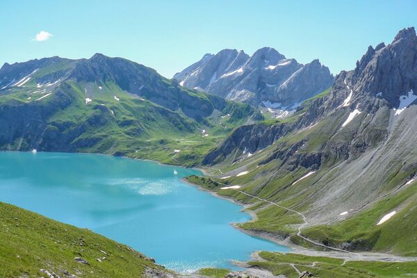
After a refreshment or snack at the mountain lodge Arflina you first walk upwards in the direction of Gaua, then the track takes you straight along to the 'Obersäss' of alp Nova. From here you have a magnificient view to the mountain chain 'Rätikon' opposite the valley. From Nova 'Obersäss' you walk down the nature trail to the branch-off to Larein 'Untersäss'. The path leads you through the forest and a recreation area for alpine birds to Larein 'Untersäss'. It is here where they make delicious cheese and butter from all the cows of both alps during the summer months June to September.
The trail now takes you down to the valley north of 'Särrä'. At the sharp turn you go left into the forest and then across the marsh 'Ful' to 'Nütieja' which is the remotest alpine settlement in Valdavos. The narrow path starting by the lowest meadow takes you down the forest to the storage place for wood from where you get to 'Rütiboden', 'Hau', 'Specht', 'Junker' as far as 'Feisti'. If you feel like making a little detour you can now walk to the baths of Jenaz. The gravelled path now leads you further out of the valley to 'Brachboden' above the villages Jenaz and Pragg-Jenaz. This is an inviting place to barbecue and to relax and the children can let off steam. This lovely hike now leads you through the picturesque upper part of the village down to the train station.
- Directions
-
Mountain lodge Arflina 2000 metres above sea-level - Alp Nova Obersäss 2024 m - Larein Untersäss 1740 m - Nütieja 1396 m - Rütiboden 1266 m - Feisti 1128 m - Bim Bad - Dürrwald - Brach - Station Jenaz 723 m
- Highest point
- 2,148 m
- Endpoint
-
Railway station Jenaz
- Height profile
-
 © outdooractive.com
 - Tips
-
Good footwear is recommended for this hike because you walk mainly downwards.
- Directions
-
Access roads A 13 to Landquart and B 28 to Fideris. By shuttle bus to 'Fideriser Heuberge'.
- Public transportation
-
Public transport by rail RhB to Küblis and by post-office van to Fideris (timetable-entries 910 or 90.221)
- Parking
-
Shortly after you get to the village there are free car parks on the left of the street. To park the car in the centre of the village is liable to cost.
-

-
AuthorThe tour From the Fideriser Heuberge to Jenaz is used by outdooractive.com provided.