


- Brief description
-
Alp Flix, a jewel created by humans, is located above Sur. In the 16th century the area was cleared by the Walser people and the land was used to live on. The alpine pasture is now inhabited all year round.
- Difficulty
-
medium
- Rating
-
- Route
-
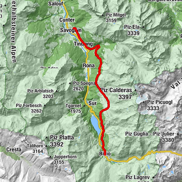
Bivio (1,769 m)Clavania3.3 kmPardeala3.7 kmSalategnas6.5 kmHotel Piz Platta7.2 kmTigias7.2 kmTga d'Meir7.4 kmTgalucas8.2 kmCotti Agricultura8.3 kmCuorts (1,963 m)8.6 kmLais9.3 kmLa Ruigna9.5 kmTinzen (1,232 m)17.9 km
- Best season
-
JanFebMarAprMayJunJulAugSepOctNovDec
- Description
-
From the starting point we follow the road to the north. Through a picturesque larch forest we cross the slope high above the Marmorera lake, from where we can take a short look at the ruins of Marmels. After the moorland we reach the decommissioned iron ore mining area of Gruba and after a short ascent we reach Salategnas, the first settlement on the high plateau of the impressive Alp Flix. The hike continues through Cuorts to the "Lais Blos" (Blue Lakes), and onwards through light forest to Plang da Crousch, one of the most beautiful vantage points of the valley. Following the downward-sloping Veia Surmirana, we pass several mountain pastures. A slightly steeper descent towards Tinizong until Savognin follows.
This hike is part of the Veia Surmirana.
- Directions
-
From the starting point we follow the path to the north. The tail leads via Pardeala and Gruba to Salategnas. From there, the path continues to the Lais da Flix via Tigias and Tgalucas. It then continues through Plang da Crousch, Alp digl Plaz, Plaz Beischen, Cruschetta, Lareschs and Tuleidas to Savognin.
- Highest point
- 2,001 m
- Height profile
-
 © outdooractive.com
 - Tips
-
Take a break at the Lais da Flix. It has two barbeque areas with wood and also has a toilet. While your sausages are sizzling on the grill, you can stow the nearby stream or cool down your feet in the lake.
- Directions
-
From Savognin along the main road to Marmorera. From Bivio along the main road to Marmorera.
- Public transportation
-
By Postbus from Savognin or Bivio to Marmorera.
- Parking
-
There are a few parking spaces available in village of Marmorera.


- Author
-
The tour Alp Flix - moorland of national importance is used by outdooractive.com provided.


General info
-
Val Surses
827
-
Surses
136


