- Brief description
-
A marvellous hiking tour from Fanas to the tiny mountain village Schuders. The cable railway helps you to mange the gradient and so there will be more time to be amazed at the scenery and to enjoy the tour.
- Difficulty
-
medium
- Rating
-
- Starting point
-
Starting point Fanas village
- Route
-
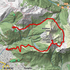
Alpina0.0 kmBerggasthaus Sassauna0.0 kmFanas (907 m)0.2 kmEggli (1,700 m)2.6 kmHuoba3.5 kmFadurer Fürrgli (2,186 m)9.6 kmSchuderser Maiensäss14.1 kmSchuders17.1 kmBerggasthof Alte Post17.3 km
- Best season
-
JanFebMarAprMayJunJulAugSepOctNovDec
- Description
-
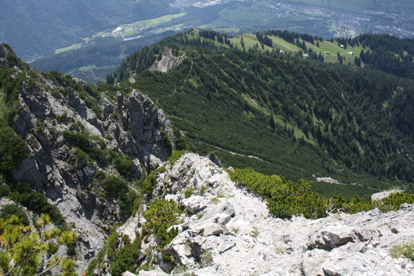
The beautiful hiking tour starts at the top end of the cable railway station and leads you past a number of lush mountain pastures with all sorts of different flowers. If you keep your eyes open and with a bit of luck, it might be possible to spot an eagle circling high above the mountain ridge. The marvellous view into the Prättigau Valley is worth a short rest.
- Directions
-
The climb to the foot of the mountain Sassauna, which is almost 2000 metres above sea-level, starts at the top end of the cable railway. The beautiful hiking tour towards the 'Fadur-Mittelsäss' at a height of 1'839 l starts right there past a number of lushing meadows with colourful flowers. If you keep your eyes open and with a bit of luck, it may be possible to spot an eagle circling high above the mountain ridge. The outstanding view into the Prättigau valley is worth a pause for rest.
The ascent begins next to the shed (Mittelhütte) across pasture up to 'Obersäss' and then to the crossing 'Fadurer-Fürggli' at a height of 2'188 metres. The path is not always clearly visible but you cananot miss the crossing. This short detour to the crossing is worthwile because from up there you will have a superb panorama of the Prättigau, especially in the direction north towards Scesaplana massif and Lüneregg.
From 'Fadur-Fürggli' the route leads along the southern slanting line of 'Girenspitz' eastwards to 'Girenfürggli'. Here starts the descent across grazing land to the lovely mountain huts of Schuders and down to the village Schuders. In the cosy restaurant 'Gaisschärä' or in the mountain inn 'Post' the guests are welcome to enjoy local food such as cheese from the alps, smoked meat and sausages, a barleysoup or delicious pasta.
If you return to Fanas by post-office van you will cross the 'Salginatobelbridge' which is a Worldmonument. To enjoy the breathtaking view is a must !
- Highest point
- 2,215 m
- Endpoint
-
Destination Schuders
- Height profile
-
 © outdooractive.com
 - Directions
-
Approach across A 13 to Landquart and B 28 to Grüsch. From Grüsch you branch off to Fanas.
- Public transportation
-
Public transport by train from Grüsch or Schiers (timetable-entry 910 or 941) and further by post-office van to Fanas (timetable-entry 90.203 from Grüsch or 90.211 from Schiers).
- Parking
-
There are free car parks for twelve hours at the bottom of the cable railway station.

-

-
AuthorThe tour From the top end of the cable railway of Fanas to Schuders. is used by outdooractive.com provided.