
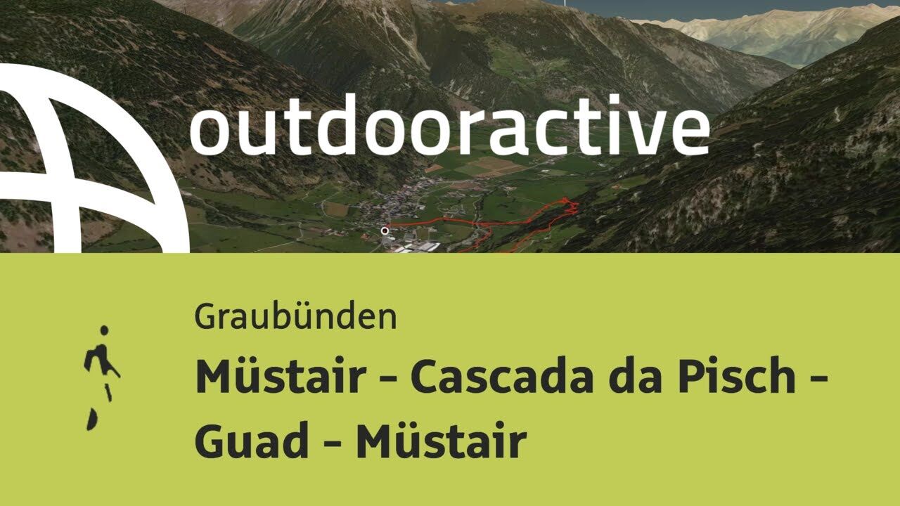
- Brief description
-
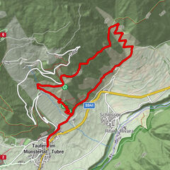
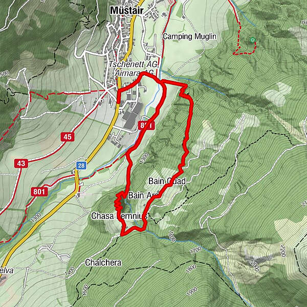
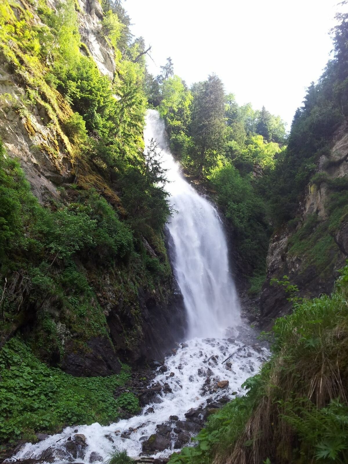
Loop hike to the Cascada da Pisch waterfall near Müstair. The cool air and spraying splashes offer welcome cooling, especially in the warm summer months.
- Difficulty
-
medium
- Rating
-
- Starting point
-
Müstair, Somvi
- Route
-
Liun0.1 kmPlazzöl0.7 kmCascada da Pisch1.9 kmChasa Lemnius2.1 kmBain Ars2.7 kmBain Guad2.9 kmLiun4.7 km
- Best season
-
JanFebMarAprMayJunJulAugSepOctNovDec
- Description
-
From the Müstair Somvi post bus stop, turn into Via Friedrich Hoppe at Hotel Liun and follow the road to Rombach. At Rombach, cross the wooden bridge and continue on the forest road past the Plazzöl playground in the direction of Sta. Maria. At the signpost "Cascada da Pisch" turn onto the hiking trail until you reach the waterfall, cross the bridge and continue to the Bains da Guad. At the Bains da Guad you can follow the road back down into the valley to the Sielva hospital.
- Directions
-
From the Müstair Somvi post bus stop, turn into Via Friedrich Hoppe at Hotel Liun and follow the road to Rombach. At Rombach, cross the wooden bridge and continue on the forest road past the Plazzöl playground in the direction of Sta. Maria. At the signpost "Cascada da Pisch" turn onto the hiking trail until you reach the waterfall, cross the bridge and continue to the Bains da Guad. At the Bains da Guad you can follow the road back down into the valley to the Sielva hospital.
- Highest point
- 1,513 m
- Endpoint
-
Sta. Maria, Sielva
- Height profile
-
 © outdooractive.com
 - Equipment
-
Good shoes, rain and sun protection, water bottle, bandages.
- Safety instructions
-
The tour was evaluated in favorable weather conditions, current weather conditions and weather forecasts are mandatory to follow before starting the tour.
Emergency call:
144 emergency call, first aid
1414 Mountain rescue REGA
112 International emergency call
- Additional information
- Directions
-
Coming from Zernez, cross the Ofen Pass and continue through Val Müstair to Müstair (last village before the border with Italy).
Coming from Italy, the first village after the border crossing at Taufers (last village before the border with Switzerland).
- Public transportation
-
The stop Müstair, Somvi is with the post bus coming from Zernez the first stop in Müstair and coming from Italy the last stop before the onward journey to Sta. Maria.
- Parking
-
Parking for the hike at the playground Plazzöl or in the village itself.
- Author
-
The tour Müstair - Cascada da Pisch - Guad - Müstair is used by outdooractive.com provided.


General info
-
Vinschgau
1291
-
Biosfera Val Müstair
565
-
Müstair
145