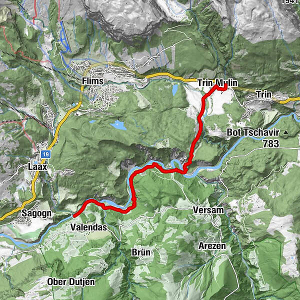
- Route
-
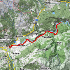
Ustria Parlatsch0.1 kmTrin Mulin (828 m)0.5 kmSpielplatz Punt Suraua0.9 kmEr Davos3.0 kmVersam-Safien (635 m)5.6 kmIsla7.9 kmValendas-Sagogn (669 m)10.1 km
- Best season
-
JanFebMarAprMayJunJulAugSepOctNovDec
- Description
-
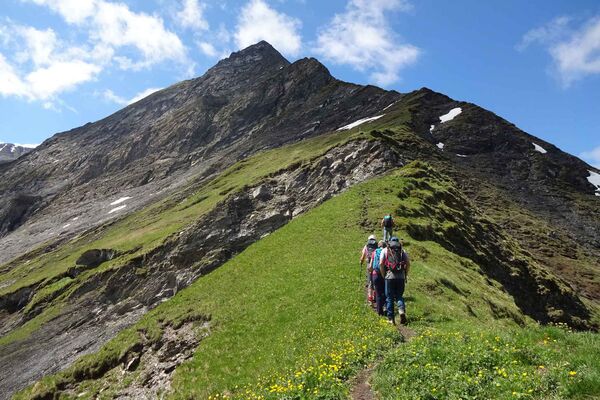
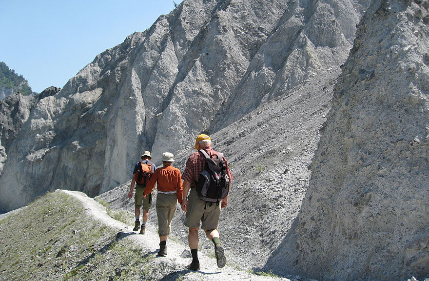
While the Senda Sursilvana stretches on high above the Vorder Rhine, the Ruin'Aulta, its counterpart, generally extends along the Rhine. In the Eighties, the Bündner Work Group for Hiking Trails (BAW) set to work carving out and connecting paths so that you can hike along the Rhine from Trin Mulin as far as Ilanz, and then up the valley from there. As a result, this route was used by countless hikers; the advantage it offers is that you can break off the hike at any time and travel back with the Rhaetian Railway. The great Ruin'Aulta (high mudflow) gorge could only be viewed from the trail before; however, a hike gives you much greater insight into this natural wonder and is an unforgettable experience.
In Trin Mulin (post office van stop), you head towards the houses on the main street; on reaching the houses at the bottom, you turn left onto a good trail that leads onto open land. At the fork in the path, we keep left and reach a footbridge which we cross, with a gentle incline to the former settlement of Pintrun, where we climb a little further through shrubbery and meadow as far as the fork in the path, from where you descend into the forest. This takes you to the Ransun forest and meadow plain. The pleasant forest path leads to the west end of the terrace, from where you have a first view of the strangely formed region, with small, bright rocks that consist of breccia (solidified detritus Schutt) from the famous Flims landslide.
You can take in the view up to the mouth of the Rabiusa, which flows from the Safien valley, and the different “islas”, pastures along the banks of the Rhine, most of which are farmed. From this border, a steep descent to Isla Bella begins, where the iron bridge of the Rhaetian Railway passes over the Rhine. In the middle of the descent, you reach the edge of the rocks and will be surprised by the unique formations created by erosion. The erosion of the rocks still continues, though this is an extremely slow process. A footpath has been attached to the iron bridge. This takes you to Erlenwald, the alder forest, where the trail leads to the rock protrusion that forces the Rhine into a distinct loop. This ridge is called Chli Isla or Chrummwag, and the soil on top is a reminder of a last thrust of the Rhine glacier after the prehistoric landslide.
Cross Chrummwag to the banks of the Rhine, and hike between RhB and the water to Versam RhB station (inn). After the station building, we hike on up the valley, flanked all the way by white limestone walls with their bizarre shapes. After the second pit that we cross, the trail extends to the left somewhat from the RhB tracks and the river, over Isla after a small incline, where you can enjoy an incredible view, before running along the river and RhB tracks again at Carrera-Tobel. We reach Valendas station, where we board the RhB before taking the post office van back later to the starting point of Trin Mulin. - Directions
-
Trin Mulin – Pintrun – Versam RhB – Ruin'Aulta – Valendas RhB
- Highest point
- 876 m
- Height profile
-
 © outdooractive.com
 - Additional information
-
Rhaetian Railway (RhB): Hikers usually prefer public transport, because travelling by car often entails the inconvenience of always having to return to your starting point. In contrast, the train and post office van allow you to have different start and end points. The Rhaetian Railway, which serves almost all of Graubünden, is a private railway which has been opening up the Bündner valleys increasingly since 1889. In 1903 the stretch from Reichenau to Ilanz was completed, and was extended as far as Disentis/Muster in 1912. Particularly since the Second World War, the post office routes have also experienced an enormous expansion, as a result of which countless combinations between rail and post office van are possible.
- Public transportation
-
Getting there: By PostBus to Trin Mulin.
Getting back: By train (RhB) from Valendas Station.
- Author
-
The tour Trin Mulin – Ruinaulta – Valendas is used by outdooractive.com provided.
GPS Downloads


Other tours in the regions
-
Heidiland
2201
-
Flims Laax Falera
774
-
Trin
277