- Brief description
-
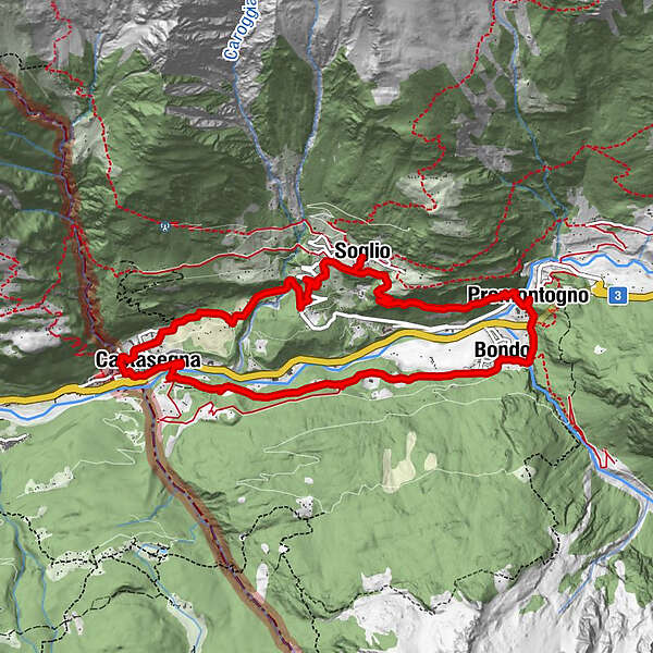
Easy circular hike from Bondo to Soglio through Castasegna.
- Difficulty
-
medium
- Rating
-
- Starting point
-
Bondo
- Route
-
Promontogno (832 m)Runch0.0 kmPlev Lavia0.1 kmI Crott0.1 kmBondo (823 m)0.5 kmReformierte Kirche Sankt Martino0.6 kmNortacc0.7 kmDimvich0.8 kmCaltüra1.1 kmPrä Bell1.4 kmBregan d'Zott1.5 kmFarzett2.0 kmLüdér2.1 kmPlän Mäira3.6 kmCastasengen (690 m)3.9 kmChiesa riformata di San Giovanni Battista3.9 kmBrentan4.6 kmVazza5.5 kmClüs5.6 kmStoll (863 m)5.7 kmCascate del Caroggia6.1 kmPregüi6.6 kmCarnella7.1 kmSot Funtana7.1 kmLò7.2 kmReformierte Kirche Soglio7.3 kmStüa Granda7.3 kmSils im Bergell (1,097 m)7.5 kmNaùn8.0 kmSpino (793 m)9.0 kmSottoponte9.4 kmPromontogno (832 m)9.8 kmBondo (823 m)10.0 kmLa Val10.0 kmRunch10.0 kmKatholische Kirche Maria Immacolata10.0 km
- Best season
-
JanFebMarAprMayJunJulAugSepOctNovDec
- Description
-
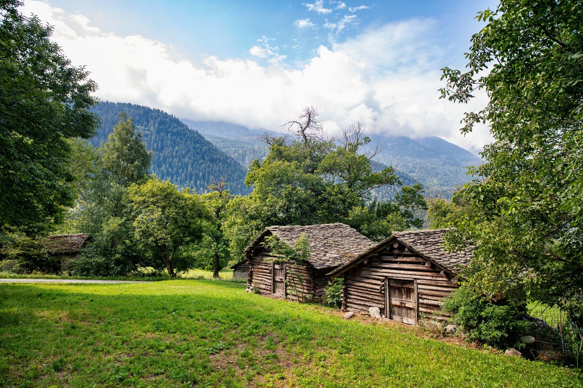
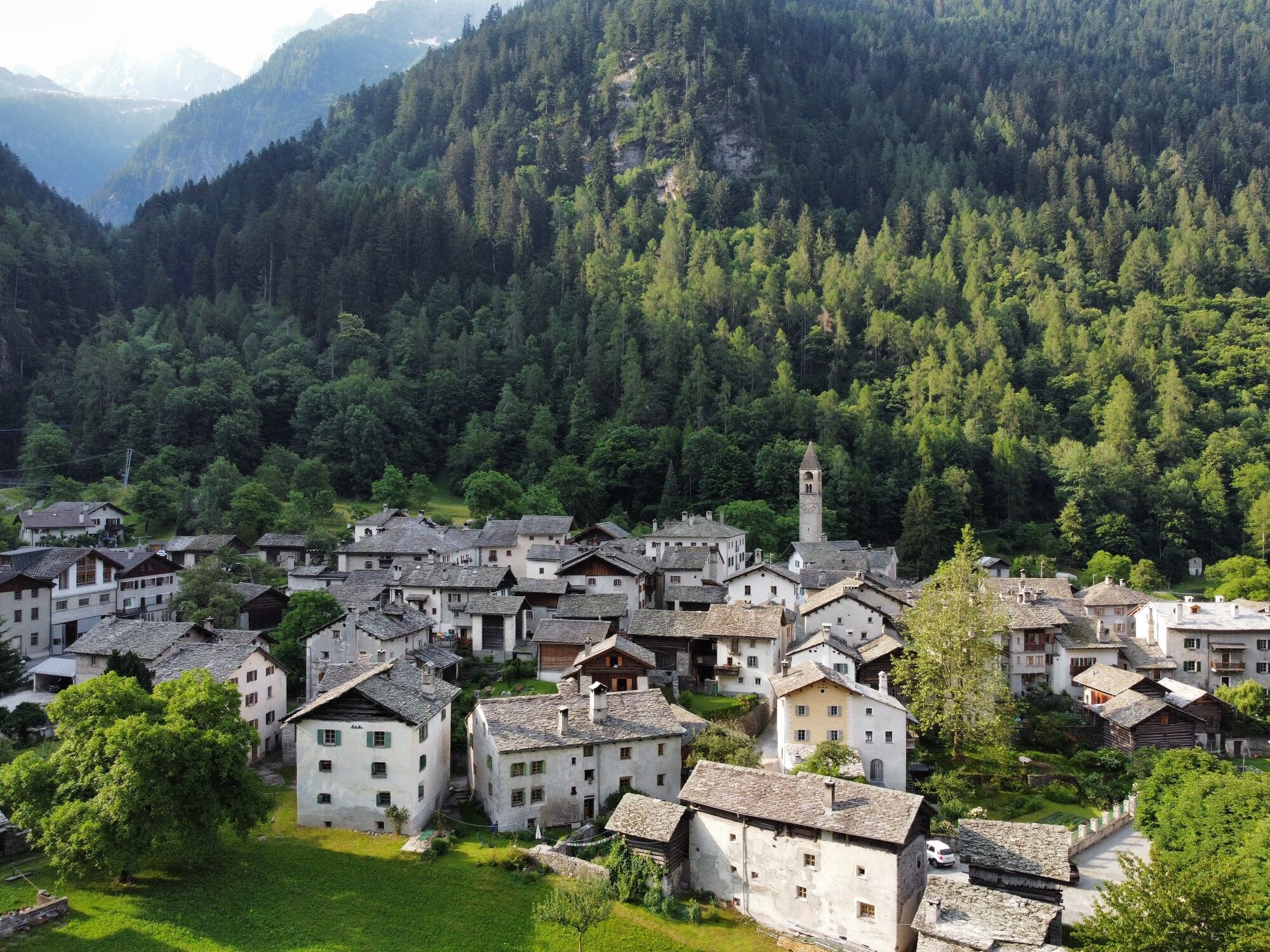
It is a casual walk, almost entirely on a small road. The path first crosses the plain that spreads out from Bondo to the west, passing a series of beautiful villages. The middle section runs through the forest, at the end of which there is a charming view of Castasegna and the lower part of the Bergell. After crossing the beautiful bridge over the Maira, the trail joins the main road at the beginning of the village of Castasegna. For the ascent to Soglio, we recommend the route through the chestnut forest of Brentan and the curious tunnel through which you can pass under the Caroggia stream by a beautiful waterfall.
Worth a visit :
Church of St.Martino in Bodo Villa Garbald in Castasegna Chestnut forest and the nature trail in Brentan - Directions
-
At the church of Bondo, turn into the small road, which is wide and well marked by low walls. It leads down the valley along the edge of the forest. In a clearing, a path turns off to the right that leads directly to Castasegna. However, it is better to follow the road. It leads to the huts of Motta (882 m), where you have a beautiful view of the valley. Downhill, across gentle meadows, you reach the huts of Salascé and Casnac before crossing the river Maira to Castasegna (697 m). For the way back via Brentan follow the main road in Castasegna until about a hundred metres before the border (old customs station) and then continue on a small steep road that leads to the square in front of the electricity plant. From here the path climbs gently through the well-known chestnut wood. Further up, the gravel road leads sloping down the slope towards the stream until, after a bend, you are in front of the beautiful waterfall. You have to go through the tunnel, which bends in the mountain and reappears on the other side of the stream. Continue uphill on a rather steep hiking trail to Soglio. After visiting the picturesque village, you descend to Bondo. To the right of the church of S. Lorenzo, a steep, moderately difficult trail leads through the forest below to the village of Promontogno and from there on to Bondo.
- Highest point
- 1,094 m
- Endpoint
-
Bondo
- Height profile
-
 © outdooractive.com
 - Equipment
-
Trekking shoes, poles, water
- Safety instructions
-
To avoid the steep descent from Soglio to Bondo, it is possible to take the post bus.
- Tips
-
Enjoy a delicious chestnut ice cream at the Salis confectionery
- Public transportation
- Parking
-
It is advisable to park the car in the square at the beginning of the village, by the old Palazzo Salis, or in a second car park at the beginning of the road into Val Bondasca. In both cases, follow the municipal roads to the western end of the village.
- Author
-
The tour Bondo - Castasegna - Soglio circular hike is used by outdooractive.com provided.


General info
-
Comer See
762
-
Val Bregaglia Engadin
468
-
Soglio
79