


- Brief description
-
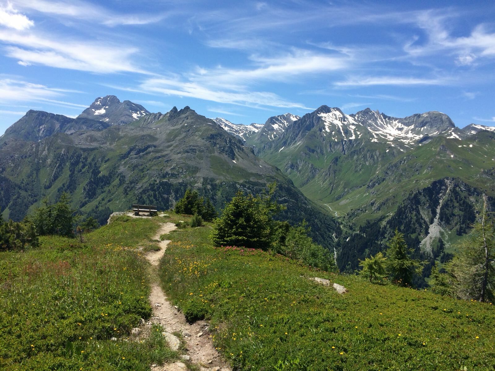
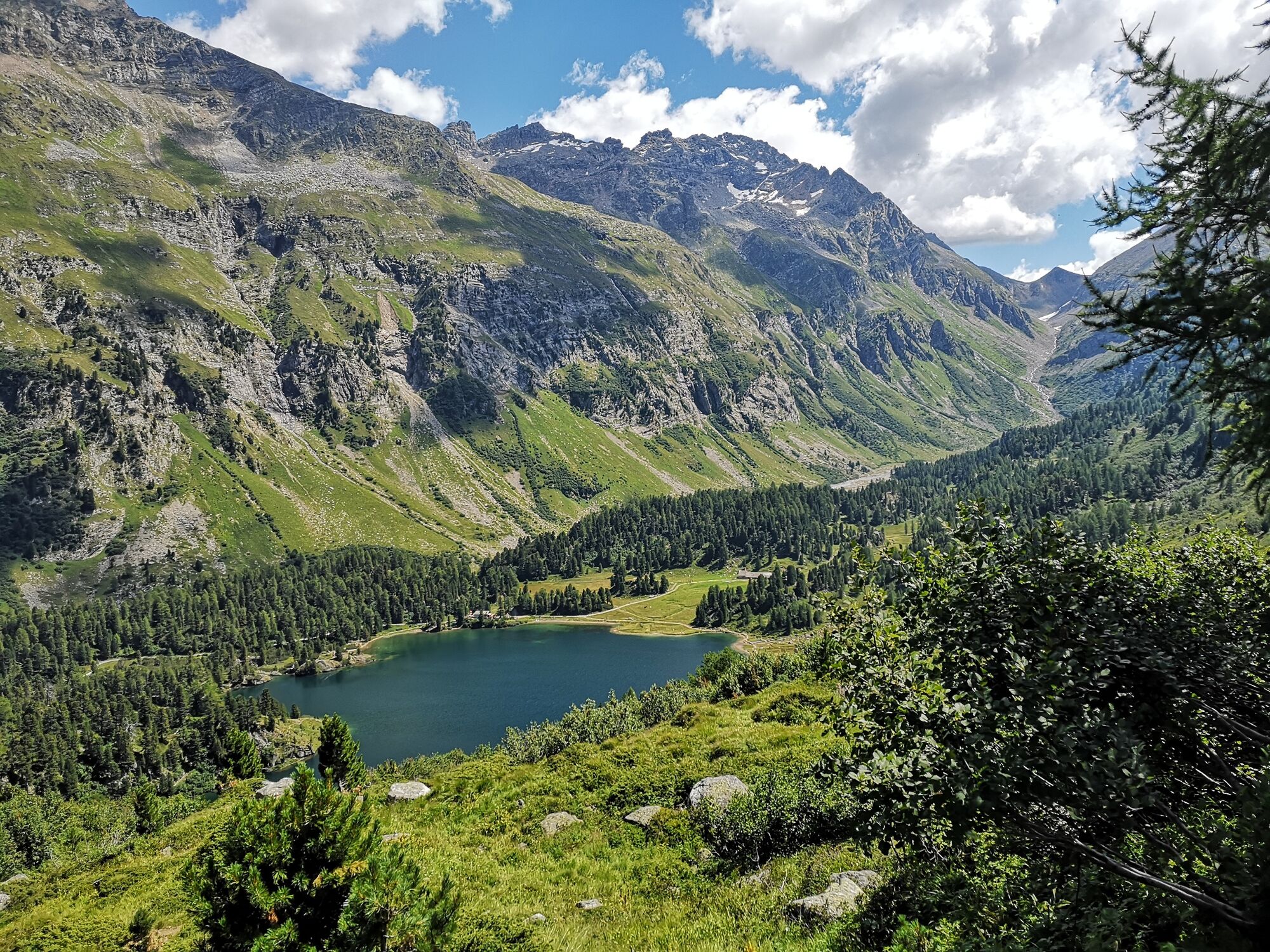
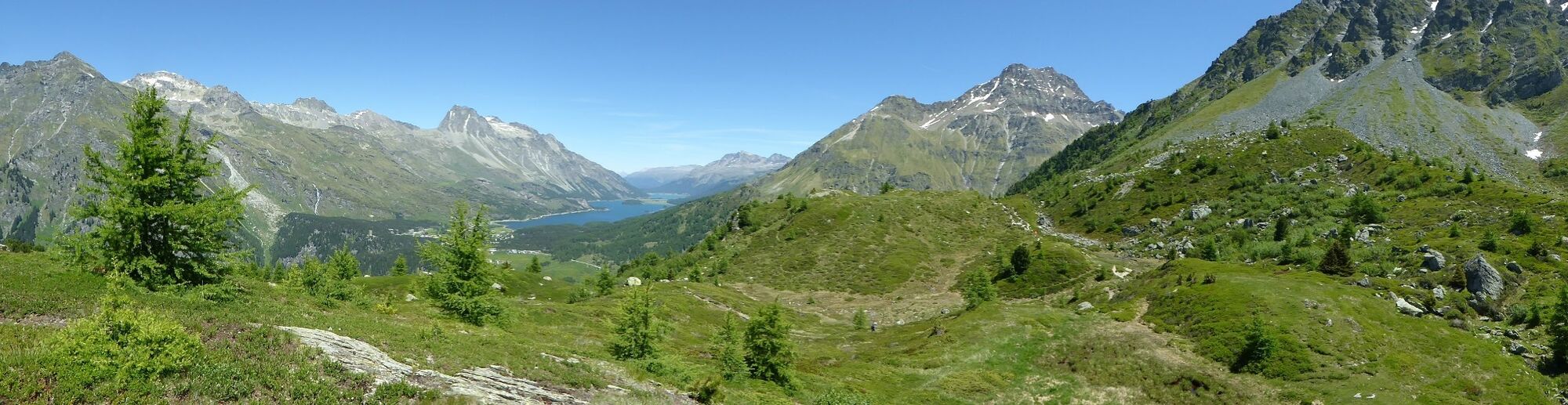
Hike up to Motta Salecina with a beautiful view over Bergell and the Engadine. And behind the Pass da Caval you can look down on the Lägh da Cavloc from an unusual perspective.
- Difficulty
-
medium
- Rating
-
- Starting point
-
Casaccia
- Route
-
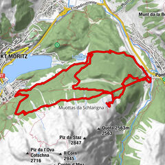
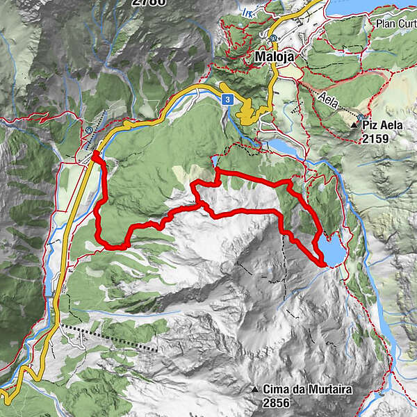
Casaccia (1,458 m)0.0 kmChiesa riformata di San Giovanni0.1 kmRistorantino Bar Sett0.1 kmSaronna2.4 kmPass dal Caval (2,136 m)4.6 kmSaronna10.0 kmRistorantino Bar Sett12.4 kmChiesa riformata di San Giovanni12.4 kmCasaccia (1,458 m)12.4 km
- Best season
-
JanFebMarAprMayJunJulAugSepOctNovDec
- Description
-
The route begins in Casaccia along a stream, the so-called "Valair". The path climbs quite steeply at the beginning until it reaches the panoramic ridge of Motta Salacina. From here it continues over the small saddle Pass dal "Caval" and down to Lägh da Cavloc.
For the way back, you can either choose the comfortable little road to Maloja. Or the footpath towards Lägh da Bitabergh. Once at the lake, you have the choice of taking the direct route to Maloja or climbing another 150 metres in altitude and then following the turnoff back to the starting point in Casaccia.
- Directions
-
In Casaccia, at the Hotel Stampa, follow the path over the Orlegna bridge and then turn right on the road that leads through a beautiful coniferous forest. After about 500 m you come to the turnoff for Motta Salacina. After a steep climb along little Valair stream, you reach the beautiful terrace of Motta Salacina (2015 m), with wonderful views of both Bergell and Engadin. The path to the Pass da Caval (2135 m) leads to the right over the gently undulating Motta and then traversing a small slope towards the west. After the pass, the trail descends to Lägh da Cavloc (1907 m).
When you reach the lake, you have a choice: the path to the right leads to the small restaurant Cavloccio and the farm shop of the Cavloc goat alp. Here begins the small road that leads comfortably down to Maloja. You can also take the left path around the lake and continue to the restaurant. Or, on the north shore of the lake, you can take the path to Lägh da Bitabergh. Once you reach the small lake, you can either take the direct route to Maloja or climb another 150 metres in altitude and then follow the turnoff back to the starting point in Casaccia.
- Highest point
- 2,140 m
- Endpoint
-
Casaccia, Maloja
- Height profile
-
 © outdooractive.com
 - Tips
-
Make a break at the small restaurant Cavloccio and visit the farm shop of the Cavloc goat alp.

- Author
-
The tour Motta Salacina is used by outdooractive.com provided.


General info
-
Veltlin / Valtellina
853
-
Val Bregaglia Engadin
458
-
Casaccia
201