- Brief description
-
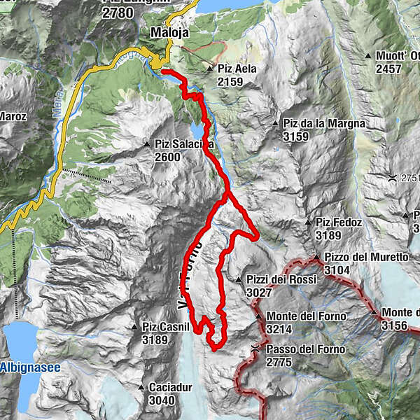
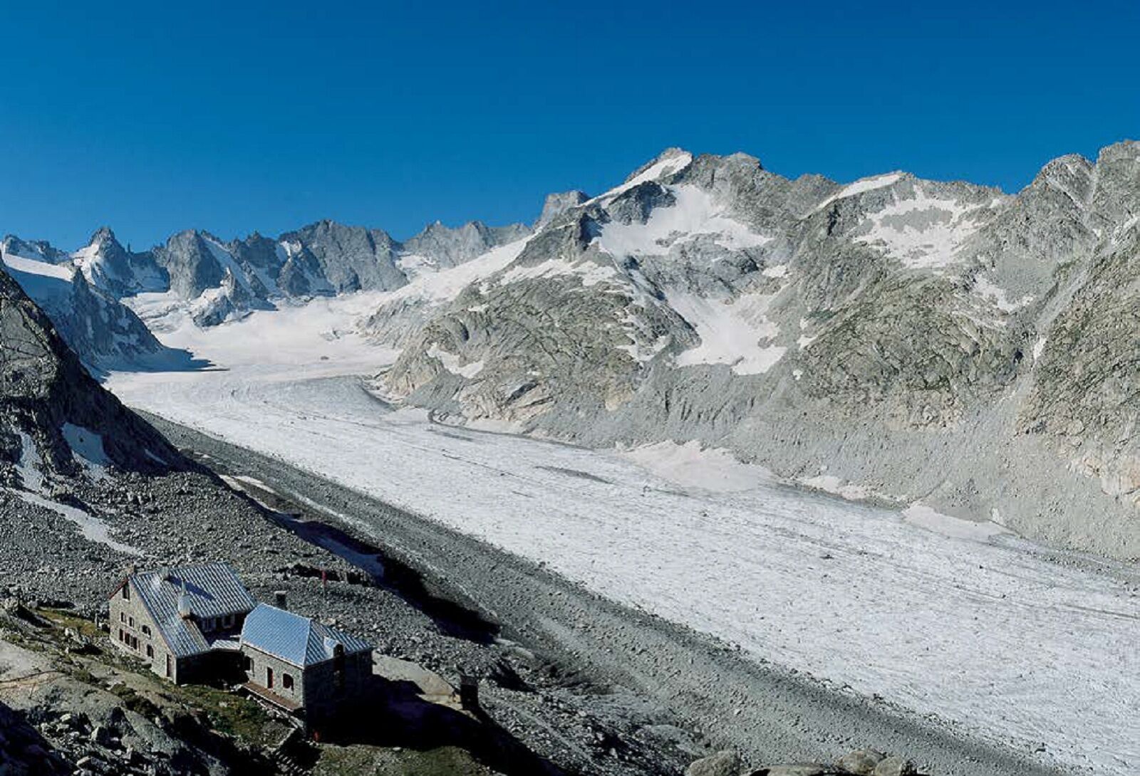
Alpine circular trail with great views of the Forno Valley and the Forno Glacier.
- Difficulty
-
difficult
- Rating
-
- Starting point
-
Maloja
- Route
-
Orden (1,807 m)0.2 kmOrden d'Ent (1,797 m)0.5 kmCavloccio3.0 kmAlp da Cavloc (1,911 m)3.3 kmPlan Canin4.9 kmCapanna del Forno CAS10.9 km
- Best season
-
JanFebMarAprMayJunJulAugSepOctNovDec
- Description
-
A varied tour, the first section of which leads from Maloja to Lake Cavloc. From there, the route follows the wide Orlegna river valley to Plan Canin.
Here the trail splits and we follow the signs towards the Muretto Pass. After a good 300 metres of altitude in the Val Muretto, the trail branches off to the right across the creek and climbs over the Laghetti dei Rossi to the actual panoramic route.
The trail leads through gravel slopes and over boulders, and you should be careful on the steep western flank of Piz dei Rossi, especially in early summer when there are fields of old snow.
The way back from the Forno Hut begins with a steep descent into the Forno Valley and follows the valley ground with a slight gradient to Plan Canin and back to Cavloc and Maloja.The route is also highly recommended the other way round (ascent to the Forno Hut through the Forno Valley, return on the Panorama Trail).
- Directions
-
At the last bend of the Maloja Pass take the road to Salecina until the parking lot of Orden, where the footpath begins. First you go slightly downhill on a wide road that leads to the houses of Salecina. There a bridge crosses the Orlegna stream. On the other side of the river you follow a wide fort road to the popular Lägh da Cavloc (1907m). Continue past the alpine building and through beautiful nature, between trees and clearings, until you reach the fork in the valley where the small reservoir of Plan Canin is located. At the signpost 'Plan Canin' the paths of the two possible accesses to the hut divide.
Follow the signpost to the Murettopass and go down a few steps to the left to a wooden bridge over the Orlegna. The trail accompanies the Murettobach for some time until, about 300 metres above Plan Canin, a sign points to the entrance to the Panorama Trail. Here the creek is crossed to the right and the trail now climbs steeply and pathlessly up the scree-covered northern flank of the Pizzi dei Rossi to the small mountain lake Laghetto dei Rossi at 2364m.
From here, the route goes around the north-western flank of the Pizzi dei Rossi, passes the deeply cut Valun dei Rossi at the only somewhat exposed part of the route (be careful when there are snow fields!) and leads up to approx. 2600 m. At this altitude, the trail traverses the slopes below the Pizzi dei Rossi and Monte del Forno on a slight incline and offers a magnificent view. This is followed by the descent to the Forno Hut (2574 m) with easy, not exposed climbing over a slab field.
From the Forno Hut, the steep descent follows the scree-covered side moraine to the valley floor (and no longer, as was the case a few years ago, to the glacier). There, the trail follows the stream with a slight gradient back to Plan Canin and then back to Cavloc and Maloja.
- Highest point
- 2,739 m
- Endpoint
-
Maloja
- Height profile
-
 © outdooractive.com
 - Tips
-
Visit to the alp of Cavloccio - direct sale of goat cheese
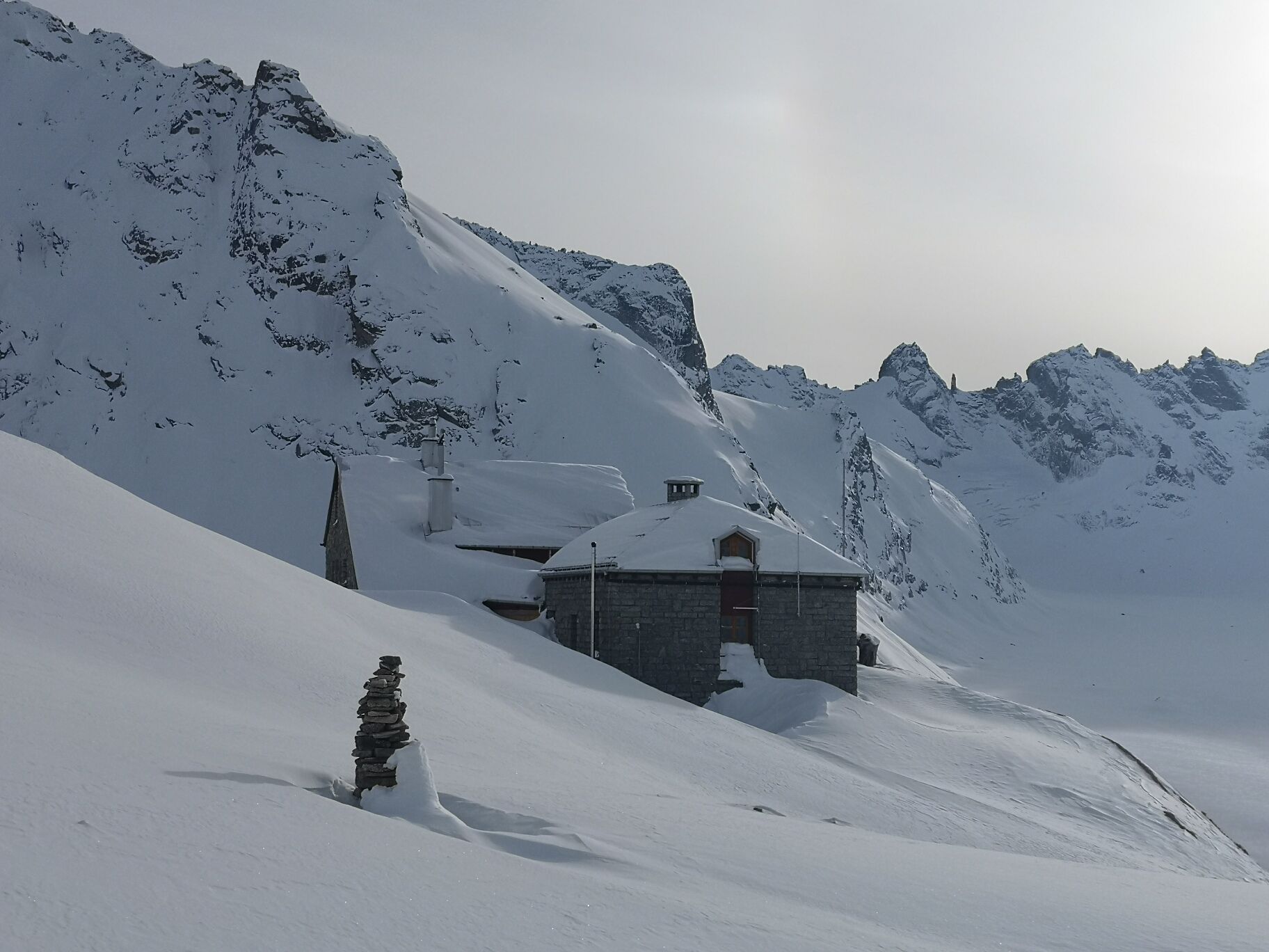
Overnight stay at the Capanna del Forno
- Additional information
- Author
-
The tour Forno Panoramatrail loop is used by outdooractive.com provided.


General info
-
Veltlin / Valtellina
851
-
Val Bregaglia Engadin
468
-
Maloja
245