

- Brief description
-
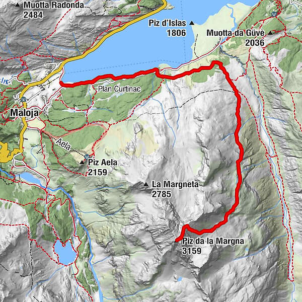
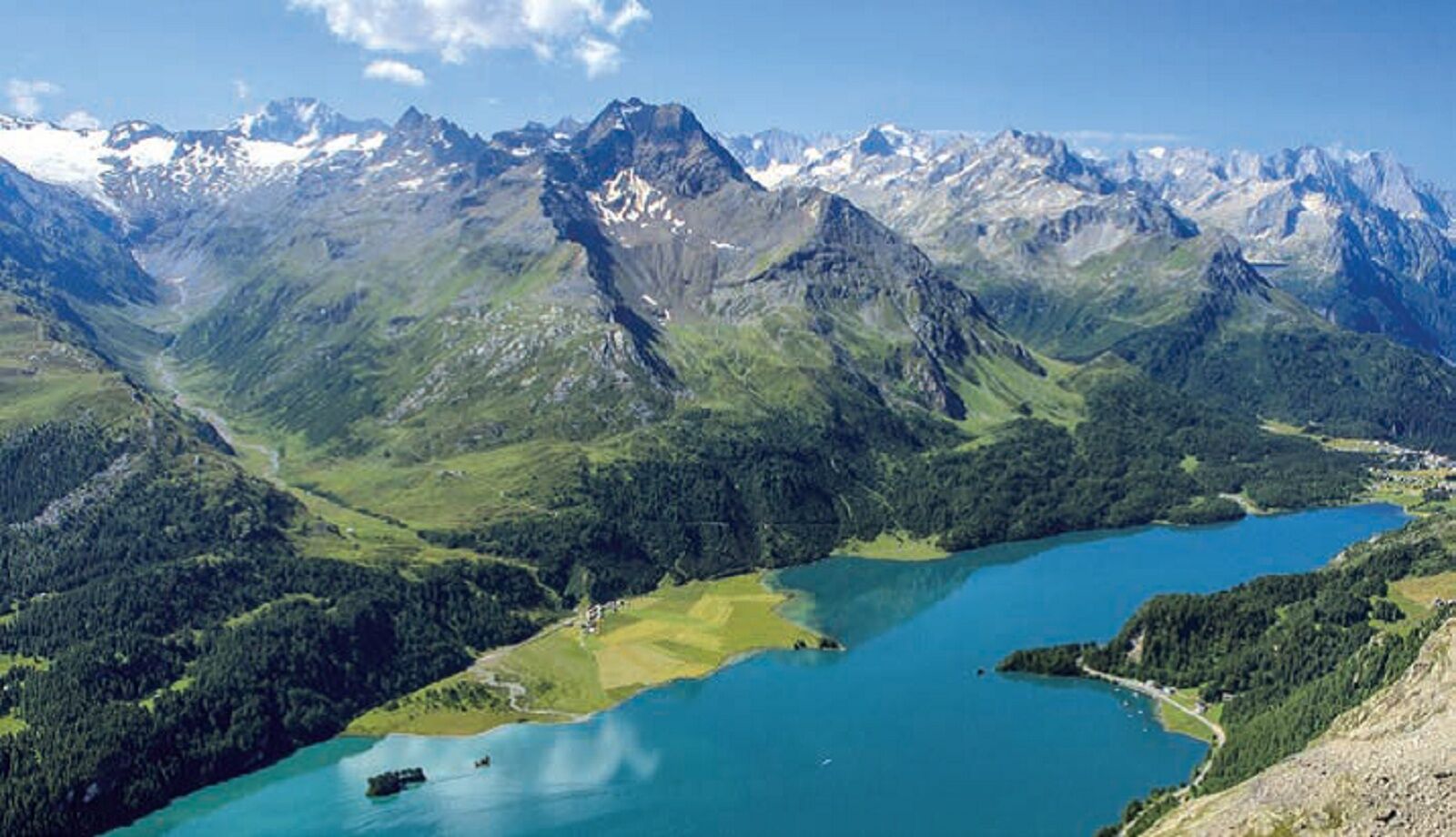
The Piz da la Margna lies above Lake Sils. It is a massive and demanding mountain from whose summit you have a magnificent panoramic view of the Engadine lakes.
- Difficulty
-
difficult
- Rating
-
- Route
-
Cresta0.0 kmPlan Cuncheta0.5 kmCa d'Starnam3.8 kmPiz da la Margna (3,159 m)7.7 kmCa d'Starnam11.7 kmPlan Cuncheta14.9 kmCresta15.4 km
- Best season
-
JanFebMarAprMayJunJulAugSepOctNovDec
- Description
-
The route initially follows the lakeshore of the Silsersee, then turns into the lower part of the Val Fedoz. From Alp Ca d'Starnam, it crosses the slope below Fil da Murtairac and climbs to the summit slope just under 2600m. The last and most demanding section leads over the rocky ridge to the summit.
- Directions
-
From Maloja, the trail follows the southern shore of Lake Sils. After about 2 km, follow the turnoff to Alp Cà d'Starnam (2024 m). From here the alpine, blue-white part of the trail begins with a long ascending traverse that leads to the scree basin below the Margna peak at an altitude of about 2580 m. From here the trail leads steeply up through the boulder field and a scree hollow to the north ridge.
From about 2980 m the most demanding (now well marked) section begins along the ridge to the summit.
- Highest point
- 3,146 m
- Endpoint
-
Maloja
- Height profile
-
 © outdooractive.com
 - Equipment
-
Mountain boots, food, emergency kit
- Safety instructions
-
Difficulty: This is a white-blue-white alpine hiking trail; users must be sure-footed, not afraid of heights and in very good physical condition, as well as being very familiar with the dangers in the mountains.
The trail was newly marked in 2023.
Depending on the conditions, rope and ice axe can be very helpful for the snowy summit section.
- Additional information
-
An alternative route leads from Maloja over the Plan di Cavai and on to Alp Ca d'Starnam - however, this trail is not as frequently used and is unmarked.
- Author
-
The tour Piz Margna is used by outdooractive.com provided.


General info
-
Veltlin / Valtellina
853
-
Engadin St. Moritz
782
-
Isola
282


