© Engadin Tourismus AG - Pontresina Tourismus
© Pontresina Tourismus

© Pontresina Tourismus

© Engadin Tourismus AG - Laura-Maria Engel

© Engadin Tourismus AG - Laura-Maria Engel

- Brief description
-
You may well see marmots and chamois along this varied route.
- Difficulty
-
medium
- Rating
-
- Starting point
-
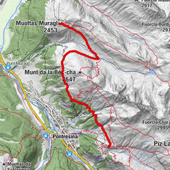
Pontresina, Restaurant Roseg Gletscher
- Route
-
Hotel Restaurant Roseg Gletscher0.0 km
- Best season
-
JanFebMarAprMayJunJulAugSepOctNovDec
- Description
-
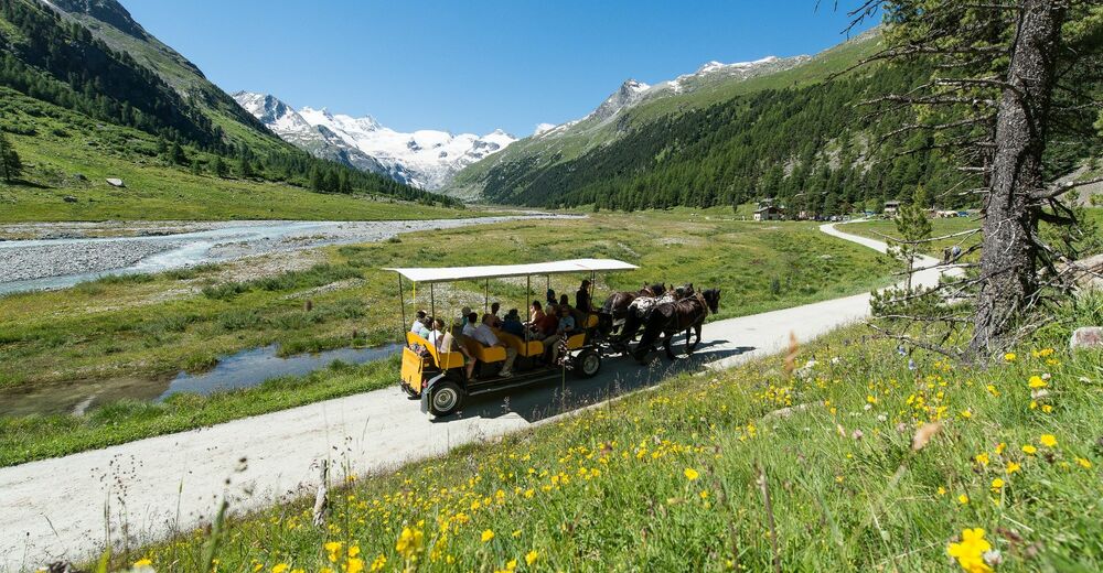
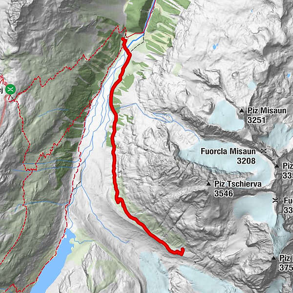
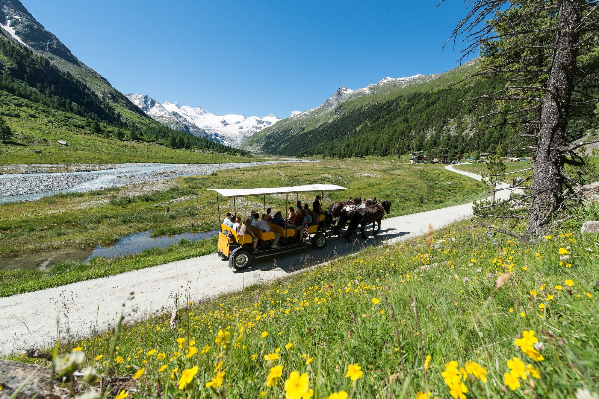
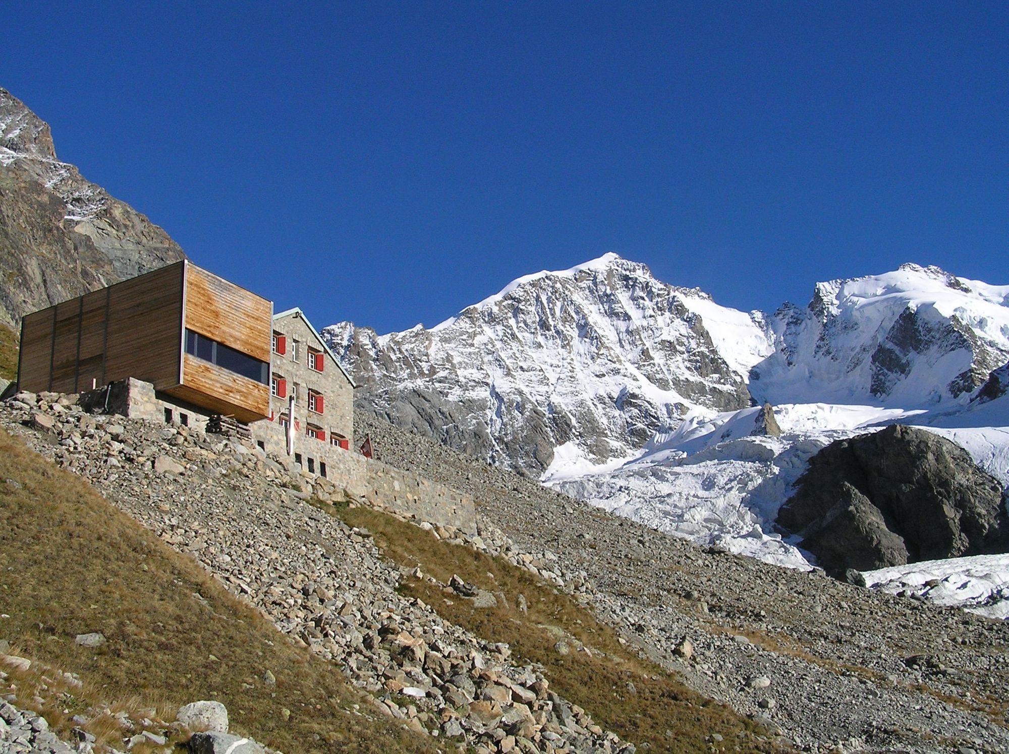
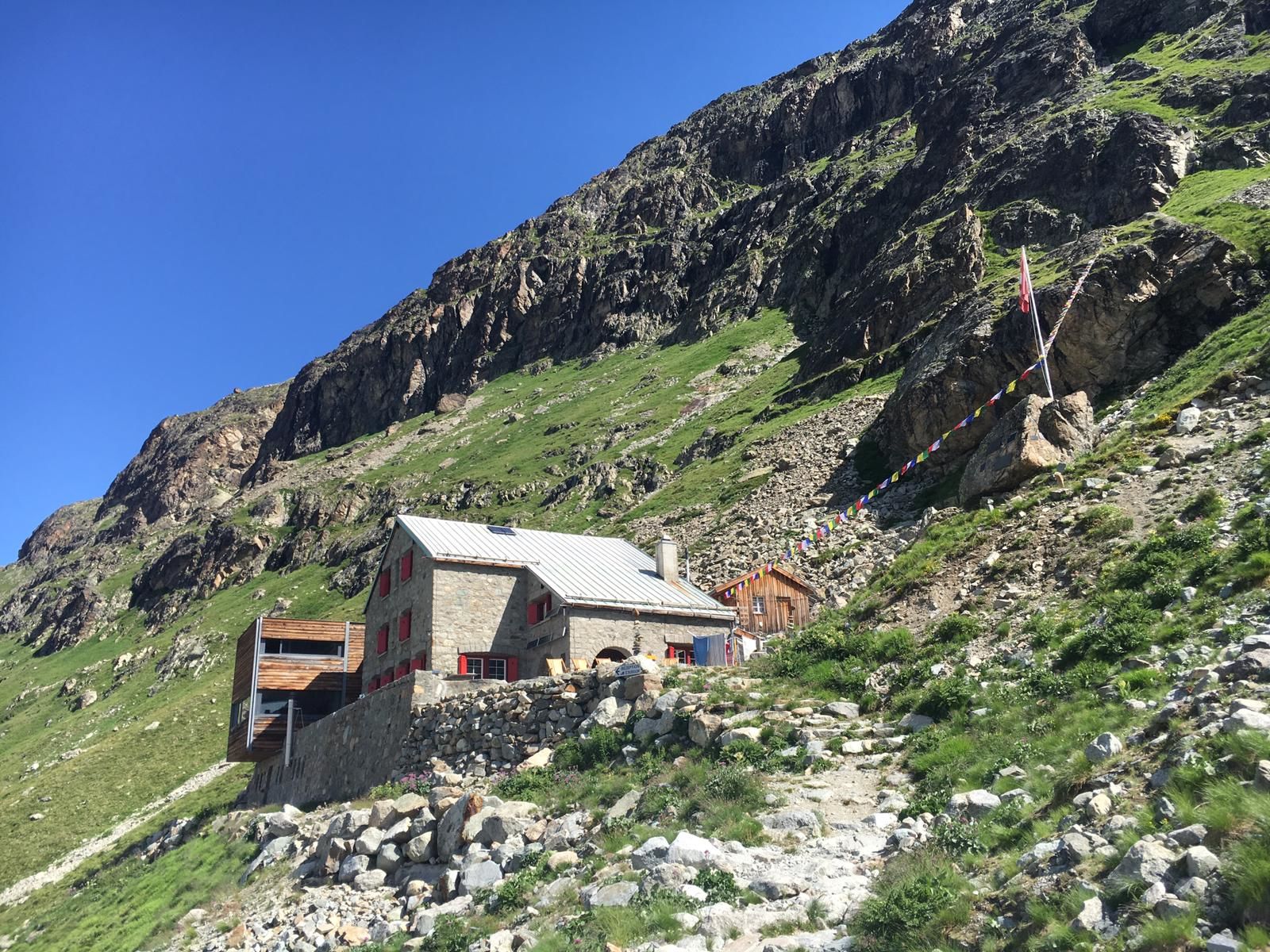
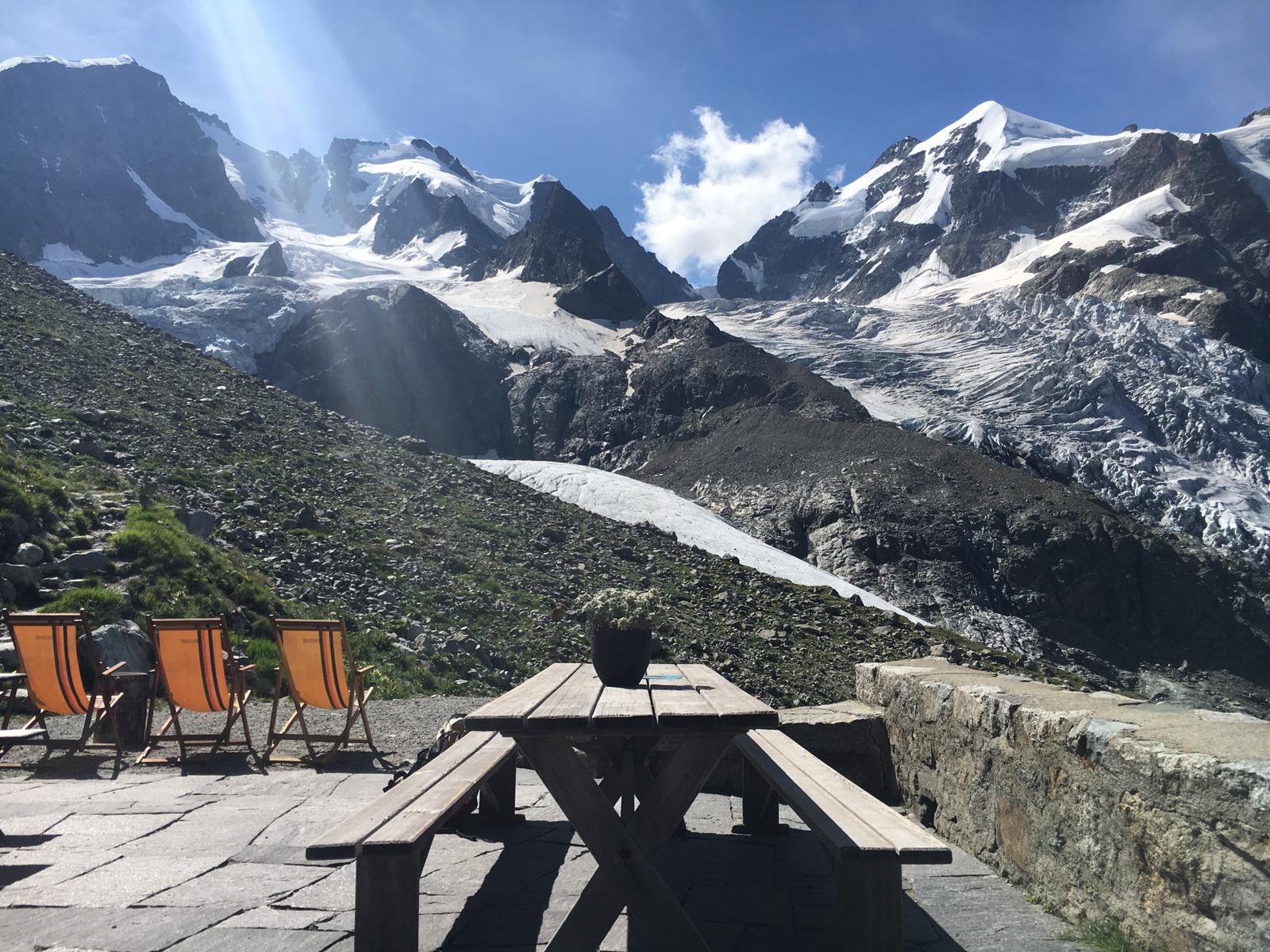
The hiking trail starts at the Hotel Restaurant Roseg Gletscher and first crosses the Ova da Roseg bridge before climbing steadily up the mountainside. The path coming from Pontresina branches off just before the bridge to the Hotel Restaurant Roseg Gletscher. On the way, you can enjoy a non-stop view of the Sella mountain range, with the Roseg and Sella Glaciers, and the wide Ova da Roseg riverbed. A short time later, you will find yourself walking along the moraine at the foot of the Tschierva Glacier towards the Tschierva hut, where an impressive panorama awaits. The imposing Piz Roseg, Piz Bernina (the only four-thousander in the Eastern Alps, with the famous Biancograt) and the Tschierva Glacier are constantly in view. The descent is by the same route. Horse-drawn carrieges operate from the Restaurant Roseg Gletscher to Pontresina (note departure times) or, if you have cycled to the valley by mountain bike or e-bike, you now have an easy ride back to Pontresina.
More information
Engadin Tourismus AG
Via Maistra 1
CH-7500 St. Moritz
Phone: +41 81 830 00 01
E-mail: allegra@engadin.ch
Internet: www.engadin.ch - Directions
-
Restaurant Roseg Gletscher - Margun Misaun - Tschierva Hütte
- Highest point
- 2,581 m
- Endpoint
-
Tschierva hut
- Height profile
-
 © outdooractive.com
 - Tips
-
If you walk from Pontresina into Val Roseg, the walking time is extended by about 2 hours.

- Author
-
The tour Val Roseg - Tschierva hut is used by outdooractive.com provided.
GPS Downloads


General info
Refreshment stop
A lot of view
Other tours in the regions
-
Veltlin / Valtellina
852
-
Engadin St. Moritz
782
-
Corvatsch
322