© Engadin Tourismus AG - Laura-Maria Engel

© Engadin Tourismus AG - Laura-Maria Engel

© Sils Tourismus

© Sils Tourismus

© Engadin Tourismus AG - Laura-Maria Engel

- Brief description
-
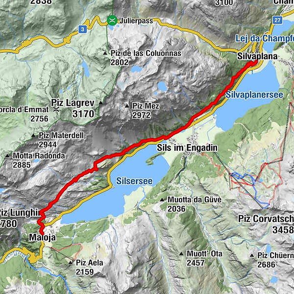
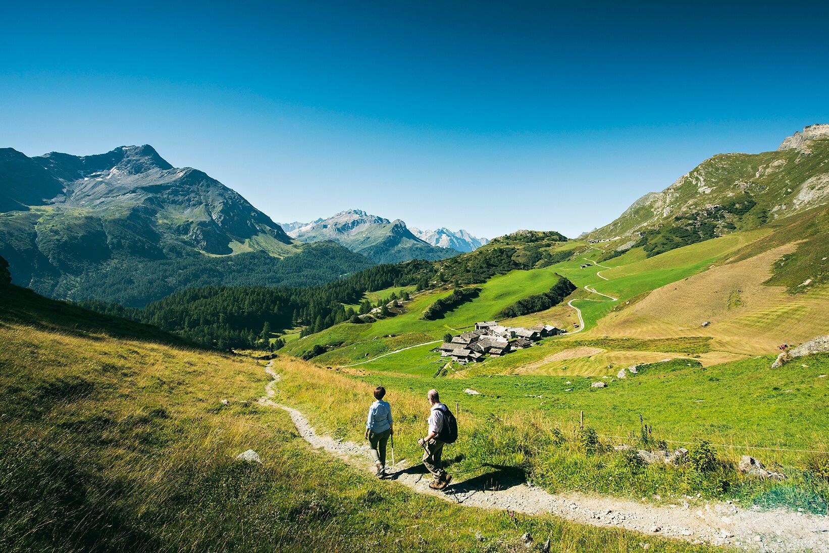
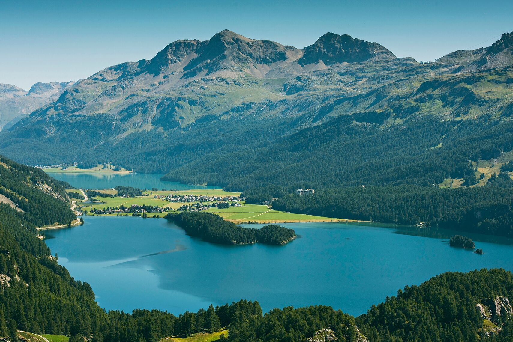
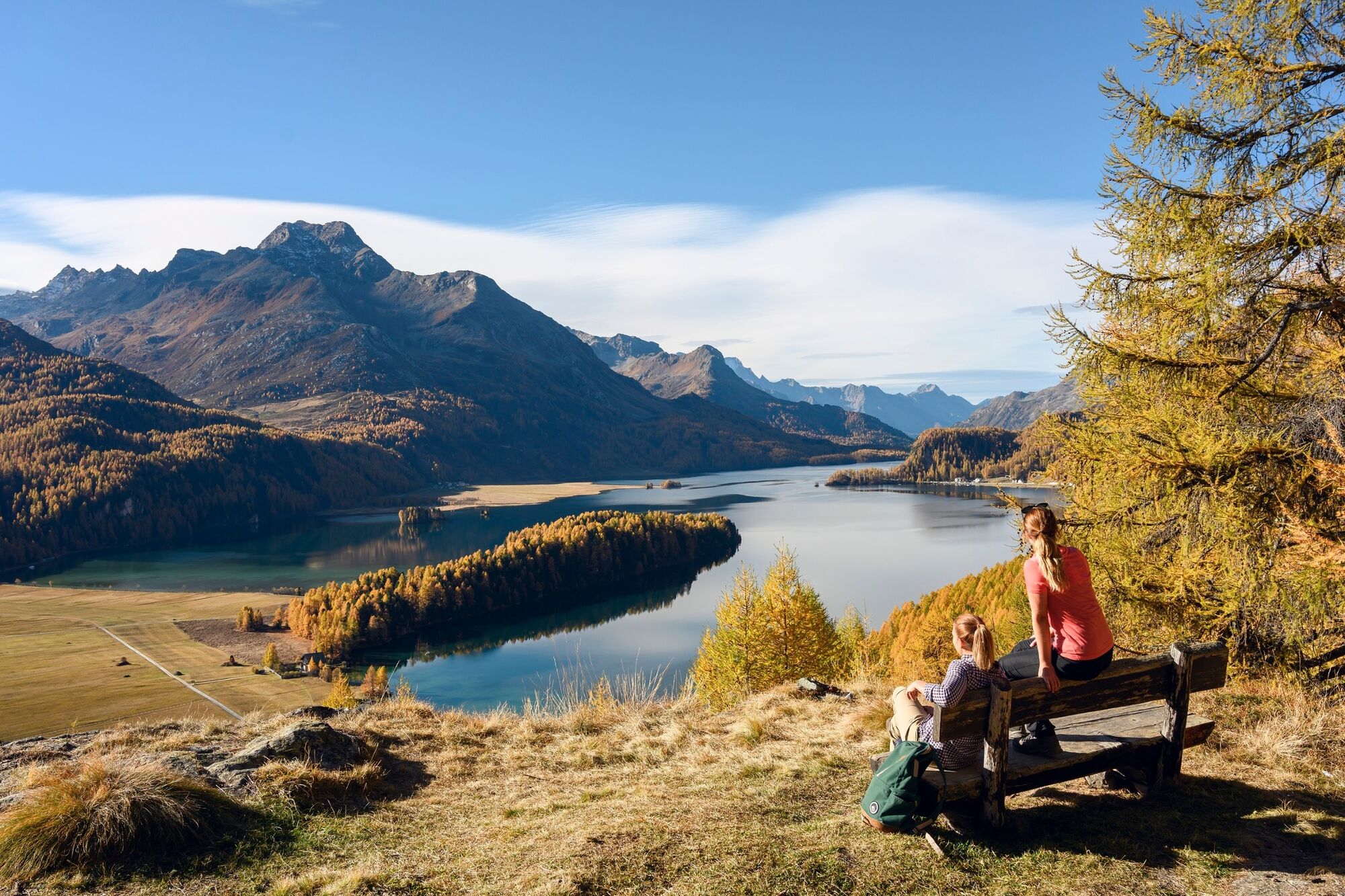
From Maloja via Grevasalvas to Silvaplana - always with the vastness of the Upper Engadin lake landscape in view.
- Difficulty
-
easy
- Rating
-
- Starting point
-
Maloja, Post office
- Route
-
Maloja (1,809 m)Maloja Posta0.0 kmPila0.6 kmBlaunca (2,037 m)2.8 kmGrevasalvas (1,941 m)4.0 kmPignoulas7.2 kmClos7.5 kmSan Lurench7.7 kmStüvetta7.7 kmCurtin da Gennas8.6 kmFöglias8.9 kmSanta Anna12.3 kmSilvaplana (1,815 m)12.4 kmSanta Maria12.4 km
- Best season
-
JanFebMarAprMayJunJulAugSepOctNovDec
- Description
-
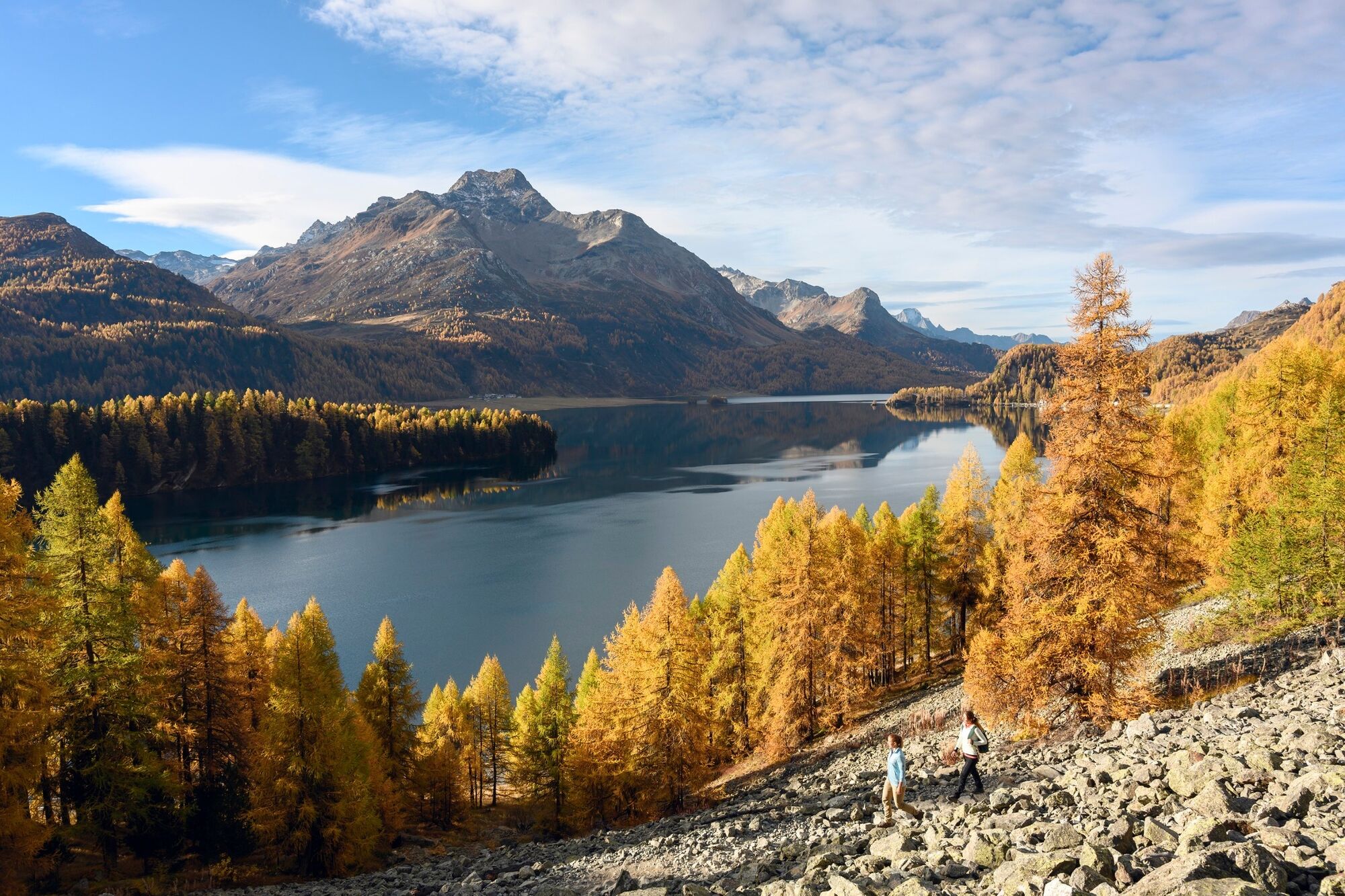
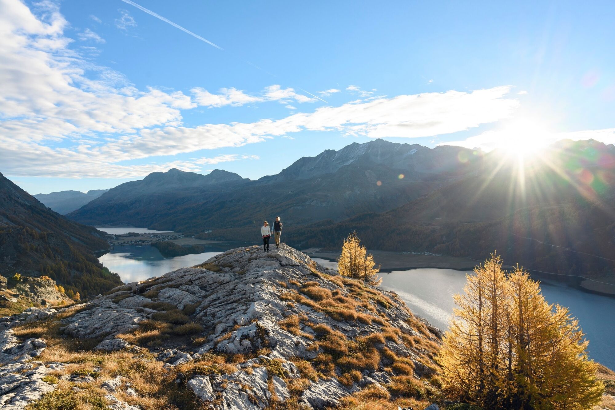
This hike starts in Maloja. The village at the bottom of the mountain pass and at the gateway to the unspoilt Bregaglia Valley has attracted artists since time immemorial, thanks to its breathtaking scenery and fascinating interplay of light and shade. The path leads past Pila and Blaunca to the traditional village of Grevasalvas, where Johanna Spyrig's children's story, Heidi was set, which slumbers peacefully above Plaun da Lej. At Sils Baselgia, the hike almost reaches the valley floor, before rising again to end in trendy Silvaplana.
More information
Engadin Tourismus AG
Via Maistra 1
CH-7500 St. Moritz
Phone: +41 81 830 00 01
E-mail: allegra@engadin.ch
Internet: www.engadin.ch
Booking
Eurotrek AG
Zürcherstrasse 42
CH-8103 Unterengstringen
Phone: +41 44 316 10 00
E-mail: eurotrek@eurotrek.ch
Online Booking - Directions
-
Maloja - Blaunca - Grevasalvas - Sils Baselgia - Silvaplana
- Highest point
- 2,036 m
- Endpoint
-
Silvaplana
- Height profile
-
 © outdooractive.com
 - Tips
-
Before you leave Maloja, you should definitely walk a little in the footsteps of the painter Giovanni Segantini, whose life and work are inseparably linked to this village.
- Public transportation
- Parking
- Author
-
The tour 87 Via Engiadina: stage 1 Maloja-Silvaplana is used by outdooractive.com provided.
GPS Downloads


General info
Cultural/Historical
Flora
A lot of view
Other tours in the regions
-
Veltlin / Valtellina
852
-
Engadin St. Moritz
782
-
Isola
282