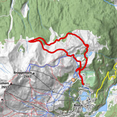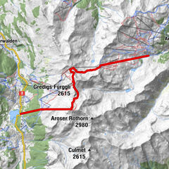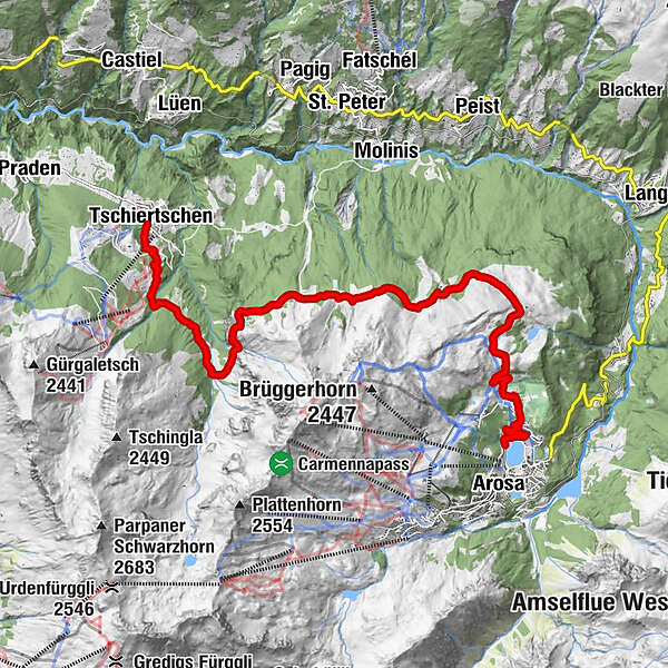

- Route
-
Tschiertschen (1,343 m)Erlebnisstall0.1 kmOchsenalp6.7 kmRot Tritt9.3 kmMaran (1,862 m)12.7 km
- Best season
-
JanFebMarAprMayJunJulAugSepOctNovDec
- Description
-
From Tschiertschen, where many holiday chalets have sprung up along the well-marked route in recent decades, you follow the road southwards via Clüs–Bleiswald forest up into the Löser, where the partially tarred improvement road ends. After crossing over the Urden creek, the old Ochsenalp route from the 19th century leads up the steep valley wall south-eastward again to Gatter (Pt. 1871). This varied section of the route passes below the exposed former wild-hay region of Bleisen and Güda. However it is geologically interesting thanks to the change in rock types.
After around 2km along a virtually flat path, we reach Ochsenalp, the popular excursion location with its traditional Alpine restaurant. The comfortable path leads eastward along a gentle incline to the forest edge between pines, larches and firs through to Alp Wolfboden and then to Rot Tritt vantage point.
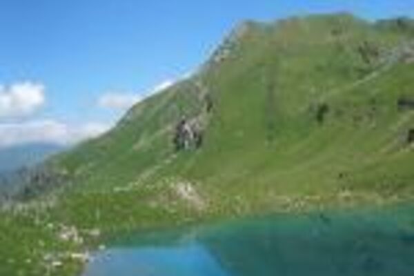
From there we pass through Prätsch, once a permanently inhabited Walser settlement, Ober Prätschsee, pleasantly warm in summer (you can bathe here) and the Maraner Alp (5 minutes to Prätschli bus station) to Maran and down to Arosa RhB train station.
Secondary route:
Tschiertschen–Sagenboden Pt. 1325–Ruchtobel–Löser 1 hr 15 mins
Inns en route: Arosa: Restaurant Ochsenalp Tel. +41 (0)81 377 42 31, Hotel Hof Maran Tel. +41 (0)81 378 51 51. - Directions
-
Tschiertschen – Ochsenalp – Arosa
- Highest point
- 2,007 m
- Height profile
-
 © outdooractive.com
 - Additional information
-
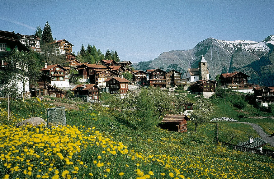
Tschiertschen: In Tschiertschen (the origin of the name is unknown), Churwalden monastery ownership was documented as early as 1222, declaring it the property of the Court of Churwalden. A chapel under the patronage of St. Jakob and Christoph is first mentioned in 1405. Its successor, the evangelical church, still retains the old curtain walls; the choir was vaulted at the start of the 15th, and the tower arose around 1500. On the north side, you can make out traces of a late-Gothic crucifixion image, beside a 6 metre-high image of St. Christopher ascribed to the Waltensburg Master. With the installation of ski-lift systems and a mountain restaurant that remains open in the winter, Tschiertschen has also gained a reputation as a winter sports destination – all the more so because this Walser village can be reached directly from Chur by post office van.
- Public transportation
-
Getting there: By PostBus to Tschiertschen.
Getting back: By train from Arosa.
- Author
-
The tour Tschiertschen – Ochsenalp – Arosa is used by outdooractive.com provided.
GPS Downloads


General info
Refreshment stop
A lot of view