
- Brief description
-
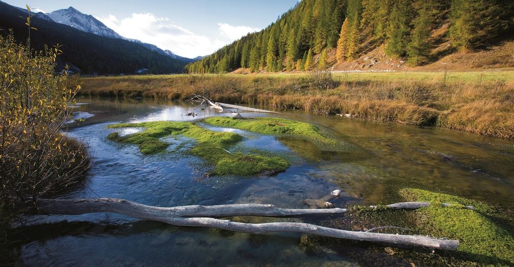
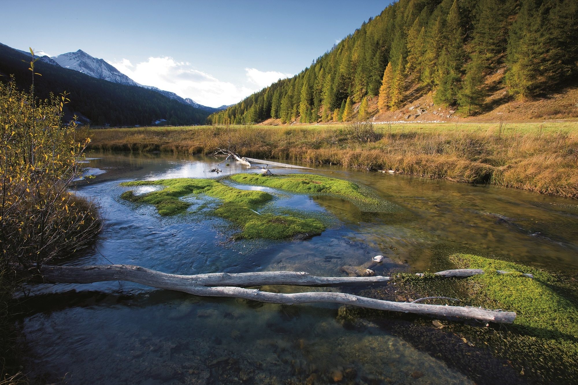
Beautiful trail for nature lovers along the only unspoilt valley river in Switzerland. Fascinating landscapes and flowering meadows enrich the run.
- Difficulty
-
easy
- Rating
-
- Starting point
-
Sta. Maria, Post bus stop Posta
- Route
-
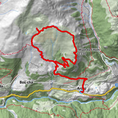
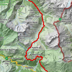
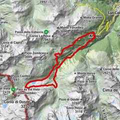
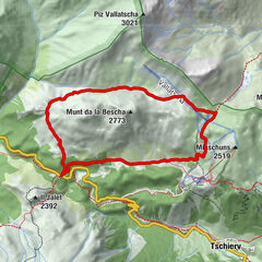
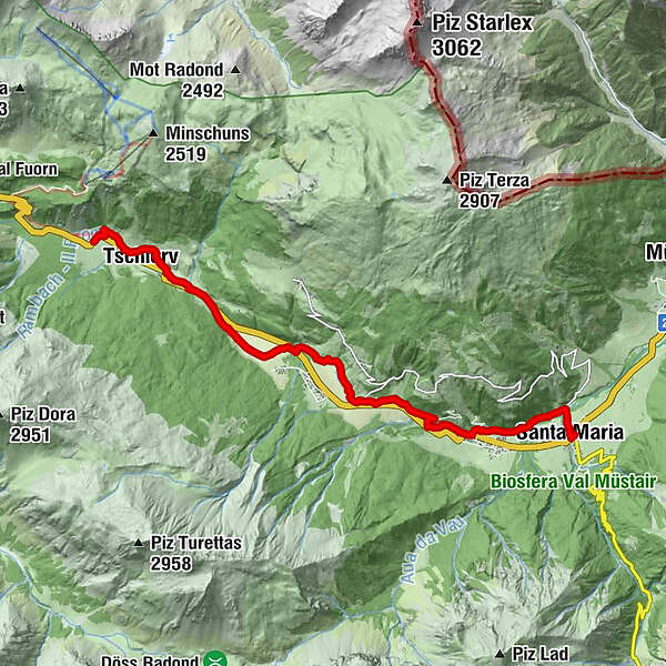
Sta. Maria Val Müstair (1,375 m)0.1 kmValcava (1,440 m)1.8 kmMuglin2.1 kmBulaseras4.1 kmFurom4.6 kmFuldera (1,638 m)5.6 kmOrasom Tschierv8.2 kmCierfs (1,660 m)9.6 km
- Best season
-
JanFebMarAprMayJunJulAugSepOctNovDec
- Description
-
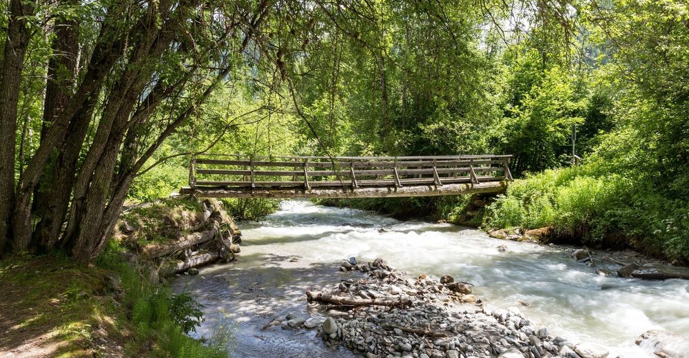
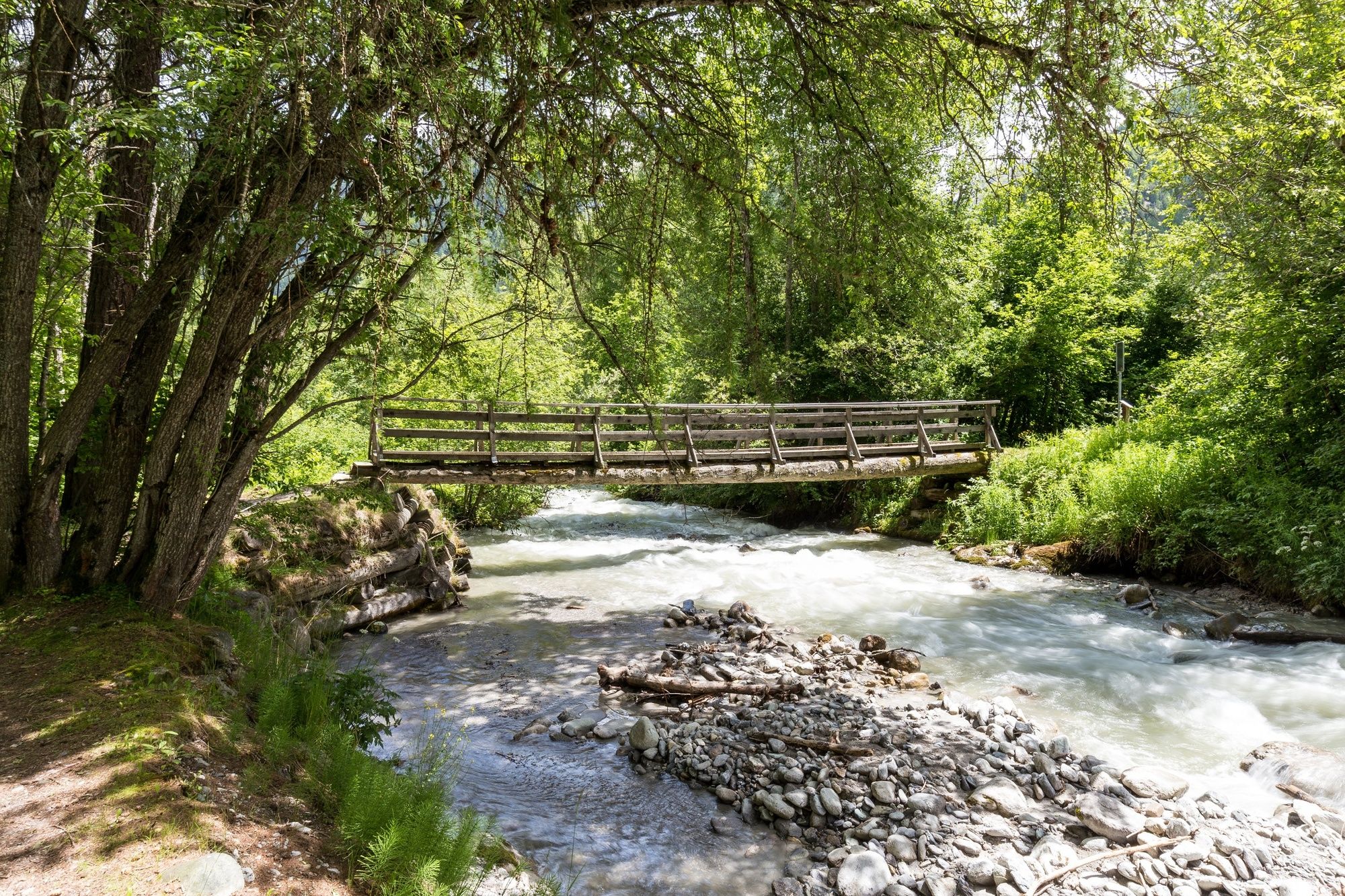
From the village centre in Sta. Maria we follow the signpost to Muglin Mall. After the mill we meet the Rombach stream. The trail winds along the stream up the valley. After about 1.5 km the trail branches off to the left and leads out of Valchava. Before the valley road, we branch off to the right over a bridge. There is a mineral water spring on the left after the bridge. Then we walk to the cross-country skiing centre. The trail leads through the plain of Fuldera. After crossing the Rombach stream, we continue through a floodplain forest. After the subway of the main road we go onto a large plain along the river. Then we cross the road in Tschierv Orasom and follow the Rombach again. Here you can end the tour with a refreshing drink on the sun terrace of the Hotel Al Rom.
If you still like, walk up to the right to the old part of the village of Tschierv, cross the village centre and follow the small stream into the spring area. Here you can cool your feet in the fresh spring water.
- Directions
-
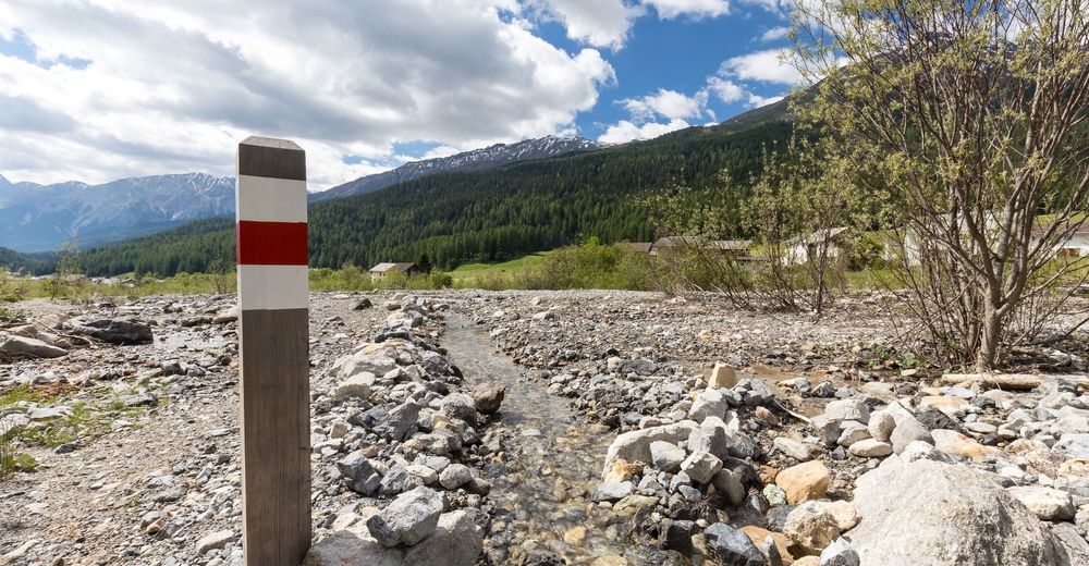
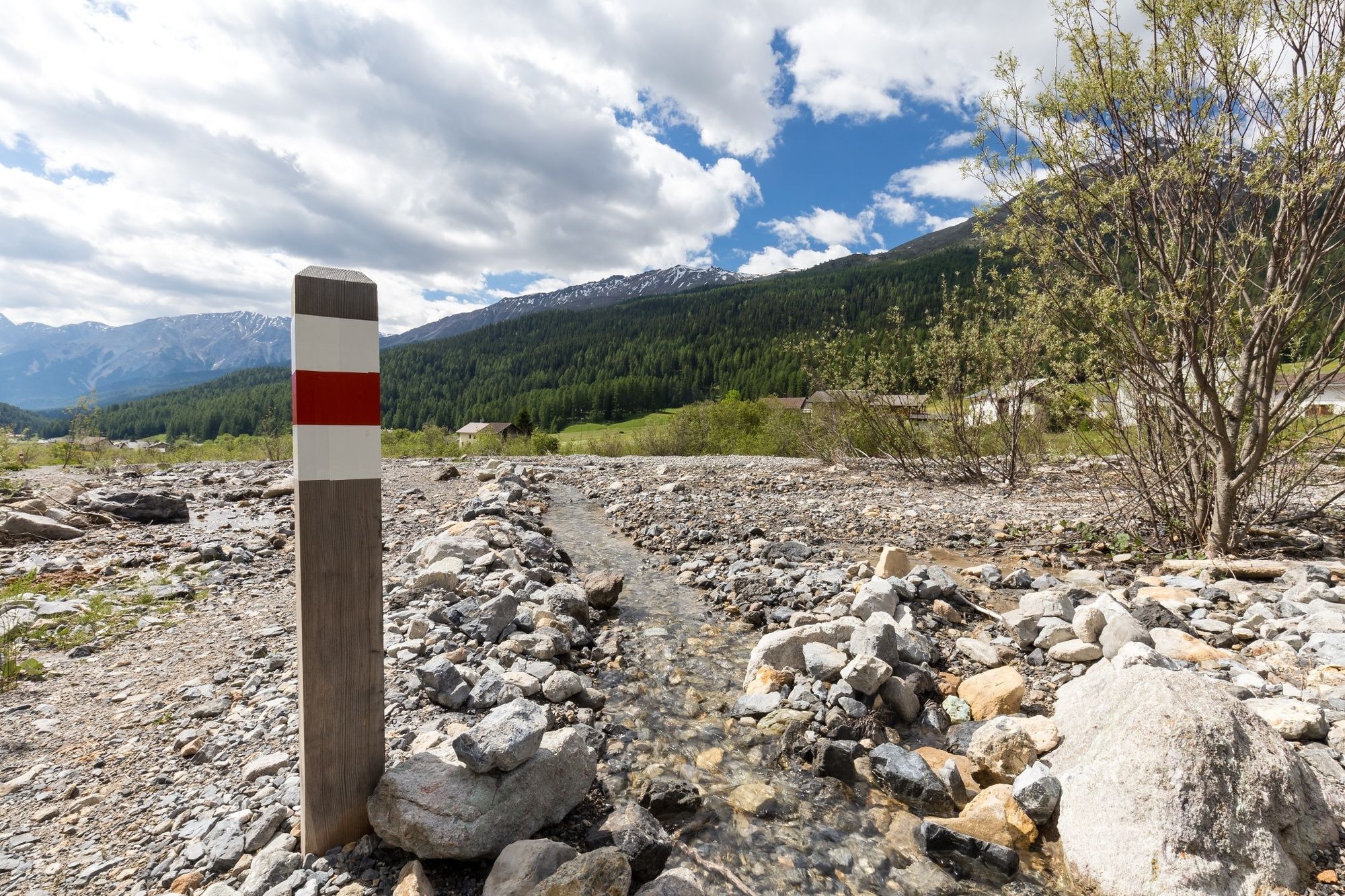
From the Sta. Maria post bus stop, posta on the hiking trail down to Rombach. From there the trail is clearly signposted with the signposts 801.
- Highest point
- 1,746 m
- Endpoint
-
Tschierv, Postbus stop Biosfera
- Height profile
-
 © outdooractive.com
 - Equipment
-
Trail running equipment, enough to drink & snacks
- Safety instructions
-
The tour was assessed in favourable weather conditions, it is imperative that the current weather conditions and weather forecasts are observed before starting the tour.
Emergency call:
144 Emergency call, first aid
1414 Mountain rescue REGA
112 International emergency call
- Tips
-
Meier-Beck Sta. Maria
Muglin Mall
Mineral water spring above Valchava
Unique habitats along the Rombach stream
Stop at the Hotel Al Rom - Directions
-
- From the north: via Landquart - Klosters by car transport through the Vereina tunnel (Selfranga - Sagliains) or via the Flüela Pass to Zernez on the H27. From Zernez on the H28 in the direction of Val Müstair to Sta. Maria, cumün (45 minutes from Vereina south portal).
- From the east: via Reschenpass (Nauders) on the SS40 to Mals. From Mals on the SS41 to the Swiss border to Sta. Maria, cumün.
- From the south: Via Bolzano and Merano on the SS40 to Malles. From Mals on the SS41 to the Swiss border to Sta. Maria, cumün.
- Public transportation
-
- With the Rhaetian Railway (from Chur, Landquart/Prättigau, from the Upper or Lower Engadine) hourly to Zernez.
- Continue by PostBus from Zernez or from Val Müstair and Mals hourly to Sta. Maria, cumün
- Parking
-
Free parking in Sta. Maria, behind the petrol station
- Author
-
The tour A la riva dal Rom Sta. Maria - Tschierv is used by outdooractive.com provided.
General info
-
Vinschgau
16
-
Biosfera Val Müstair
30
-
Fuldera
8