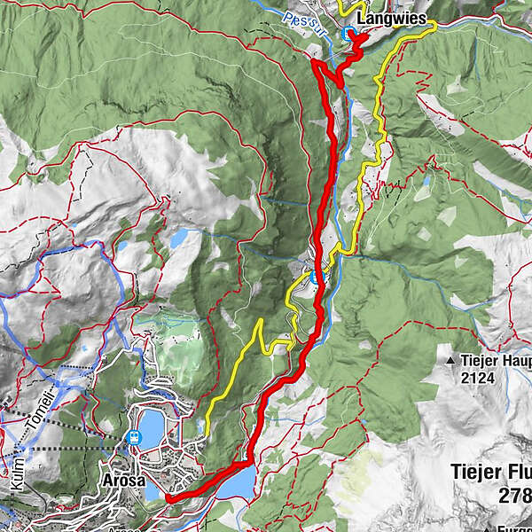

- Brief description
-
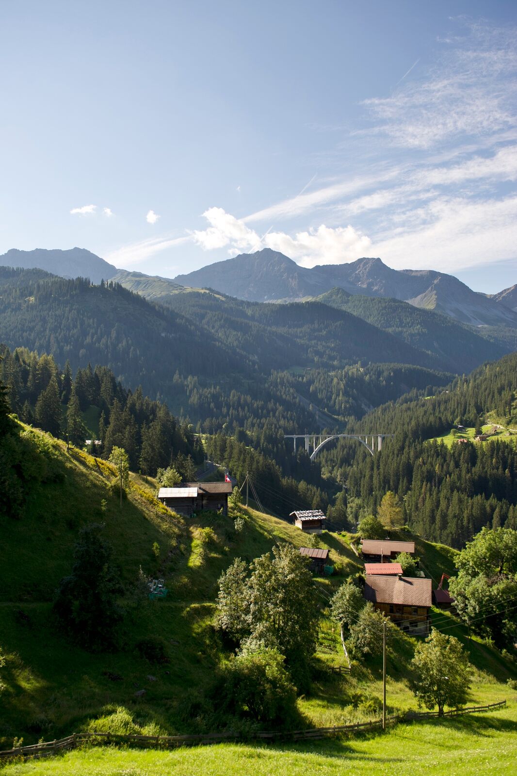
Easy hike through the forest to Litzirüti and on under the impressive Langwieserviadukt, where the Fondeierbach and Plessur rivers flow together.
- Difficulty
-
easy
- Rating
-
- Starting point
-
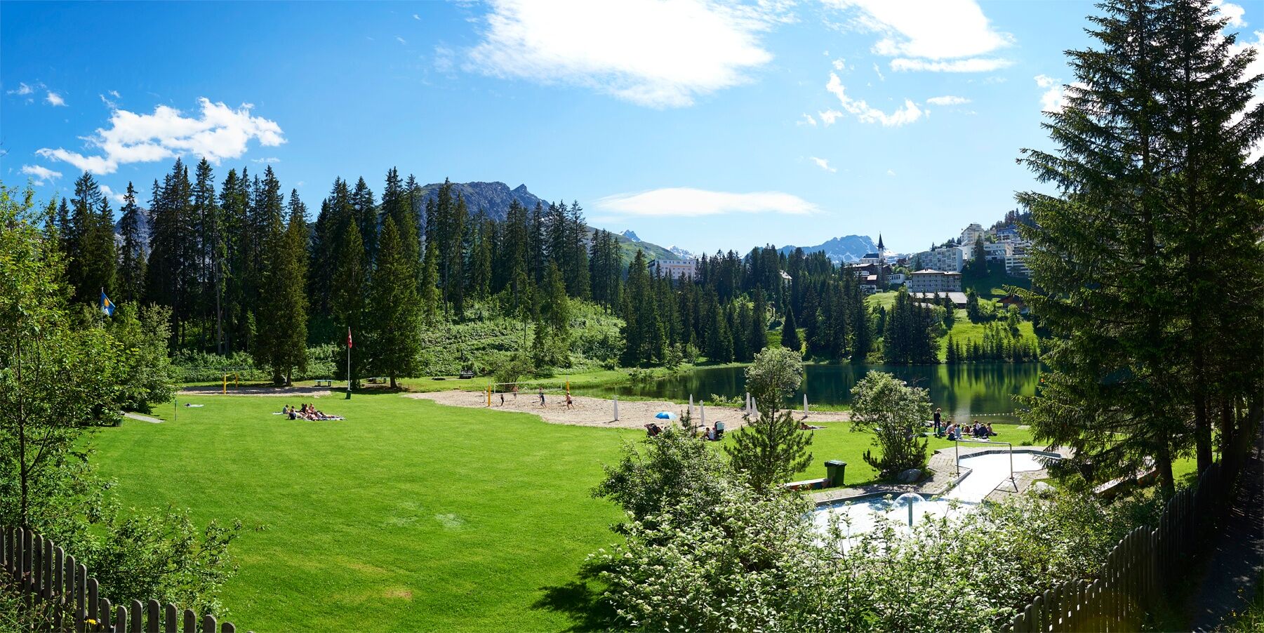
Untersee Arosa
- Route
-
Arosa (1,739 m)In den Brünst2.5 kmCasa Rustica2.6 kmLitzirüti (1,452 m)3.2 kmHotel Ramoz3.2 kmLangwies (1,373 m)6.6 kmLangwies (1,317 m)6.8 km
- Best season
-
JanFebMarAprMayJunJulAugSepOctNovDec
- Description
-
The hike starts at the Untersee lake Arosa on the old Poststrasse. After the first hundred metres you may already enjoy a fantastic view on the reservoir lake, the Schiesshorn and the Furggahörner. The trail continues through the forest along the Plessur river all the way down to Langwies where a short cut leads on a narrow, romantic path under the 62m high viaduct of Langwies. The view from above can be admired from the train on the return journey.
- Directions
-
Arosa - Litzirüti - Langwieser Viadukt - Langwies
- Highest point
- 1,690 m
- Endpoint
-
Bahnhof Langwies
- Height profile
-
 © outdooractive.com
 - Equipment
- Safety instructions
- Tips
-
On this walk you can also follow the themed route "Protection,Forest,Humans" with interesting information about nature hazards, protection forest and humans.
- Additional information
-
The hike is also possible during the winter season.
Arosa strives to provide hikers with a well-developed and marked network of hiking trails. Please heed the rules and signposting.
Please keep your dogs on a leash Please take litter and leftovers from picnics home again You will often see game on your walks. Enjoy the sight of these animals and respect their familiar surroundings. Leave trail markings where they are Do not use closed paths (winter sports report) Do not leave the officially marked winter hiking trails - Directions
-
Once you arrive in Chur, follow the sign posts Arosa. The train station in Langwies is also clearly signposted. To reach the Untersee lake, drive all the way to Arosa. At the village entrance you need to turn left and follow the street all the way downhill to the Untersee lake.
- Public transportation
-
The hike starts at the Untersee lake Arosa and ends at the train station Langwies. The Untersee lake is accessible via the Rhaetian Railway and the local bus. The Rhaetian Railway also stops at the train station Langwies. The trains operate on an hourly basis in both directions.
- Parking
-
There are a few parking spots available at the train station Langwies. There is only a limited number of parking spots at the Untersee lake Arosa. Therefore it is recommended to park at the Ochsenbühl car park and either take the local bus to the Untersee lake or walk by foot. Further information can be found here.

- Author
-
The tour Arosa - Viaduct Langwies is used by outdooractive.com provided.