© Engadin Samnaun Val Müstair - Andrea Badrutt

© Engadin Samnaun Val Müstair - Andrea Badrutt

© Engadin Samnaun Val Müstair - Andrea Badrutt

© Engadin Samnaun Val Müstair - Andrea Badrutt

© Engadin Samnaun Val Müstair - Andrea Badrutt

- Brief description
-
With the digital hiking guide (WebParkSNP), you can discover many exciting facts about nature in a playful way. Attention is drawn to small natural phenomena.
- Difficulty
-
easy
- Rating
-
- Starting point
-
Ardez train station
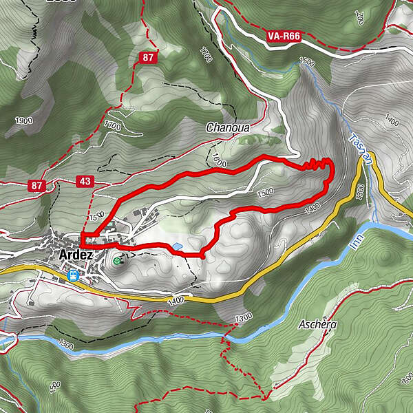
- Route
-
Ardez (1,467 m)Ardez (1,467 m)4.1 km
- Best season
-
JanFebMarAprMayJunJulAugSepOctNovDec
- Description
-
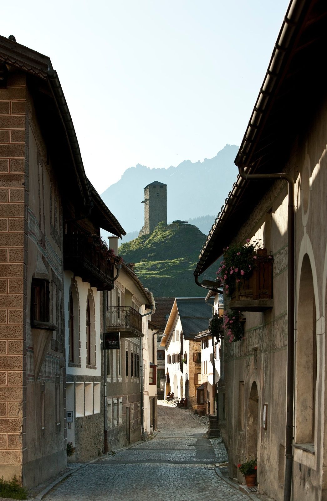
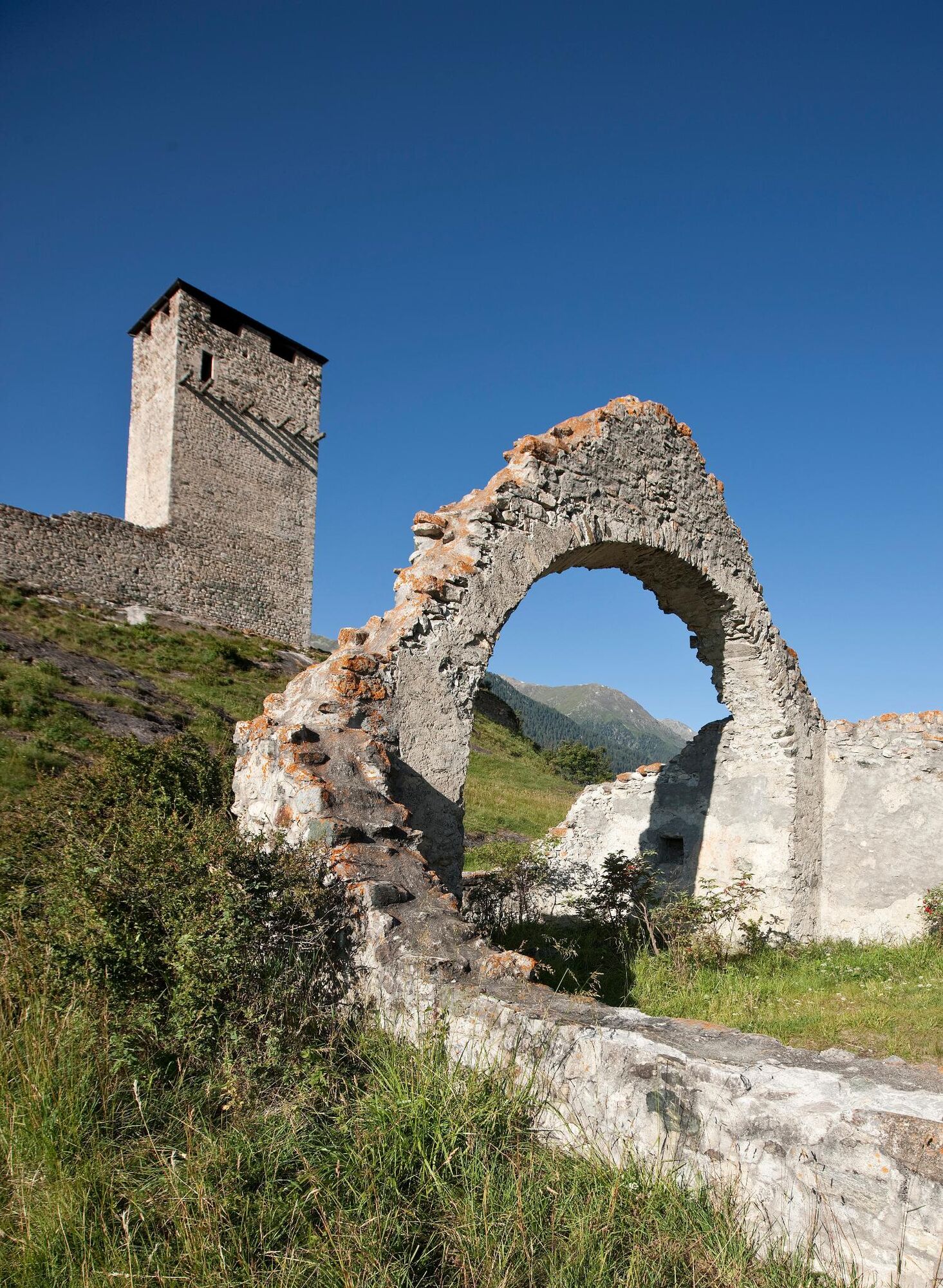
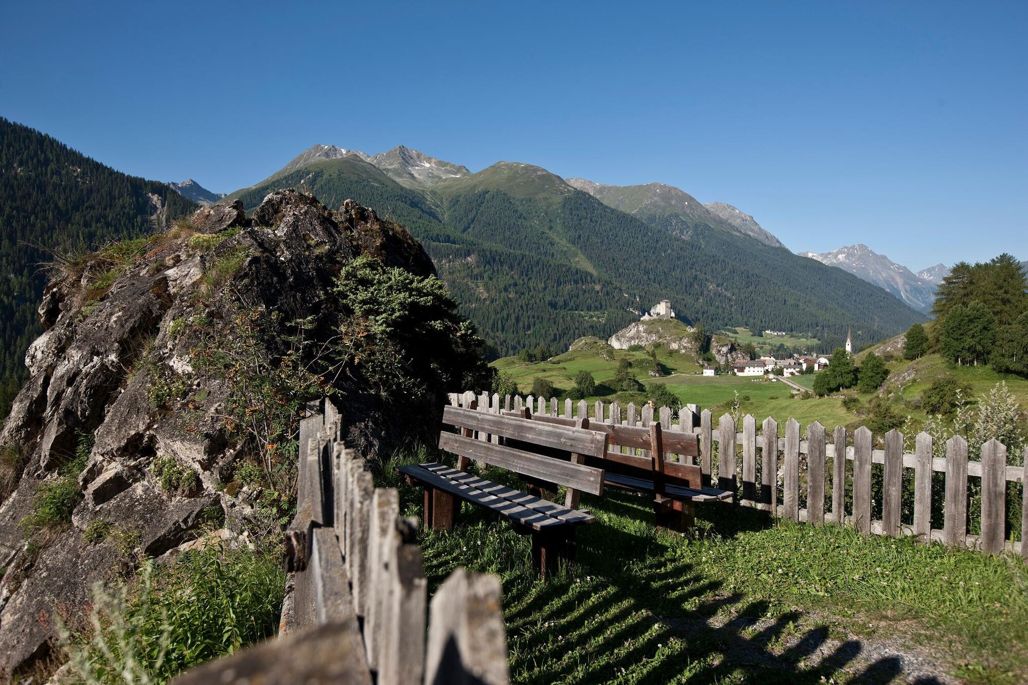
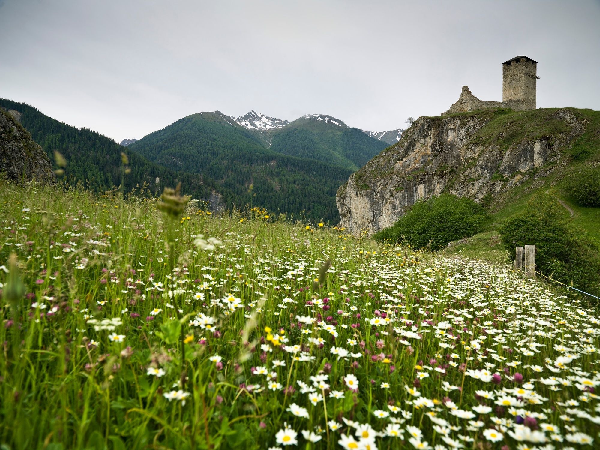
The explorers' trail in Ardez is an experience for the whole family. You start at the church in the centre of Ardez. You then walk to the east, to the Lajet, where the first animals can be discovered. The path continues down to a boulder. A steep ascent now awaits us, which leads us above the village of Ardez. This is the highlight of the adventure trail, where you can enjoy the wonderful view of the Steinsberg ruins and the Engadine mountains. From here the path leads non-stop downhill, back to the church in the village.
Download App iWebPark – digital hiking guide National Park region
Apple Store
Google Play
- Directions
-
From Ardez railway station through the village up to the church.
Follow the signpost in the direction of Lajet and turn onto the Forscherpfad (explorer's path)
Back to Ardez
- Highest point
- 1,571 m
- Endpoint
-
Ardez train station
- Height profile
-
 © outdooractive.com
 - Equipment
-
Trainers or hiking boots, possibly poles, rain gear
- Safety instructions
-
The tour was assessed in favourable weather conditions, it is imperative that the current weather conditions and weather forecasts are observed before starting the tour.
Emergency call:
144 Emergency call, first aid
1414 Mountain rescue REGA
112 International emergency call
- Tips
-
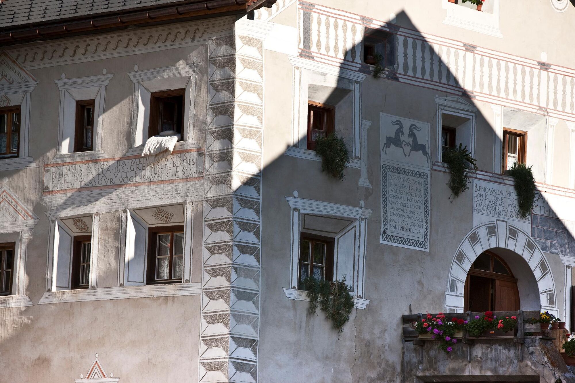
Ardez, which is considered a model village of Romansh residential culture, invites you to explore its roads and squares with its Engadine houses and village fountains.
- Arrival
-
- From the north: via Landquart - Klosters by car transport through the Vereina Tunnel (Selfranga - Sagliains) or via the Flüela Pass into the Lower Engadine on H27 to Ardez.
- From the east: via Landeck / Austria in the direction of St. Moritz on H27 to Ardez
- From the south: via Reschenpass (Nauders-Martina) or Ofenpass (Val Müstair-Zernez) on H27 to Ardez
- Public transportation
-
- By Rhaetian Railway (from Chur, Landquart/Prättigau or from the Upper Engadine) hourly to Ardez
- Parking
-
- Parkplätze am Bahnhof Ardez (Ardez Süd) oder beim Hotel Schorta's Alvetern (Ardez West)
- Author
-
The tour Exploration Trail Emerald Area Ardez is used by outdooractive.com provided.
GPS Downloads


General info
Refreshment stop
Fauna
Other tours in the regions
-
Engadin Scuol Zernez
734
-
Ardez
153