
- Brief description
-
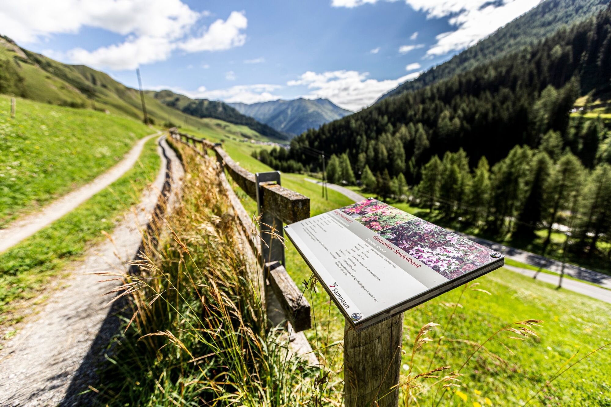
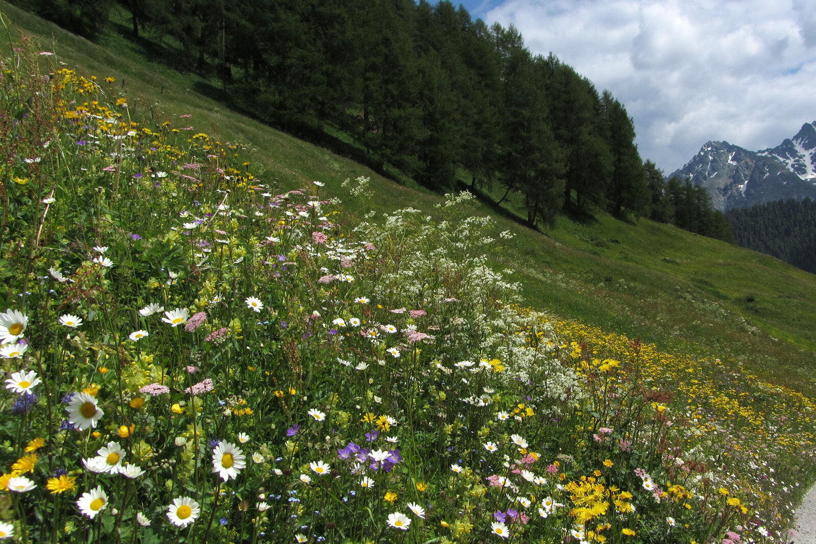
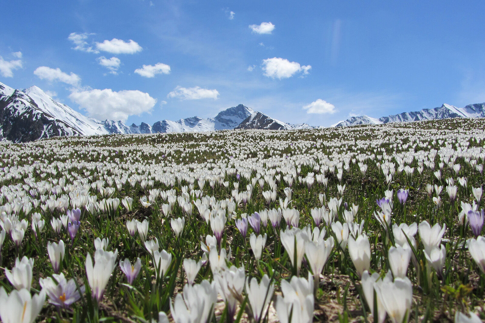
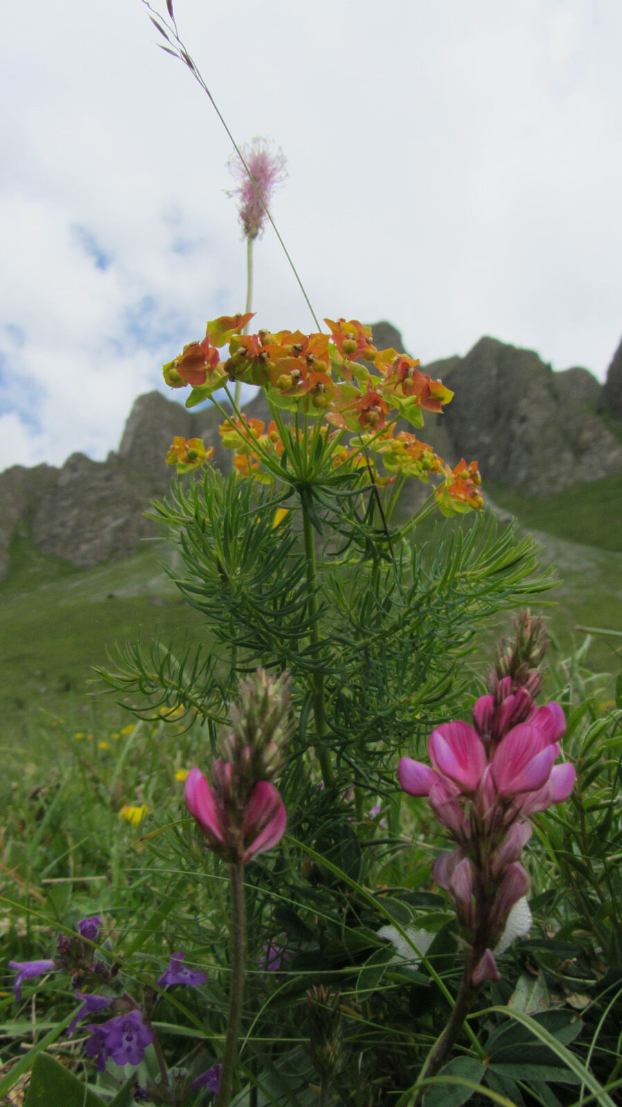
There are over 900 plant species in Samnaun. The plant trail on the Chè d'Mot lookout presents some of these plants.
- Difficulty
-
easy
- Rating
-
- Starting point
-
PostBus stop Samnaun-Ravaisch, village
- Route
-
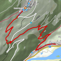
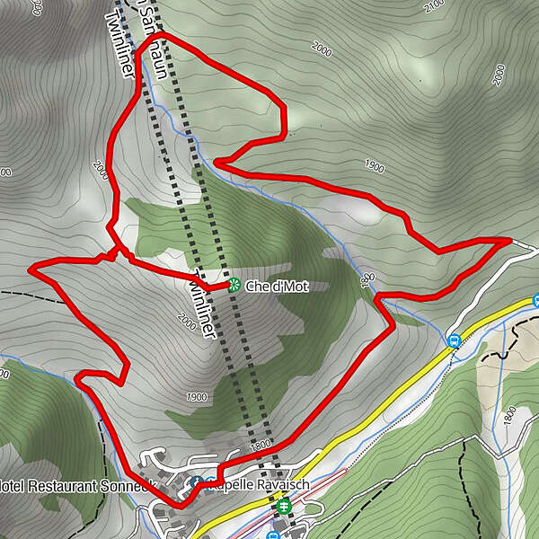
Ravaisch (1,799 m)0.1 kmHotel Restaurant Sonneck0.1 kmHotel Restaurant Soldanella0.2 kmChe d'Mot1.6 kmPlan (1,725 m)3.9 km
- Best season
-
JanFebMarAprMayJunJulAugSepOctNovDec
- Description
-
The plant trail begins in Samnaun-Ravaisch and has a total of 28 informative panels. At point 1919 you follow the path toward Chè d'Mot. On this lookout hill with the four striking cableway masts we enjoy the panorama of the entire Samnaun valley. For a while we follow the same path back to point 2014 until the field trail leads us via Tschidanaderet to Salatsch and from there down to the Schergenbach, which is where we return to Ravaisch.
- Directions
-
Start in Samnaun Ravaisch
Follow the road towards Ravaischa
Side trip to Chè d'Mot
Further past Figliusa to Tschischanaderet
For saladsch, branch back to Samnaun Ravaisch - Highest point
- 2,045 m
- Endpoint
-
PostBus stop Samnaun-Ravaisch, village
- Height profile
-
 © outdooractive.com
 - Equipment
-
Good shoes, rain and sun protection, water bottle, bandages.
- Safety instructions
-
The tour has been evaluated under favorable weather conditions. Current weather conditions and weather forecasts must be taken into account before the tour starts.
emergency call:
144 Emergency call, first aid
1414 Mountain rescue REGA
112 International emergency call
- Additional information
- Directions
-
- From the north: via Landquart - Klosters by car transport through the Vereina tunnel (Selfranga - Sagliains) Then take the H27 in the direction via Scuol and Martina to Vinadi. At the junction Vinadi to Samnaun (about 1 hour from Vereina Südportal)
- From the east: via the Inn valley road B180 via Landeck to Pfunds, junction Kajetansbrücke and via Spiss to Samnaun.
- From the south: via Reschenpass (Nauders) on B180 to Pfunds, junction Kajetansbrücke and via Spiss to Samnaun.
- Public transportation
-
- With the Rhaetian Railway (from Chur, Landquart/Prättigau or from the Upper Engadine) every hour to Scuol-Tarasp station
- Continue with the PostBus (from Scuol-Tarasp, or Martina, cunfin) every hour to the PostBus stop Samnaun-Ravaisch, junction
- In Samnaun during the day hourly access with the Samnaunbus
- Parking
-
Parking at the cable cars in Samnaun-Ravaisch.
- Author
-
The tour Samnaun Plant Trail is used by outdooractive.com provided.