
- Brief description
-
Varied hike along the free-flowing main valley river, along magnificent and largely untouched floodplains along the Rombach. The accompanying brochure "A la riva dal Rom - a river writes history" provides exciting insights into the eventful history, the special habitats and the legends surrounding the Rombach and thus turns the hike into a theme trail.
- Difficulty
-
medium
- Rating
-
- Starting point
-
PostBus stop Tschierv, Süsom Tschierv
- Route
-
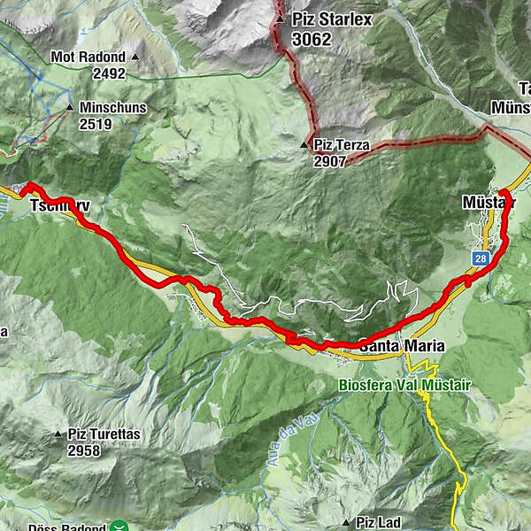
Cierfs (1,660 m)1.0 kmOrasom Tschierv2.3 kmFuldera (1,638 m)4.9 kmFurom6.1 kmBulaseras6.6 kmMuglin8.6 kmValcava (1,440 m)8.9 kmSta. Maria Val Müstair (1,375 m)10.1 kmPlazzöl13.4 kmMüstair (1,273 m)14.0 kmChavalatsch14.5 kmHeiligkreuzkapelle14.7 km
- Best season
-
JanFebMarAprMayJunJulAugSepOctNovDec
- Description
-
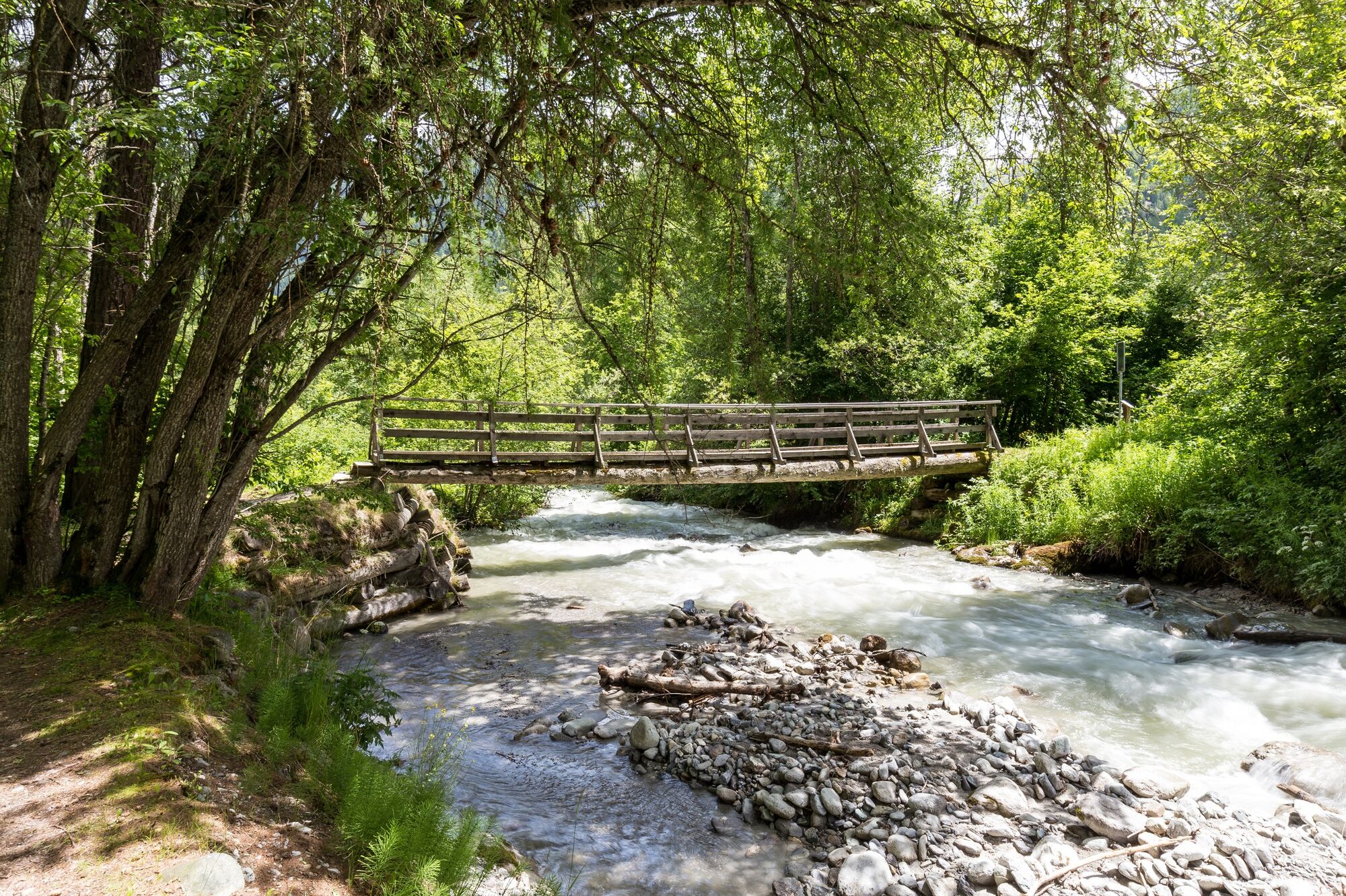
The hiking trail «A la riva dal Rom» starts at the source of the Rombach stream in Süsom-Tschierv and leads to Müstair. It is clearly signposted with the signposts 801. The hike leads past fens, overcomes steep steps of the stream and leads along the lower course of the river through mysterious, elf-inhabited meadows.
The hike is easy to manage, offers many opportunities to rest, two playgrounds with fireplaces directly on the water (in Valchava and Müstair) and several inns in the villages not far from the route. The route through the plain between Tschierv and Fuldera or in Müstair between the Schützenhaus and the schoolhouse is also suitable for prams. The hike can be done in stages.
The handy and richly illustrated information brochure «A la riva dal Rom - a river writes history» turns the hiking trail into a theme trail. It conveys the eventful history, the special habitats and the legends around the Rombach. The brochure also contains a detailed hiking map and is available free of charge at the guest information office or at the Center da Biosfera.
Download the information brochure:
Brochure «A la riva dal Rom - a river writes history».
- Directions
-
From the Süsom Tschierv PostBus stop, follow signpost 801. The trail leads along the Rombach to Müstair.
- Highest point
- 1,730 m
- Endpoint
-
PostBus stop Müstair, Clostra Son Jon
- Height profile
-
 © outdooractive.com
 - Equipment
-
Good shoes, rain and sun protection, water bottle, first aid kit.
- Safety instructions
-
The tour was assessed in favourable weather conditions, it is imperative that the current weather conditions and weather forecasts are observed before starting the tour.
Emergency call:
144 Emergency call, first aid
1414 Mountain rescue REGA
112 International emergency call
- Additional information
- Directions
-
- From the north: via Landquart - Klosters by car transport through the Vereina tunnel (Selfranga - Sagliains) or via the Flüela Pass to Zernez on the H27. From Zernez on the H28 into Val Müstair to Tschierv. (35 minutes' drive from Vereina south portal).
- From the east: via Reschenpass (Nauders) on the SS40 to Mals. From Mals on the SS41 to the Swiss border in Müstair. From Müstair on the H28 to Tschierv.
- From the south: Via Bolzano and Merano on the SS40 to Malles. From Mals on the SS41 to the Swiss border in Müstair. From Müstair on the H28 to Tschierv.
- Public transportation
-
- By Rhaetian Railway (from Chur, Landquart/Prättigau or from the Upper Engadine) hourly to Zernez.
- By PostBus (from Zernez or Mals) hourly to the PostBus stop Tschierv, Süsom Tschierv
- Parking
-
- Free parking in Tschierv


- Author
-
The tour 801 A la riva dal Rom - on the banks of the Rom is used by outdooractive.com provided.


General info
-
Vinschgau
1290
-
Biosfera Val Müstair
566
-
Fuldera
145