
- Brief description
-
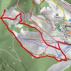
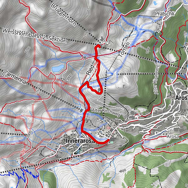
The route of the Bear Sanctuary adventure experience trail leads from tge Arosa Bear Sanctuary to the Tschuggenhütte, past the Bergkirchli and to the Kulmwiese.
- Difficulty
-
easy
- Rating
-
- Starting point
-
Arosa Bear Sanctuary
- Route
-
Brüggerstuba0.0 kmInnerarosa (1,820 m)1.9 km
- Best season
-
JanFebMarAprMayJunJulAugSepOctNovDec
- Description
-
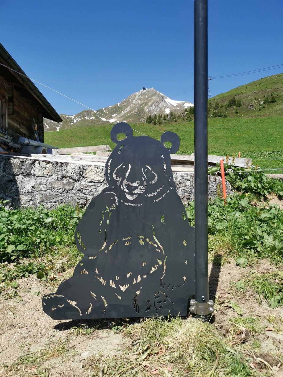
You simply can't miss the stars of the trail. It is not for nothing that they belong to the family of the big bears. Set out and discover the six big bears, find out where they live and how big they can grow. Once you have found and measured all the bears, you will find out which is the biggest big bear.
- Directions
-
There are various ways to get to the start of the hike. Enjoy a leisurely ride on the Arosa-Weisshorn aerial cableway to the middle station (free ride with the Arosa All-Inclusive Card) or take the local bus to the Prätschli terminus and enjoy a short hike along the Arlenwaldweg to the LAW (Arosa-Weisshorn aerial cableway) middle station.
- Highest point
- 2,015 m
- Endpoint
-
Arosa Kulmwiese
- Height profile
-
 © outdooractive.com
 - Equipment
-
Good footwear and weather-dependent clothing
- Safety instructions
- Tips
-
Present the complete booklet at the Arosa Tourism guest information desk (sports and congress centre in the village) and receive a big-bear surprise.
- Additional information
-
Arosa strives to provide hikers with a well-developed and marked network of hiking trails. Please heed the rules and signposting.
Please keep your dogs on a leash Please take litter and leftovers from picnics home again You will often see game on your walks. Enjoy the sight of these animals and respect their familiar surroundings. Leave trail markings where they are Do not use closed paths (winter sports report) Do not leave the officially marked winter hiking trails - Directions
-
From Chur, the winding Schanfiggerstrasse leads to Arosa. Let the journey already become an adventure.
- Public transportation
-
From Chur with the Rhaetian Railway to Arosa. From Arosa railway station you can reach the LAW valley station (Arosa-Weisshorn aerial cableway) in a short time.
- Parking

- Author
-
The tour Bear Sanctuary Experience Trail Summer is used by outdooractive.com provided.


General info
-
Heidiland
2201
-
Arosa Lenzerheide
819
-
Hochwang
281