
- Brief description
-
Hike to the many castles in the Domleschg valley.
- Difficulty
-
medium
- Rating
-
- Starting point
-
Thusis, railroad station
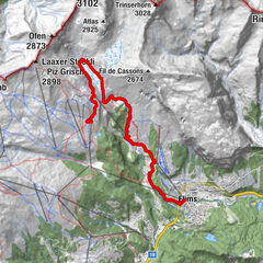
- Route
-
Thusis (697 m)Tosanna (720 m)0.1 kmÜbernolla0.6 kmSils im Domleschg (633 m)2.2 kmSt. Cassian3.4 kmSankt Agatha4.8 kmMarktplatz4.9 kmFürstenaubruck4.9 kmFürstenau6.0 kmSchauenstein Andreas Caminada6.2 kmPratval (687 m)7.9 kmRodels (684 m)8.4 kmAlmens (787 m)9.3 kmPaspels (778 m)10.9 kmTomils (801 m)13.0 kmRothenbrunnen (625 m)15.0 kmReformierte Kirche Rothenbrunnen15.2 kmRothenbrunnen (622 m)15.9 km
- Best season
-
JanFebMarAprMayJunJulAugSepOctNovDec
- Description
-
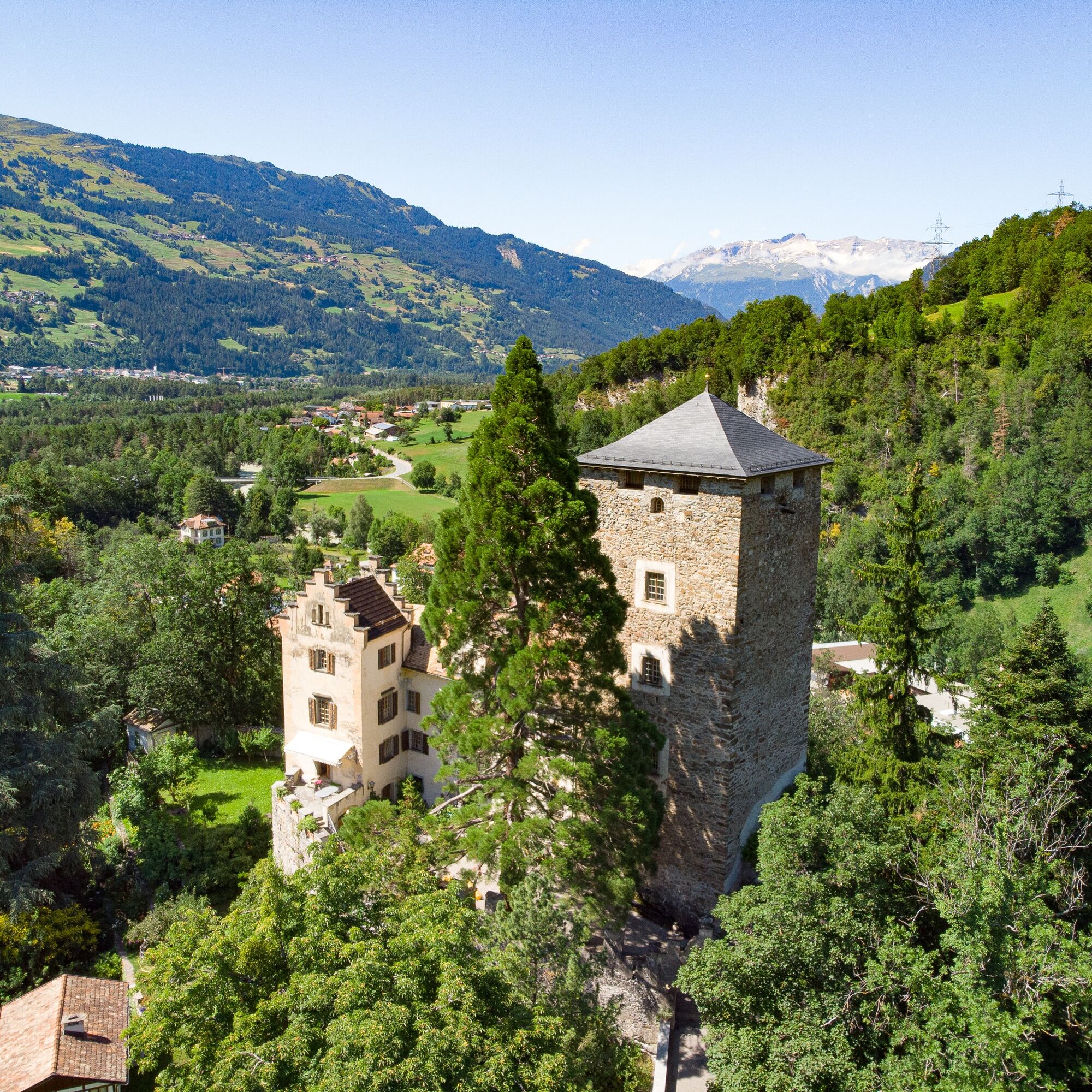
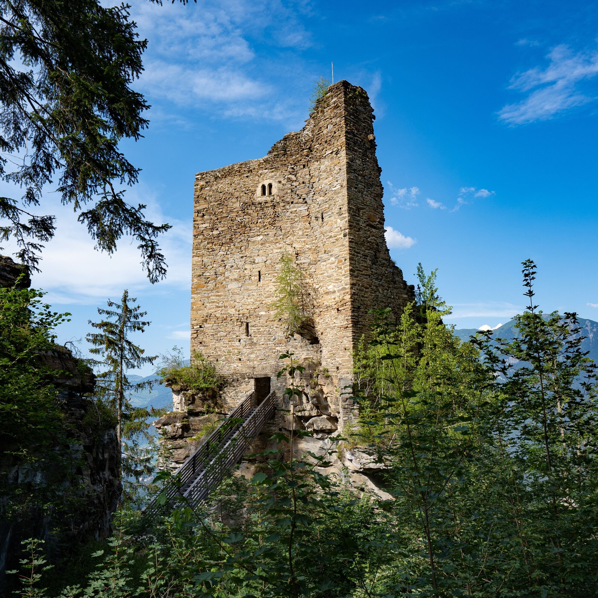
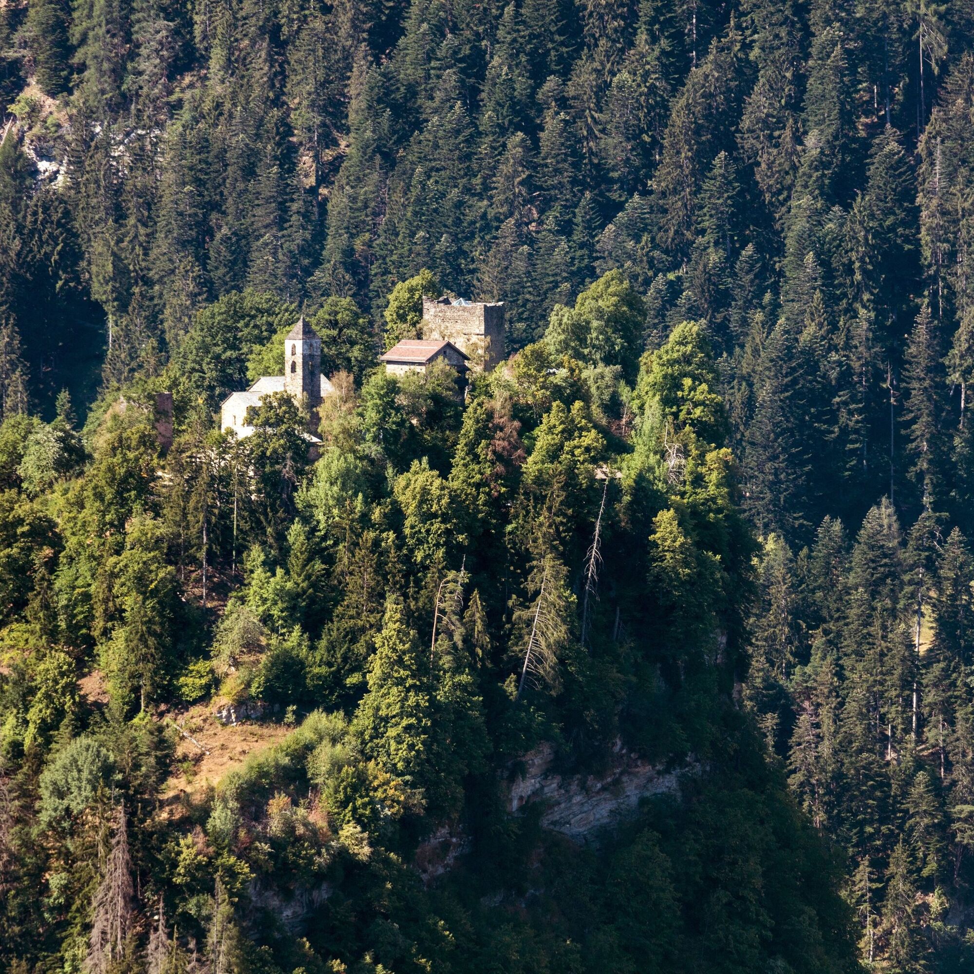
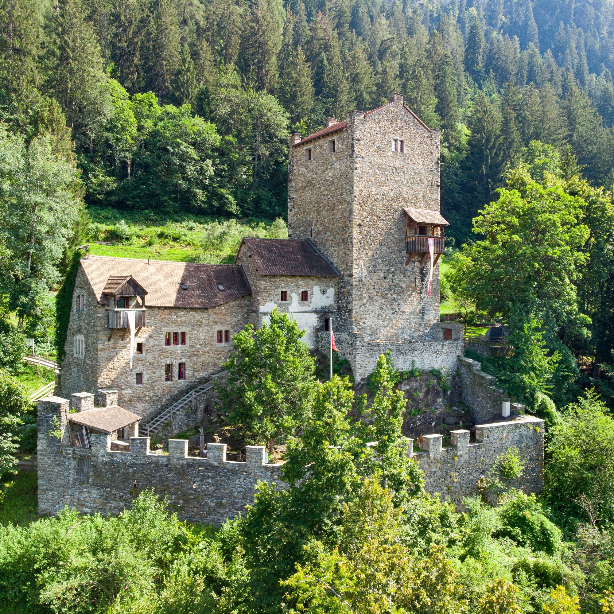
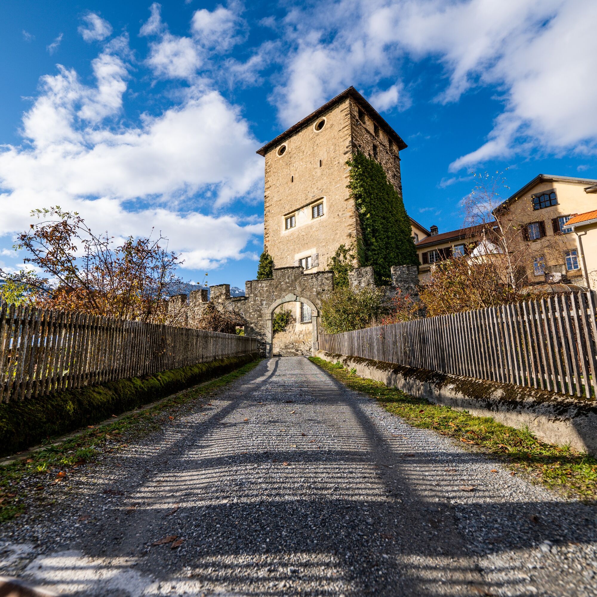
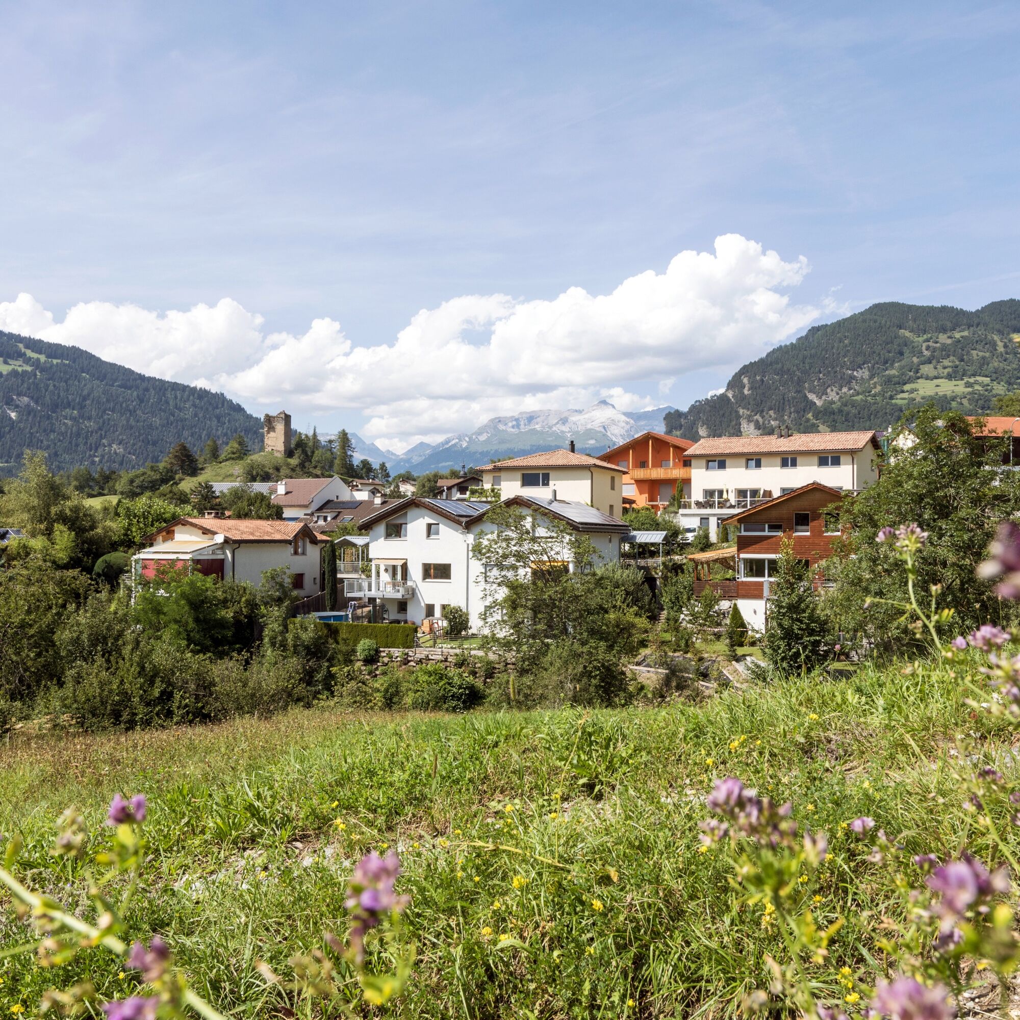
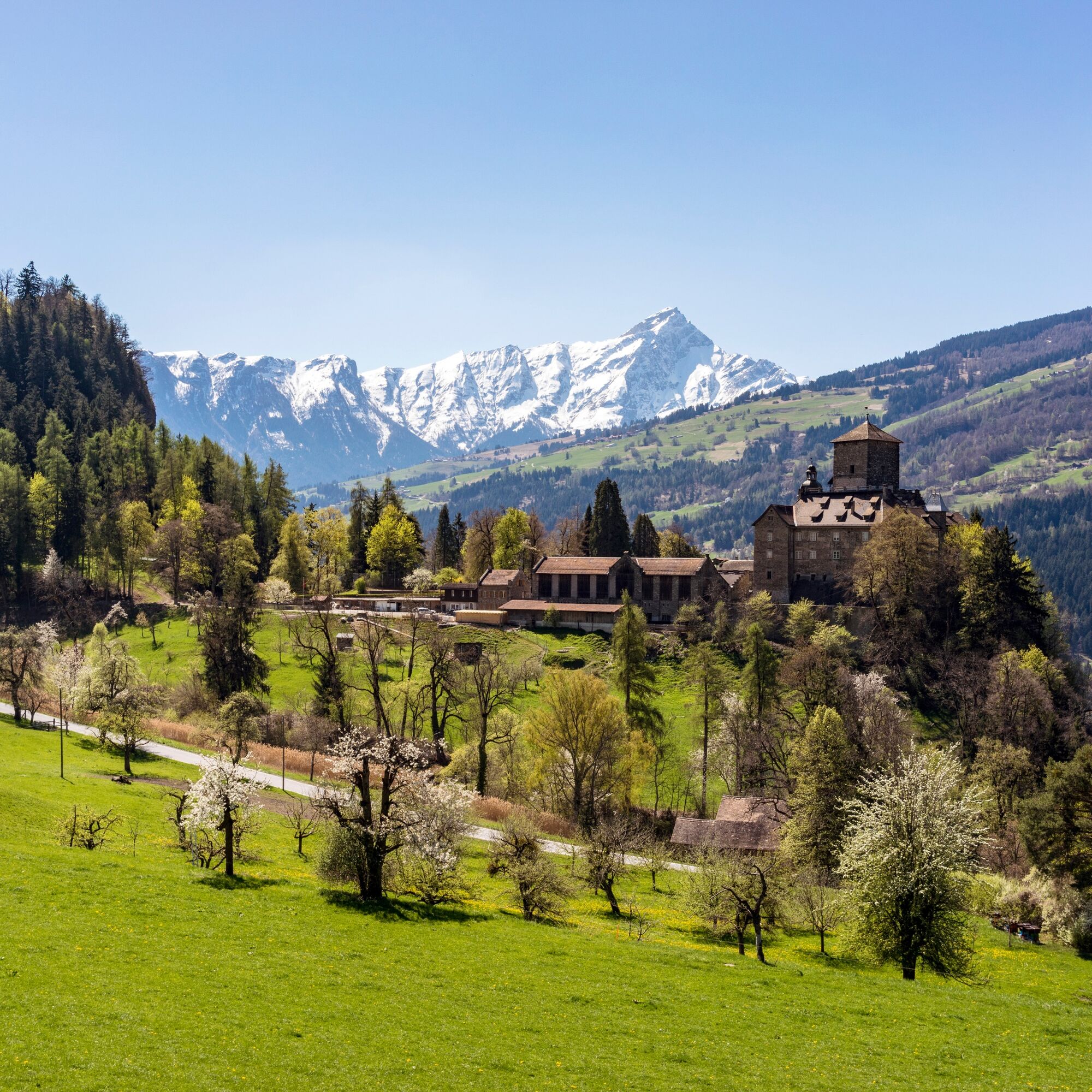
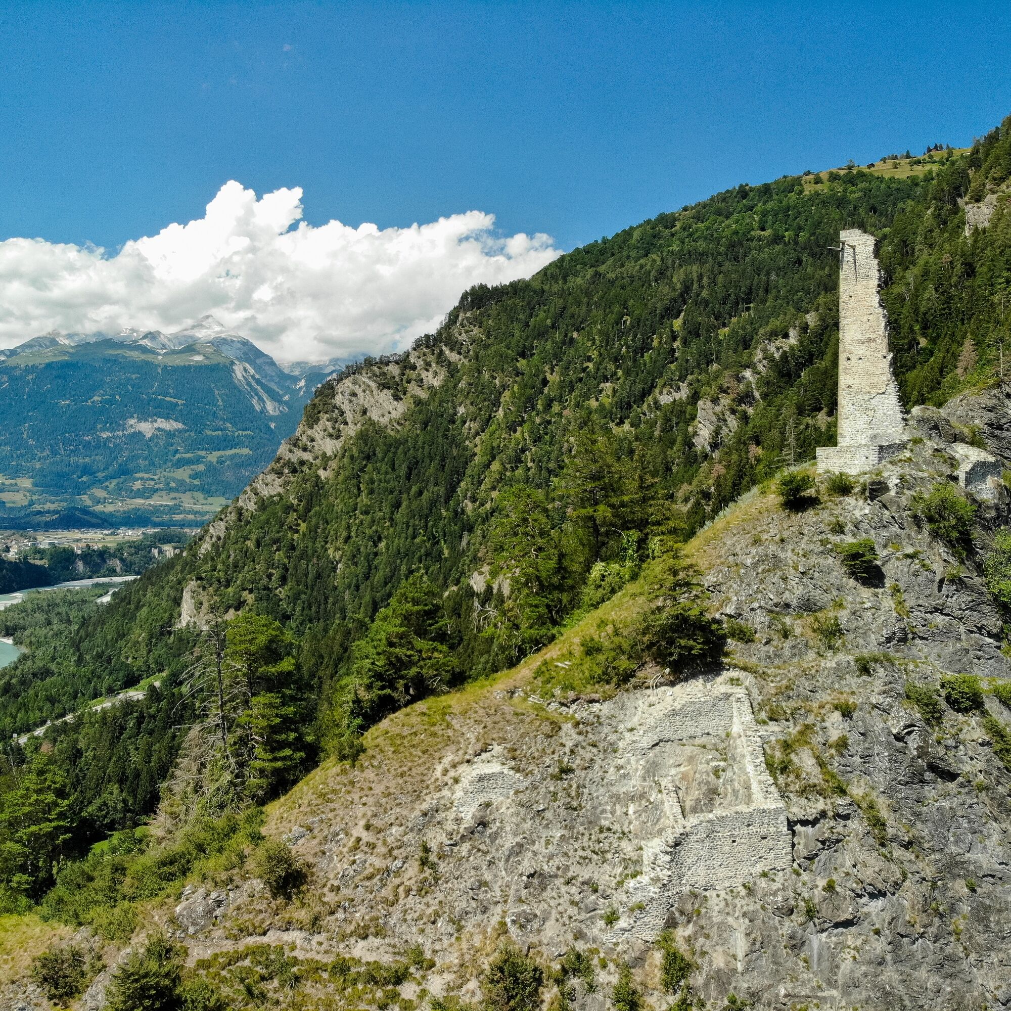
The diverse and varied cultural landscape of Domleschg is characterized by high-stem orchards, hedges, dry stone walls and especially by its castles and palaces, to which the Domleschg Castle Trail is dedicated. This is not an educational castle trail, but simply a varied hiking and walking trail that leads through the Domleschg cultural landscape, pointing out the individual ruins, castles and palaces that are presented to interested hikers along the way. The Domleschg Castle Trail leads through Domleschg between Thusis and Rothenbrunnen railroad stations and can also be explored in stages and in combination with the Postbus. Brief portraits of 15 objects can be found in the handy MiniGuide folding brochure.
The Domleschg Castle Trail was initiated and implemented by the municipalities of Domleschg, Rothenbrunnen, Sils i.D., Thusis and the town of Fürstenau in collaboration with Viamala Tourism and the Johann Martin von Planta Foundation, which is domiciled in Domleschg.
Any hiking trail closures/restrictions or detour can be found here.
- Directions
-
Thusis railroad station - Sils i.D. - Hohen Rätien castle complex - Ehrenfels castle - old Sils i.D. railroad station - St. Cassian chapel - Baldenstein castle - Albula - Cumparduns - Albulasteg - Fürstenau - Planezzas - Klein Rietberg - Almens - Canovasee - Paspels - Tomils - Mulegns - Rothenbrunnen - Rothenbrunnen railroad station
- Highest point
- 803 m
- Endpoint
-
Rothenbrunnen, railroad station
- Height profile
-
 © outdooractive.com
 - Equipment
-
Weatherproof clothing recommended.
- Tips
-
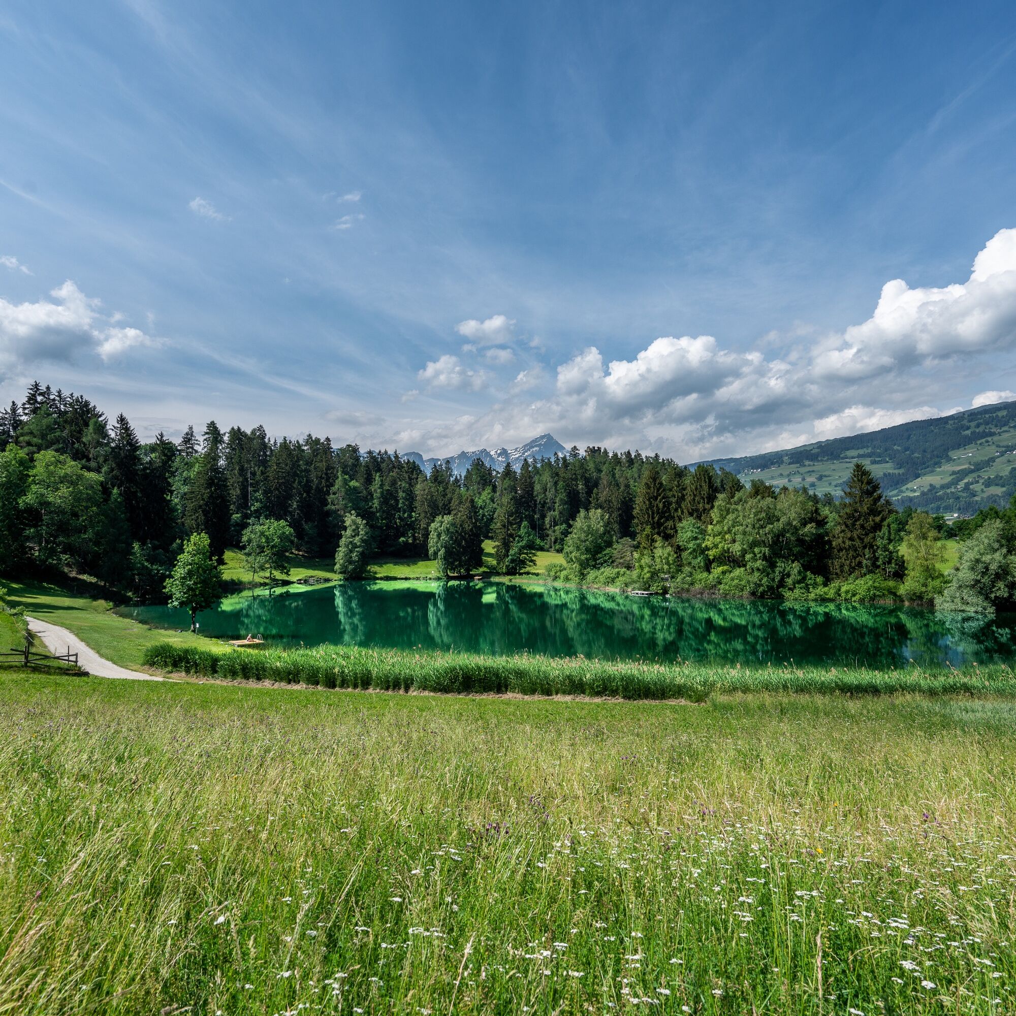
Treat yourself to a little cooling off and/or relaxation break at Lake Canova in Paspels.
- Additional information
- Directions
-
On the A13, take exit 22 Thusis Süd and drive in the direction of Thusis/Sils i.D..
- Public transportation
- Parking

- Author
-
The tour Domleschg Castle Trail is used by outdooractive.com provided.


General info
-
Glarnerland
1972
-
Viamala
790
-
Cazis
242