- Brief description
-
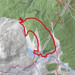
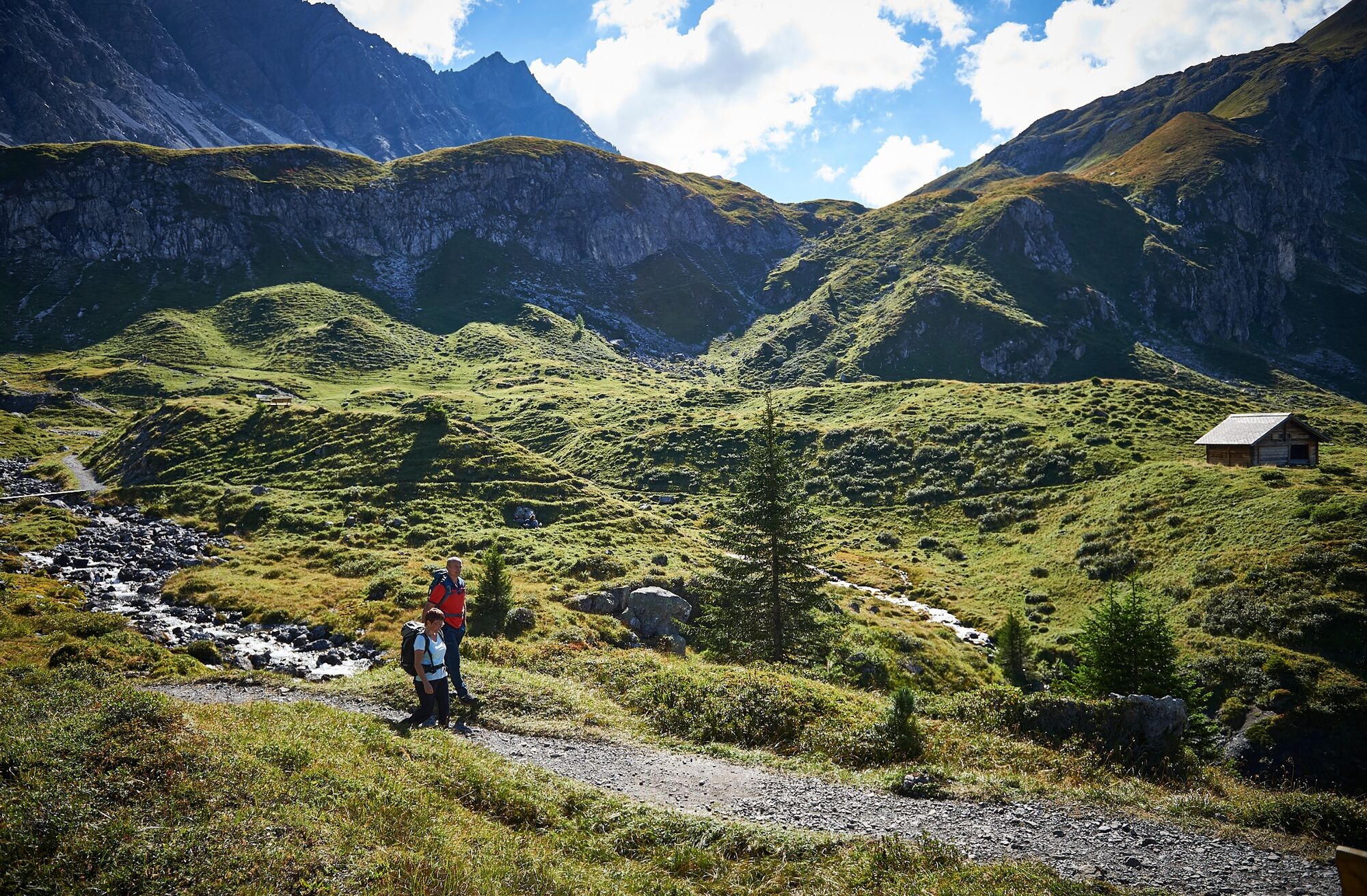
This hike takes you to 2 of a total of 10 lakes in Arosa. From the Hörnli valley station you reach the Älplisee and afterwards the Schwellisee. At the end you will return to the Hörnli.
- Difficulty
-
medium
- Rating
-
- Starting point
-
Hörnli Valley Station
- Route
-
Innerarosa (1,820 m)Alpenblick0.9 kmInnerarosa (1,820 m)7.4 km
- Best season
-
JanFebMarAprMayJunJulAugSepOctNovDec
- Description
-
The part 10-lake hike leads past two of the lakes. Start and end of the tour is at the Hörnli valley station
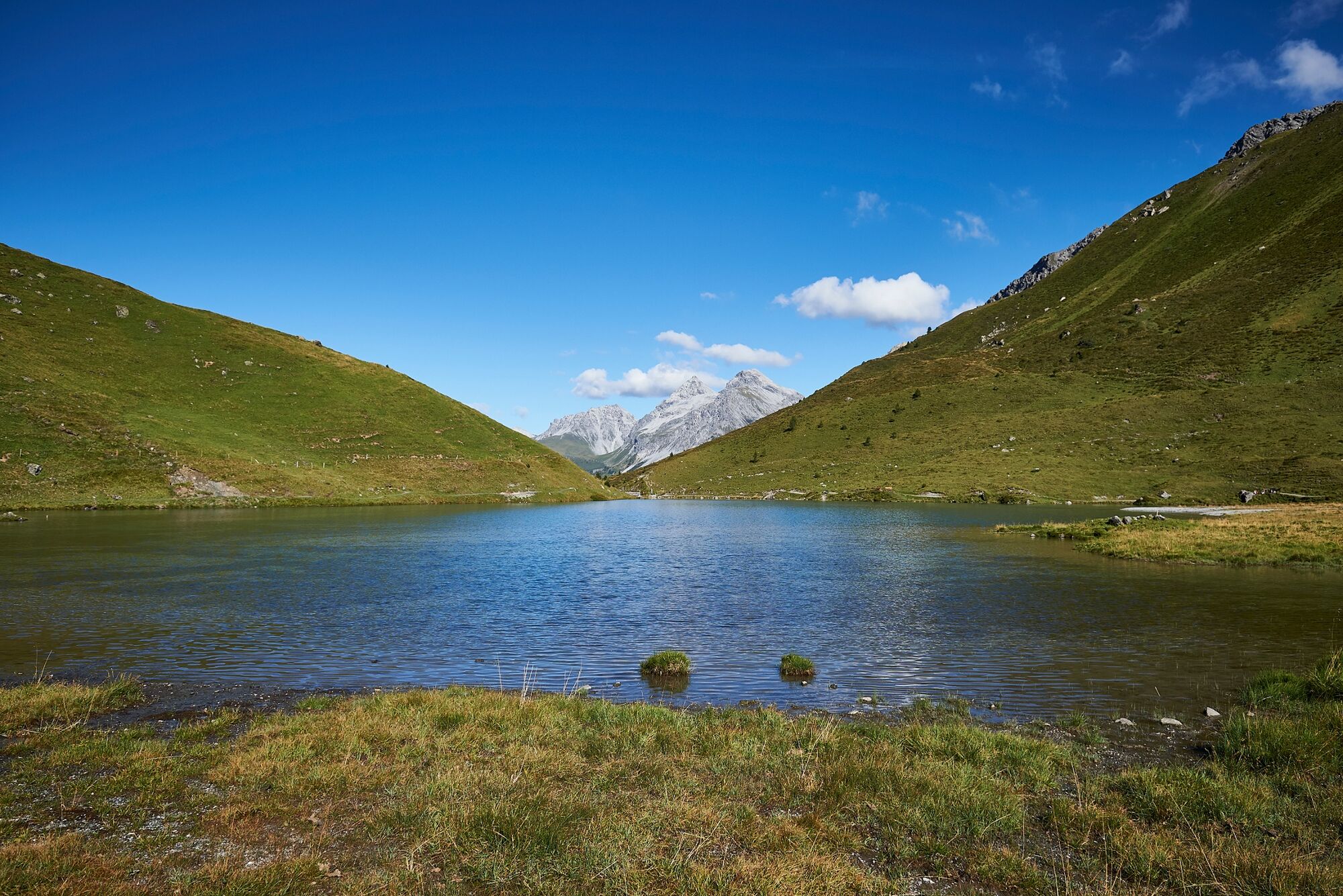
Älplisee
The Älplisee is situated at 2,156 m.a.s.l. on the Arosa Älpli, southwest of Innerarosa behind the Älpliriegel. The lake is embedded in the source area of the Plessur, between the Schwellisee, the mountains Erzhorn, Aroser Rothorn as well as Älplihorn. In summer the demanding mountain hiking trails in the direction of Erzhornsattel, Rothorn, Ramozhütte/Welschtobel, Hörnli and to Gredigs Fürggli lead past the lake.
Schwellisee
The Schwellisee is situated at 1,933 m.a.s.l. on the Arosa Alp, southwest of Innerarosa on the young Plessur. The stone pine trunks in the lake still bear witness to the extensive stone pine forest that once stretched far above the Schwellisee and was later cleared by the Walsers.
The board for the 10-Lake-Plausch is placed at the outflow of the lake.
- Directions
-
Hörnlibahn - Schwellisee - Älplisee - Schwellisee - Hörnlibahn
- Highest point
- 2,171 m
- Endpoint
-
Hörnli Valley Station
- Height profile
-
 © outdooractive.com
 - Equipment
-
good footwear, clothing suitable for the weather, food and drink
- Safety instructions
- Tips
-
Take a good camera - the colors of the lakes are beautiful.
- Additional information
-
Arosa strives to provide hikers with a well-developed and marked network of hiking trails. Please heed the rules and signposting.
Please keep your dogs on a leash Please take litter and leftovers from picnics home again You will often see game on your walks. Enjoy the sight of these animals and respect their familiar surroundings. Leave trail markings where they are Do not use closed paths (winter sports report) Do not leave the officially marked winter hiking trails - Directions
-
By car on the road from Chur to Arosa to the Hörnli valley station.
- Public transportation
-
Take the RhB from Chur to Arosa. Then on foot or by bus to the Hörnli valley station.
- Parking
- Author
-
The tour 2 Lake Hike to the Älplisee and the Schwellisee is used by outdooractive.com provided.


General info
-
Arosa Lenzerheide
816
-
Hochwang
281