


- Brief description
-
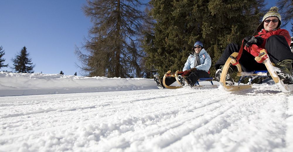
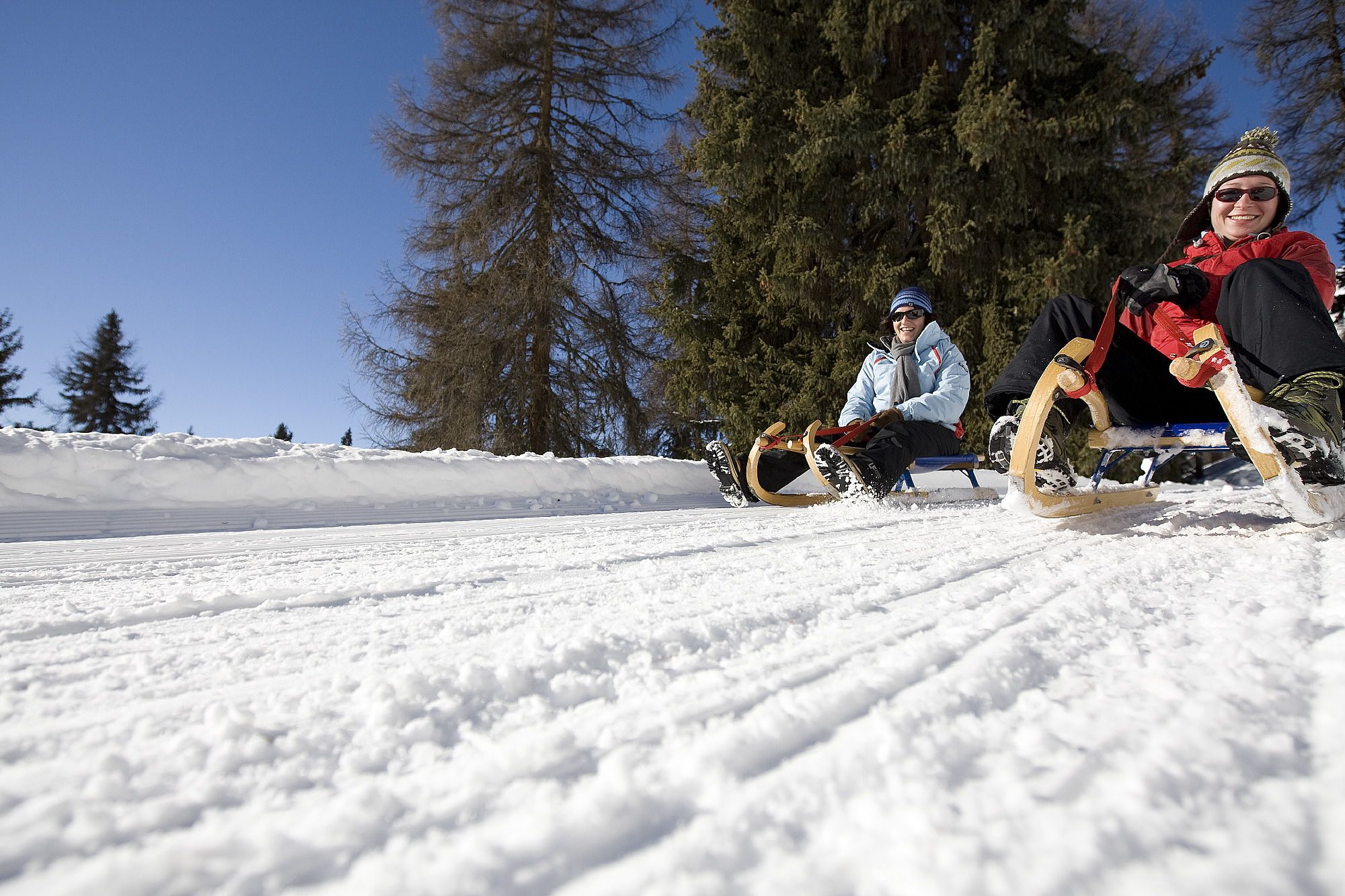
Beautiful toboggan run, combined with an easy hike with panoramic views.
- Difficulty
-
easy
- Rating
-
- Starting point
-
Martinatsch
- Route
-
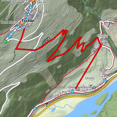
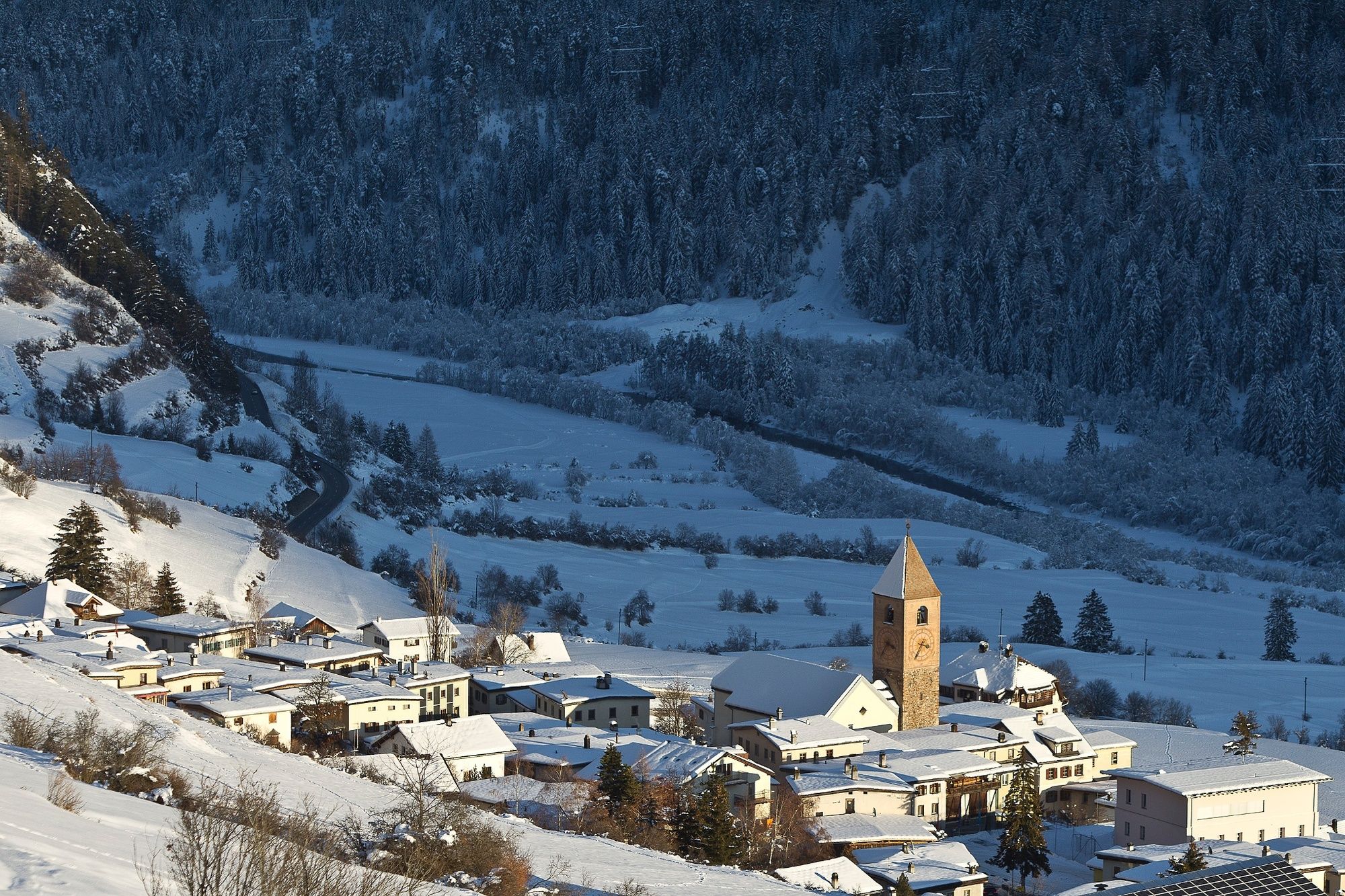
Ramosch (1,236 m)4.0 km
- Best season
-
AugSepOctNovDecJanFebMarAprMayJunJul
- Description
-
The toboggan run is located along the winter hiking trail from Vnà to Ramosch. You are constantly accompanied by a panoramic view of the mountain world of the Lower Engadine. Along the way there are always benches which invite you to rest.
- Directions
-
Bus stop Vnà, Jalmèr
Follow the winter hiking trail towards Ramosch
At Runai a path branches off up along the meadow, and joins the upper path
There the ride with the sledge can begin
Follow the path down towards Ramosch until you reach the beginning of the village.
Walk through the village until you reach the church
There is the bus stop Ramosch, Plaz
Here you can either go back to Vnà or to Ramosch, Stradun and change there to go to Scuol or Martina
- Highest point
- 1,691 m
- Endpoint
-
Ramosch
- Height profile
-
 © outdooractive.com
 - Equipment
-
Sledges, high and sturdy hiking boots or winter boots, warm clothing, sun protection, gloves and helmet recommended.
- Safety instructions
-
The trail is groomed after each snowfall. Please note the condition reports in the winter sports report. The tour was assessed in favourable weather conditions, current snow and weather conditions must be noted before starting.
Emergency call:
144 Emergency call, first aid
1414 Mountain rescue REGA
112 International emergency call
- Tips
-
With good bus connections from Ramosch to Vnà, you can also enjoy the experience with the family twice a day. As an alternative you can follow the toboggan run to Seraplana at the Motta junction.
- Directions
-
- From the north: via Landquart - Klosters by car transport through the Vereina Tunnel (Selfranga - Sagliains) or via the Flüela Pass into the Lower Engadine on H27.
- From the east: via Landeck / Austria in the direction of St. Moritz on H27
- From the south: via Reschenpass (Nauders-Martina) or Ofenpass (Val Müstair-Zernez) on H27
Ramosch is directly on the Engadine road H27 (20 minutes drive from Vereina south portal). Turn off there and follow the road to Vnà.
- Public transportation
-
- By Rhaetian Railway (from Chur, Landquart/Prättigau or Upper Engadine) hourly to Scuol-Tarasp.
- By bus from Scuol in the direction of Martina. Change buses in Ramosch and continue to Vnà.
- Parking
-
Free parking directly at the bus stop Vnà, Jalmèr – start of winter hiking trail to Ramosch


- Author
-
The tour Martinatsch – Ramosch is used by outdooractive.com provided.


General info
-
Vinschgau
11
-
Engadin Scuol Zernez
25
-
Ramosch-Vnà
8