
- Brief description
-
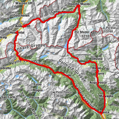
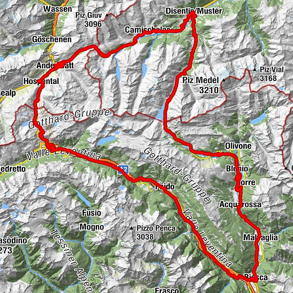
St. Gotthard Cycling Arena: Gotthard (2091 m) – Lukmanier (1914 m) – Oberalp (2046 m)
- Difficulty
-
difficult
- Rating
-
- Route
-
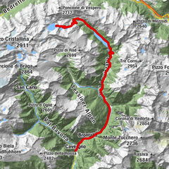
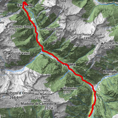
Andermatt (1,447 m)0.6 kmBahnhofgebäude2.9 kmGüetli3.1 kmHimmelbiel3.1 kmHospental (1,493 m)3.2 kmObergadmen3.4 kmCentral3.4 kmMätteli7.5 kmGotthardpass 2106m12.4 kmAlte Sust13.0 kmOspizio del San Gottardo (2,091 m)13.0 kmScuderia13.0 kmSan Gottardo13.0 kmTramiòra15.7 kmMotto Bartola20.3 kmScima du Bòsc'20.3 kmFondo del Bosco22.8 kmSan Carlo24.4 kmAirolo (1,175 m)24.8 kmMuron26.0 kmOratorio di Santa Maria Vergine26.8 kmGobbi30.0 kmPiotta30.3 kmAmbri-Piotta31.7 kmAmbrì Sopra32.1 kmAmbrì32.2 kmLa Montanara32.2 kmAmbrì Sotto32.5 kmFiesso36.1 kmFiesso di Sopra36.1 kmRodi36.8 kmOsteria Marisa42.1 kmFaido (715 m)42.1 kmChiesa di Sant'Andrea42.1 kmAlbergo Faido42.3 kmChiggiogna (665 m)44.3 kmLavorgo (615 m)47.8 kmNivo48.7 kmBiaschina50.7 kmGrotto Pescatori52.6 kmGiornico (391 m)53.4 kmChiesa di San Nicolao54.0 kmBodio (321 m)57.3 kmPersonico (320 m)59.0 kmGrotto Val d'Ambria59.6 kmChiesa parrocchiale dei Santi Innocenti61.3 kmPollegio (300 m)61.4 kmOsteria Giandotti61.7 kmDel Ponte63.3 kmPomodoro Ristorante Pizzeria64.5 kmChiesa di San Carlo Borromeo64.7 kmBiasca (301 m)65.0 kmPiazzora65.7 kmLoderio67.8 kmRampeda68.0 kmSemione (399 m)70.6 kmChiesa di Santa Maria Assunta70.7 kmMalvaglia (389 m)71.3 kmGrotto71.4 kmLudiano (477 m)71.4 kmRongie71.6 kmMotto (Blenio)73.3 kmMarogno73.8 kmChiesa dei Santi Luca e Fiorenzo75.1 kmCrespögn75.2 kmDongio (478 m)75.6 kmBoscero75.9 kmRoccabella76.6 kmScaradra76.8 kmPozzo77.2 kmStallaccia77.5 kmStazione77.8 kmComprovasco78.0 kmAcquarossa (430 m)78.2 kmLottigna (626 m)79.7 kmGrumo81.2 kmPonto Valentino (716 m)82.8 kmChiesa dei Santi Pietro e Paolo84.2 kmLargario (847 m)84.3 kmBlenio87.3 kmPro Natura Zentrum Lucomagno98.7 kmHospezi S. Maria103.0 kmSogn Gions111.0 kmPardatsch Dadens111.6 kmCascada Fimatsch112.4 kmFuorns113.5 kmPardé114.9 kmBaselgia S. Martin115.8 kmPlatta116.0 kmCuraglia117.7 kmMumpé Medel119.9 kmRaveras122.3 kmDisentis122.6 kmPrau124.1 kmCuoz124.7 kmBuretsch124.8 kmPalius125.5 kmRuaunas125.9 kmTscharschès126.2 kmCaglia127.2 kmCrestas128.1 kmBugnei130.1 kmSedrun131.3 kmIl Badus131.5 kmHotel Mira131.7 kmCamischolas131.8 kmChaplutta S. Onna131.9 kmCuschina Menono132.0 kmZarcuns132.4 kmPosta133.4 kmRueras133.4 kmSelva136.6 kmAnitas Rheingärtli137.5 kmTschamut137.6 kmGasthaus Piz Calmot143.4 kmPiz Calmot143.6 kmOberalppass (2,033 m)143.6 kmAndermatt (1,447 m)154.1 km
- Best season
-
JanFebMarAprMayJunJulAugSepOctNovDec
- Description
-
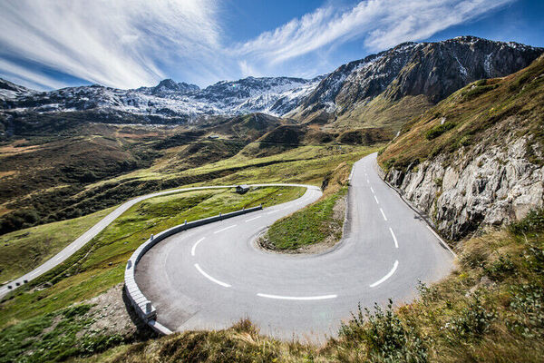
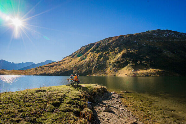
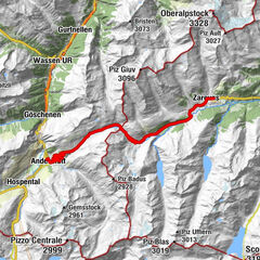
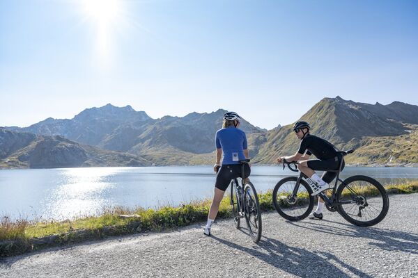
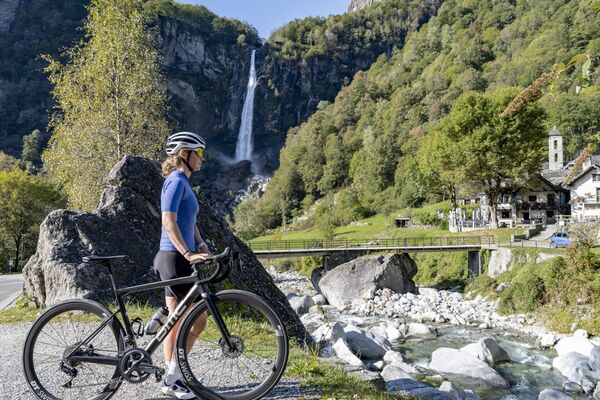
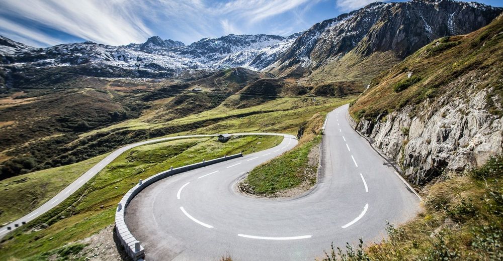
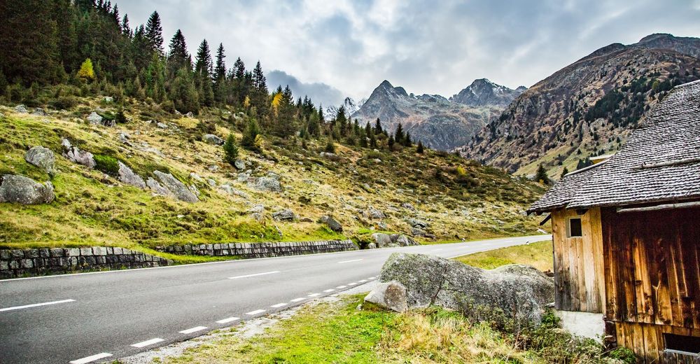
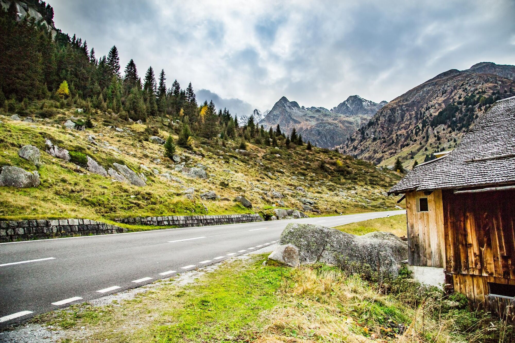
The route starts in Andermatt and takes you to the next village of Hospental. From there you ascend to the famous Gotthard Pass. Culture vultures will enjoy visiting the museum there or the Sasso San Gottardo fort, which also houses a unique display of giant crystals. The descent into Canton Ticino follows the historic Tremola road with its cobblestones and numerous hairpins – alternatively, take the broad, smooth pass road. After Airolo, the route passes through the Piotta Gorge with the former Uri customs station of Dazio Grande. Why not stop off for refreshments in a cool grotto in Biasca before negotiating the ascent to the Lukmanier Pass? On arrival at the pass, you could have a picnic by the reservoir by way of reward for your exertions. The pass road on the far side ends at Disentis, which boasts a monastery (open to the public). The route then heads for the Oberalp Pass in parallel to the young Anterior Rhine, passing authentic Grisons villages on the way. A lighthouse at the pass (a nod to Rotterdam at the far end of the Rhine) draws attention to the nearby source of the river. The route ends with the descent back to Andermatt, during which you have glorious views of the Urseren valley below.
- Directions
-
Andermatt - Hospental - Gotthard - Biasca - Lukmanier - Disentis - Oberalp - Andermatt
- Highest point
- 2,106 m
- Endpoint
-
Andermatt
- Height profile
-
 © outdooractive.com
 - Additional information
-
The tour can also be completed in two days with an overnight stay in Andermatt, Biasca or Disentis, depending on where you start and finish.
The tour can be completed in either direction and started anywhere along the route.
Cyclists may prefer to make the descent to Airolo from the Gotthard Pass on the regular pass road instead of the Tremola.

- Author
-
The tour St. Gotthard Cycling Arena: Gotthard – Lukmanier – Oberalp is used by outdooractive.com provided.