© Sedrun Disentis Tourismus - Heidi Meier

© Sedrun Disentis Tourismus - Heidi Meier

© Sedrun Disentis Tourismus - Heidi Meier
- Brief description
-
Viel Technik ist gefragt, denn es geht praktisch nur runter!
- Difficulty
-
medium
- Rating
-
- Route
-
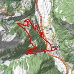
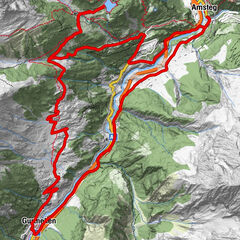
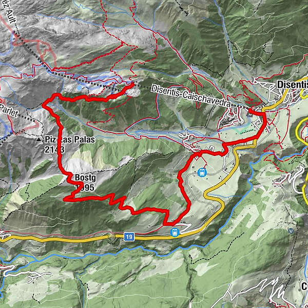
Caischavedra (1,872 m)Caischavedra0.1 kmBostg (1,995 m)3.5 kmBostg3.8 kmPrau Sura6.0 kmCurschettas7.1 kmMumpé Tujetsch7.3 kmSum Craps7.4 kmBegl da Trutg7.6 kmMuschnei8.1 kmVal Sut8.2 kmPlauncas Sut8.3 kmUstria Cresta8.7 kmSegnas8.9 kmBuretsch9.3 kmCuoz9.8 kmPrau10.2 kmSteak Houses Chevrina10.8 kmSontga Catrina10.8 km
- Best season
-
JanFebMarAprMayJunJulAugSepOctNovDec
- Highest point
- 1,983 m
- Endpoint
-
Disentis, Talstation
- Height profile
-
 © outdooractive.com


-

-
AuthorThe tour GD - St. Gotthard Disentis is used by outdooractive.com provided.
GPS Downloads


Surfaces
Trial
General info
Refreshment stop
A lot of view
Other tours in the regions
-
Uri
194
-
Disentis Sedrun
117
-
Tujetsch
34