


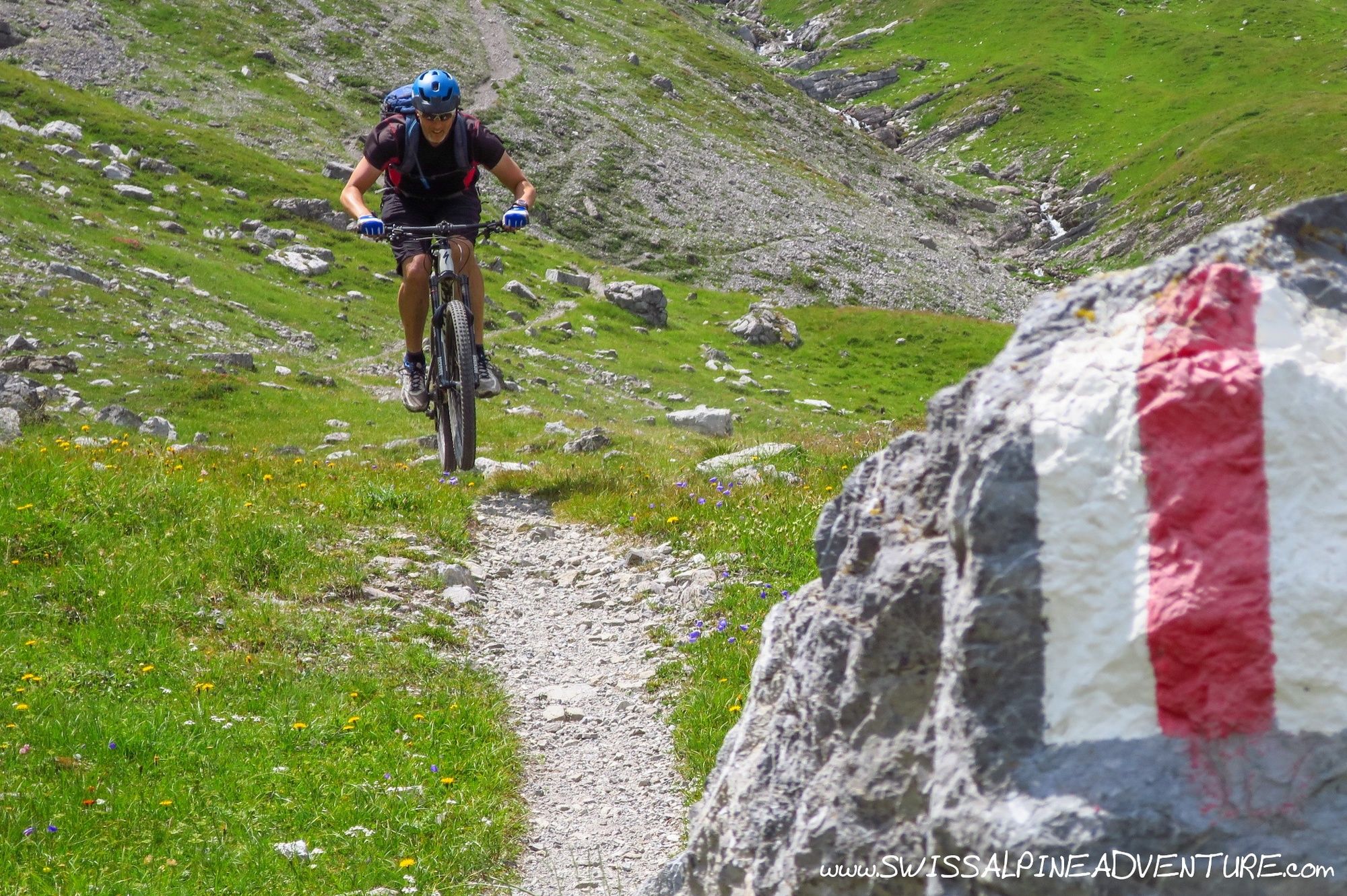
- Brief description
-
A relatively physical tour with one of the best alpine singletrails in Graubünden as the reward for a 1.5 to 2 hour hike-a-bike.
- Difficulty
-
difficult
- Rating
-
- Starting point
-
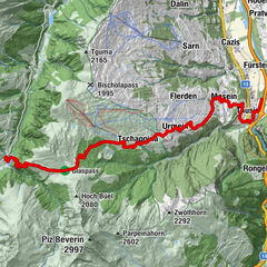
Lenzerheide, Rothorn Top Station
- Route
-
Restaurant am Parpaner Rothorn0.0 kmRothorn (2,857 m)0.0 kmCulmet (2,615 m)6.6 kmArosa (1,739 m)18.2 kmDorfkirche Arosa18.6 kmInnerarosa (1,820 m)20.0 kmHörnligrat (2,500 m)23.4 kmTschiertschen (1,343 m)32.6 kmBergrestaurant Furgglis34.9 kmUndersäss36.6 kmPraden38.5 kmAusserpraden39.3 kmGrida (942 m)42.5 kmPassugg43.3 kmMeiersboden44.1 kmAraschgen45.0 kmKapelle Alterssiedlung Bodmer45.9 kmChur (593 m)47.1 km
- Best season
-
JanFebMarAprMayJunJulAugSepOctNovDec
- Description
-
The tour starts with a relatively technical descent from Rothorn towards Alp Sanaspans. From here it's a hike and ride over three high Alpine passes before getting to a long and flowy (Techno-flow) descent to Arosa. A life in Arosa can either bring you back towards Lenzerheide or you can descend further to finsh the tour in Chur.
- Directions
-
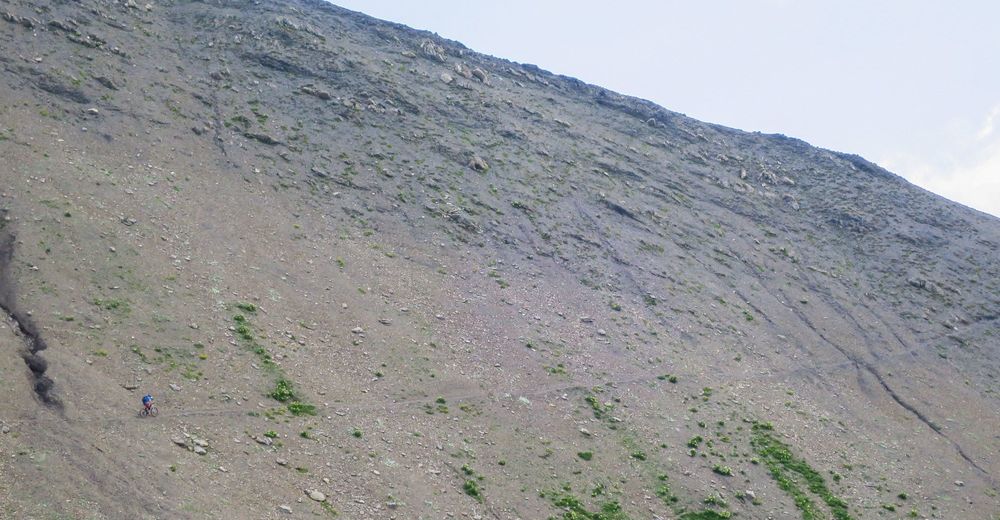
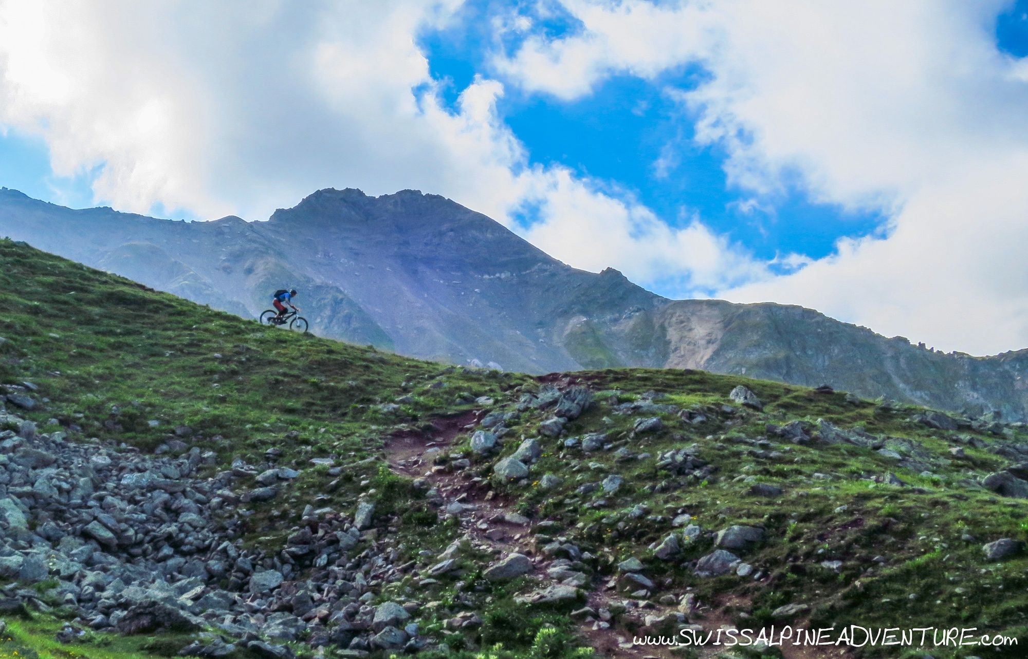
From Rothorn descend about 200m to the east and then take the right turn on a loose scree access road towards Alp Sanaspans. There is a singletrail cutting straight through between many of the switchbacks on the access road, but this should only be ridden by technically very strong riders.
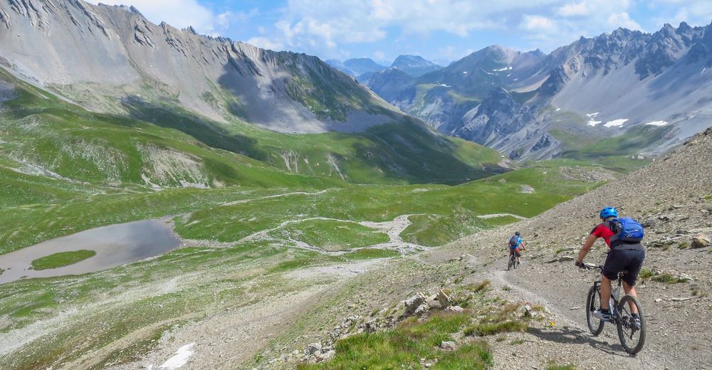
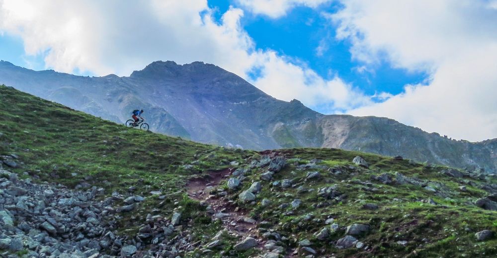
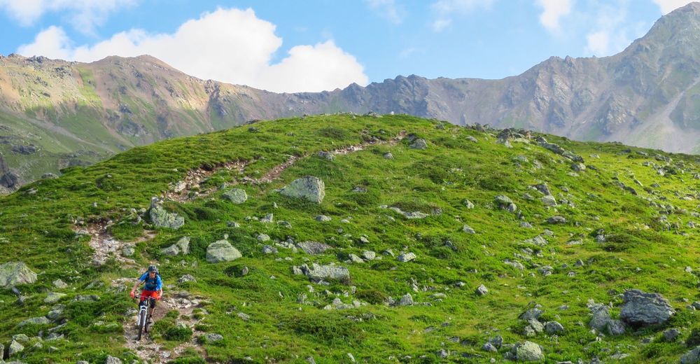
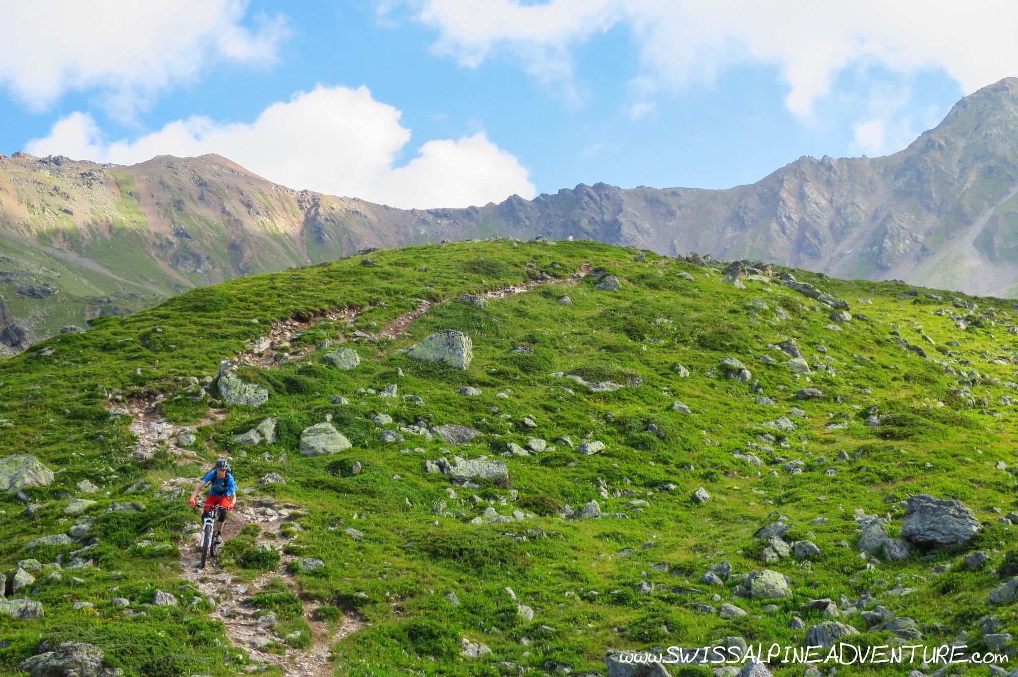
At Pt. 2631 turn left and take the singletrail down towards Alp Sanaspans. This trail is relatively technical and the further down you go it gets looser and more challenging. At Pt. 2149 the hike starts. For strong riders it is possible to ride to the river crossing, but the trail is not always obvious until you actually get accross the river. From this point it's a hike for all.
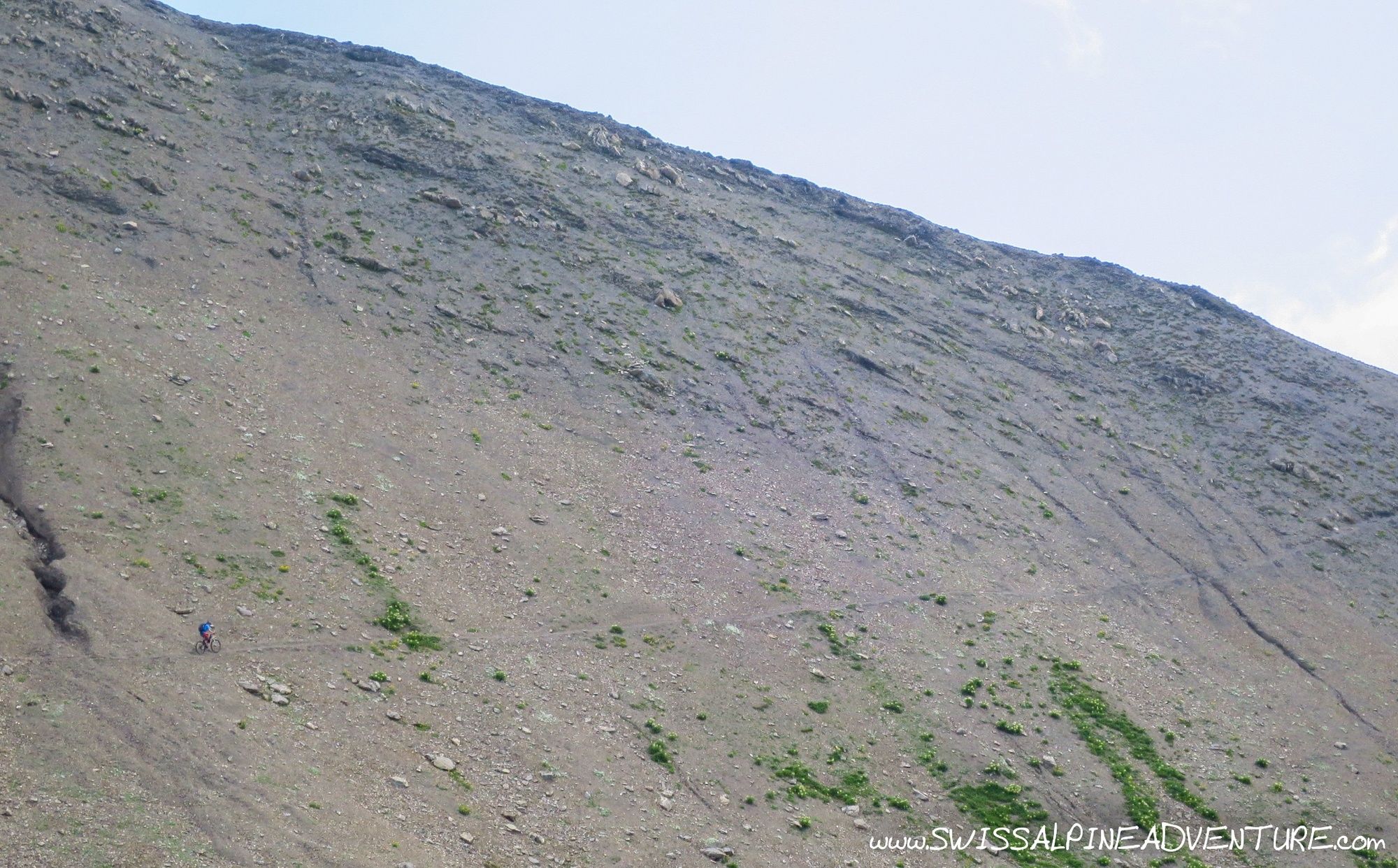
The hike brings you up to the pass at Culmet (2615m), and from here it is rideable to point 2618. Shortly after 2618 there is a steep, loose and technical section of trail which is probably best for all to push down (even this is not easy) before you can once again remount the bike and ride to point 2487, where you will once again carry the bikes to Furcletta.
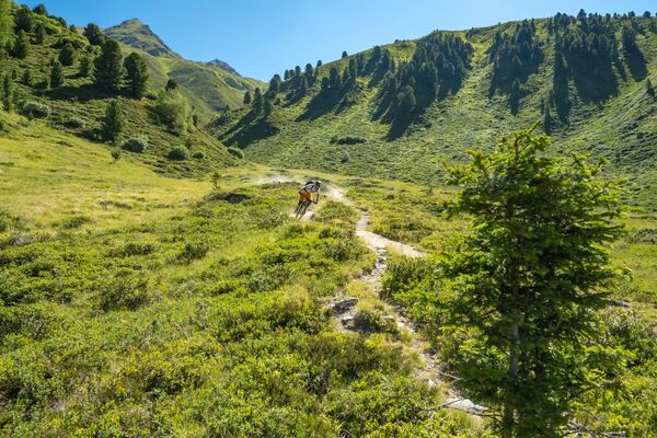
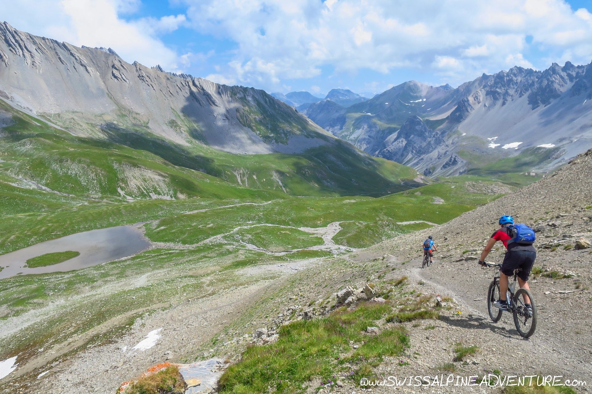
From Furcletta, the trail starts properly with approximately 8km of some of the best singletrail that I have found to date in Graubünden riding through the Welschtobel to Arosa.
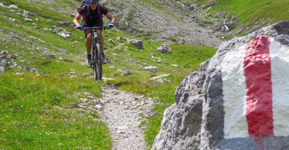
Once getting to the waste water plant below Arosa, climb up past the swimming lake, through the town and to the Hornli liftstation. Here you can decide if you will take the cable car (or ride) accross to Urden Furgli at Lenzerheide and follow the "Bike Attack" route down to your start point in Lenzerheide or follow the singletrail down past Urdensee to Tschiertschen. On the way to Tschiertschen there are two trail options, my prefered one is the trail that takes the right hand side of the river at point 1683 (Near Löser). To Tschiertschen.
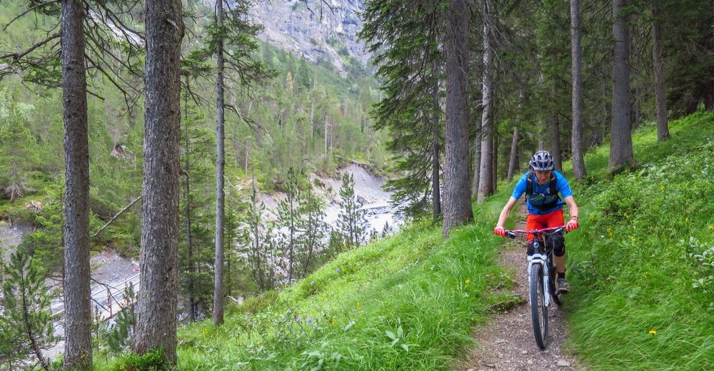
In Tschiertschen ride up towards Berghaus Furglis and turn right on the Alp road going towards Joch, after only about 50m on this Alp road take the singletrail to the right heading down to Untersäss. From here cross the river and take the trail down to Praden where you will join the main road for a short time to Usser Praden.
In Usser Praden you can either follow the road the whole way down to Passug if you are feeling tired or else ride/push/carry your bike up to Pt. 1286. From here take the Alp road to Pt. 1358 and take the trail past Pruss down towards Ober Grida and Passugg.
In Passugg there is a small access road accross the road from the Tourism School which brings you down to the river where you can follow the road back to the train station in Chur.
- Highest point
- 2,835 m
- Endpoint
-
Lenzerheide, Rothorn Valley Station
- Height profile
-
 © outdooractive.com
 - Equipment
-
An all-mountain or enduro bike is recommended for this tour.
- Safety instructions
-
The tour is in high alpine terrain. There are places where a fall could lead to serious injury. Some of the trails are narrow, steep and technical and at times there is a degree of exposure. This tour should only be attempted by those with significant alpine mountain biking experience.
- Tips
-
Bring a picnic lunch and enjoy the views from Furcletta.
- Directions
-
Take the A3 to Chur, Exit Chur Sud/Lenzerheide and folllow signposts for Lenzerheide. Shortly after passing Valbella the car park for the Rothorn lift will be on the left hand side.
- Public transportation
-
Lenzerheide is accessible by Post Auto from Chur. Buses leave every half hour at x:00 and x:30. You will want to get off the bus at the Stop "Rothorn Bahn".
- Parking
-
Parking is available at the Rothorn valley station.


-

-
AuthorThe tour Lenzerheide - Arosa - Chur (Culmet & Welschtobel) is used by outdooractive.com provided.
Surfaces
General info
-
Heidiland
336
-
Arosa Lenzerheide
259
-
Tschiertschen-Praden
98