


- Brief description
-
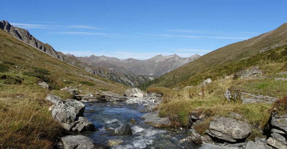
The tour begins in Acla da Fans and leads along the road for a short distance. Shortly after the first tunnel, the alpine road turns right into the wild Val Sampuoir.
- Difficulty
-
medium
- Rating
-
- Starting point
-
Acla da Fans
- Route
-
Spiss (1,628 m)Pfandshof (1,507 m)0.0 kmPlan God Nair6.0 kmPlan God Nair12.0 kmPfandshof (1,507 m)17.9 kmSpiss (1,628 m)17.9 km
- Best season
-
JanFebMarAprMayJunJulAugSepOctNovDec
- Description
-
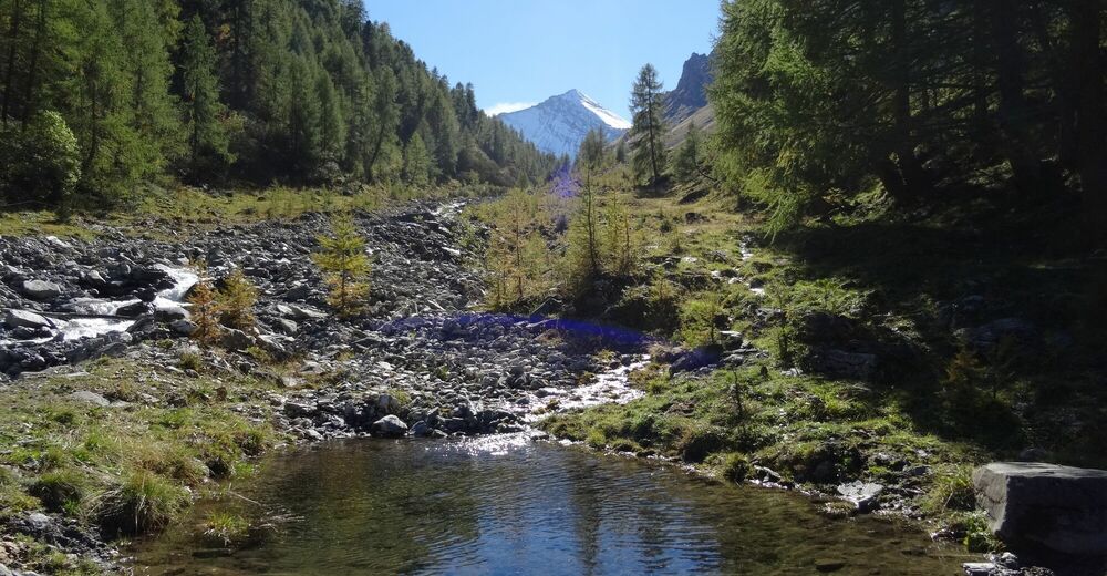
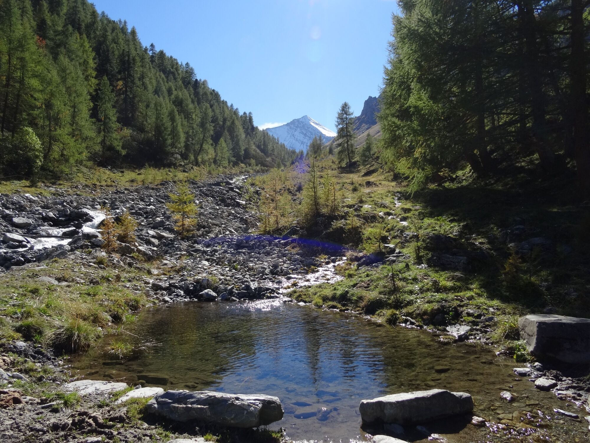
Acla da Fans is a duty-free shop in the middle of the forest. The Samnaun duty-free zone begins in the area. The Val Sampuoir, at the valley exit of which Acla da Fans is located, belongs to the neighbouring municipality of "Valsot". The tour therefore begins at Acla da Fans and leads about 1.5 km along the Samnaun road, including a short, single-lane tunnel (be careful!). Shortly after the first tunnel, the alpine road turns right into the wild Val Sampuoir and the steady climb through the forest begins. After about 5.5 km and 450 metres of altitude difference at Plan da Purschès, you change the side of the valley and are now above the timberline. At the end of the valley you can see the highest peak in Samnaun, the Muttler, at 3296 m above sea level. The alpine road is somewhat less developed on the last 2 km. The bike tour ends at the alp "Las Eras", here you can only continue on foot, either in the direction of the Rossbodenjoch into the Samnaun "Val Maisas", or in the south over the Fuorcla Salèt in the direction of Tschlin in the Lower Engadine. From the alp "Las Eras", the same path leads back down the Val Sampuoir.
- Directions
-
From Acla da Fans the tour leads in the direction of Vinadi.
Shortly after the first tunnel turn right onto the natural road
Follow the road into the Val Sampuoir until the road ends at 2094 m above sea level and the destination Las Eras is reached.
As in the past, the Val Sampuoir is still used as an alpine pasture area, you pass the impressive alpine hut and there are some nice fireplaces on the way - Highest point
- 2,109 m
- Endpoint
-
Las Eras
- Height profile
-
 © outdooractive.com
 - Equipment
-
Helmet, gloves, good shoes, glasses, rain and sun protection, water bottle, repair kit, first aid kit
- Safety instructions
-
The tour was assessed in favourable weather conditions, current weather conditions and weather forecasts must be compulsorily observed before starting the tour. This tour requires a certain level of riding safety, balance and technical riding skills.
Emergency call:
144 Emergency call, first aid
112 International emergency call
Show consideration when crossing and overtaking hikers.
Most of the mountain bike routes in Graubünden run on single trails that are also signposted as hiking trails. Hikers always have the right of way.
- Tips
-
There are some nice barbecue sites along the route.
- Additional information
- Directions
-
From the north: via Landquart - Klosters by car transport through the Vereina tunnel (Selfranga - Sagliains). Then take the H27 in the direction of Scuol and Martina to Vinadi. At the Vinadi turn-off, head towards Samnaun until you reach Acla da Fans (approx. 1 hour from Vereina south portal).
From the east: via the Inntalstrasse B180 via Landeck to Pfunds, turn off at the Kajetansbrücke bridge and via Spiss towards Samnaun, turn left before Samnaun towards Acla da Fans.
From the south: via Reschenpass (Nauders) on B180 to Pfunds, junction Kajetansbrücke and via Spiss to Samnaun, turn left before Samnaun towards Acla da Fans.
Please note: If you are travelling to Samnaun, you will need a valid travel document (passport, ID), as you will pass through customs in Martina or Spissermühle.
- Public transportation
-
- By Rhaetian Railway (from Chur, Landquart/Prättigau or from the Upper Engadine) hourly to Scuol-Tarasp station.
- Continue by PostBus (from Scuol-Tarasp or Martina, Cunfin) hourly to PostAtuo stop Acla da Fans, direction Samnaun
- In Samnaun during the day, hourly service with the Samnaunbus.


- Author
-
The tour Acla da Fans - Val Sampuoir is used by outdooractive.com provided.