

© Chur - Die Alpenstadt - Michael Christ

© Chur - Die Alpenstadt - Michael Christ
© Chur - Die Alpenstadt - Michael Christ
© Unbekannt
© Chur - Die Alpenstadt - Michael Christ

© Chur - Die Alpenstadt - Michael Christ

© Chur - Die Alpenstadt - Michael Christ

© Chur - Die Alpenstadt - Michael Christ

© Chur - Die Alpenstadt - Michael Christ

- Brief description
-
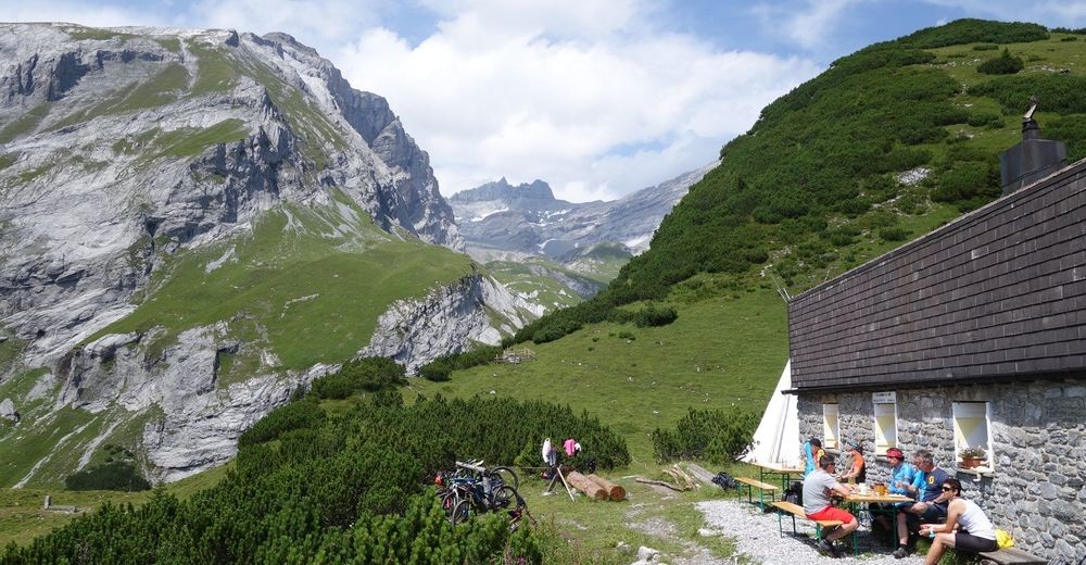
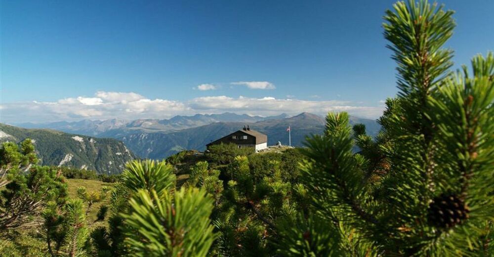
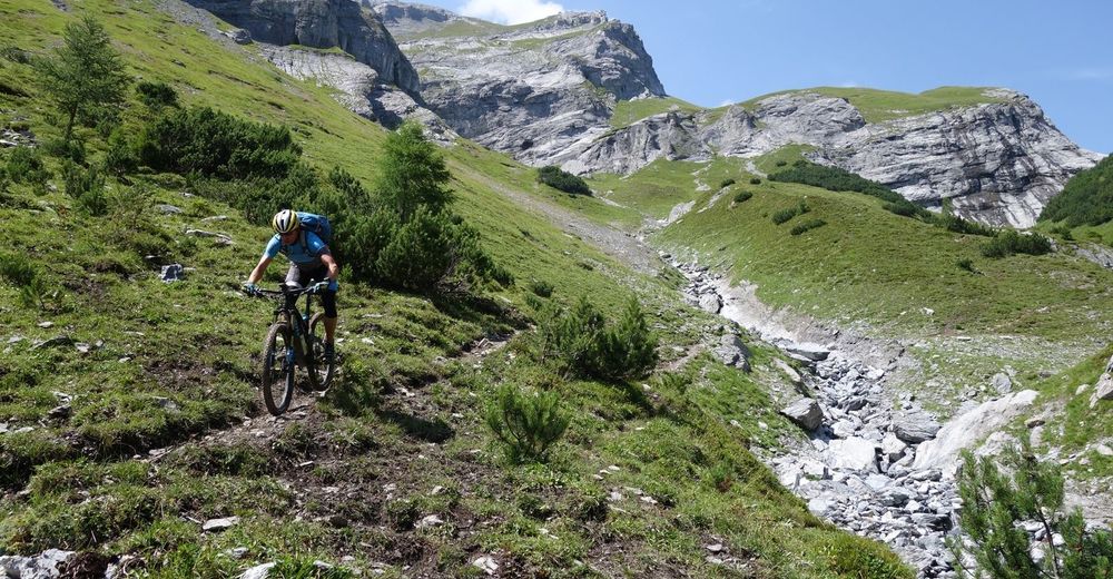
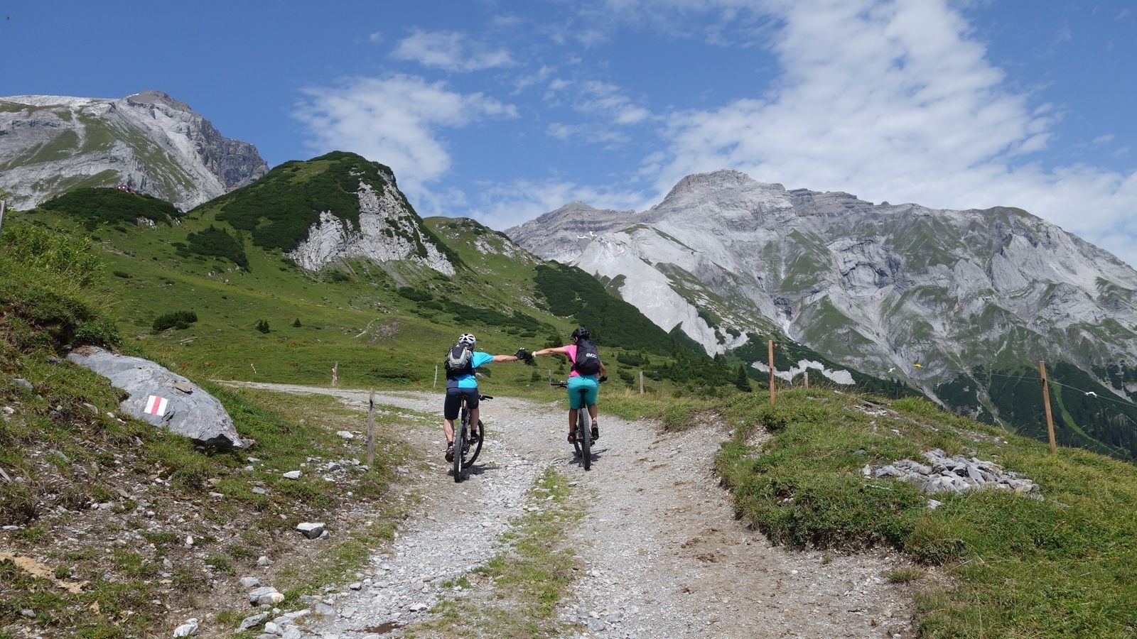
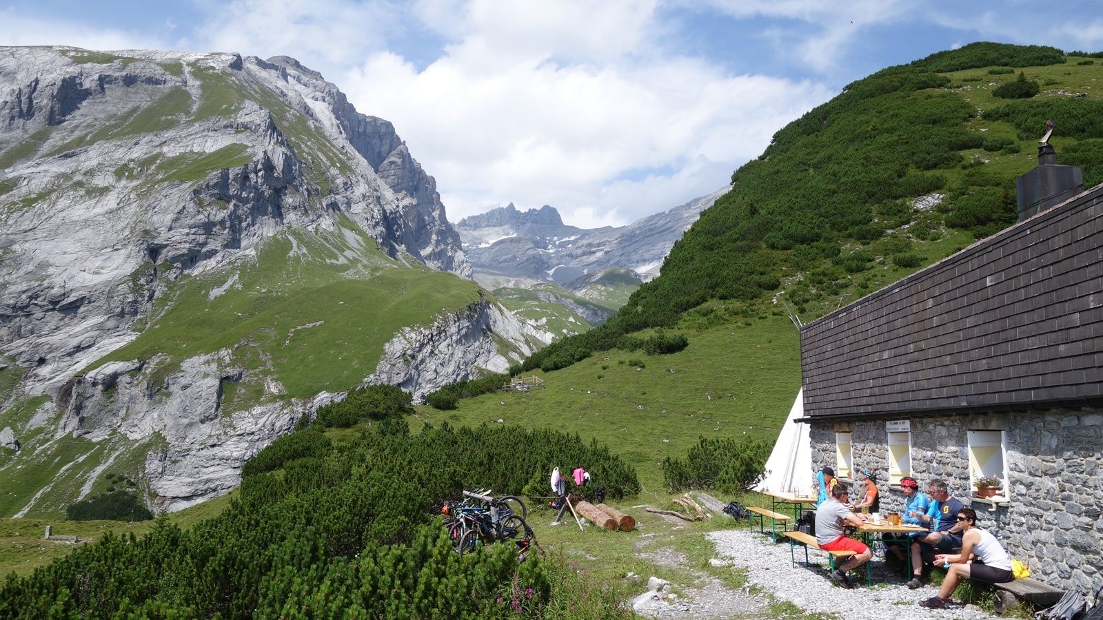
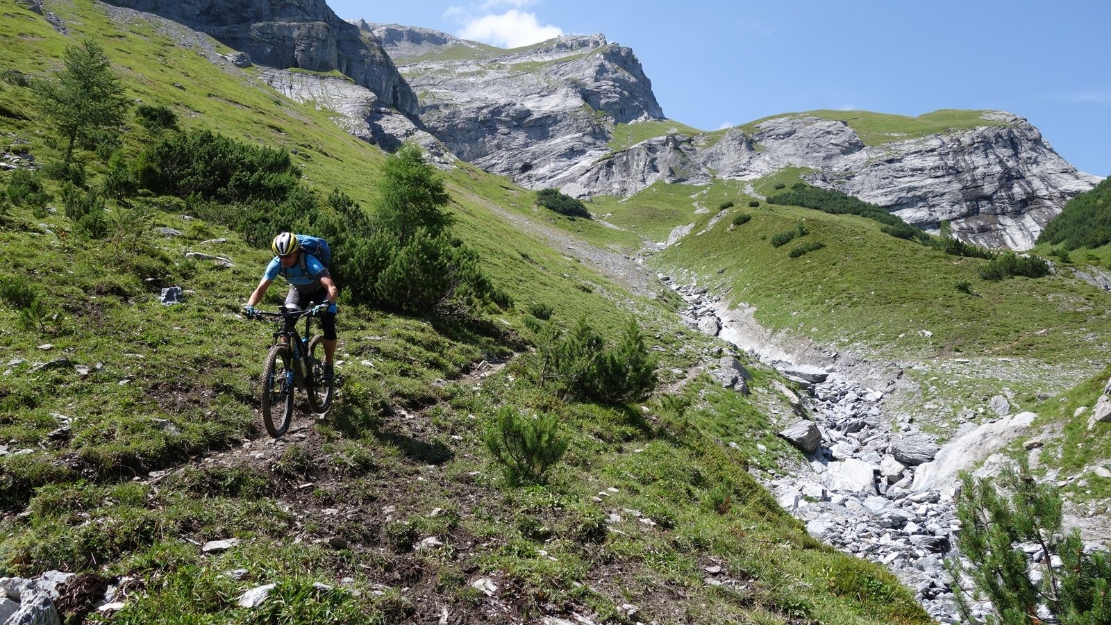
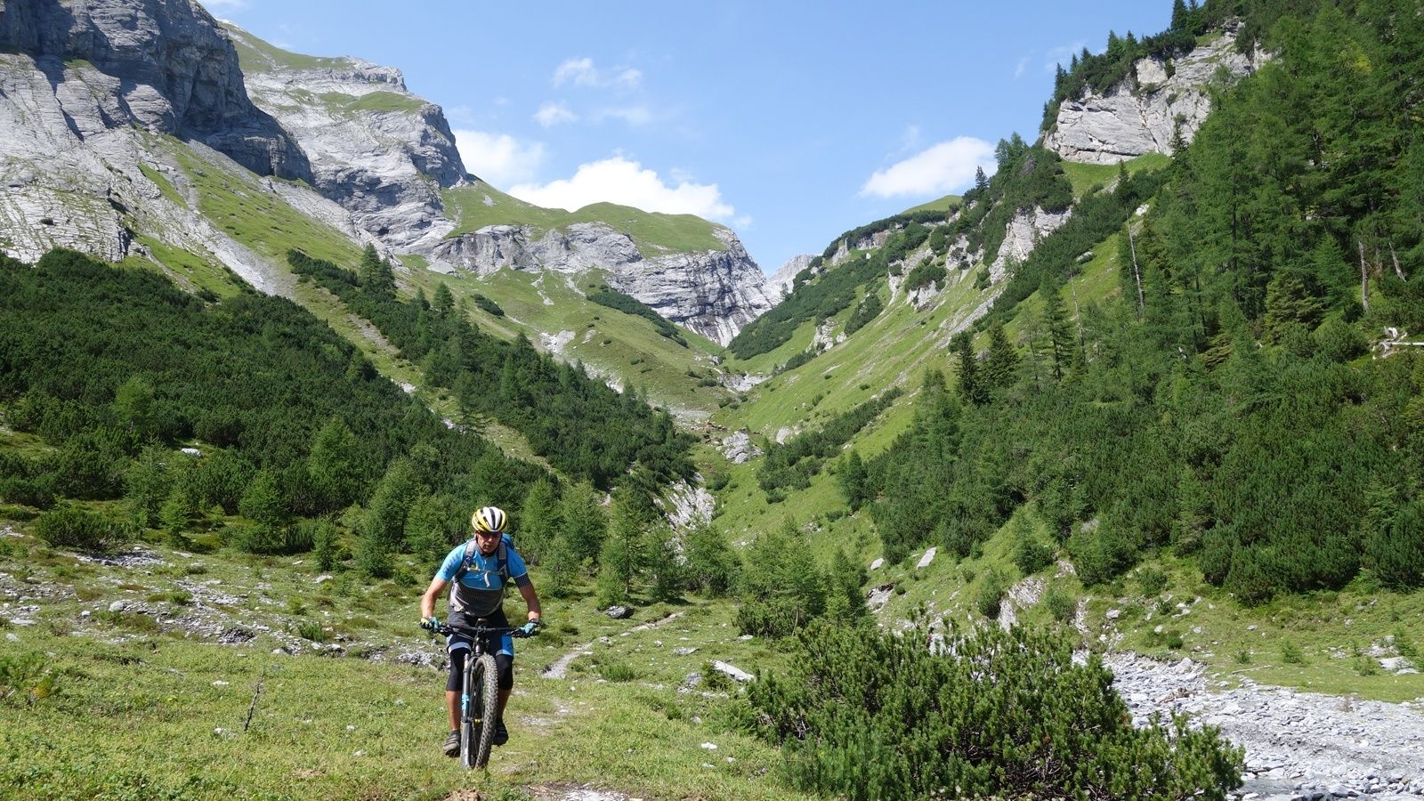
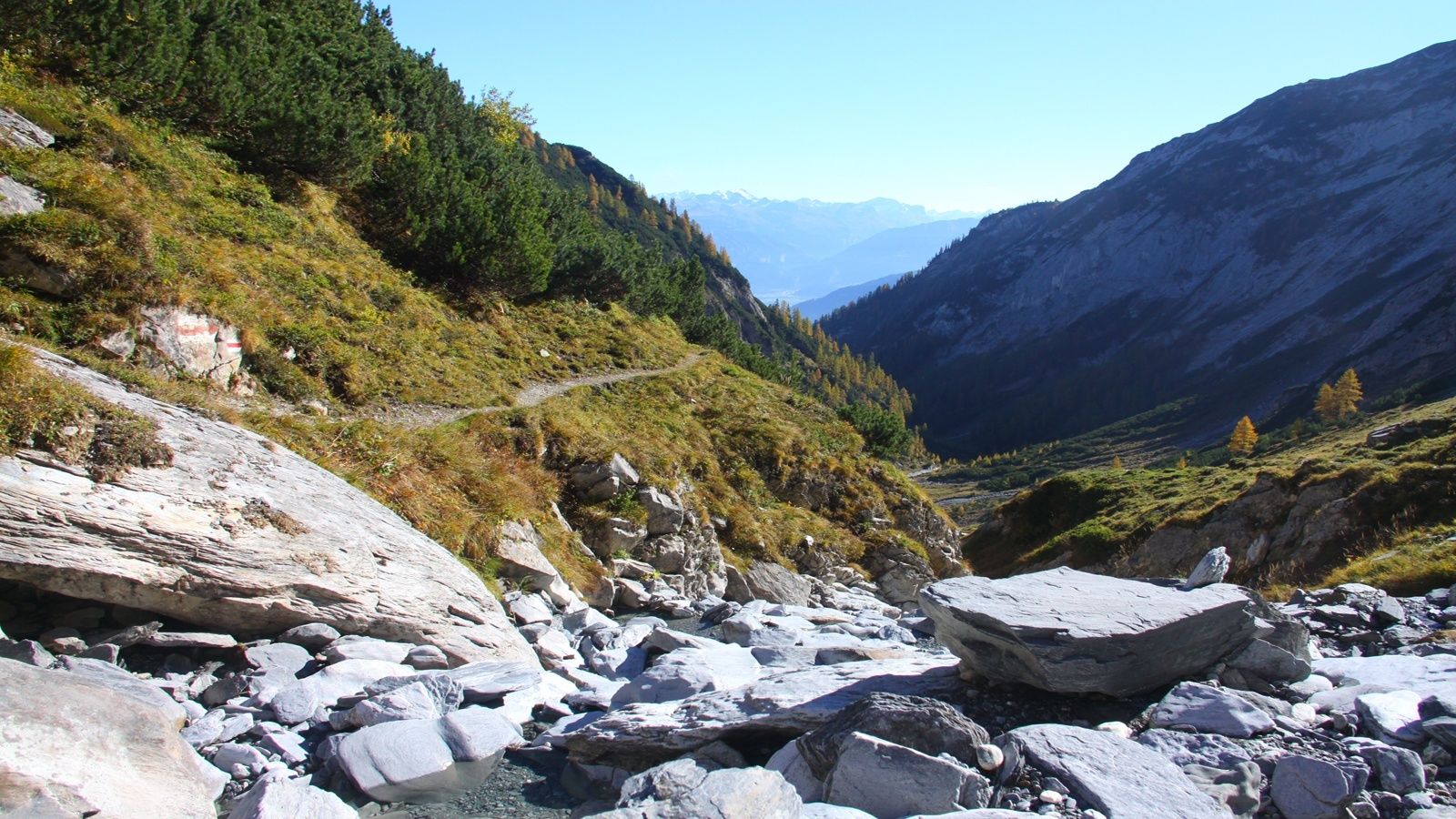
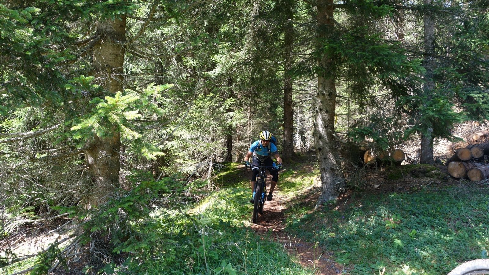
Eine Tagestour, die vieles fordert und noch mehr bietet: Anspruchsvoller Aufstieg, lohnenswerte Einkehrmöglichkeiten, einzigartige Bergkulissen und fantastische Aussichten sowie eine Trail-Abfahrt, die man nicht so schnell vergessen wird.
- Difficulty
-
difficult
- Rating
-
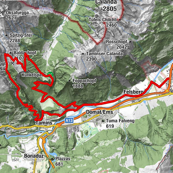
- Route
-
Chur (593 m)Restaurant Calanda2.5 kmFelsberg (572 m)2.8 kmReformierte Kirche3.2 kmEms (586 m)4.7 kmPassherberge Überuf13.8 kmKunkelspass (1,357 m)13.8 kmRingelspitzhütte SAC (1,998 m)19.2 kmTamins26.6 kmEms (586 m)30.9 kmReformierte Kirche32.7 kmFelsberg (572 m)33.2 kmRestaurant Calanda33.8 kmChur (593 m)36.1 km
- Best season
-
JanFebMarAprMayJunJulAugSepOctNovDec
- Highest point
- 1,986 m
- Endpoint
-
Obere Au, Chur
- Height profile
-
 © outdooractive.com


-

-
AuthorThe tour Ringelspitzhütte / Lavoitobel is used by outdooractive.com provided.
GPS Downloads


Surfaces
Trial
General info
Refreshment stop
Flora
A lot of view
Other tours in the regions
-
Heidiland
338
-
Chur und Rheintal
264
-
Domat/Ems
89


