© Engadin St. Moritz Mountains - Filip Zuan

© Engadin St. Moritz Mountains - Filip Zuan

© Engadin St. Moritz Mountains - Filip Zuan

© Engadin Tourismus AG - Laura-Maria Engel
© Engadin St. Moritz Mountains - Filip Zuan

© Engadin St. Moritz Mountains - Filip Zuan
© Engadin St. Moritz Mountains - Filip Zuan

© Engadin St. Moritz Mountains - Filip Zuan

- Brief description
-
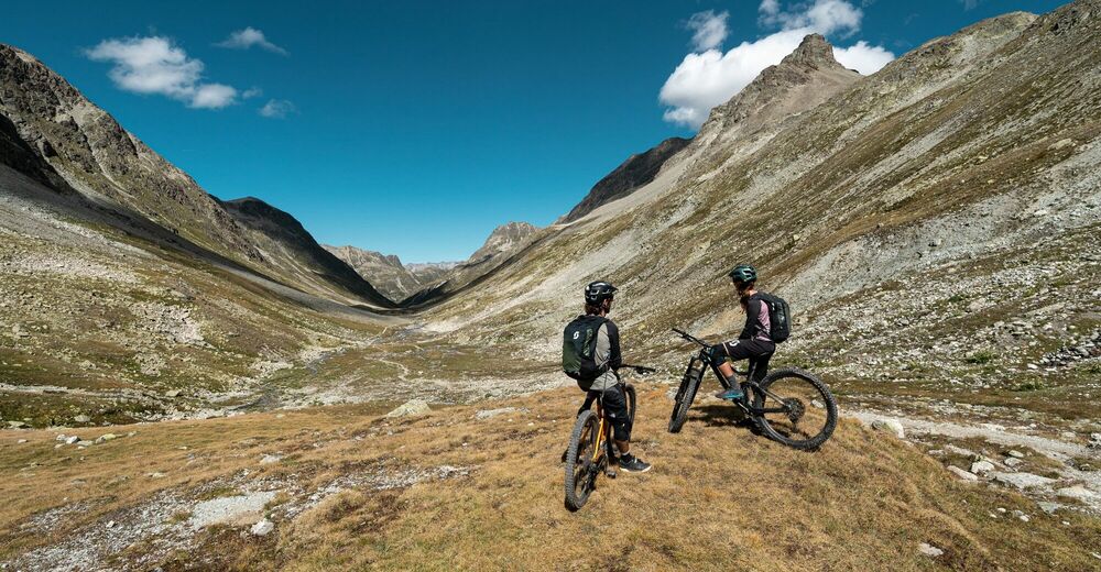
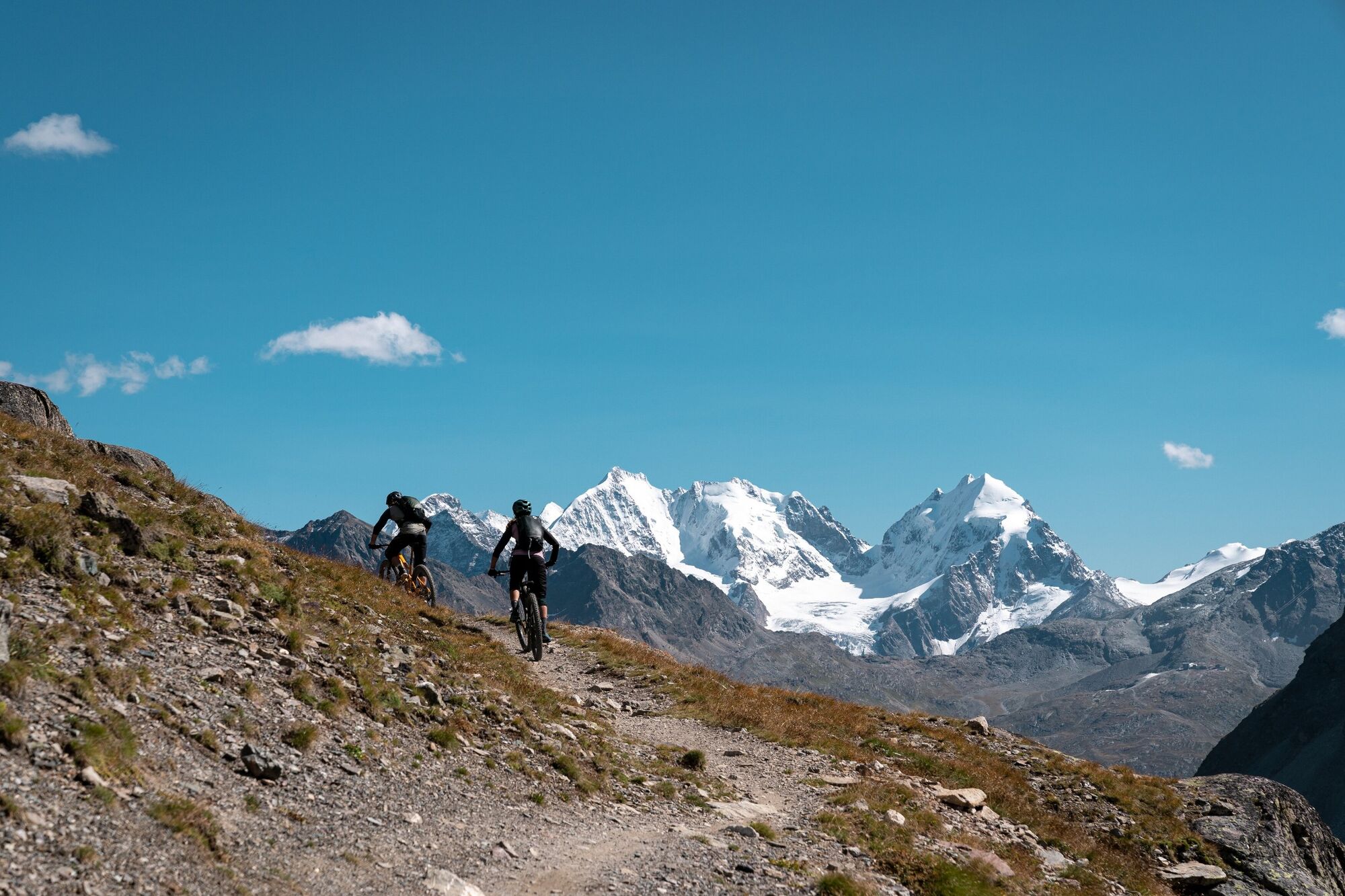
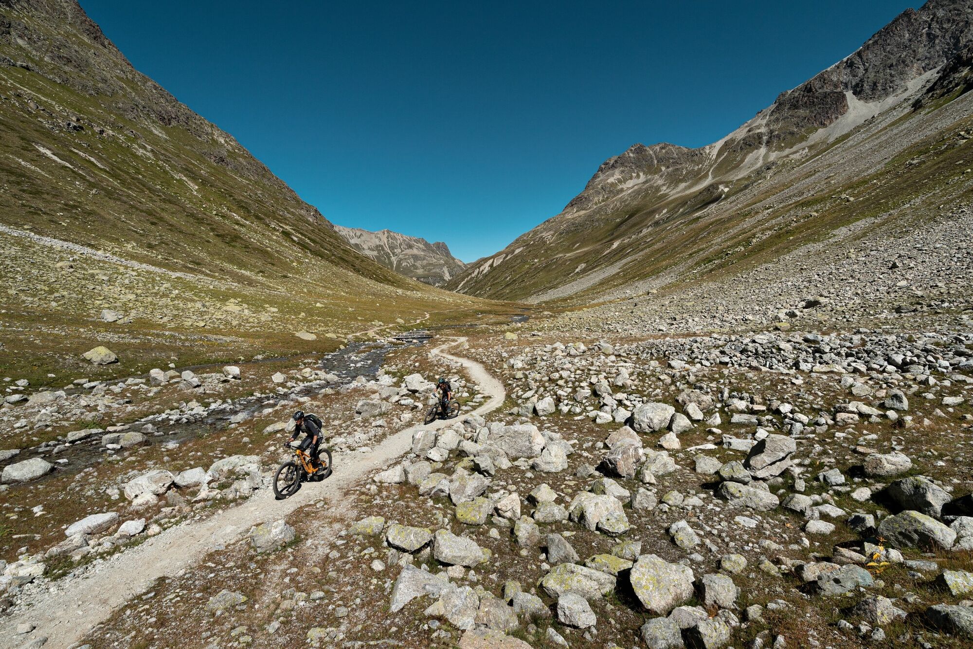
A dream single trail through the magnificent scenery of the Val Suvretta and the Val Bever.
- Difficulty
-
medium
- Rating
-
- Starting point
-
Celerina, railway station
- Route
-
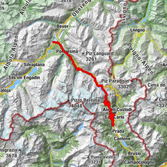
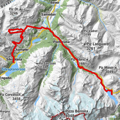
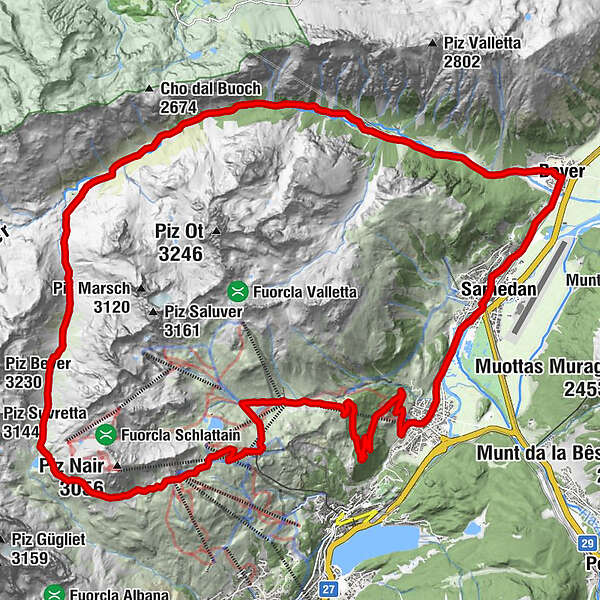
Celerina (1,730 m)Celerina Seglias (1,730 m)0.3 kmCelerina Tschinas2.2 kmSankt Moritz (1,822 m)3.8 kmMarguns6.6 kmCorviglia8.4 kmAlpina Hütte9.1 kmBerggasthaus Spinas24.5 kmVal Bever25.7 kmBever (1,708 m)28.2 kmBever (1,714 m)28.5 kmDa Primo28.5 kmSamaden (1,721 m)30.6 kmSamedan Staziun (1,706 m)30.7 kmSamedan (1,705 m)30.7 kmCelerina (1,714 m)33.4 km
- Best season
-
JanFebMarAprMayJunJulAugSepOctNovDec
- Description
-
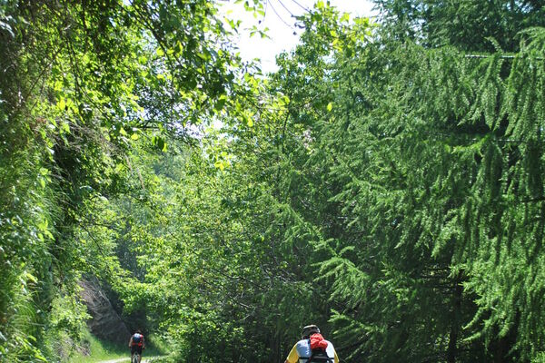
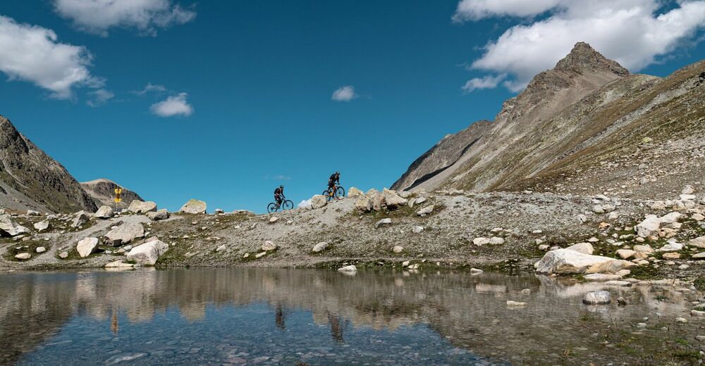
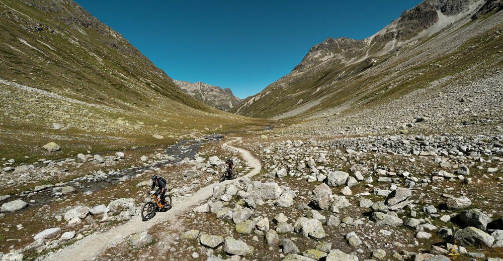
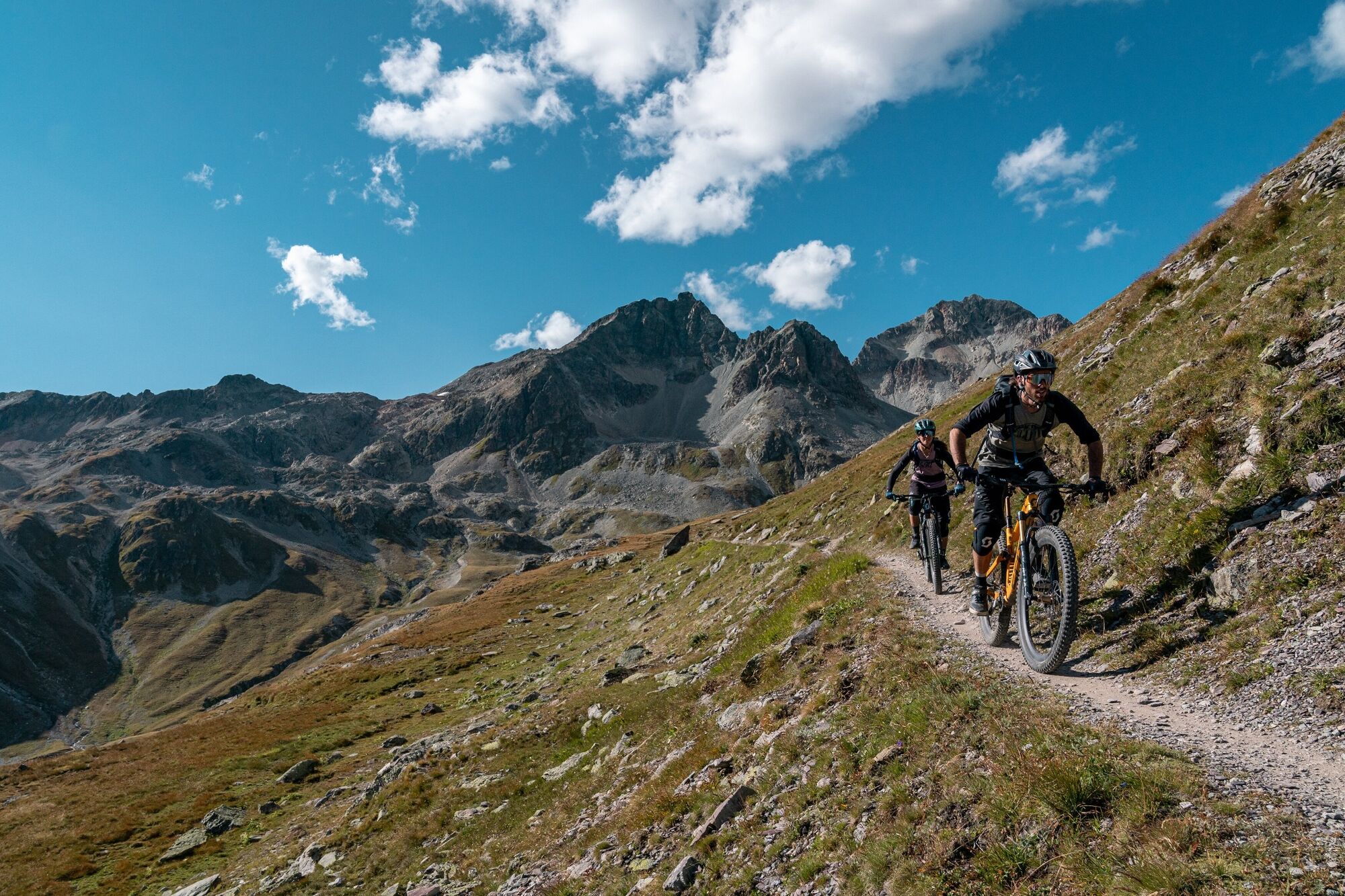
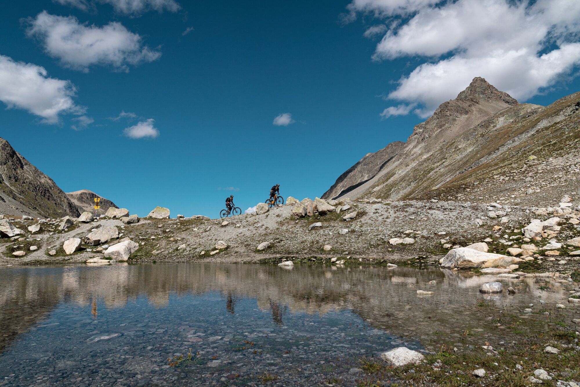
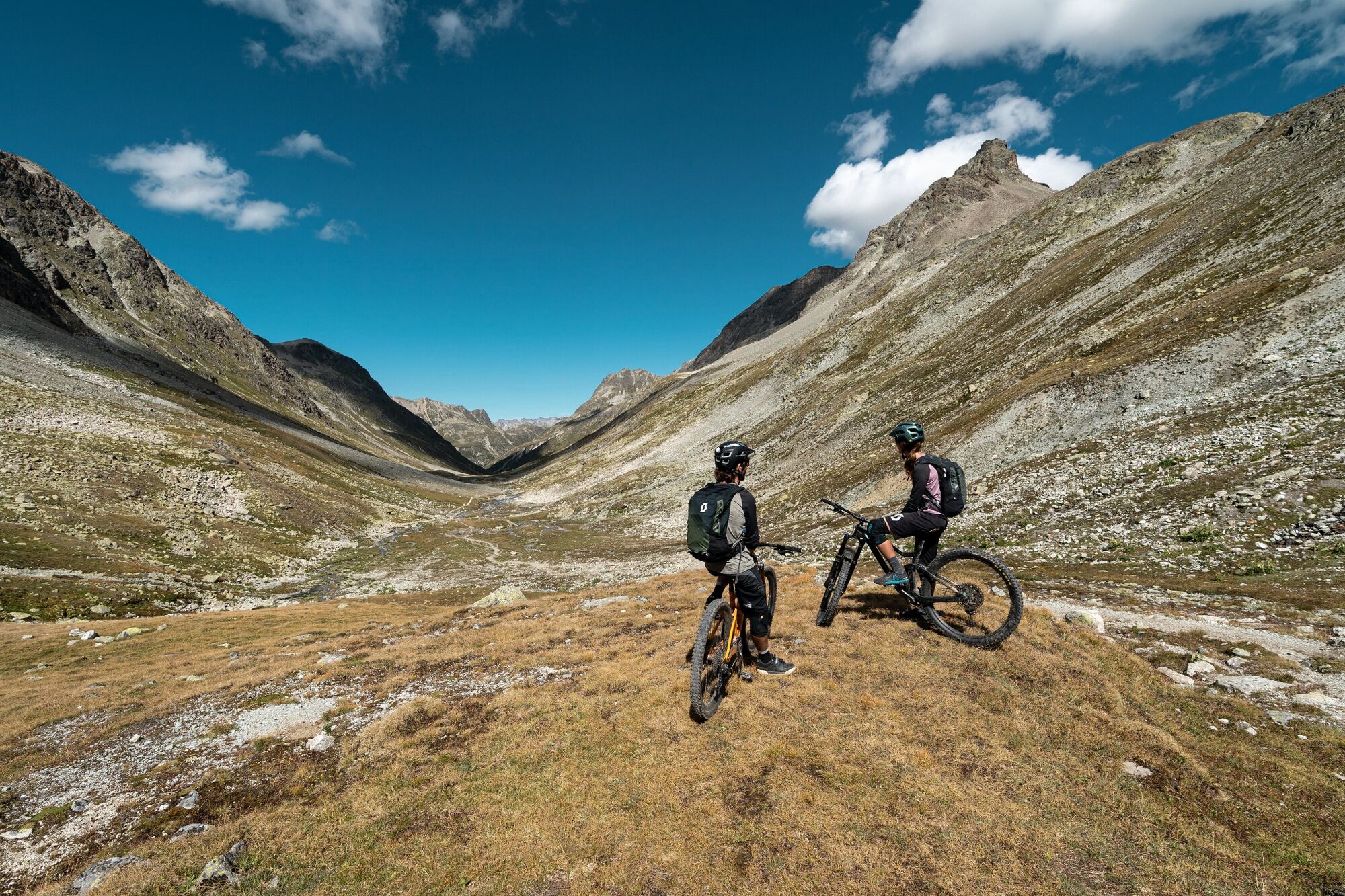
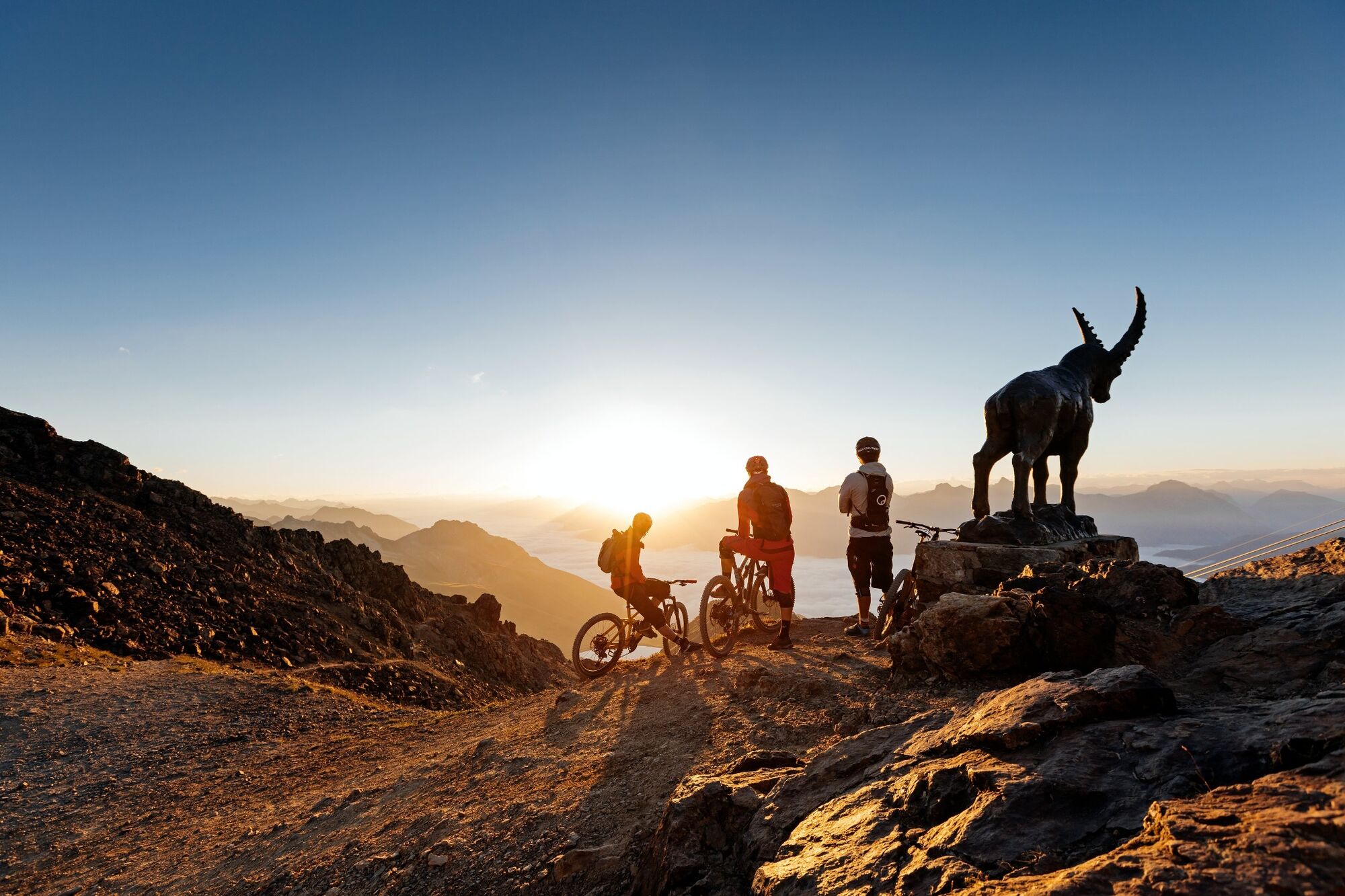
The route starts at Celerina railway station. Pass the train station to the valley station of the Marguns gondola and from there on the gravel road up to Marguns (alternatively you can also take the Marguns gondola up) . From Marguns the route continues via the Glüna Hut to the Corviglia top station. From here, it is just under 200 vertical metres to the highest point - first along a steep gravel track, then by way of a spectacular trail around the Piz Nair to the Suvretta Pass. This point marks the beginning of the flow trail, which winds its way down through the fabulous high-mountain basin of the Val Suvretta for almost six kilometres. In the Val Bever, the path merges with a well-prepared gravel trail - whose undulations also provide a bit of fun. The return route leads along the bike path via Samedan to Celerina.
More information
Engadin St. Moritz Tourismus AG
Via Maistra 1
CH-7500 St. Moritz
Phone: +41 81 830 00 01
E-mail: allegra@engadin.ch
Internet: www.engadin.ch - Directions
-
Marguns - Corviglia - Alpina Hut - Suvretta pass - Spinas - Bever - Samedan - Celerina
- Highest point
- 2,679 m
- Endpoint
-
Celerina, railway station
- Height profile
-
 © outdooractive.com
 - Safety instructions
-
The last stretch down to Val Bever requires skill and ability.
- Tips
-
With the support of the mountain railways, the tour is also possible as an after-work round.

- Author
-
The tour Suvretta Loop (671) is used by outdooractive.com provided.
GPS Downloads


General info
Refreshment stop
A lot of view
Other tours in the regions
-
Engadin St. Moritz
171
-
Corviglia
82