© Engadin St. Moritz Mountains - Filip Zuan
© Engadin St. Moritz Mountains - Filip Zuan
© Engadin St. Moritz Mountains - Filip Zuan
© Engadin St. Moritz Mountains - Filip Zuan
© Engadin St. Moritz Mountains - Filip Zuan
© Engadin St. Moritz Mountains - Filip Zuan

- Brief description
-
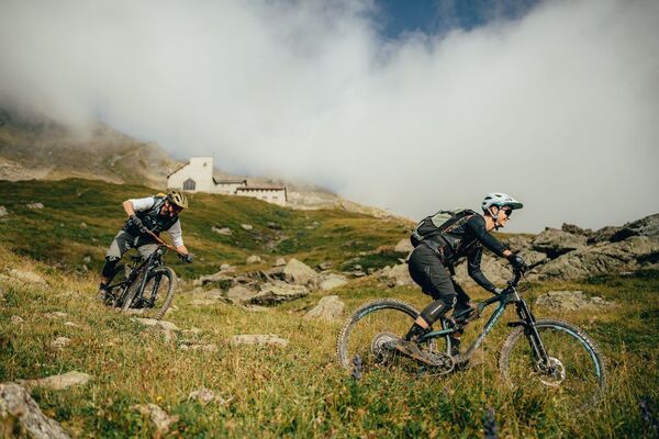
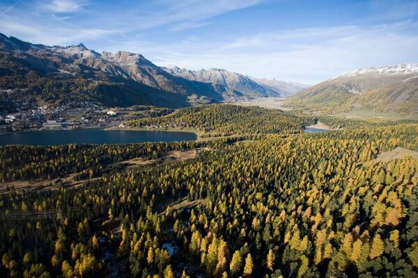
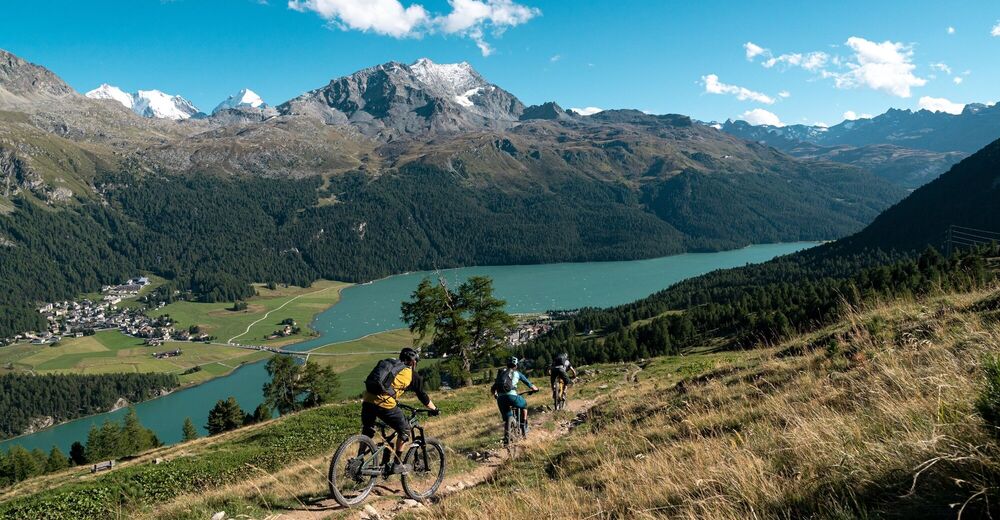
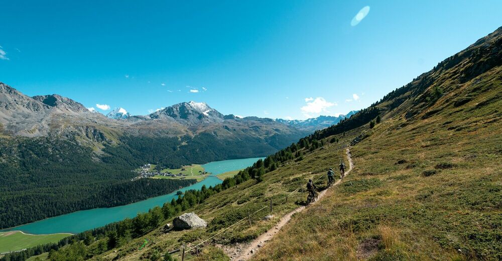
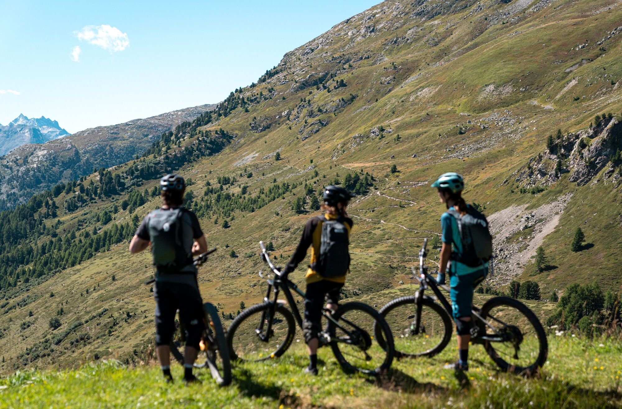
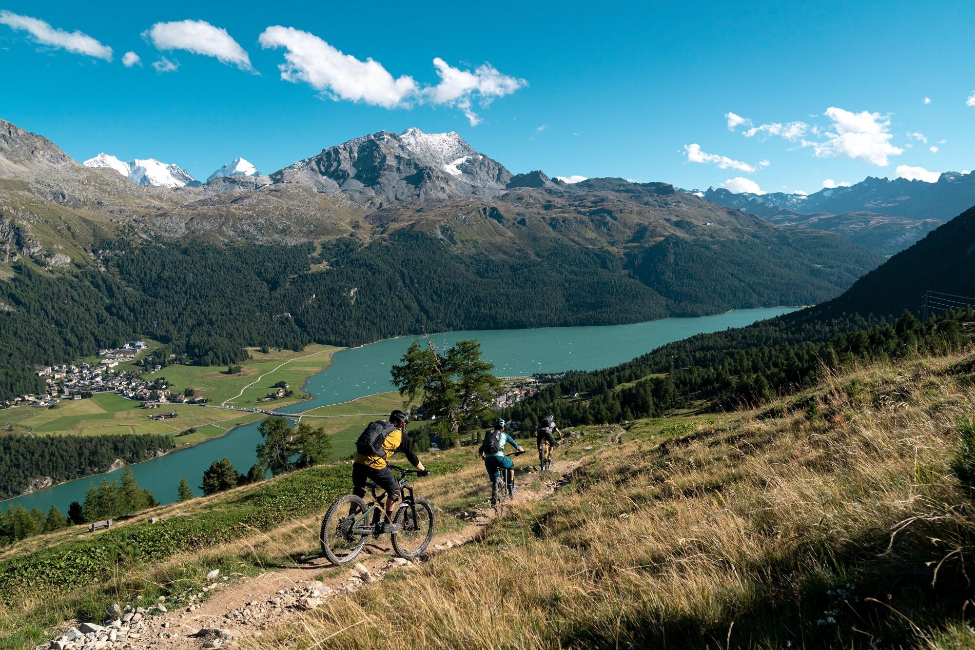
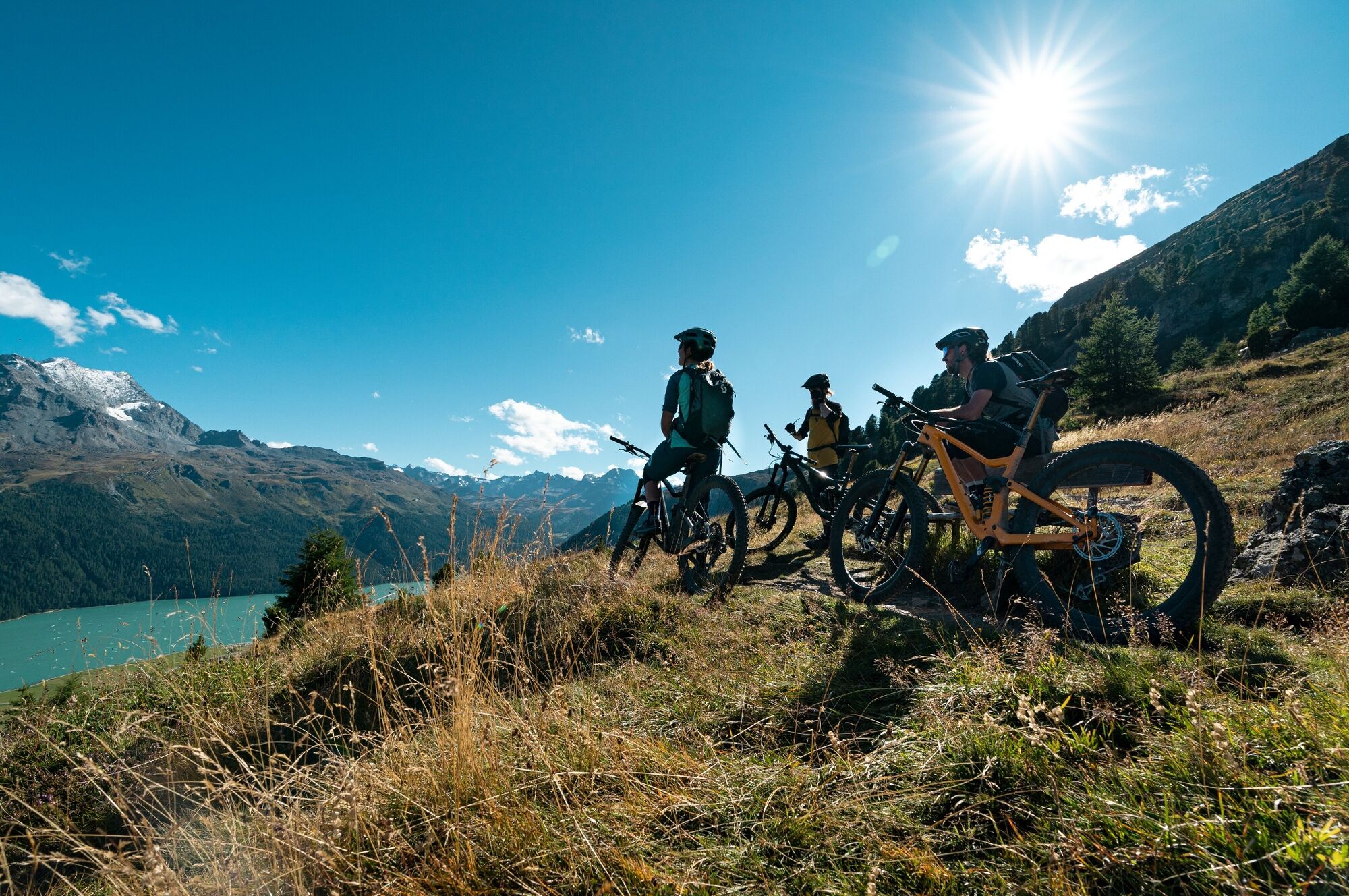
Dominant motifs on this trail are the Upper Engadin lakes and the glaciers around the Piz Corvatsch.
- Difficulty
-
medium
- Rating
-
- Starting point
-
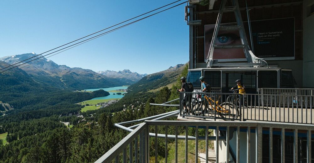
St. Moritz Bad, aerial cable-way, summit station Signal
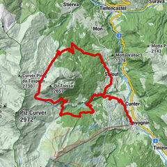
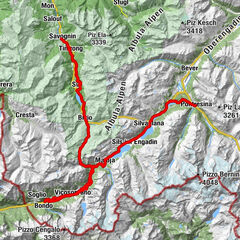
- Route
-
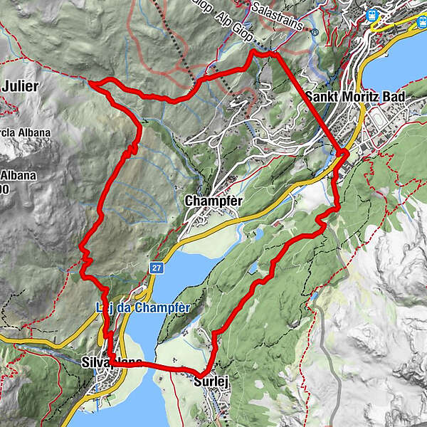
Alp Giop1.5 kmEl Paradiso2.7 kmAlp Suvretta4.0 kmSilvaplana (1,815 m)9.3 kmSurlej10.3 km
- Best season
-
JanFebMarAprMayJunJulAugSepOctNovDec
- Description
-
From the Signal summit station, a panorama trail takes you to the Alp Suvretta, followed by a quick downhill stretch and a short flow trail leading to the Orchas region where you take the left trail. A varied route appears that will delight each and every biker, running down to Silvaplana. Through Silvaplana and over the Surlej bridge, the trail leads to the other side of the valley. Follow the trail that leads into the forest. Past Lej Zuppò with barbecue areas, you reach the starting point, the signal gondola.
More information
Engadin St. Moritz Tourismus AG
Via Maistra 1
CH-7500 St. Moritz
Phone: +41 81 830 00 01
E-mail: allegra@engadin.ch
Internet: www.engadin.ch - Directions
-
St. Moritz Bad Signal gondola - to station of the Signal gondola - Alp Suvretta - Val Suvretta - Via Engiadina - Orchas - Julier pass road - Silvaplana - St. Moritz Bad
- Highest point
- 2,209 m
- Endpoint
-
St. Moritz Bad, aerial cable-way, valley station Signal
- Height profile
-
 © outdooractive.com
 - Tips
-
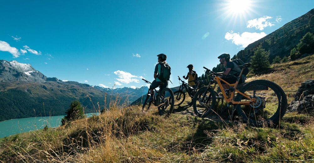
The Via Engiadina above Silvaplana and the view of the Upper Engadin lake district offers a panoramic experience par excellence.
- Public transportation
-
Take the Engadin Bus to St. Moritz Signalbahn


- Author
-
The tour Signalbahn-Alp Suvretta-Silvaplana-Signalbahn is used by outdooractive.com provided.
GPS Downloads


General info
Refreshment stop
A lot of view
Other tours in the regions
-
Veltlin / Valtellina
205
-
Engadin St. Moritz
171
-
Silvaplana
69