
- Brief description
-
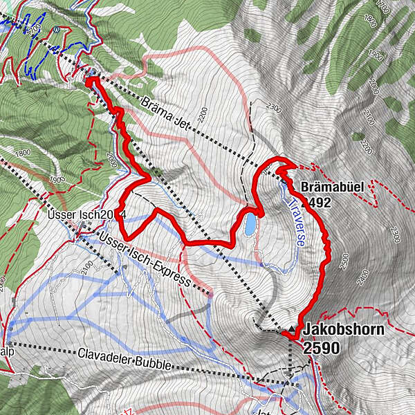
From the Jakobshorn peak over the ridge to the mountain station of the Brämabüel chairlift, past the reservoir to Jschalp. A varied trail with breathtaking views!
- Difficulty
-
medium
- Rating
-
- Starting point
-
Jakobshorn mountain station
- Route
-
Jakobshorn (Clavadelerberg)0.0 kmJakobshorn (2,590 m)0.1 kmBrämabüel (2,492 m)1.2 kmBräma Jet (2,492 m)1.2 kmJschalp4.9 kmDavos (1,560 m)4.9 km
- Best season
-
JanFebMarAprMayJunJulAugSepOctNovDec
- Description
-
First you take the Jakobshorn cable car to the Jakobshorn mountain station. If you already have a few descents behind you and are feeling hungry for the first time, we can recommend the burgers in the Sun Peak restaurant!
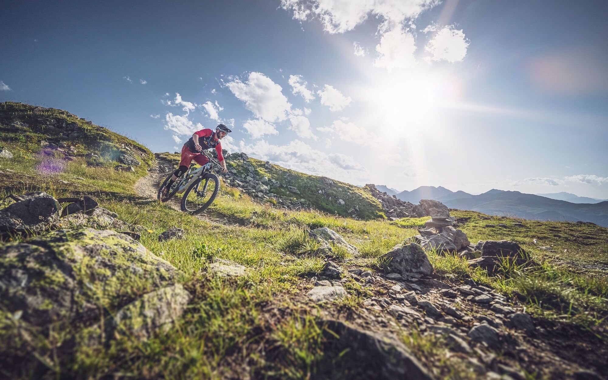
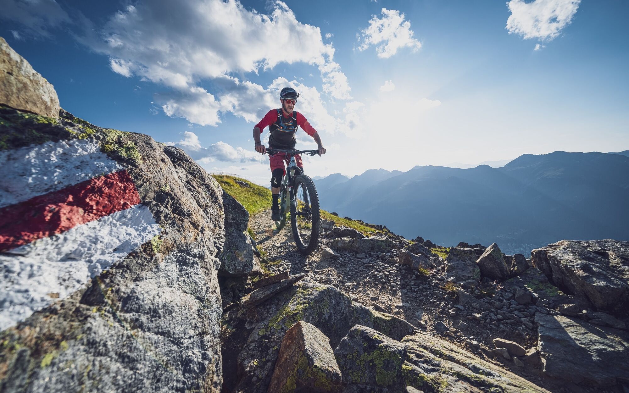
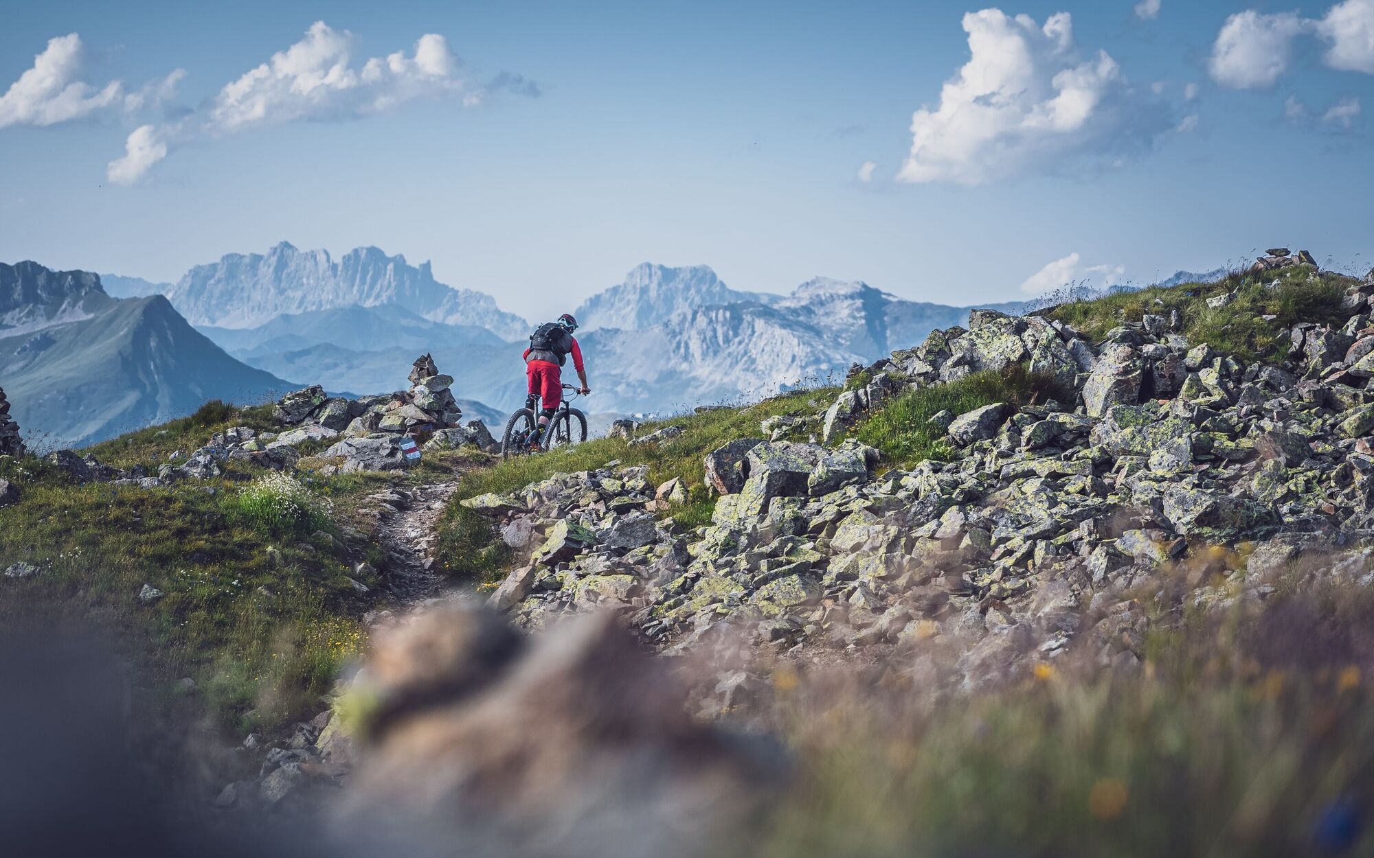
First you pedal a few meters on the road, before you turn off on the narrow hiking trail at the height of the Güggelbahn. After that, you'll pass behind the Jakobshorn peak on a narrow trail. The trail is very exposed but never dangerous! Right at the beginning the trail is very steep on the ridge, so ride carefully! After that it goes straight for a bit before a short but crisp climb follows.
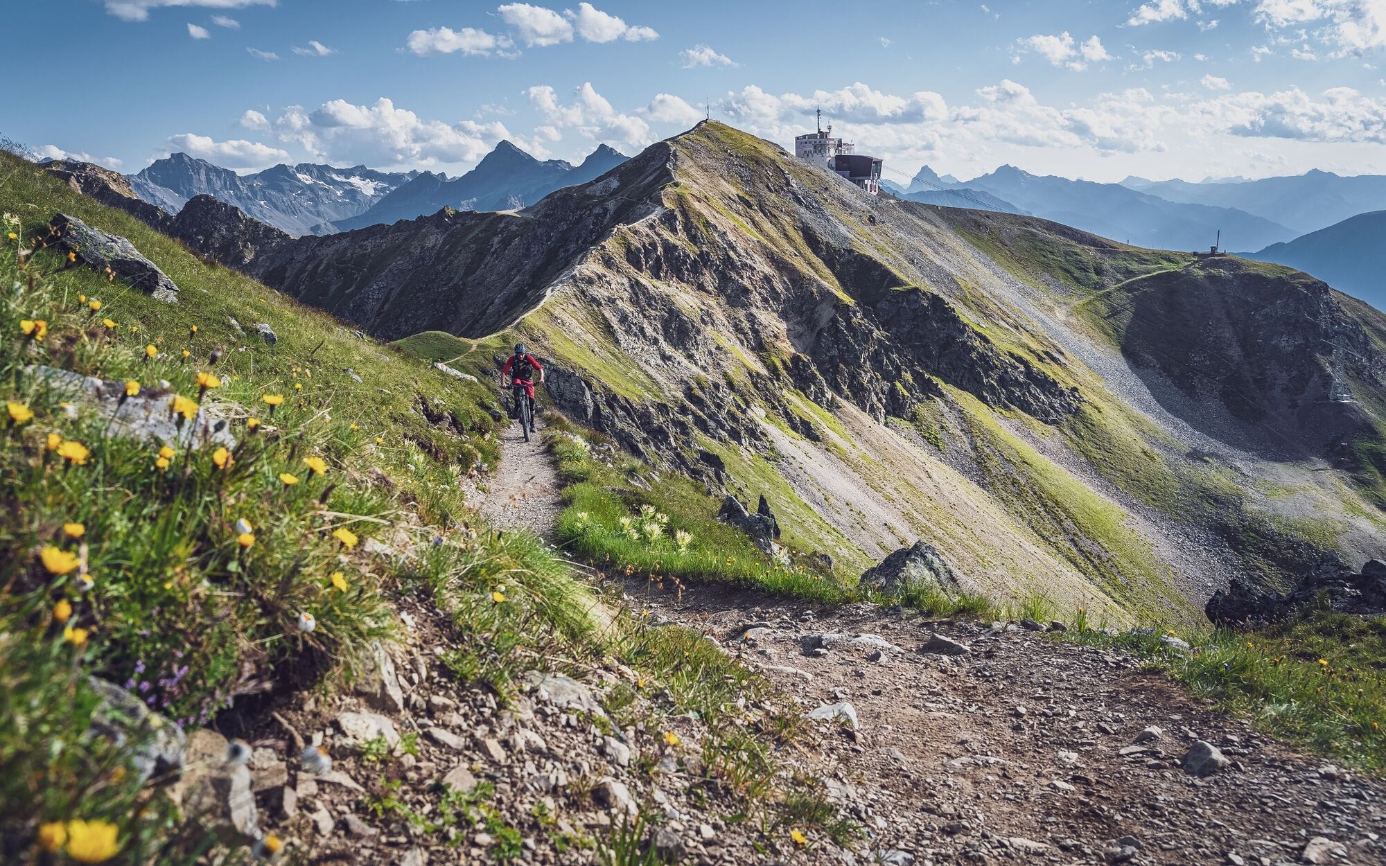
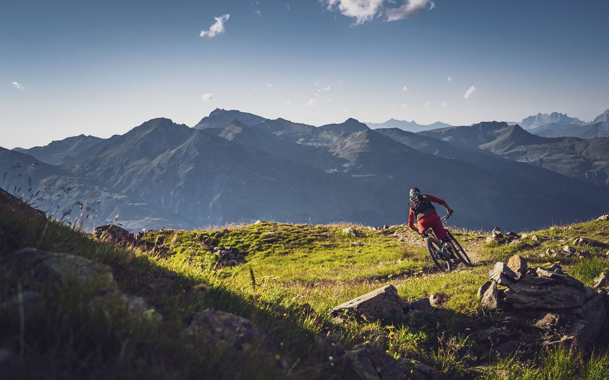
At the top you can already see the many "cairns", but also immediately put another stone on top. Before the descent, a unique view of Davos and Lake Davos opens up to you. One of the most popular photo spots in Davos!You follow the narrow trail to the mountain station of the chairlift Bräma. Shortly before the station the trail widens again, once you have passed the station on the right, it narrows again.At the turnoff in the direction of Teufi, follow the signs in the direction of Jschalp.
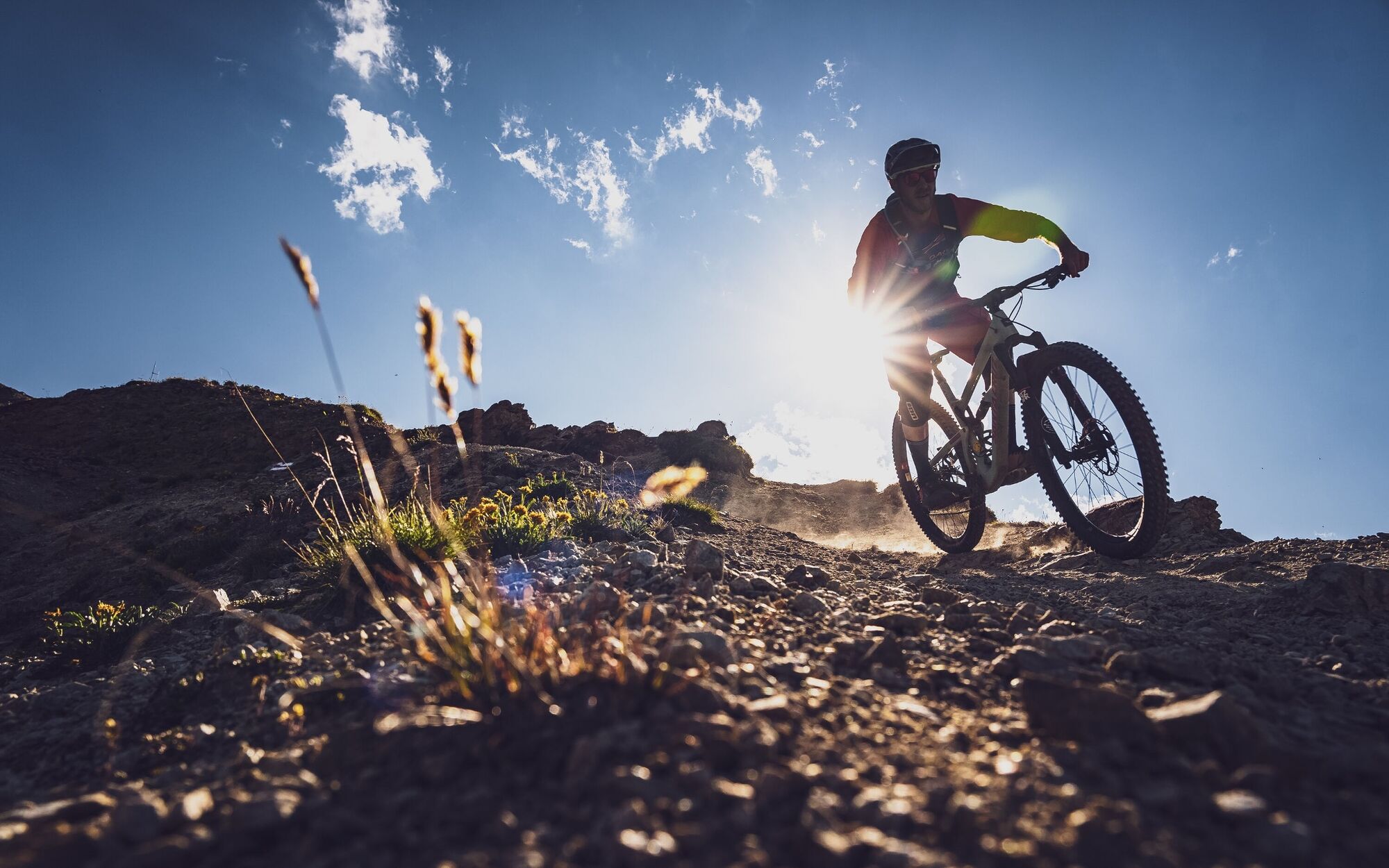
Alternatively, you can also ride in the direction of Teufi, but this trail is only for advanced bikers.After a few meters you can already see the reservoir and the Jakobshorn cable car. At the reservoir there is a small bench to enjoy the view.You continue on a wide road (watch out for gravel) until you come to the junction of the technical trail. You follow the Technik Trail past alpine roses, streams and through a forest to Jschalp.Here you can also add the second part of the technique trail to the valley station or take the 2nd section of the Jakobshorn cable car back to the summit. - Highest point
- 2,563 m
- Endpoint
-
Jakobshorn middle station, Jschalp
- Height profile
-
 © outdooractive.com
 - Tips
-
The burgers at the Sun Peak restaurant on the summit are super tasty! Be sure to use the photo spot above the Brämalift for a souvenir photo.
- Author
-
The tour Jakobshorn - Brämabüel - Jschalp is used by outdooractive.com provided.


Surfaces
-
Davos Klosters
205
-
Davos
75